NASA Satellites Watch as Hurricane Harvey Intensifies Off Texas Coast (Video)
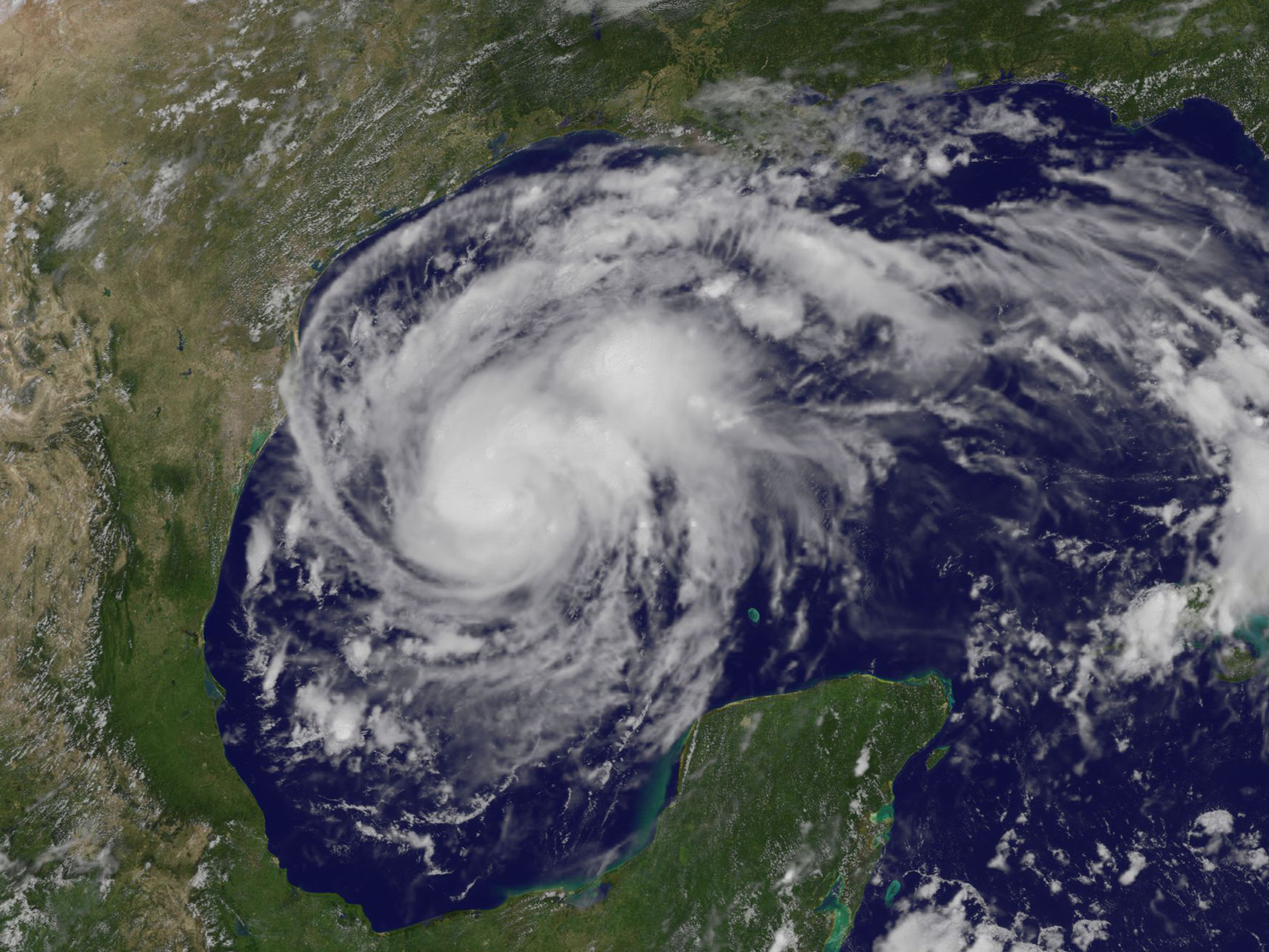
Tropical storm Harvey has been gaining strength and will likely make landfall as a major hurricane, NASA satellite images revealed.
What started out as the remnants of a tropical storm could become the worst hurricane to hit Texas in nearly 50 years and the first Category 3 hurricane to hit the United States in almost 12 years, the Weather Channel reports.
On Wednesday (Aug. 23), the National Hurricane Center (NHC) upgraded the scattered storm remnants to a tropical depression, and by Thursday (Aug. 24) it started to shape up as a large "tropical cyclone" over the Gulf of Mexico. As always, NASA and the National Oceanic and Atmospheric Administration (NOAA) are monitoring the weather event from space with Earth-observing satellites. [See amazing photos of Hurricane Harvey from space]
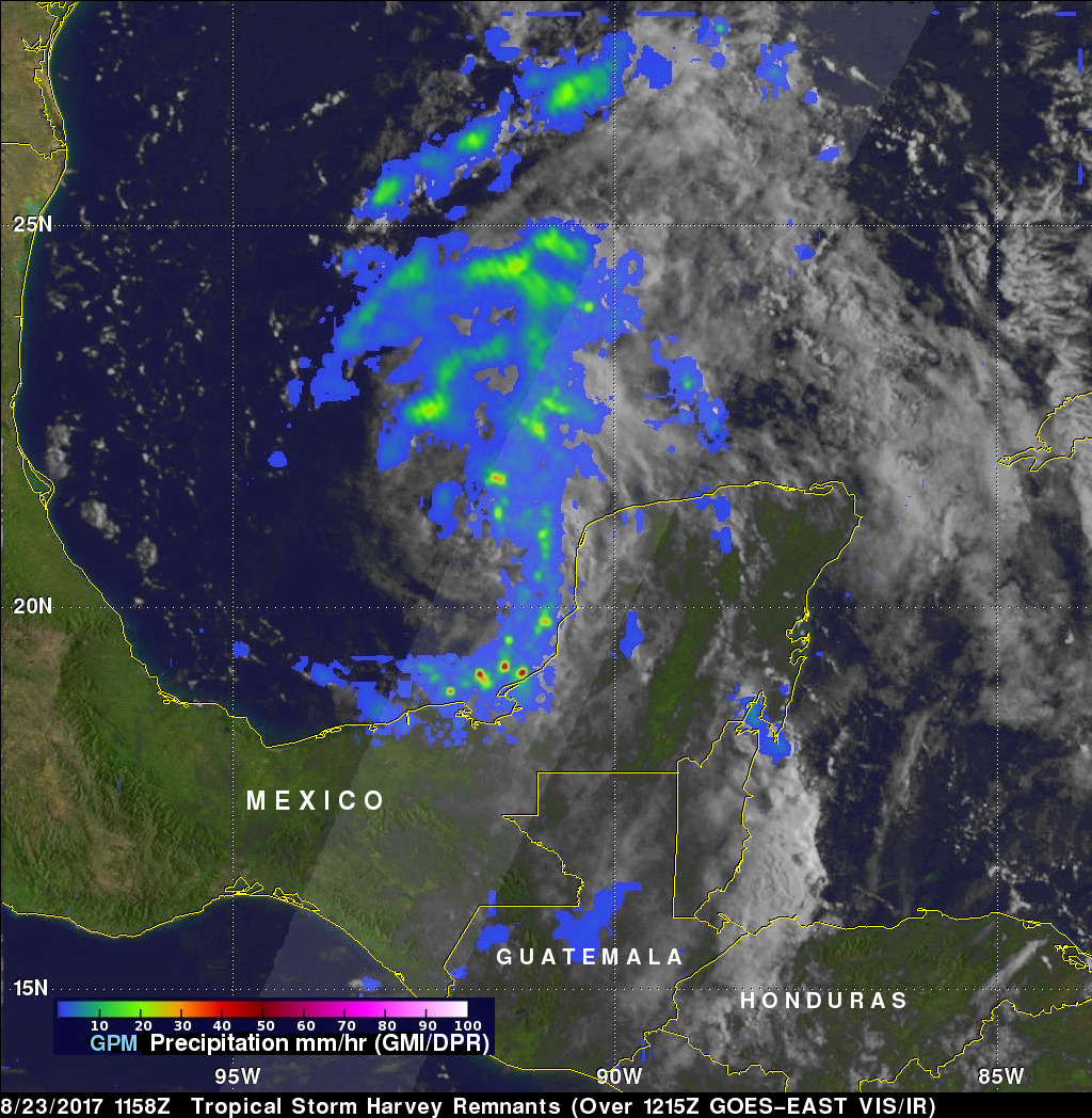
NASA's Global Precipitation Measurement mission (GPM) satellite flew over the area on Wednesday morning and detected areas of heavy rainfall in the clouds of Tropical Storm Harvey, with some regions experiencing more than 1.96 inches (50 millimeters) of rain per hour — a number that will likely climb, NASA officials said in a statement. "The heavy rainfall that the GPM core satellite observed continued to build, and on Aug. 24, the NHC noted that rainfall totals are expected to be tremendous." In a public weather advisory, the NHC said that parts of Texas could accumulate up to 30 inches (76 centimeters) of rainfall.
Another NASA satellite, GOES East (formerly GOES-13), has been keeping an eye on the storm from its geosynchronous orbit over the U.S. East Coast. Scientists at NASA's Goddard Space Flight Center in Greenbelt, Maryland, created an animation of the storm's development from Tuesday (Aug. 22) to Thursday (Aug. 24).
"The animation showed the movement of Harvey as a remnant low pressure area moving off the Yucatan Peninsula, re-forming into a tropical depression and now into a hurricane in the southwestern Gulf of Mexico," NASA officials said. The storm is now moving northwest toward Texas and is expected to make landfall either Friday night (Aug. 25) or early Saturday (Aug. 26).
Email Hanneke Weitering at hweitering@space.com or follow her @hannekescience. Follow us @Spacedotcom, Facebook and Google+. Original article on Space.com.
Breaking space news, the latest updates on rocket launches, skywatching events and more!

Hanneke Weitering is a multimedia journalist in the Pacific Northwest reporting on the future of aviation at FutureFlight.aero and Aviation International News and was previously the Editor for Spaceflight and Astronomy news here at Space.com. As an editor with over 10 years of experience in science journalism she has previously written for Scholastic Classroom Magazines, MedPage Today and The Joint Institute for Computational Sciences at Oak Ridge National Laboratory. After studying physics at the University of Tennessee in her hometown of Knoxville, she earned her graduate degree in Science, Health and Environmental Reporting (SHERP) from New York University. Hanneke joined the Space.com team in 2016 as a staff writer and producer, covering topics including spaceflight and astronomy. She currently lives in Seattle, home of the Space Needle, with her cat and two snakes. In her spare time, Hanneke enjoys exploring the Rocky Mountains, basking in nature and looking for dark skies to gaze at the cosmos.


