Vernal Equinox 2018: Satellite Sees First Day of Spring
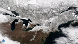
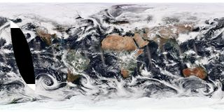
The National Oceanic and Atmospheric Administration (NOAA) celebrated a crisp start to spring today (March 20) in the Northern Hemisphere with a stunning view of Earth from sunset to sunrise.
NOAA officials tweeted the view of sunset on March 19 through sunrise March 20, taken with the agency's GOES-East weather satellite.
"Happy Spring #Equinox and happy #firstdayofspring!" NOAA officials wrote. "Today the length of night and day are nearly equal. The days will now become longer at the higher latitudes because it takes the sun longer to rise and set."

The vernal equinox occurs as the sun passes over the equator from Earth's perspective and the Northern Hemisphere begins to tilt toward the sun, leading to longer days in the north and shorter days in the south. It marks the north's first day of spring — snowy weather in some areas notwithstanding — and the beginning of fall for those in the Southern Hemisphere. While the day-to-day variations in weather are much more complex, the vernal equinox is a sign that warmer days are on the way.
The next big sun event for the Northern Hemisphere is the summer solstice on June 21, the longest day of the year, when Earth's northern half is most directly tilted toward the sun. (It's also the south's winter solstice.)

Even better views are coming. NOAA launched what will be the new GOES-West spacecraft this month in partnership with NASA; the eagle-eyed satellite will help track extreme weather across the western United States and eastern Pacific Ocean as a counterpart to GOES-East. The satellite will move to its final GOES-West vantage point after about six months of preparing its instruments and running checks.
To see more NOAA imagery taken today, readers can visit https://www.nesdis.noaa.gov/content/imagery-and-data.
Get the Space.com Newsletter
Breaking space news, the latest updates on rocket launches, skywatching events and more!
Email Sarah Lewin at slewin@space.com or follow her @SarahExplains. Follow us @Spacedotcom, Facebook and Google+. Original article on Space.com.
Join our Space Forums to keep talking space on the latest missions, night sky and more! And if you have a news tip, correction or comment, let us know at: community@space.com.

Sarah Lewin started writing for Space.com in June of 2015 as a Staff Writer and became Associate Editor in 2019 . Her work has been featured by Scientific American, IEEE Spectrum, Quanta Magazine, Wired, The Scientist, Science Friday and WGBH's Inside NOVA. Sarah has an MA from NYU's Science, Health and Environmental Reporting Program and an AB in mathematics from Brown University. When not writing, reading or thinking about space, Sarah enjoys musical theatre and mathematical papercraft. She is currently Assistant News Editor at Scientific American. You can follow her on Twitter @SarahExplains.
Most Popular


