9/11 Remembered in Space Photos
What 9/11 looked like from orbit.
On Sept. 11, 2001, terrorist attacks that crashed planes into New York City's World Trade Center, the Pentagon in Washington, D.C., and a field in Pennsylvania shocked the United States and the world. Satellites allowed U.S. officials to monitor the event from space.
One American astronaut - NASA's Frank Culbertson - could only look on at the tragedy from orbit as he worked on the International Space Station. You can see Culbertson's photos of the New York City as it appeared from space on 9/11 here, along with other satellite views of the attacks and aftermath.
An American's View from Space
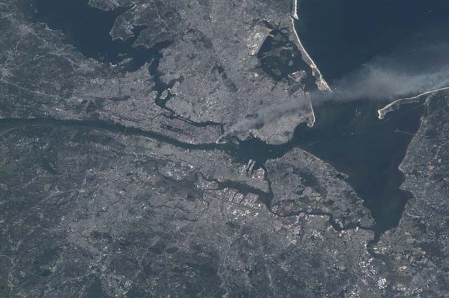
This image is one of a series taken by Culbertson that day of metropolitan New York City by the International Space Station's Expedition 3 crew that shows the smoke plume rising from Manhattan.
Smoke Still Rising from Manhattan Two Days Following
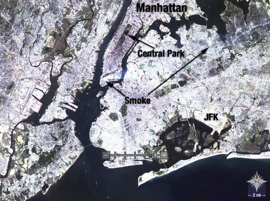
Landsat 5 satellite acquired this image of New York City on Sept. 13, 2001, two days after the terrorist attacks that destroyed the towers of the World Trade Center, as smoke continued to emanate from lower Manhattan.
Smoke Plume Rising from Manhattan 2
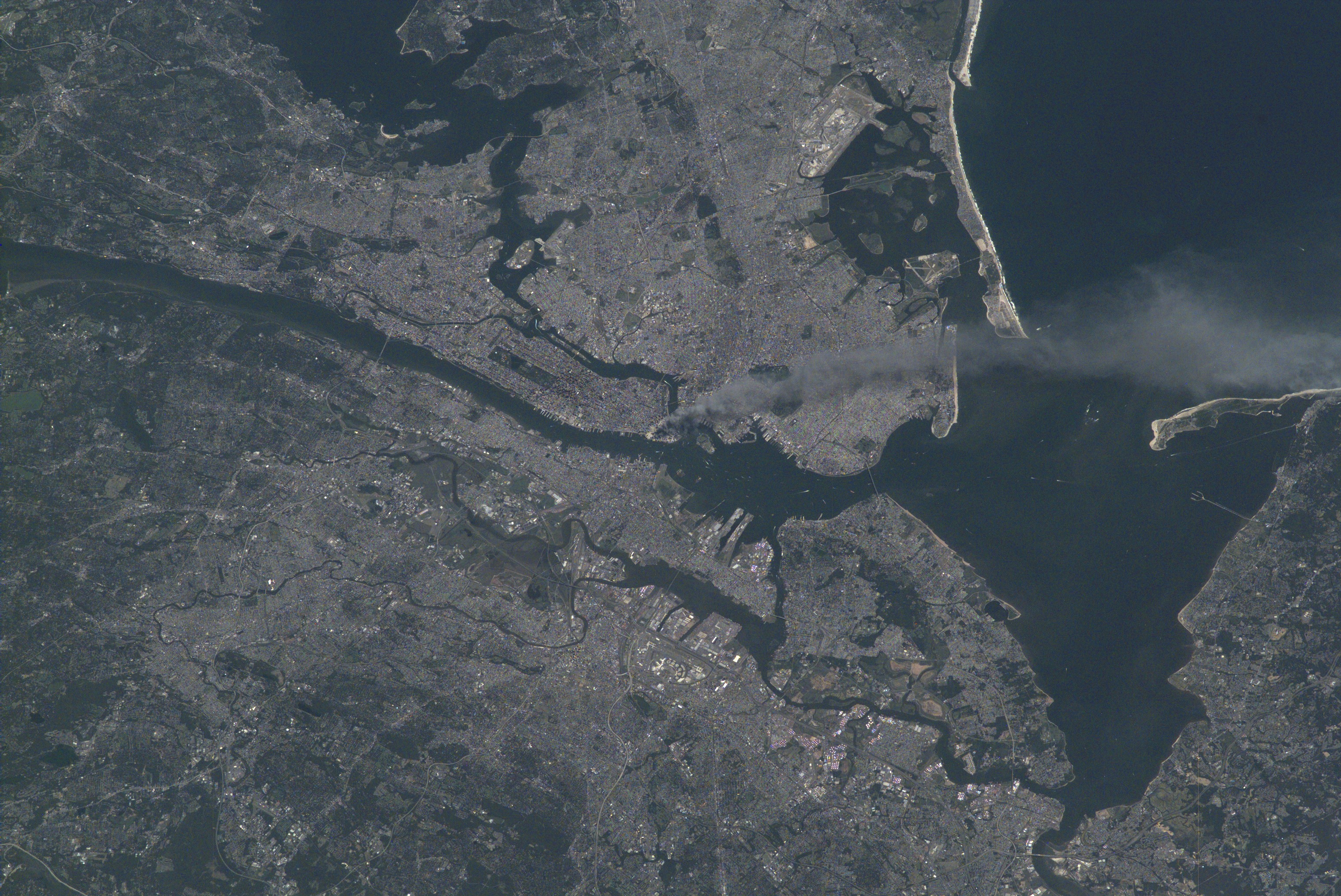
One of a series of pictures of metropolitan New York City taken by one of the Expedition Three crew members onboard the International Space Station (ISS) at various times during the day on September 11, 2001. A smoke plume rises from the Manhattan area where the World Trade Center was destroyed. The orbital outpost was flying at an altitude of approximately 250 miles.
SPOT Satellite Image of World Trade Center Fires
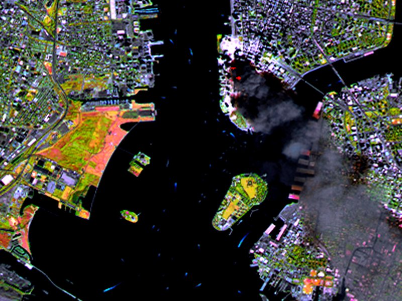
SPOT satellite image of Manhattan, acquired on September 11 at 11:55 AM EST, 3 hours after two planes crashed into the World Trade Center. The colors result from the use of infrared bands to identify the actual fire hot spots (see red spots near the base of the smoke plume). The SPOT satellites orbit at an altitude of 822 km.
Smoke Plume Rising from Manhattan 3
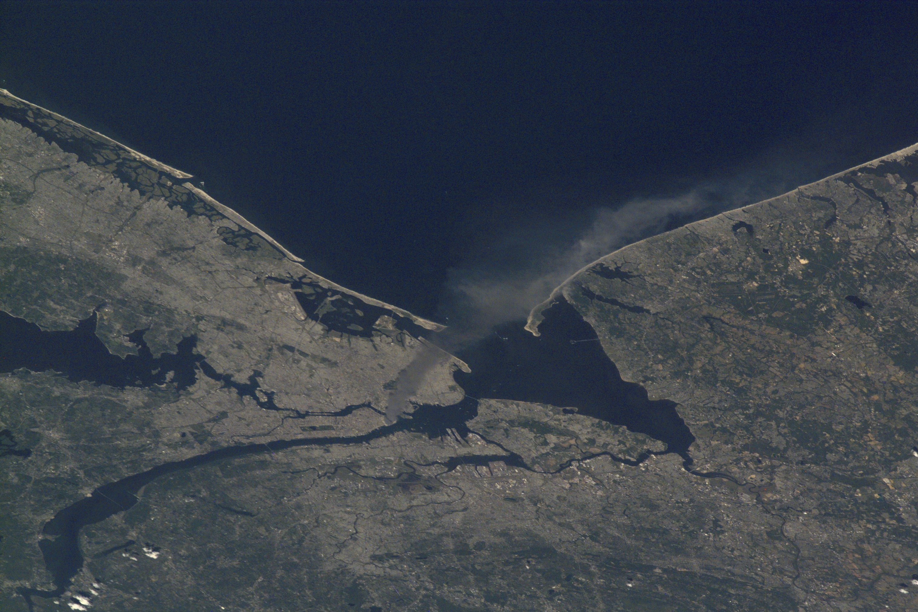
One of a series of pictures of metropolitan New York City taken by one of the Expedition Three crew members onboard the International Space Station (ISS) at various times during the day on September 11, 2001. A smoke plume rises from the Manhattan area where the World Trade Center was destroyed. The orbital outpost was flying at an altitude of approximately 250 miles.
Get the Space.com Newsletter
Breaking space news, the latest updates on rocket launches, skywatching events and more!
Smoke Plume Rising from Manhattan 4
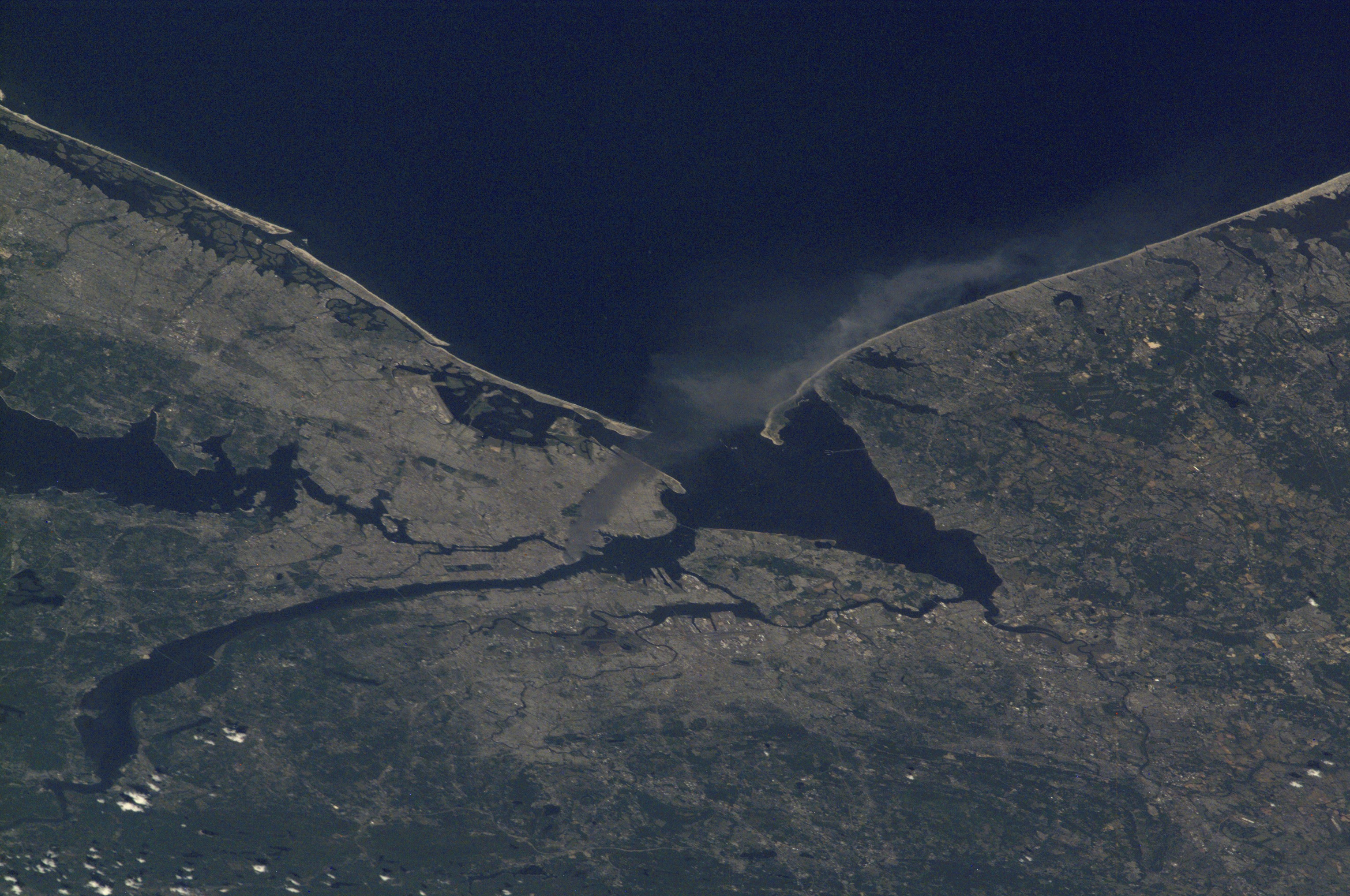
One of a series of pictures of metropolitan New York City taken by one of the Expedition Three crew members onboard the International Space Station (ISS) at various times during the day on September 11, 2001. A smoke plume rises from the Manhattan area where the World Trade Center was destroyed. The orbital outpost was flying at an altitude of approximately 250 miles.
SPOT Satellite Images of World Trade Center Fires (Wider)
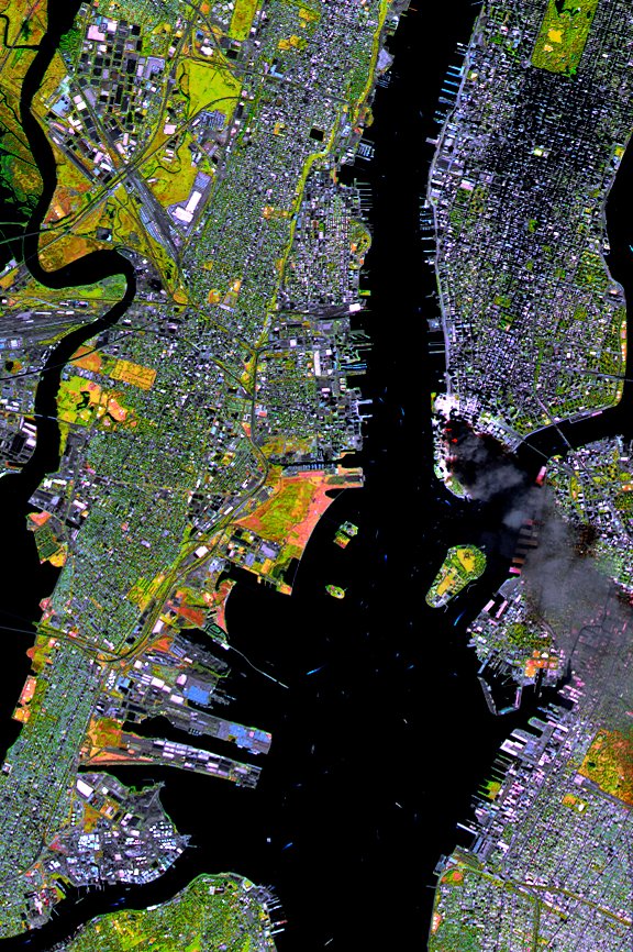
SPOT satellite image of Manhattan, acquired on September 11 at 11:55 AM EST, 3 hours after two planes crashed into the World Trade Center. The colors result from the use of infrared bands to identify the actual fire hot spots (see red spots near the base of the smoke plume). The SPOT satellites orbit at an altitude of 822 km.
Smoke Plume Rising from Manhattan 5
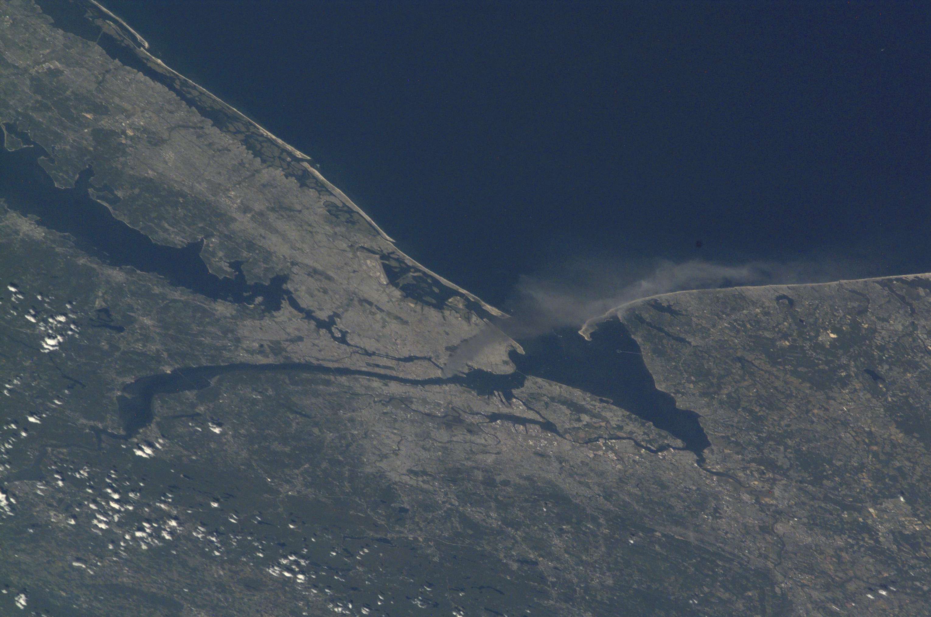
One of a series of pictures of metropolitan New York City taken by one of the Expedition Three crew members onboard the International Space Station (ISS) at various times during the day on September 11, 2001. A smoke plume rises from the Manhattan area where the World Trade Center was destroyed. The orbital outpost was flying at an altitude of approximately 250 miles.
World Trade Center Aftermath as Seen by IKONOS Satellite
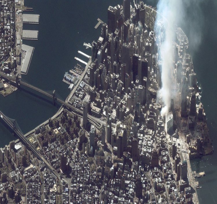
This one-meter resolution satellite image of Manhattan, New York was collected at 11:43 a.m. EDT on Sept. 12, 2001, by Space Imaging's IKONOS satellite. The image shows an area of white dust and smoke at the location where the 1,350-foot towers of the World Trade Center once stood. IKONOS travels 423 miles above the Earth's surface at a speed of 17,500 miles per hour.
Smoke Plume Rising from Manhattan 6
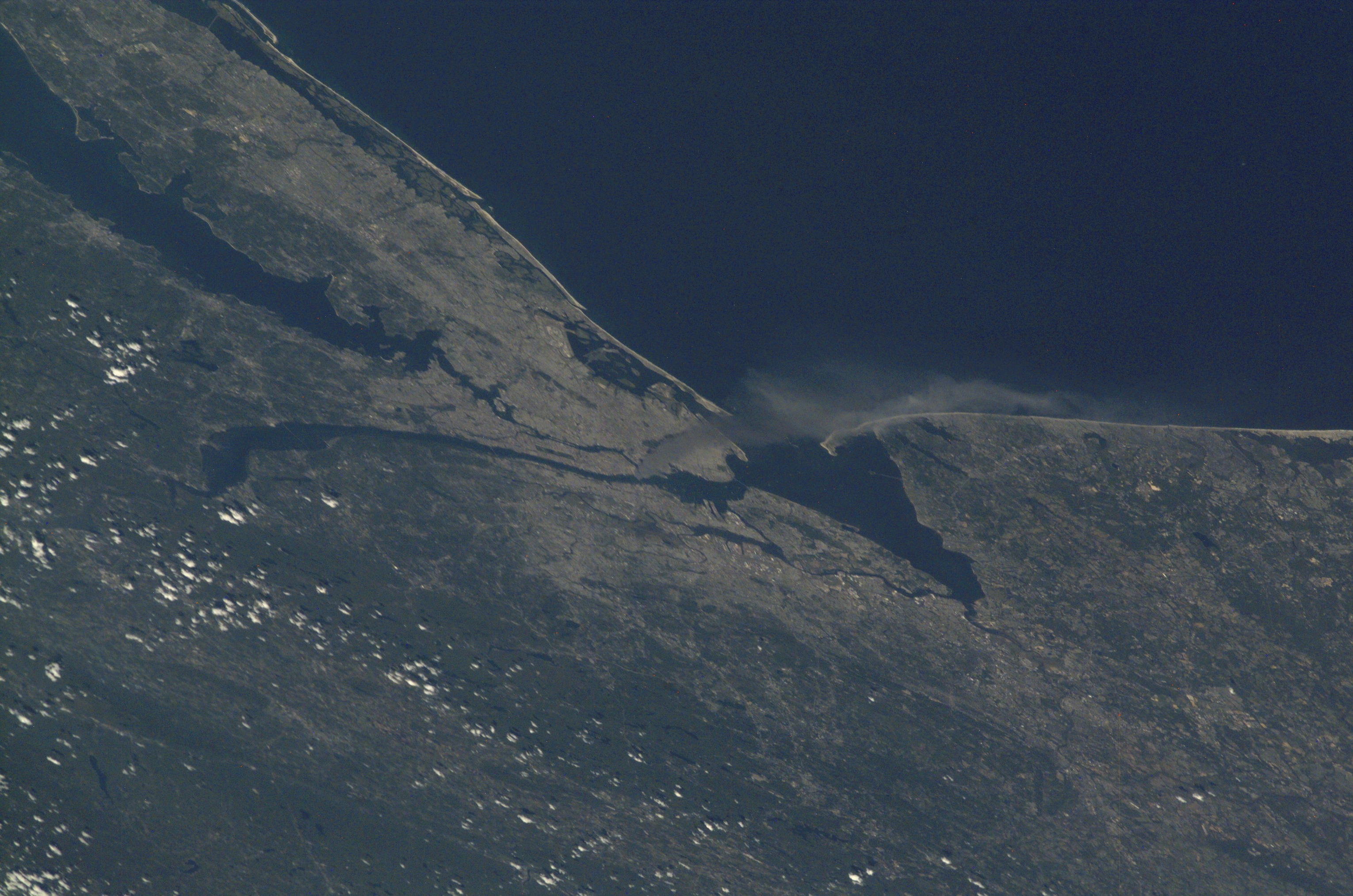
One of a series of pictures of metropolitan New York City taken by one of the Expedition Three crew members onboard the International Space Station (ISS) at various times during the day on September 11, 2001. A smoke plume rises from the Manhattan area where the World Trade Center was destroyed. The orbital outpost was flying at an altitude of approximately 250 miles.
World Trade Center Aftermath as Seen by IKONOS Satellite
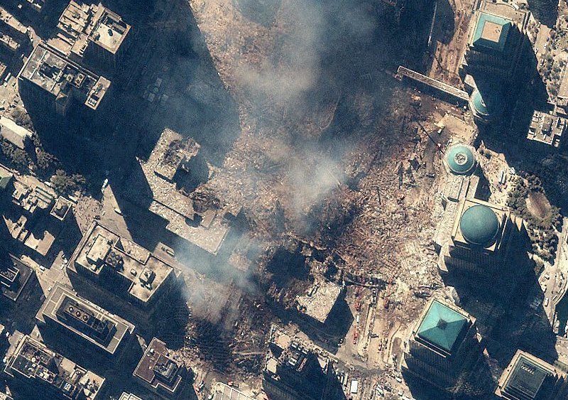
Space Imaging's IKONOS satellite collected this image of Manhattan, New York at 11:54 a.m. EDT on Sept. 15, 2001. The image shows the remains of the 1,350-foot towers of the World Trade Center, and the debris and dust that settled throughout the area. Also visible are many emergency and rescue vehicles in the streets. IKONOS orbits 423 miles above the Earth's surface at a speed of 17,500 miles per hour.
Join our Space Forums to keep talking space on the latest missions, night sky and more! And if you have a news tip, correction or comment, let us know at: community@space.com.

Space.com is the premier source of space exploration, innovation and astronomy news, chronicling (and celebrating) humanity's ongoing expansion across the final frontier. Originally founded in 1999, Space.com is, and always has been, the passion of writers and editors who are space fans and also trained journalists. Our current news team consists of Editor-in-Chief Tariq Malik; Editor Hanneke Weitering, Senior Space Writer Mike Wall; Senior Writer Meghan Bartels; Senior Writer Chelsea Gohd, Senior Writer Tereza Pultarova and Staff Writer Alexander Cox, focusing on e-commerce. Senior Producer Steve Spaleta oversees our space videos, with Diana Whitcroft as our Social Media Editor.
