Photos: Asteroid Vesta and NASA's Dawn Spacecraft
False-Color Image Shows Proof of an Impact
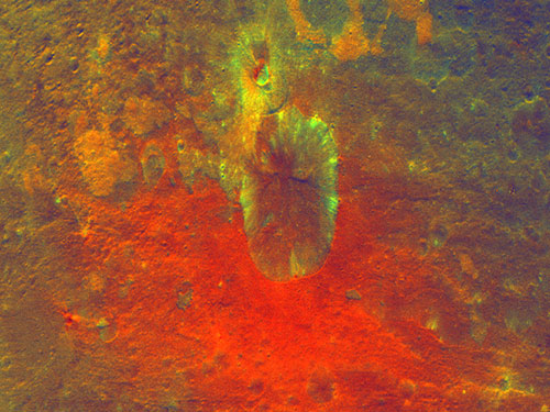
This false-color image obtained by NASA's Dawn spacecraft shows a crater on the giant asteroid Vesta.
Impressive Mountain Tops on Vesta
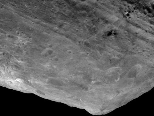
In this image of the south pole region of the asteroid Vesta, a mountain is rising approximately 9 miles (15 kilometers) above the floor of a crater.
Vesta's Surface in 3D: A Big Mountain at the Asteroid's South Pole
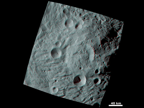
When Dawn sent the first images of the giant asteroid Vesta to the ground, scientists were fascinated by this surface feature at the south pole.
A False-Color Topography of Vesta's South Pole
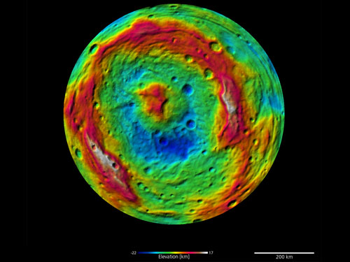
This false-color map of the giant asteroid Vesta was created from stereo images obtained by the framing camera aboard NASA's Dawn spacecraft.
Vesta's Surface in 3D: Details of Wave-Like Terrain in the South Pole
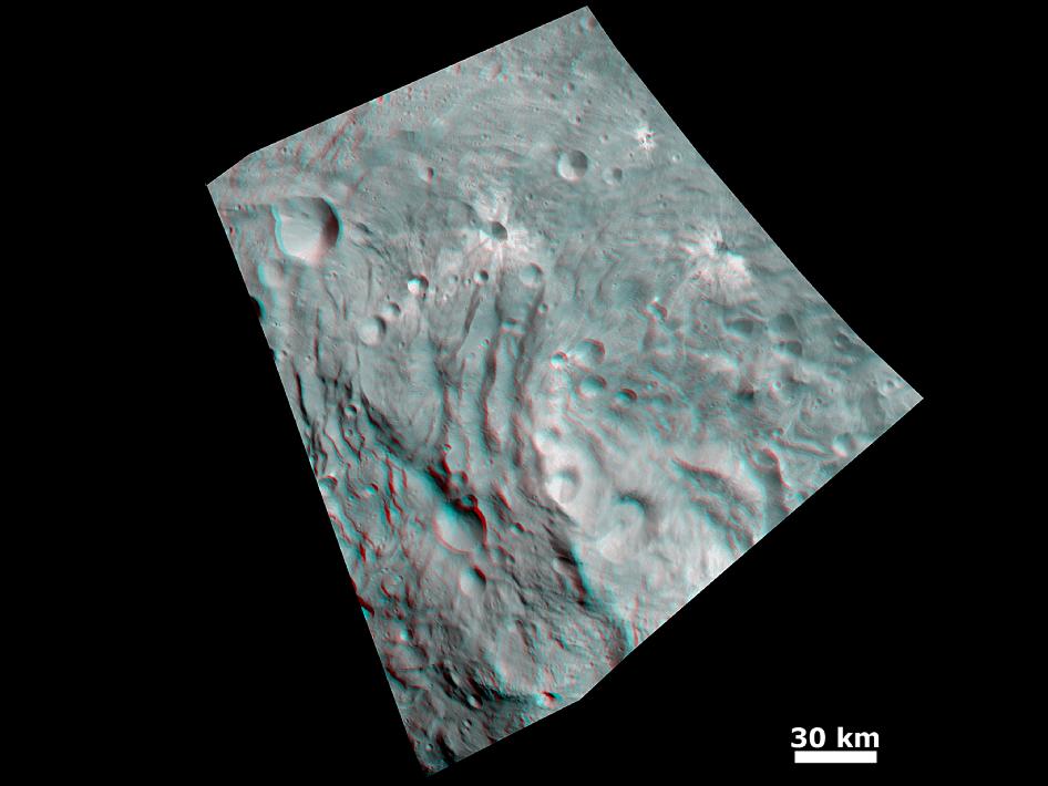
In this image, obtained by NASA's Dawn spacecraft, topography in the area surrounding Vesta's south pole area shows impact craters, ridges and grooves.
Vesta's Dark Side
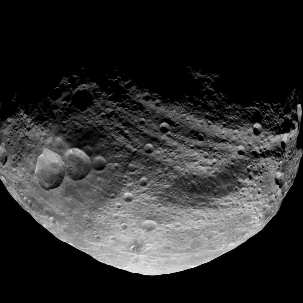
Dawn took this image over Vesta's northern hemisphere after the spacecraft completed its first passage over the dark side of the giant asteroid on July 23, 2011.
Latest Image of Vesta Captured by Dawn on July 17, 2011

NASA's Dawn spacecraft obtained this image with its framing camera on July 17, 2011. It was taken from a distance of about 9,500 miles (15,000 kilometers) away from the protoplanet Vesta. Each pixel in the image corresponds to roughly 0.88 miles (1.4 kilometers)
Get the Space.com Newsletter
Breaking space news, the latest updates on rocket launches, skywatching events and more!
Global Mineral Map of Vesta
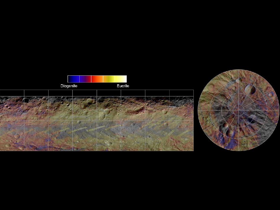
This colorized map from NASA's Dawn mission shows the distribution of minerals across the surface of the giant asteroid Vesta. The visible and infrared mapping spectrometer collected the data used to create this mosaic image in August 2011.
Anaglyph Image of Vesta's South Polar Region
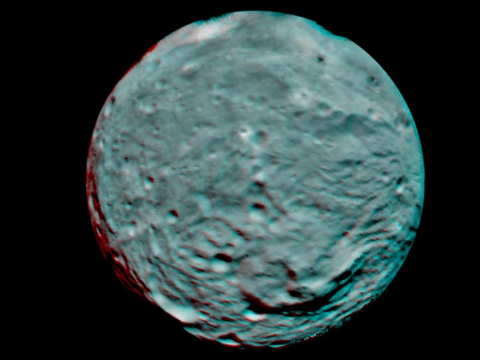
This anaglyph image of the south polar region of the asteroid Vesta was put together from two clear filter images, taken on July 9, 2011 by the framing camera instrument aboard NASA's Dawn spacecraft. Each pixel in this image corresponds to roughly 2.2 miles (3.5 kilometers). The anaglyph image shows the rough topography in the south polar area, the large mountain, impact craters, grooves, and steep scarps in three dimensions. The diameter of Vesta is about 330 miles (530 kilometers). Use red-green (or red-blue) glasses to view in 3-D (left eye: red; right eye: green [or blue]).
An Enhanced View of Vesta's South Polar Region
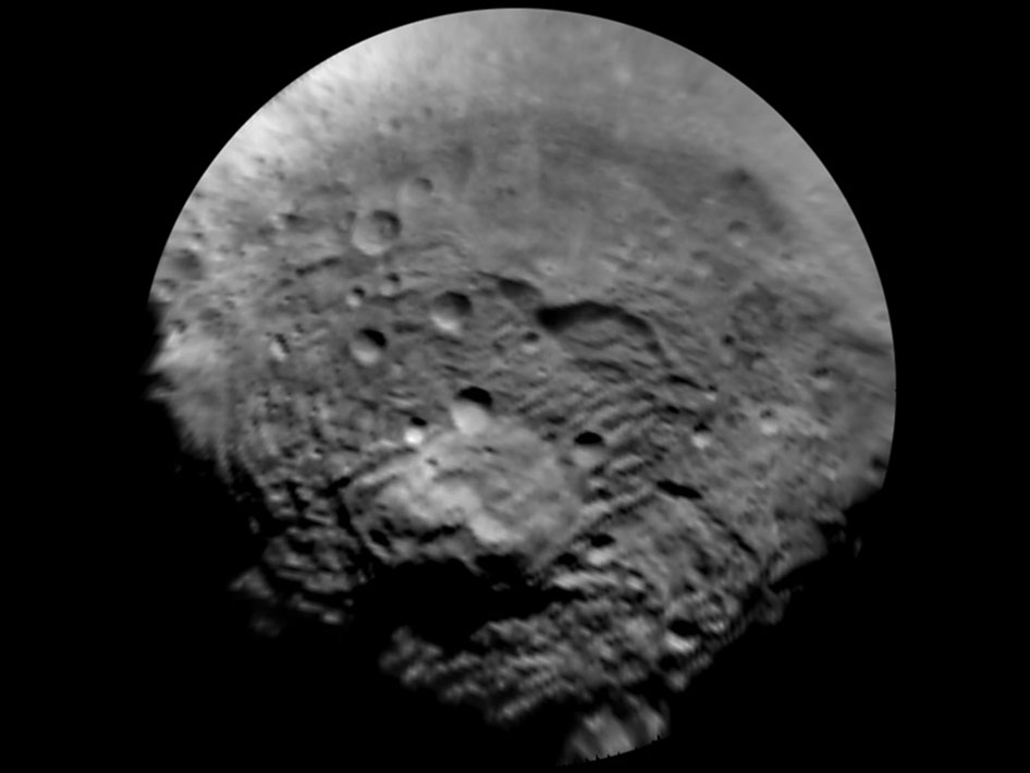
NASA's Dawn spacecraft took this image of the south polar region of Vesta, which has a diameter of 330 miles (530 kilometers). The image was taken on July 9, 2011, and it has a scale of about 2.2 miles (3.5 km) per pixel. To enhance details, the resolution was enlarged to .6 miles (1 km) per pixel. This region is characterized by rough topography, a large mountain, impact craters, grooves and steep scarps.
Join our Space Forums to keep talking space on the latest missions, night sky and more! And if you have a news tip, correction or comment, let us know at: community@space.com.

Space.com is the premier source of space exploration, innovation and astronomy news, chronicling (and celebrating) humanity's ongoing expansion across the final frontier. Originally founded in 1999, Space.com is, and always has been, the passion of writers and editors who are space fans and also trained journalists. Our current news team consists of Editor-in-Chief Tariq Malik; Editor Hanneke Weitering, Senior Space Writer Mike Wall; Senior Writer Meghan Bartels; Senior Writer Chelsea Gohd, Senior Writer Tereza Pultarova and Staff Writer Alexander Cox, focusing on e-commerce. Senior Producer Steve Spaleta oversees our space videos, with Diana Whitcroft as our Social Media Editor.
