Hurricane Irene Photos From Space
Hurricane Beginning to Intensify
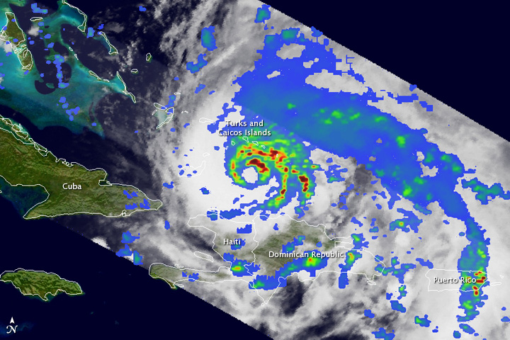
The Tropical Rainfall Measuring Mission (TRMM) satellite passed directly over Hurricane Irene late on August 23, 2011, capturing these images of a storm getting ready to intensify.
Intenstifying Hurricane
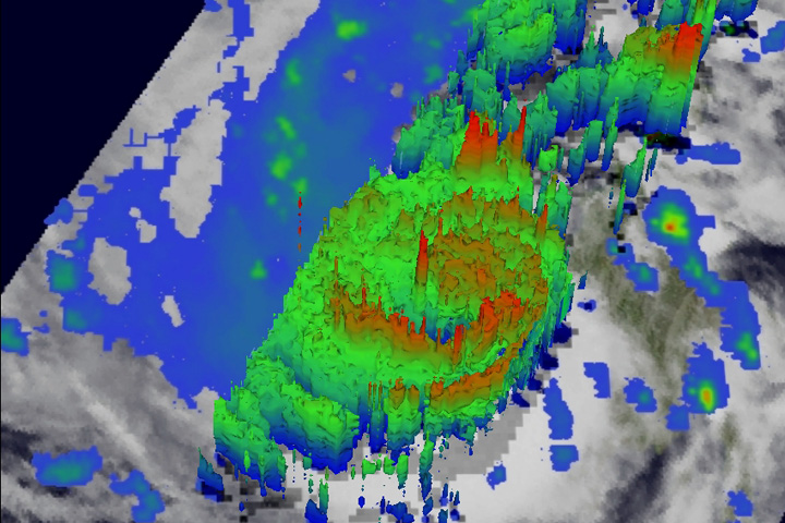
The Tropical Rainfall Measuring Mission (TRMM) satellite passed directly over Hurricane Irene late on August 23, 2011, capturing these images of a storm getting ready to intensify.
Irene Closing on the Bahamas
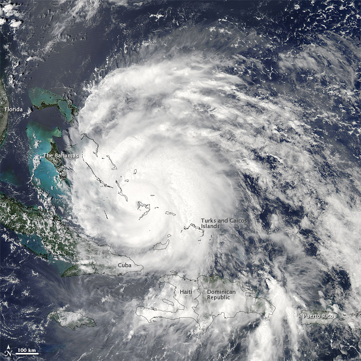
Hurricane Irene strengthened on its path toward the continental United States in late August 2011.
3-D Hurricane Irene
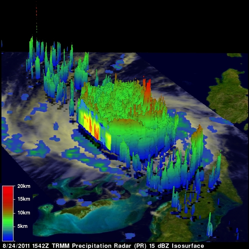
Another 3-D view of Irene, captured on August 24, revealed once again the presence of a deep convective tower within the eyewall. The red area indicates rainfall rates of 50mm/hr (~2 inches), while yellow and green areas indicate moderate rainfall between .78 to 1.57 inches (20-40 mm) per hour.
Hurricane Irene as Seen by Astronaut Garan on the International Space Station
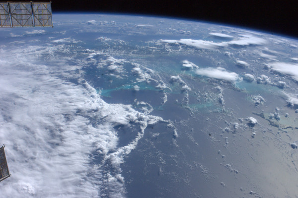
Astronaut Ron Garan caught Hurricane Irene from the International Space Station on August 24, 2011: "Hurricane #FromSpace the outer bands of #Irene can be seen just west of Turks & Caicos yesterday - 8/24/11 #NASA"
Hurricane Irene Over the Bahamas
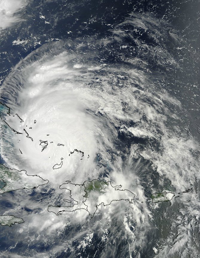
The MODIS Instrument aboard NASA's Terra satellite captured this visible image of Hurricane Irene over the southern Bahamas on August 24, 2011 at 15:05 UTC (11:05 a.m. EDT). Just three hours later at 2 p.m. EDT, Hurricane Irene's eye was over Crooked Island, Bahamas, near 22.7 North and 74.3 West. Irene's winds increased to 120 mph (195 kmh) and it was moving to the northwest near 12 mph (19 kmh). Irene's minimum central pressure is 954 millibars.
Hurricane Irene Grows Ominous
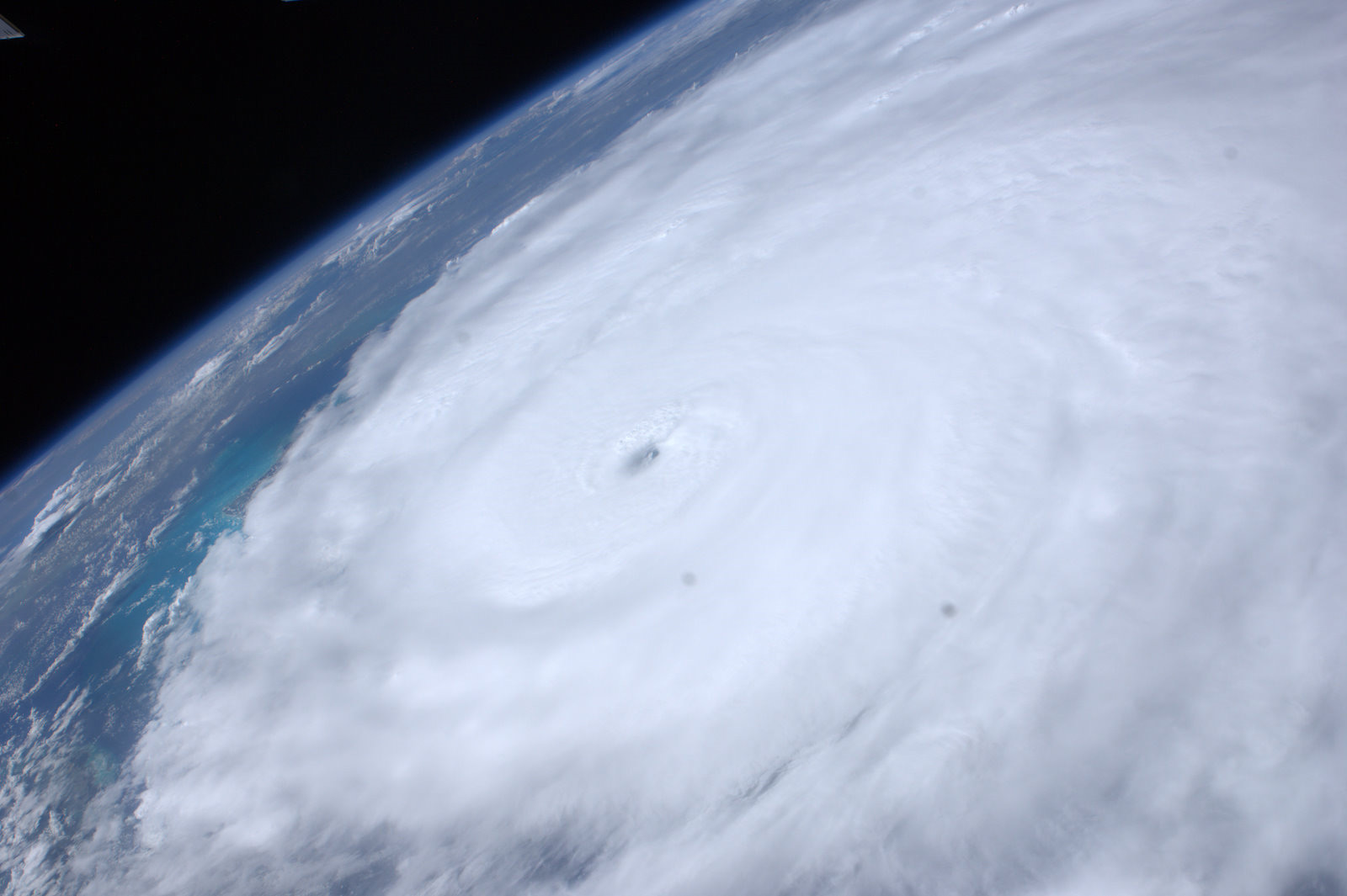
Astronaut Ron Garan tweeted this picture of Hurricane Irene from the International Space Station on August 24, 2011: "Ominous view #FromSpace of Hurricane #Irene east of the Bahamas @ 3:14pm EST today. East FL coast is calm b4 storm."
Get the Space.com Newsletter
Breaking space news, the latest updates on rocket launches, skywatching events and more!
Hurricane Irene as Seen by the GOES Satellite on August 24, 2011.
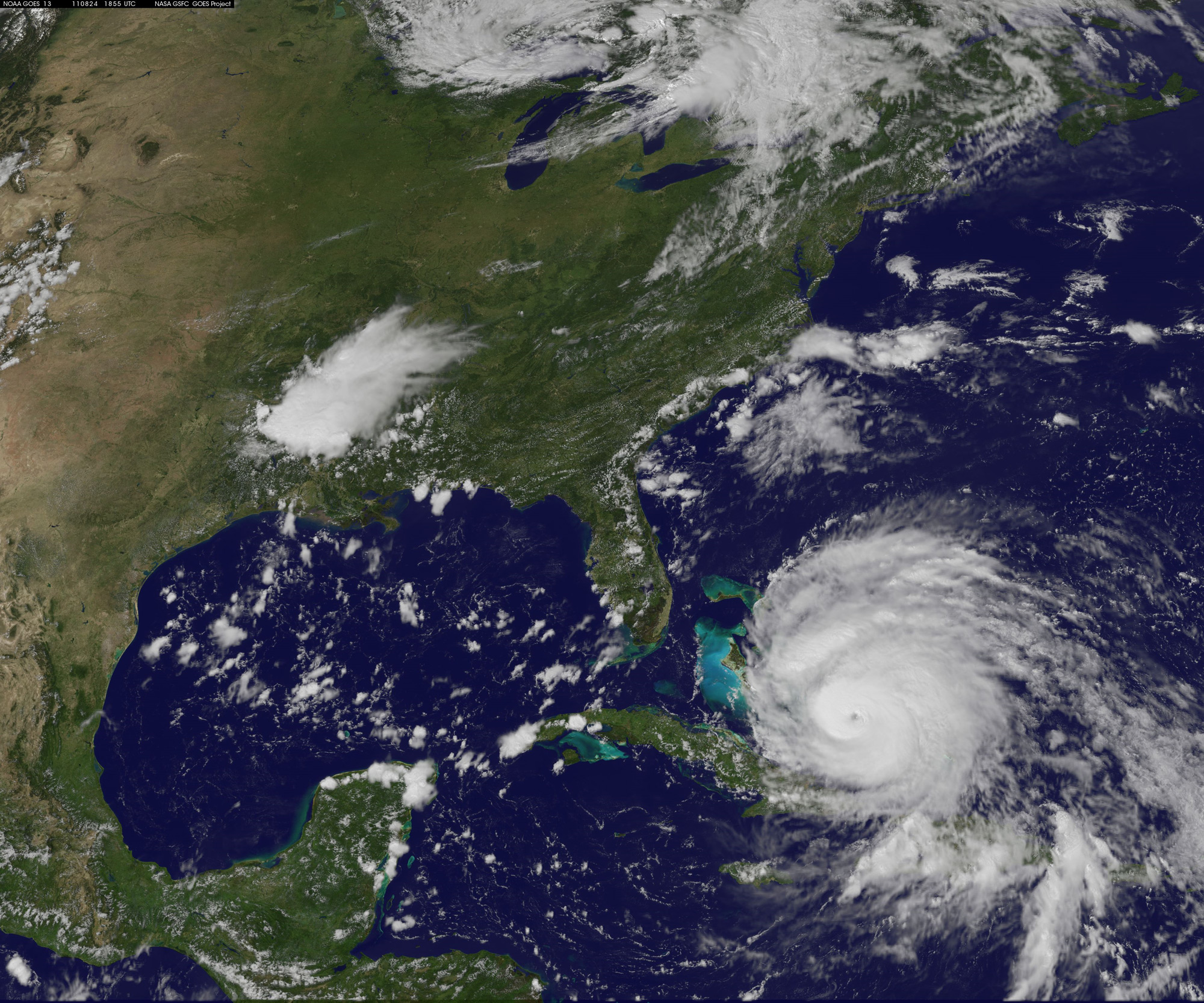
As Hurricane Irene continues to strengthen, its shape is becoming more defined. In this image, taken by the GOES satellite at 2:55 p.m. Eastern Daylight Time on August 24, 2011, Irene has a distinct eye. The clouds spiraling around the center are becoming more compact, and the storm is more circular than in previous days.
Eye of Hurricane Irene
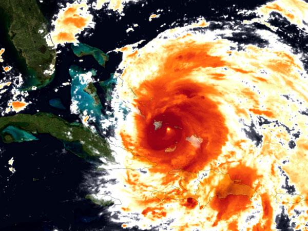
Hurricane Irene's eye as seen by infrared instruments onboard the GOES-East satellite.
Warm Atlantic Water for Hurricane Irene
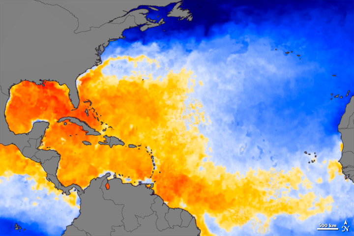
As Hurricane Irene rumbles through the Atlantic Ocean, it needs fuel to sustain itself. Warm water is the main fuel, and there is plenty of it right now, as there usually is this time of year. The map above shows sea surface temperatures (SST) in the Atlantic Ocean, Gulf of Mexico, and the Caribbean Sea on August 23, 2011
Join our Space Forums to keep talking space on the latest missions, night sky and more! And if you have a news tip, correction or comment, let us know at: community@space.com.

Space.com is the premier source of space exploration, innovation and astronomy news, chronicling (and celebrating) humanity's ongoing expansion across the final frontier. Originally founded in 1999, Space.com is, and always has been, the passion of writers and editors who are space fans and also trained journalists. Our current news team consists of Editor-in-Chief Tariq Malik; Editor Hanneke Weitering, Senior Space Writer Mike Wall; Senior Writer Meghan Bartels; Senior Writer Chelsea Gohd, Senior Writer Tereza Pultarova and Staff Writer Alexander Cox, focusing on e-commerce. Senior Producer Steve Spaleta oversees our space videos, with Diana Whitcroft as our Social Media Editor.


