Photos: Mars Volcano Views Revealed by Spacecraft
Eden Patera Supervolcano on Mars
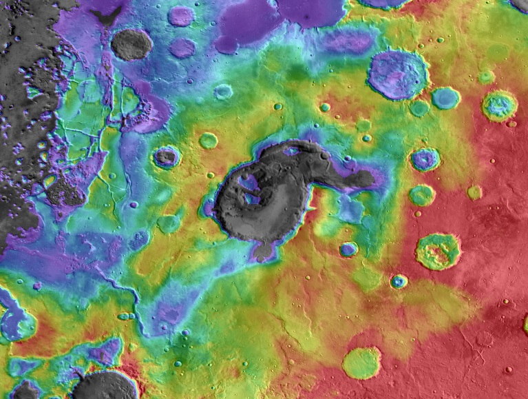
This image shows digital elevation data overlaid on daytime thermal infrared images of Eden Patera, the type example of an ancient supervolcano on Mars. Red colors are relatively high and purple-gray colors are low. Image released Oct. 2, 2013. [Read the full story.]
3-Dimensional View of Eden Patera
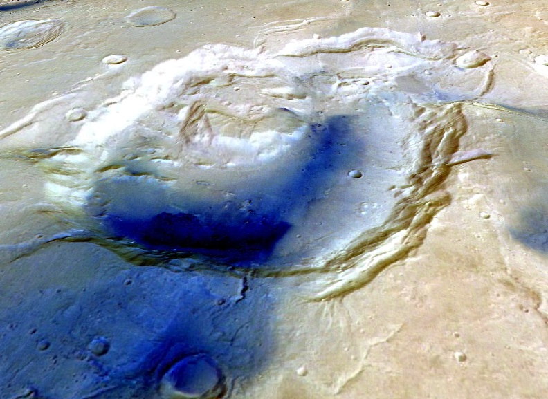
This image shows a 3-dimensional view of Eden Patera looking toward the east. Color image data from the High Resolution Stereo Camera (HRSC) were draped over digital topographic data from the same instrument. Image released Oct. 2, 2013. [Read the full story.]
Oxus Patera Supervolcano on Mars
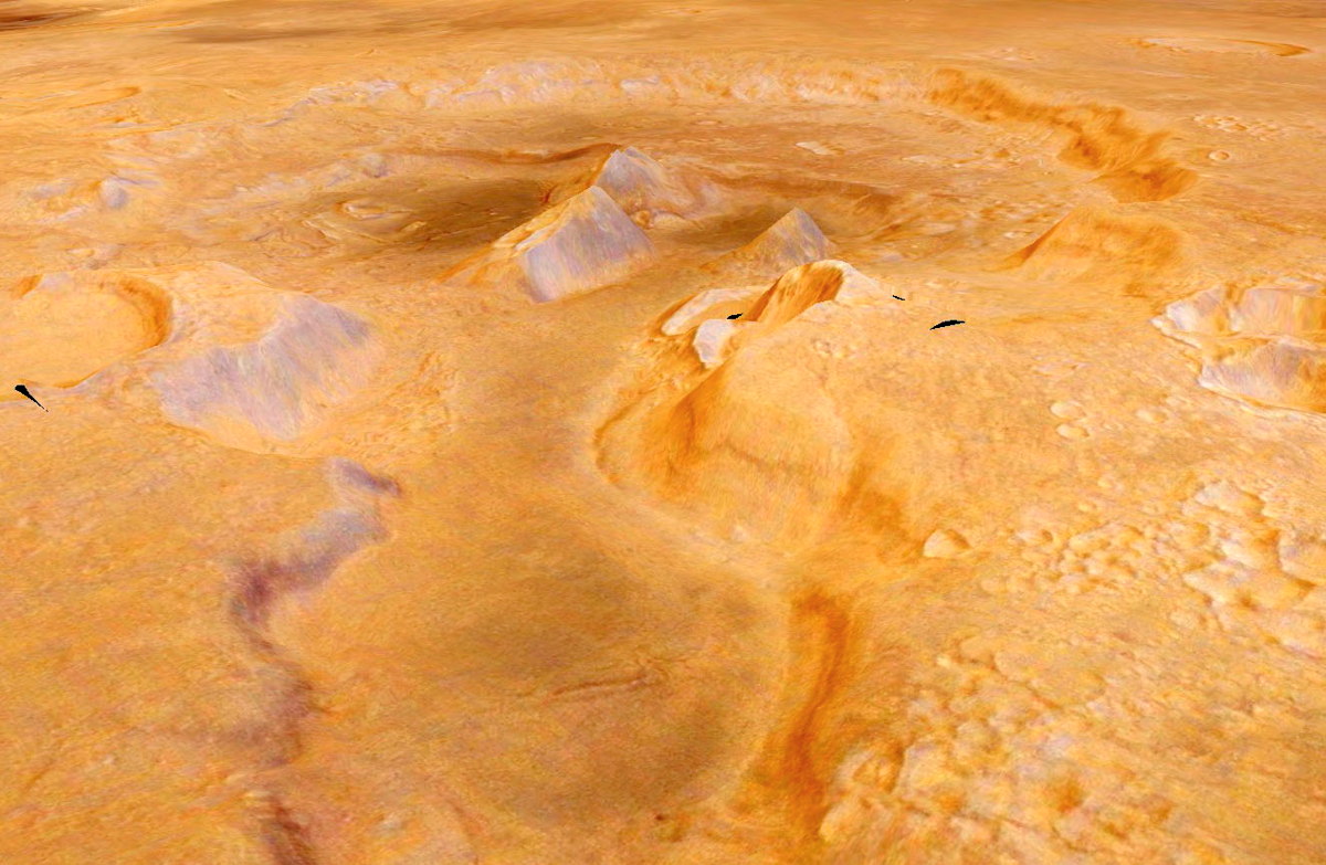
This image shows another candidate supervolcano on Mars, called Oxus Patera. The image was created by draping color images from the High Resolution Stereo Camera draped over digital elevation data from the same instrument. Image released Oct. 2, 2013. [Read the full story.]
Floor of Eden Patera
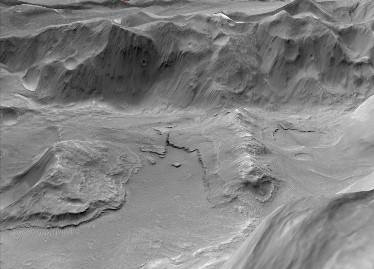
This image shows a high-resolution view of layered materials and collapse features on the floor of Eden Patera. The layers represent areas where lava in an ancient lava lake attached to ridges and hills in the floor of the crater, froze against the bedrock, and then detached as the lava lake drained from beneath. Image released Oct. 2, 2013. [Read the full story.]
Battered Martian Volcano Tharsis Tholus
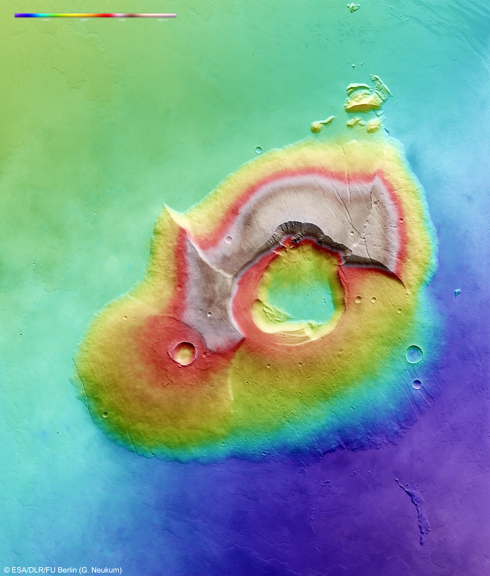
Tharsis Tholus towers almost 5 miles (8 km) above the surrounding terrain of Mars. Its base stretches 96 x 77 miles (155 x 125 km), and is unusual in its battered condition. The main feature of Tharsis Tholus is the caldera at its centre. It has an almost circular outline, about 20 x 21 miles (32 x 34 km), and is ringed by faults where the caldera floor has subsided by as much as 1.6 miles (2.7 km). The image was created using a Digital Terrain Model (DTM) obtained data taken by the High Resolution Stereo Camera on ESA's Mars Express spacecraft during four orbits of Mars between October 28 and November 13, 2004. Elevation data from the DTM is color-coded: Purple indicates the lowest lying regions and beige the highest. The scale is in meters.
Martian Volcano Tharsis Tholus in Perspective 1
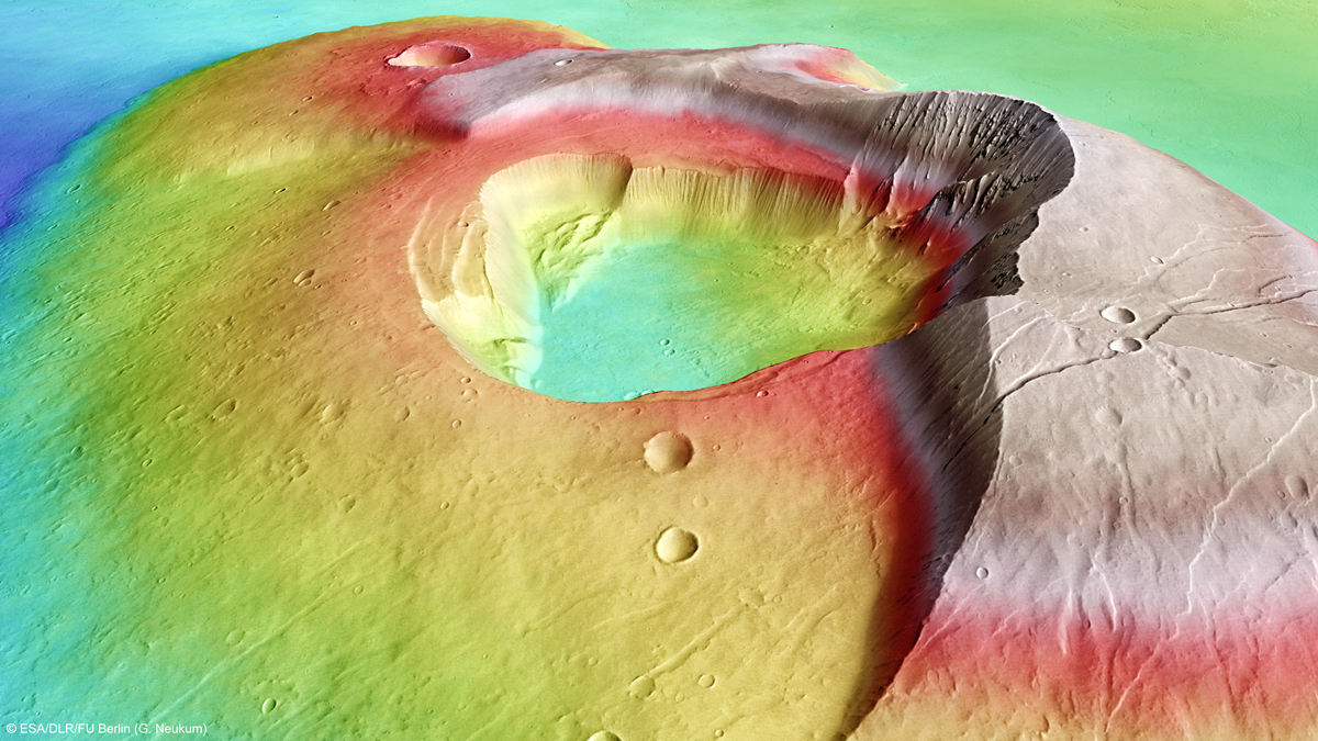
Martian volcano Tharsis Tholus towers miles almost 5 miles (8 km) above the surrounding terrain. The image was created using a Digital Terrain Model (DTM) obtained from the High Resolution Stereo Camera on ESA's Mars Express spacecraft. Elevation data from the DTM is color-coded: Purple indicates the lowest lying regions and beige the highest. The scale is in meters. In these images, the relief has been exaggerated by a factor of three.
Martian Volcano Tharsis Tholus in Perspective 2
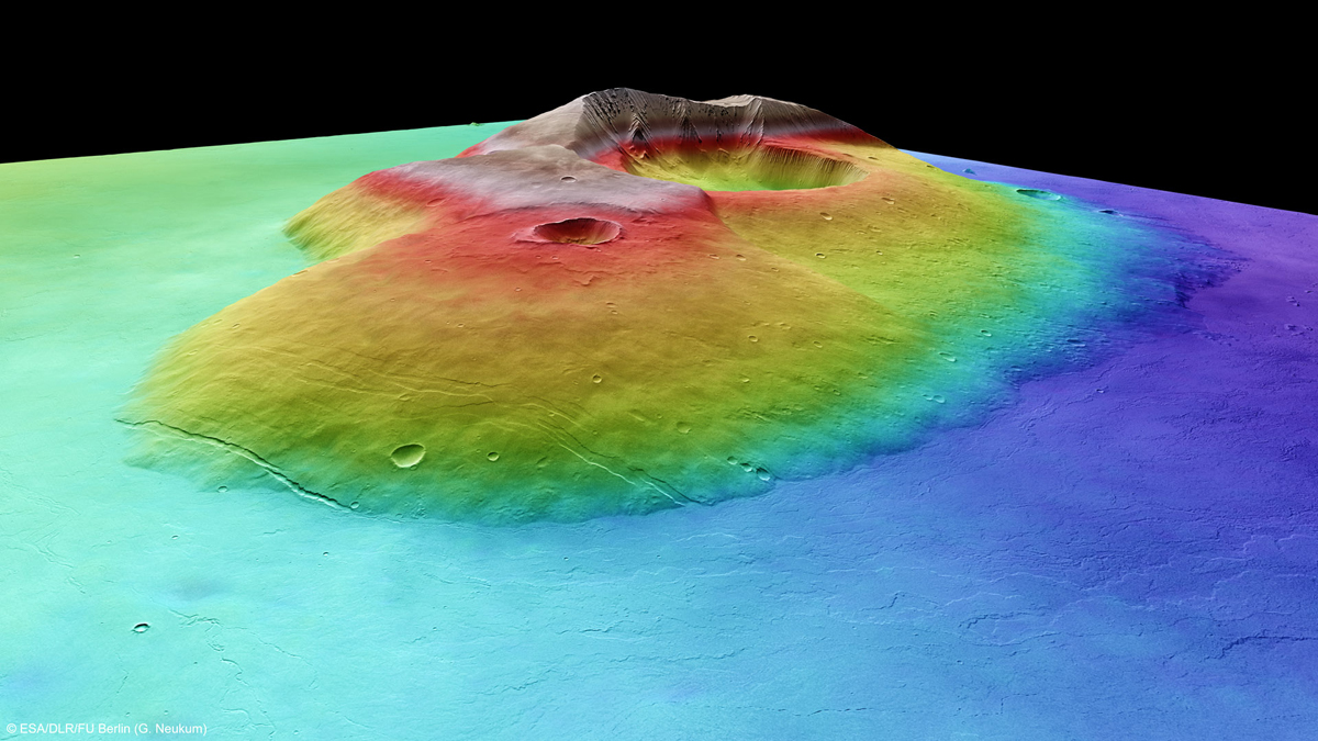
Martian volcano Tharsis Tholus towers miles almost 5 miles (8 km) above the surrounding terrain. The image was created using a Digital Terrain Model (DTM) obtained from the High Resolution Stereo Camera on ESA's Mars Express spacecraft. Elevation data from the DTM is color-coded: Purple indicates the lowest lying regions and beige the highest. The scale is in meters. In these images, the relief has been exaggerated by a factor of three.
Get the Space.com Newsletter
Breaking space news, the latest updates on rocket launches, skywatching events and more!
Martian Volcano Tharsis Tholus in Perspective 4
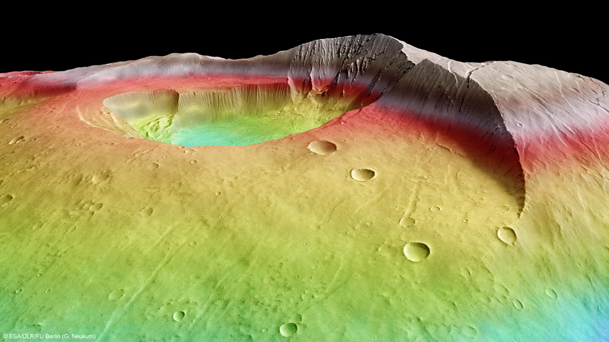
Martian volcano Tharsis Tholus towers miles almost 5 miles (8 km) above the surrounding terrain. The image was created using a Digital Terrain Model (DTM) obtained from the High Resolution Stereo Camera on ESA's Mars Express spacecraft. Elevation data from the DTM is color-coded: Purple indicates the lowest lying regions and beige the highest. The scale is in meters. In these images, the relief has been exaggerated by a factor of three.
Tharsis Tholus in Context
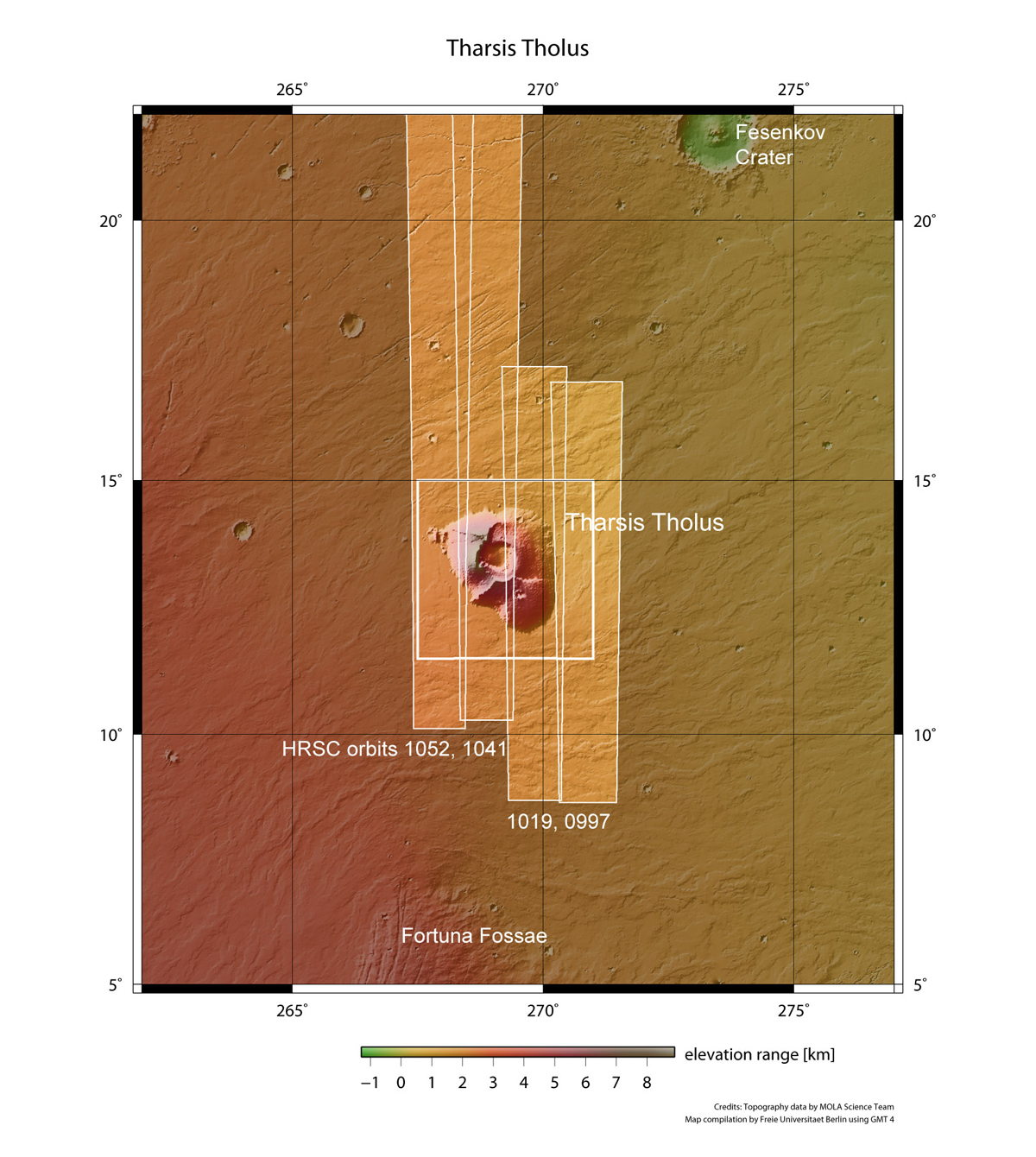
In this wider contextual image of the region surrounding Tharsis Tholus, the rectangles show the region covered in this Mars Express HRSC image release. The area is situated at approximately 13°N/268°E.
Mars Volcano Could Harbor Life
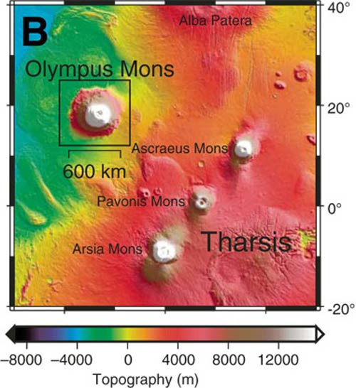
A relief map showing the relative size and location of Olympus Mons, the largest volcano on Mars and in the solar system.
Mars Volcanoes Possibly Still Active, Pictures Show
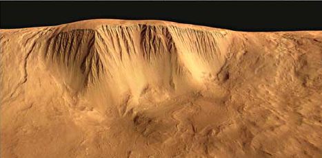
The western scarp of Olympus Mons has both steep and gentle slopes with clear channels, some likely created by flowing liquid, perhaps water, and some apparently carved by glaciers.
Join our Space Forums to keep talking space on the latest missions, night sky and more! And if you have a news tip, correction or comment, let us know at: community@space.com.

Space.com is the premier source of space exploration, innovation and astronomy news, chronicling (and celebrating) humanity's ongoing expansion across the final frontier. Originally founded in 1999, Space.com is, and always has been, the passion of writers and editors who are space fans and also trained journalists. Our current news team consists of Editor-in-Chief Tariq Malik; Editor Hanneke Weitering, Senior Space Writer Mike Wall; Senior Writer Meghan Bartels; Senior Writer Chelsea Gohd, Senior Writer Tereza Pultarova and Staff Writer Alexander Cox, focusing on e-commerce. Senior Producer Steve Spaleta oversees our space videos, with Diana Whitcroft as our Social Media Editor.

