Photos: Red Planet Views from Europe's Mars Express
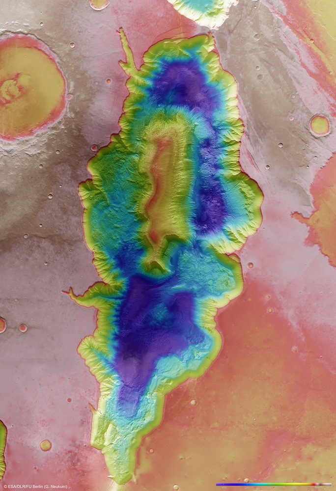
Hebes Chasma Topography
This color-coded topography map shows the relative heights and depths of features in and around Hebes Chasma. White and red show the highest terrains, while blue and purple show the deepest. This region of Mars was imaged by the High Resolution Stereo Camera on ESA’s Mars Express on eight occasions between 2004 and 2009 to create this new mosaic. Image released Oct. 10, 2013.
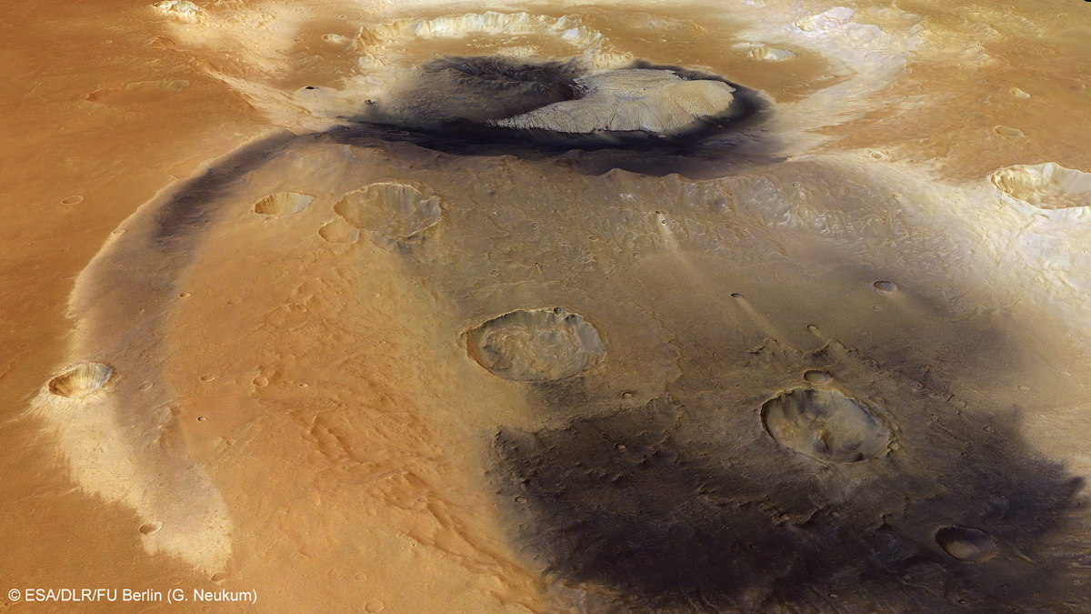
Becquerel Crater on Mars
Prominent patches of wind-blown dust, possibly mixed with volcanic ash, radiate from Becquerel crater and into a neighbouring crater. Image released Sept. 9, 2013.
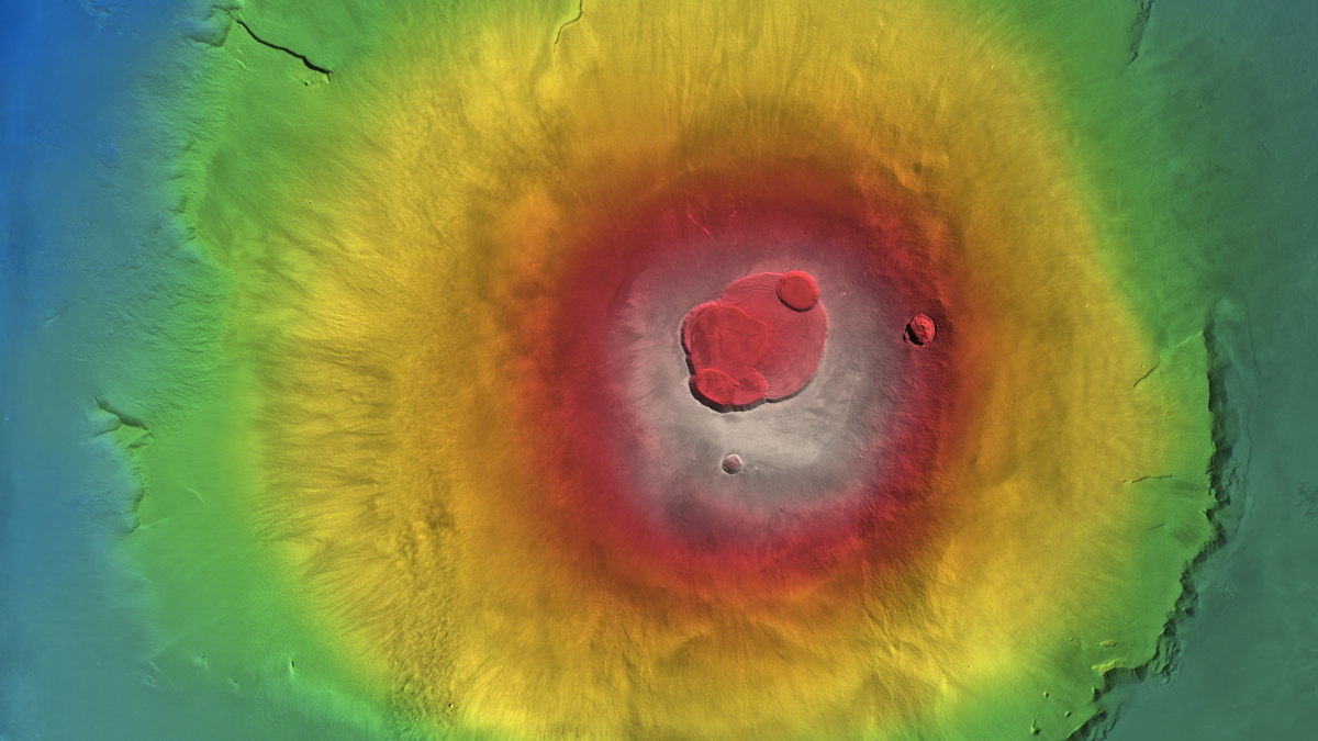
Color-Coded Elevation Model of Olympus Mons
Germany's Mars Express spacecraft arrived at the red planet in 2003.
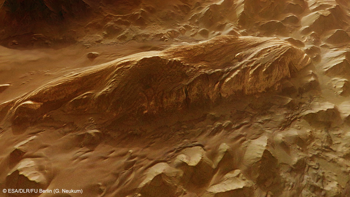
Juventae Chasma Perspective
The largest layered mound in Juventae Chasma on Mars is seen here in close-up perspective view. Image released Dec. 12, 2013.
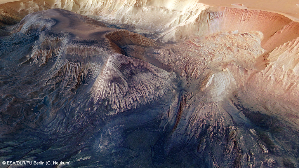
Hebes Chasma Landslides
A flat-topped mesa is located in the centre of Hebes Chasma and rises to a similar height as the surrounding plains. Exposed within the walls of the mesa are layers of sediments deposited by wind and water. Numerous grooves are etched into the mountain, suggesting the material is weak and easily eroded. The walls of Hebes Chasma are also weak – a large landslide dominates the right side of this image. Image released Oct. 10, 2013.
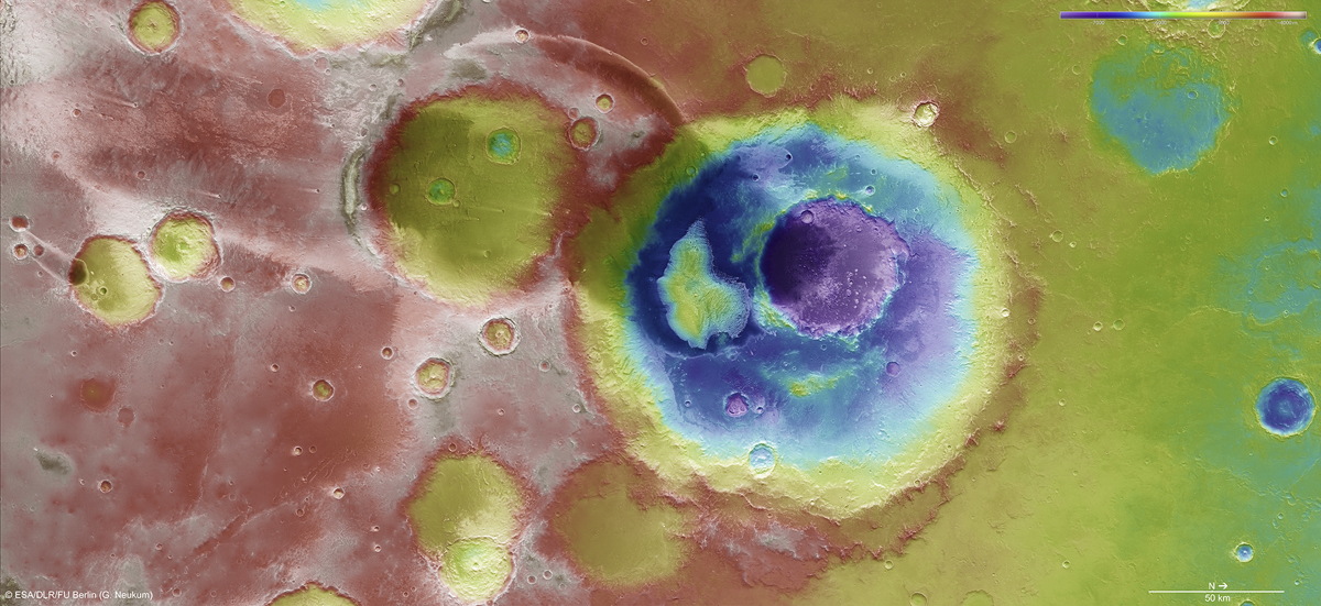
Becquerel Crater Topography
This color-coded topography map shows the relative heights and depths of features in and around Becquerel crater. White and red are the highest terrains, while blue and purple are the deepest, such as inside large impact craters. A decrease in overall elevation is seen towards the north (right) side of the image; this region occupies the transition zone between the southern highlands and the northern lowlands of Mars. Image released May 9, 2013.
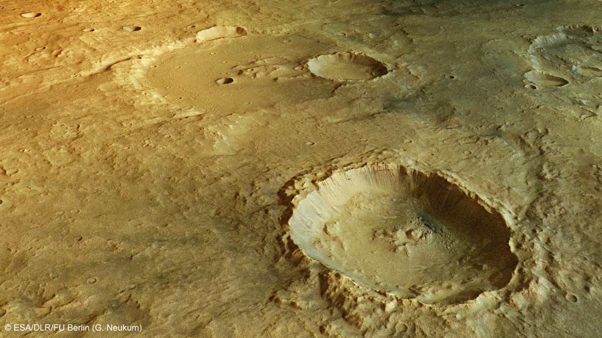
Landslides in Crater of Tagus Valles on Mars
One of the deepest craters in the region of Tagus Valles lies in the foreground of this perspective view. Numerous landslides have occurred within this crater, leaving grooves in the crater wall as material slumped to the floor below. Image released Jan. 8, 2013.
Breaking space news, the latest updates on rocket launches, skywatching events and more!
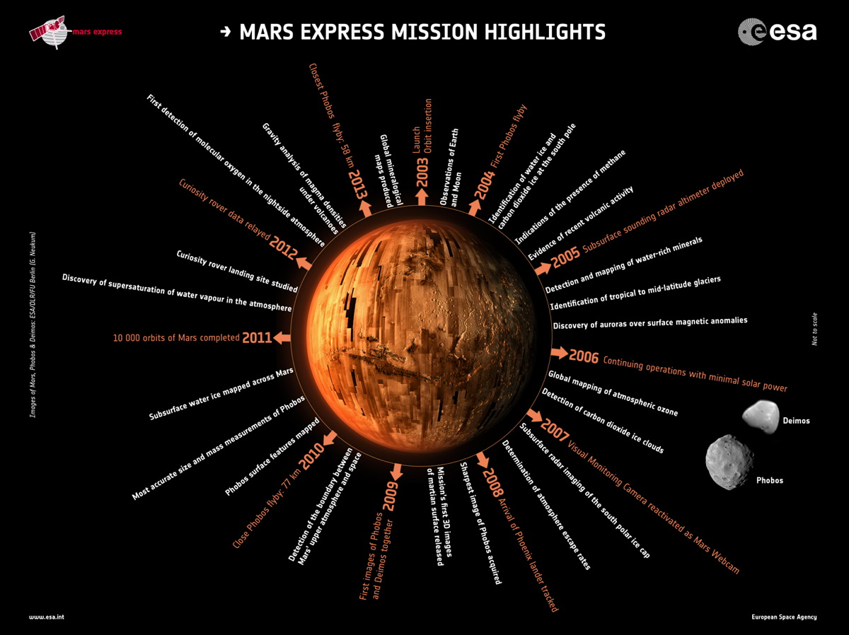
Mars Express Mission Highlights
Operations and science highlights from ESA’s Mars Express mission, which celebrated 10 years since launch on June 2, 2013. The central image of Mars is composed from images taken by the High Resolution Stereo Camera (HRSC) images, which has mapped around 95% of the planet’s surface. The images of Phobos and Deimos were also taken by the HRSC. Image released June 3, 2013.

Space.com is the premier source of space exploration, innovation and astronomy news, chronicling (and celebrating) humanity's ongoing expansion across the final frontier. Originally founded in 1999, Space.com is, and always has been, the passion of writers and editors who are space fans and also trained journalists. Our current news team consists of Editor-in-Chief Tariq Malik; Editor Hanneke Weitering, Senior Space Writer Mike Wall; Senior Writer Meghan Bartels; Senior Writer Chelsea Gohd, Senior Writer Tereza Pultarova and Staff Writer Alexander Cox, focusing on e-commerce. Senior Producer Steve Spaleta oversees our space videos, with Diana Whitcroft as our Social Media Editor.
