Satellite Spies Two Storms in One Shot
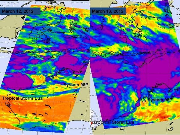
Two tropical storm systems are threatening Northern Australia today, and are so close to each other they were caught in the same satellite view.
One has gathered enough strength to be given an official name, Tropical Cyclone Lua, while the other is still getting organized and remains unnamed. The unnamed storm is currently the more immediate threat though, as it is close enough to the coast to warrant warnings of high seas.
NASA's Aqua satellite passed over the area at 0539 UTC yesterday (March 13) and was able to see both storms in a single image. Lua appears on the left in the image in the Southern Indian Ocean, with System 96P on the right, above the Southern Pacific Ocean.
Lua formed off the northern coast of Western Australia and as of yesterday it had maximum winds of about 40 mph (65 kph) and was located about 240 miles (386 kilometers) west-northwest of Port Hedland, Australia. (In the Atlantic basin, Lua would be a tropical storm.)
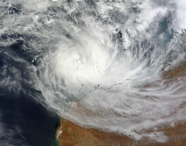
Forecasters at the Joint Typhoon Warning Center (JTWC) expect the storm to meander for a couple of days before strengthening and then making landfall in the Pilbara region of Western Australia on March 16.
System 96P is located about 170 nautical miles west of Darwin and 115 nautical miles northwest of Port Keats and was moving to the south.
The Atmospheric Infrared Sounder (AIRS) instrument aboard the Aqua satellite showed that deep convection (rising air that forms the thunderstorms that make up the tropical cyclone) is growing in size around the circulation center. There are also bands of thunderstorms spiraling into the low's center.
Get the Space.com Newsletter
Breaking space news, the latest updates on rocket launches, skywatching events and more!
Because the system is over an area of warm water, it is becoming more organized, the JTWC said. They anticipate that it will become a tropical depression before curving towards the southeast for a landfall south of Port Keats late on March 14, or early on March 15. Local residents are advised to monitor the storm and take caution.
This story was provided by OurAmazingPlanet, a sister site to SPACE.com.
Join our Space Forums to keep talking space on the latest missions, night sky and more! And if you have a news tip, correction or comment, let us know at: community@space.com.
For the science geek in everyone, Live Science breaks down the stories behind the most interesting news and photos on the Internet, while also digging up fascinating discoveries that hit on a broad range of fields, from dinosaurs and archaeology to wacky physics and astronomy to health and human behavior. If you want to learn something interesting every day, Live Science is the place for you.

