Mars Odyssey: Pictures from Longest Mars Mission
Mars Odyssey over Mars' South Pole
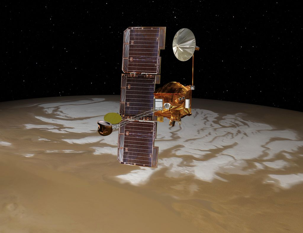
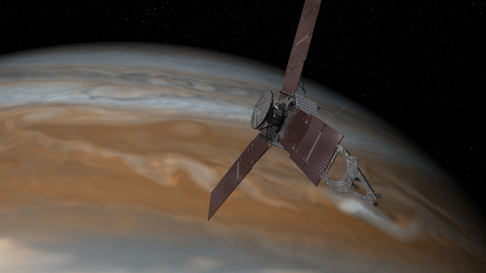
NASA's Mars Odyssey spacecraft passes above Mars' south pole in this artist's concept illustration. The spacecraft has been orbiting Mars since October 24, 2001. The spacecraft will serve as a vital relay for NASA's Mars rover Curiosity's landing on Aug. 5, 2012. [Related: Mars Rover Curiosity Landing Coverage]
Mars Odyssey: Arabia Dunes
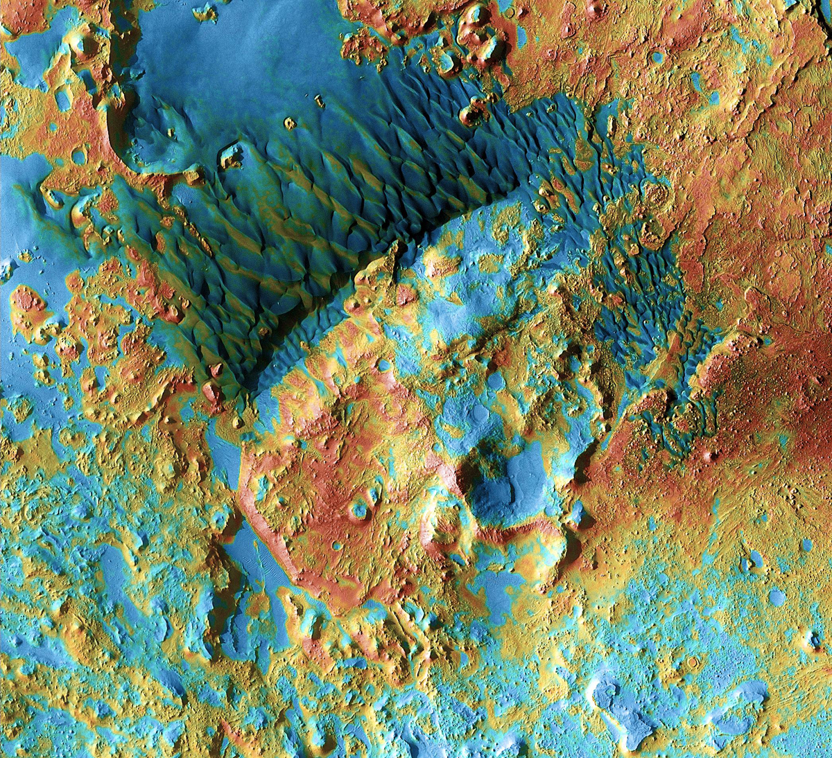
Sand dunes shaped like blue-black flames lie next to a central hill within an unnamed, 120-kilometer-wide (75-mile-wide) crater in eastern Arabia on Mars. False colors depict the nature of the ground surface: Areas in bluish tints have more fine sand at the surface, while redder tints indicate harder sediments and outcrops of rock. This scene combines images taken during the period from February 2003 to August 2004 by the Thermal Emission Imaging System instrument on NASA's Mars Odyssey orbiter.
Mars Odyssey: Noctis Canyon
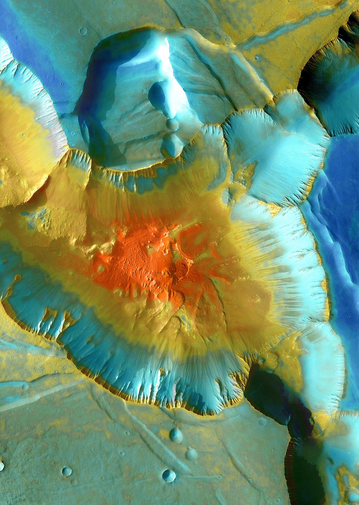
A false-color mosaic focuses on one junction in Noctis Labyrinthus where canyons meet to form a depression 4,000 meters (13,000 feet) deep. Dust (blue tints) lies on the upper surfaces, while rockier material (warmer colors) lies below. The pictures used to create this mosaic image were taken from April 2003 to September 2005 by the Thermal Emission Imaging System instrument on NASA's Mars Odyssey orbiter.
Mars Odyssey: Polar Dunes
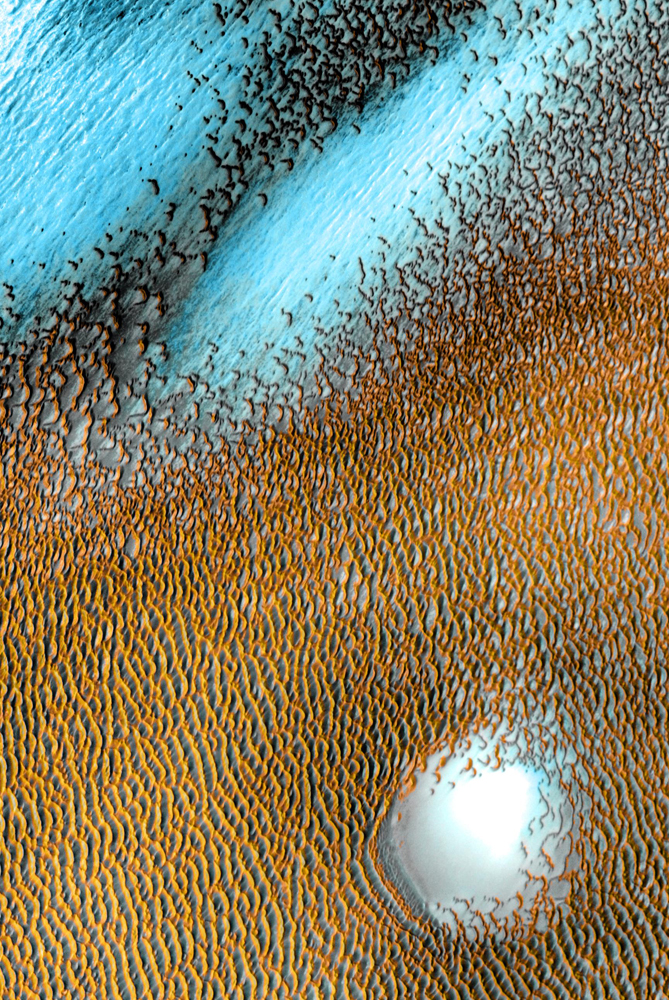
A sea of dark dunes, sculpted by the wind into long lines, surrounds the northern polar cap covering an area as big as Texas. In this false-color image, areas with cooler temperatures are recorded in bluer tints, while warmer features are depicted in yellows and oranges. Thus, the dark, sun-warmed dunes glow with a golden color. This image covers an area 30 kilometers (19 miles) wide. This scene combines images taken during the period from December 2002 to November 2004 by the Thermal Emission Imaging System instrument on NASA's Mars Odyssey orbiter.
Mars Odyssey: Bunge Crater Dunes
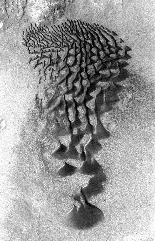
Fans and ribbons of dark sand dunes creep across the floor of Bunge Crater in response to winds blowing from the direction at the top of the picture. The frame is about 14 kilometers (9 miles) wide. This image was taken in January 2006 by the Thermal Emission Imaging System instrument on NASA's Mars Odyssey orbiter.
Olivine-Rich Bedrock Around Nili Fossae
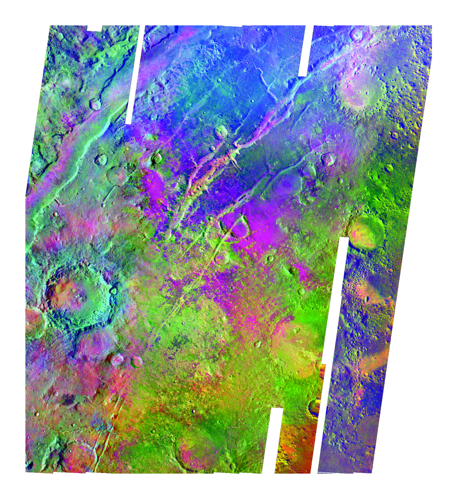
Olivine-rich bedrock around Nili Fossae on Mars, seen by Mars Express spacecraft. Image released July 22, 2009.
Mars Odyssey: Noctis Vista
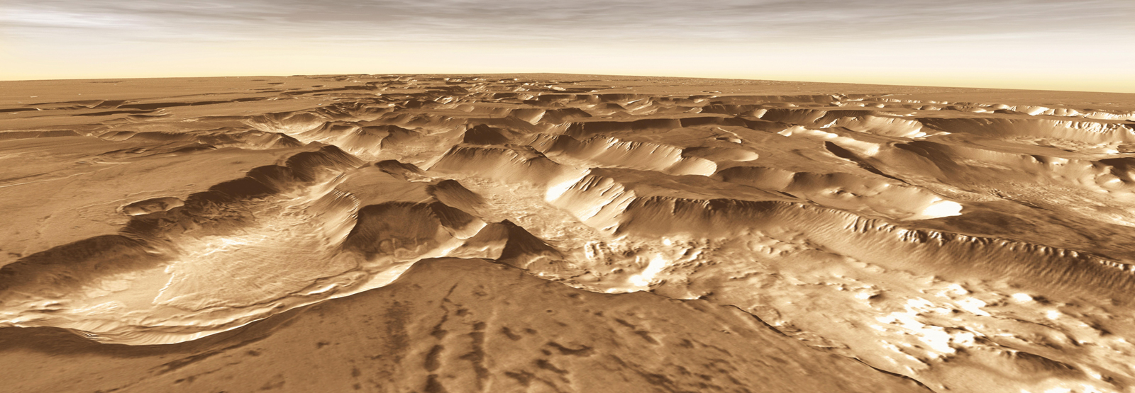
West of Valles Marineris lies a checkerboard named Noctis Labyrinthus, which formed when the Martian crust stretched and fractured. As faults opened, they released subsurface ice and water, causing the ground to collapse. This westward view combines images taken during the period from April 2003 to September 2005 by the Thermal Emission Imaging System instrument on NASA's Mars Odyssey orbiter.
Get the Space.com Newsletter
Breaking space news, the latest updates on rocket launches, skywatching events and more!
NASA Probe Looks at Bright Side of Mars
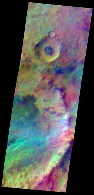
Pastel colors swirl across Mars, revealing differences in the composition and nature of the surface in this false-color infrared image taken on May 22, 2009,by the Thermal Emission Imaging System (THEMIS) camera on NASA's Mars Odyssey orbiter.
Mars, After Dark: Odyssey Spacecraft Paints a Vivid Portrait
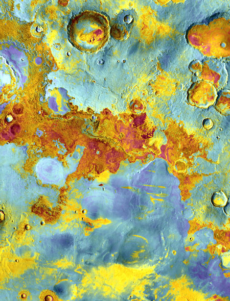
False-color view of part of Meridiani Planum, about 250 miles (400 kilometers) northeast of where Mars rover Opportunity landed. The image was taken from NASA’s Mars Odyssey orbiter using its Thermal Emission Imaging System (THEMIS) - a camera that images Mars in 5 visible and 10 infrared “colors.” The image combines daytime and nighttime infrared views. Reddish areas have more rocks and hardened sediments, while bluish areas feature more dust, sand, and fine-grain material. Image
Ice Patches Found on Mars Eyed for Next Mission
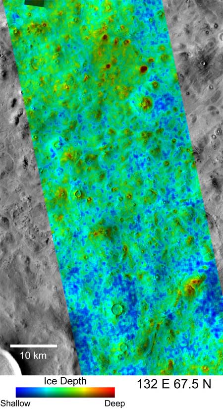
This map shows how deep deep you would have to dig to find water ice on Mars. It is shown in false colors and was made using THEMIS temperature measurements from the Mars Odyssey Orbiter. Blue shows where ice would be 5 centimeters (2 inches) deep, while red shows an ice depth of more than 18 centimeters (7 inches). The region lies at 67.5 degrees north and 132 degrees east, and the scale bar is 6.2 miles long. Click on the image to download a 1.7MB version.
Martian Dust Storm Creeps North
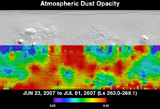
Infrared images from NASA's Mars Odyssey orbiter show how the dust storm is blocking sunlight to the planet's surface. Opacity decreases from left to right on the scale bar. The purple areas are nearly clear, while the red regions show roughly a two-thirds reduction in sunlight.
Join our Space Forums to keep talking space on the latest missions, night sky and more! And if you have a news tip, correction or comment, let us know at: community@space.com.

Space.com is the premier source of space exploration, innovation and astronomy news, chronicling (and celebrating) humanity's ongoing expansion across the final frontier. Originally founded in 1999, Space.com is, and always has been, the passion of writers and editors who are space fans and also trained journalists. Our current news team consists of Editor-in-Chief Tariq Malik; Editor Hanneke Weitering, Senior Space Writer Mike Wall; Senior Writer Meghan Bartels; Senior Writer Chelsea Gohd, Senior Writer Tereza Pultarova and Staff Writer Alexander Cox, focusing on e-commerce. Senior Producer Steve Spaleta oversees our space videos, with Diana Whitcroft as our Social Media Editor.

