Satellites Keep an Eye on Isaac's Movements
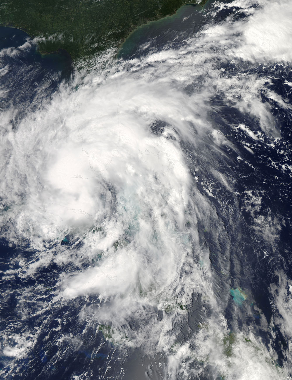
While Gulf Coast residents have been warily watching the progress of Tropical Storm Isaac, NASA satellites have been tracking the storm's path and development from above. The latest satellite data show that Isaac is consolidating, a mark of a strengthening storm.
The Atmospheric Infrared Sounder (AIRS) instrument onboard NASA's Aqua satellite acts like an "infrared eye" for storm watchers providing temperature data on Isaac's clouds and the ocean waters around the storm. Cloud temperatures can indicate whether a storm is strengthening or weakening, and knowing the temperature of the surrounding oceans helps forecasters know whether the storm is moving into an environment that will fuel it farther.
AIRS has been keeping an eye on Isaac's path since last week as it moved through the eastern and central Caribbean Sea, across eastern Cuba and into the Gulf of Mexico.
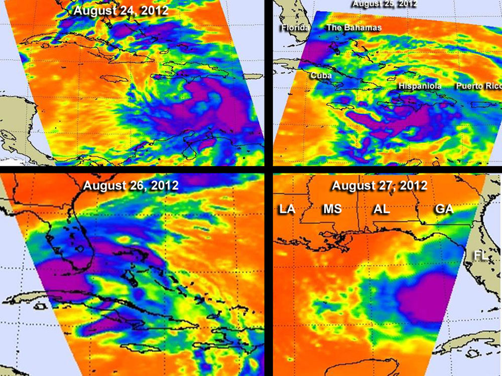
AIRS data taken yesterday (Aug. 26) showed that the area of strong convection (rising air that forms the thunderstorms that make up a tropical cyclone) in the storm had increased. On Aug. 27, Isaac's center of circulation appeared more rounded on AIRS imagery, according to a NASA statement, indicating the circulation center was becoming more organized — a harbinger of a stronger storm.
The Aqua satellite also captured a visible light image of Isaac as the storm passed over Florida and Cuba. Observations from the GOES-13 satellite provide a "movie" showing Isaac's recent movements.
Tropical Storm Isaac currently has maximum sustained winds of 65 mph (100 kph), about 9 mph (14.5 kph) short of the hurricane threshold. But the storm is expected to strengthen into a hurricane over the next 24 hours, though wind shear has been limiting the storm's development so far today. (Wind shear occurs when winds at different levels in the atmosphere are moving in different directions, which can hamper a storm's development.) The low causing this shear is expected to move away though, which will clear Isaac's path to becoming the fourth hurricane of the 2012 Atlantic hurricane season.
As of the latest update from the U.S. National Hurricane Center, Isaac's center was located about 250 miles (400 kilometers) south of Apalachicola, Fla., and about 310 miles (500 km) southeast of the mouth of the Mississippi River. It is moving in a west-northwestward direction.
Get the Space.com Newsletter
Breaking space news, the latest updates on rocket launches, skywatching events and more!
A hurricane warning is currently in effect from east of Morgan City, La., to Destin, Fla., an area that includes New Orleans. The storm is bearing down on New Orleans seven years to the day after Hurricane Katrina devastated the city.
Hurricane watches and tropical storm warnings and watches have been issued for other areas of the Gulf Coast. The NHC has warned that the impacts from Isaac's storm surge are likely to be significant and that the storm could bring large amounts of rain, as well as the possibility of tornadoes in some places.
This story was provided by OurAmazingPlanet, a sister site to SPACE.com.
Join our Space Forums to keep talking space on the latest missions, night sky and more! And if you have a news tip, correction or comment, let us know at: community@space.com.
OurAmazingPlanet was founded in 2010 by TechMediaNetwork, which owned Space.com at the time. OurAmazingPlanet was dedicated to celebrating Earth and the mysteries still to be answered in its ecosystems, from the top of the world to the bottom of the sea. The website published stories until 2017, and was incorporated into LiveScience's Earth section.


