Satellites See Isaac Make Landfall Over Louisiana

Breaking space news, the latest updates on rocket launches, skywatching events and more!
You are now subscribed
Your newsletter sign-up was successful
Want to add more newsletters?
Hurricane Isaac made two landfalls late last night (Aug. 28) and in the wee hours of this morning, and NASA satellites caught the whole show from their perch in orbit.
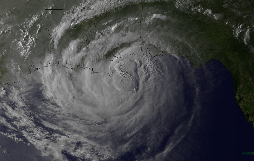
Isaac made its first landfall over a small spit of land in Plaquemines Parish in southeast Louisiana at 7:45 p.m. EDT (1145 UTC) before re-emerging over water. It stalled over waters near the Louisiana coast for several hours before making its second landfall at 2:15 a.m. CDT (0715 UTC) just west of Port Fourchon.
The storm made landfall as a Category 1 hurricane with winds of 80 mph (130 kph). Isaac is still a hurricane and is maintaining its strength over the wetland-dominated terrain of southeastern Louisiana.
Article continues belowThe National Oceanic and Atmospheric Administration's GOES-13 satellite spied the landfalls, and an animation made from its observations covers the period from Aug. 27 through early today (Aug. 29). A visible light image from the satellite spied the first landfall as sunlight was fading over the United States.
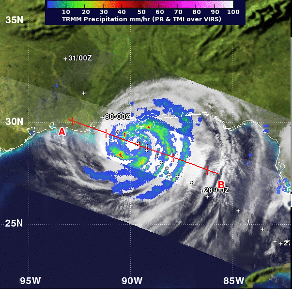
NASA's Tropical Rainfall Measuring Mission (TRMM) satellite captured a view of Isaac's rainfall rates on at 11:05 p.m. EDT yesterday, just 3 hours and 20 minutes after its first landfall in southeastern Louisiana. The heaviest rainfall rates, near 2 inches (50 millimeters) per hour surrounded the center of the storm, causing inland flooding on its slow crawl, according to a NASA statement.
Flooding is a big threat from Isaac because of its slow movement, and because it is drawing a lot of energy from the warm waters of the Gulf of Mexico, NASA said. Levees in Plaquemines Parish have been overtopped in some areas, though levees in New Orleans are holding and pumps are working.
Isolated tornadoes are also possible as Isaac continues moving inland, and a tornado watch has been put in place for some areas of Louisiana and Mississippi until 4 pm CDT.
Breaking space news, the latest updates on rocket launches, skywatching events and more!
This story was provided by OurAmazingPlanet, a sister site to SPACE.
OurAmazingPlanet was founded in 2010 by TechMediaNetwork, which owned Space.com at the time. OurAmazingPlanet was dedicated to celebrating Earth and the mysteries still to be answered in its ecosystems, from the top of the world to the bottom of the sea. The website published stories until 2017, and was incorporated into LiveScience's Earth section.


