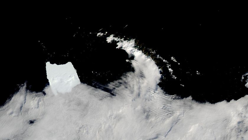
'Frankenstorm' from Space: Hurricane Sandy Satellite Photos
Hurricane Sandy from the International Space Station
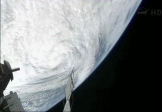
This view of Hurricane Sandy was sent from the International Space Station on Oct. 29. 2012, as the "Frankenstorm" approached the northeast coast of the United States.
Hurricane Sandy Global View: Oct. 28, 2012
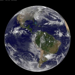
NOAA's GOES-13 satellite captured this visible image of the massive Hurricane Sandy on Oct. 28 at 1302 UTC (9:02 a.m. EDT). The line of clouds from the Gulf of Mexico north are associated with the cold front that Sandy is merging with. Sandy's western cloud edge is already over the Mid-Atlantic and northeastern U.S.
Hurricane Sandy at Night: Oct. 28, 2012
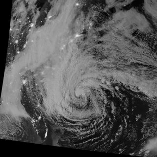
This night-view image of Hurricane Sandy was acquired by the Visible Infrared Imaging Radiometer Suite (VIIRS) on the Suomi NPP satellite around 2:42 a.m. Eastern Daylight Time (06:42 Universal Time) on October 28, 2012. In this case, the cloud tops were lit by the nearly full Moon (full occurs on October 29). Some city lights in Florida and Georgia are also visible amid the clouds.
Hurricane Sandy Off the Carolinas
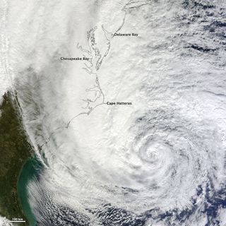
At noon Eastern Daylight Time (16:00 Universal Time) on October 28, 2012, the Moderate Resolution Imaging Spectroradiometer (MODIS) on NASA’s Terra satellite acquired this image of Hurricane Sandy off the southeastern United States.
At 11 a.m. local time (one hour before the image was captured), the U.S. National Hurricane Center reported that the storm was located at 32.5° North and 72.6° West, about 250 miles (400 kilometers) southeast of Cape Hatteras, North Carolina, and 575 miles (930 kilometers) south of New York City. Maximum sustained winds were 75 miles (120 kilometers) per hour, and the central pressure was 951 millibars (28.08 inches).
Hurricane Sandy over East Coast
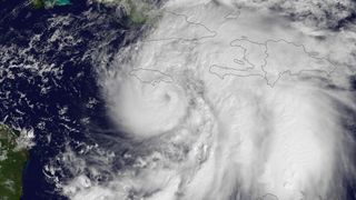
NOAA's GOES East satellite snapped this image of Hurricane Sandy at 10:45 a.m. EDT (1445 UTC) on Oct. 24, 2012, as it was headed for landfall on Jamaica. [Watch the Video: Hurricane Sandy from Space]
Hurricane Sandy over Puerto Rico and the Virgin Islands
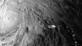
Early in the morning of October 25, 2012, the Suomi NPP satellite passed over Hurricane Sandy after it made landfall over Cuba and Jamaica, capturing this highly detailed infrared imagery, showing areas of deep convection around the central eye. Besides the highly detailed infrared imagery, the satellite’s day night band captured detailed visible-like imagery of the cloud tops, along with the city lights of Puerto Rico and the Virgin Islands.
Hurricane Sandy as the "Bride of Frankenstorm"
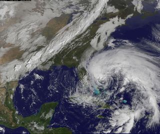
This visible image was taken from NOAA's GOES-13 satellite on Friday, Oct. 26 at 10:15 a.m. EDT, and shows Hurricane Sandy's huge cloud extent of up to 2,000 miles while centered over the Bahamas, and the line of clouds associated with a powerful cold front approaching the U.S. east coast.
Get the Space.com Newsletter
Breaking space news, the latest updates on rocket launches, skywatching events and more!
Hurricane Sandy Rainfall Map
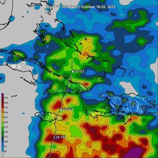
TRMM rainfall totals were tallied for the seven-day period from Oct. 18-25, 2012. The heaviest rainfall occurred over open ocean where totals were as high as 325 millimeters. Rainfall amounts as high as 250 millimeters were measured over eastern Cuba and some extreme southern areas of Hispaniola. Hurricane Sandy's track with appropriate symbols is shown overlaid in white.
Hurricane Sandy from Space Station
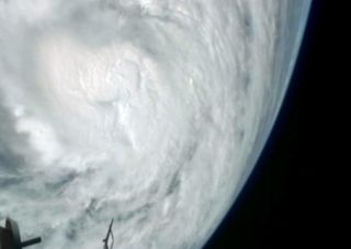
This still from a NASA video shows a view of Hurricane Sandy on Thursday, Oct. 25, as the Category 2 storm approached the Bahamas. The video was taken by cameras aboard the International Space Station 240 miles above Earth.
TRMM Satellite Rainfall of Hurricane Sandy
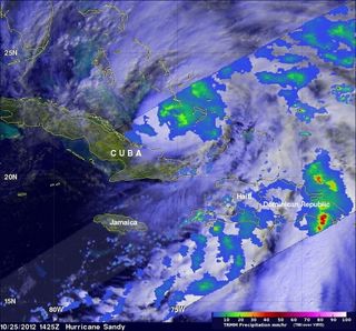
On Oct. 25 at 10:25 a.m. EDT, NASA's TRMM satellite saw that rain associated with Hurricane Sandy storm's center, was moderate (in green and blue) and falling at a rate of 20 to 40 mm per hour. The heaviest rainfall at the time of this image was falling over the Dominican Republic at more than 2 inches/50 mm per hour (red).
Infrared Imagery of Hurricane Sandy's Eastern Half
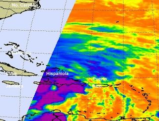
The AIRS instrument aboard NASA's Aqua satellite captured infrared imagery of Hurricane Sandy's eastern half on Oct. 25 at 0559 UTC (1:59 a.m. EDT) that showed some strong thunderstorms (purple) around the eye of Sandy. Those thunderstorms are reaching high into the troposphere where cloud top temperatures are as cold as -63 Fahrenheit (-52 Celsius). The yellow areas indicate the edges of the clouds associated with Sandy. Cloud cover extends far to the west, outside of Aqua's track.
Join our Space Forums to keep talking space on the latest missions, night sky and more! And if you have a news tip, correction or comment, let us know at: community@space.com.

Space.com is the premier source of space exploration, innovation and astronomy news, chronicling (and celebrating) humanity's ongoing expansion across the final frontier. Originally founded in 1999, Space.com is, and always has been, the passion of writers and editors who are space fans and also trained journalists. Our current news team consists of Editor-in-Chief Tariq Malik; Editor Hanneke Weitering, Senior Space Writer Mike Wall; Senior Writer Meghan Bartels; Senior Writer Chelsea Gohd, Senior Writer Tereza Pultarova and Staff Writer Alexander Cox, focusing on e-commerce. Senior Producer Steve Spaleta oversees our space videos, with Diana Whitcroft as our Social Media Editor.
