'Frankenstorm' from Space: Hurricane Sandy Satellite Photos
Hurricane Sandy by GOES 13: Oct. 28, 2012
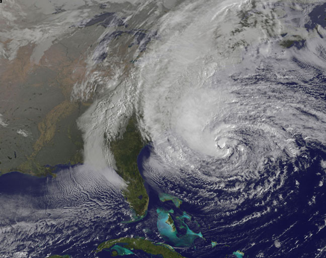
NOAA's GOES-13 satellite captured this visible image of the massive Hurricane Sandy on Oct. 28 at 1302 UTC (9:02 a.m. EDT). The line of clouds from the Gulf of Mexico north are associated with the cold front that Sandy is merging with. Sandy's western cloud edge is already over the mid-Atlantic and northeastern United States.
Hurricane Sandy on Oct. 26, 2012: Terra
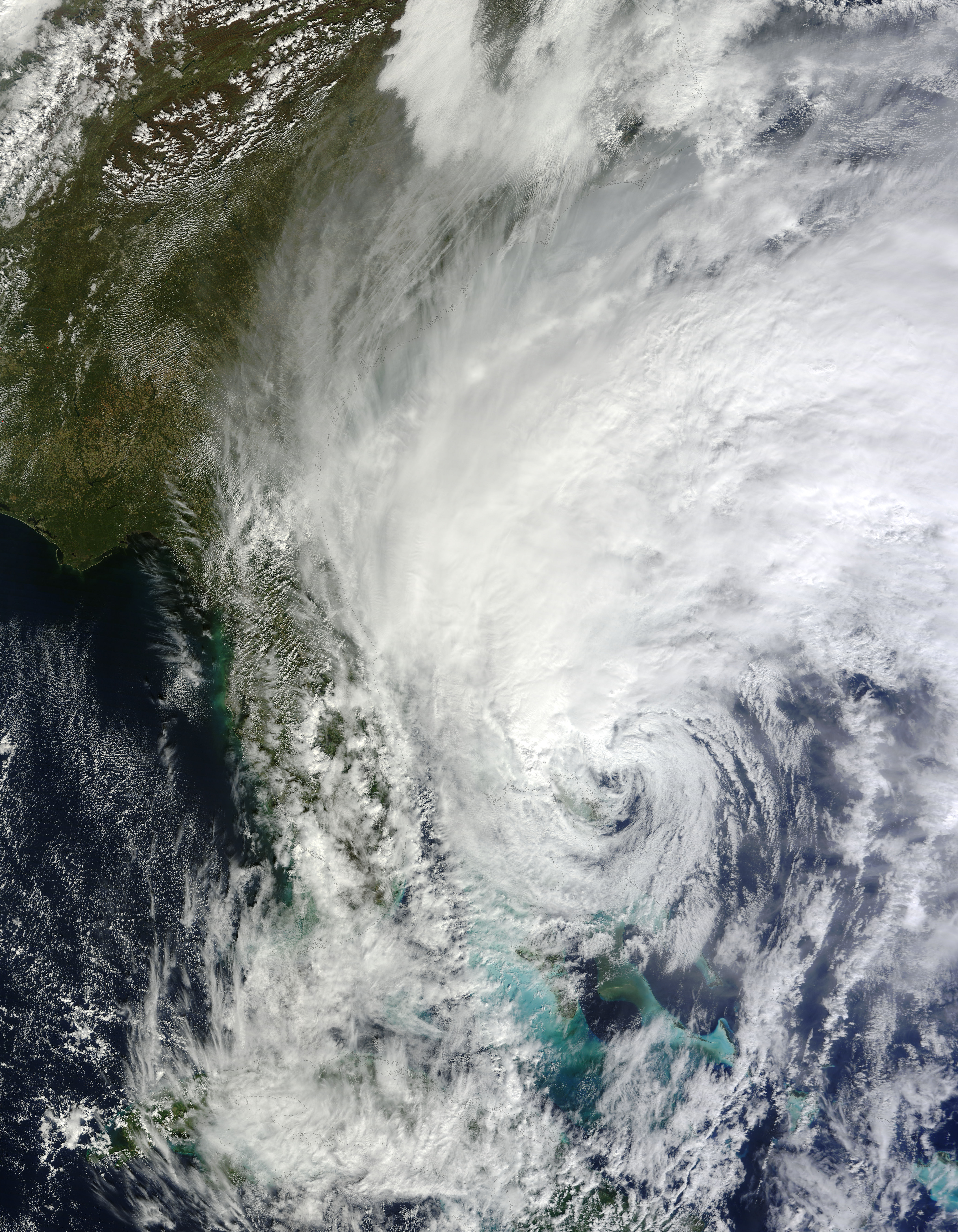
This visible image of Hurricane Sandy shows the massive extent of its clouds, covering about 2,000 miles. The image was taken by the MODIS instrument on NASA's Terra satellite on Oct. 26 at 16:10 UTC (12:10 p.m. EDT). Sandy's center was in the Bahamas at that time, and its western clouds were brushing the southeastern U.S. coast.
Get the Space.com Newsletter
Breaking space news, the latest updates on rocket launches, skywatching events and more!
Join our Space Forums to keep talking space on the latest missions, night sky and more! And if you have a news tip, correction or comment, let us know at: community@space.com.

Space.com is the premier source of space exploration, innovation and astronomy news, chronicling (and celebrating) humanity's ongoing expansion across the final frontier. Originally founded in 1999, Space.com is, and always has been, the passion of writers and editors who are space fans and also trained journalists. Our current news team consists of Editor-in-Chief Tariq Malik; Editor Hanneke Weitering, Senior Space Writer Mike Wall; Senior Writer Meghan Bartels; Senior Writer Chelsea Gohd, Senior Writer Tereza Pultarova and Staff Writer Alexander Cox, focusing on e-commerce. Senior Producer Steve Spaleta oversees our space videos, with Diana Whitcroft as our Social Media Editor.

