Black Marble: Amazing Earth at Night Photos from Space
Old Night Vision Meets New
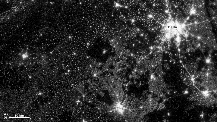
On Nov. 12, 2012, the Visible Infrared Imaging Radiometer Suite (VIIRS) on the Suomi NPP satellite captured the top image of city, village, and highway lights near Delhi, India.
Night Lights 2012 - The Black Marble
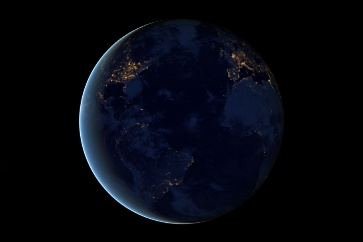
This new global view and animation of Earth’s city lights is a composite assembled from data acquired by the Suomi National Polar-orbiting Partnership (Suomi NPP) satellite. The data was acquired over nine days in April 2012 and thirteen days in October 2012.
The Lights of London
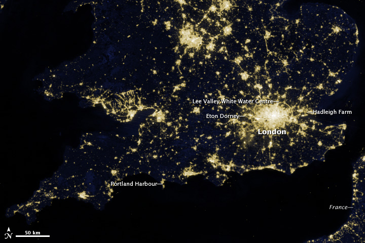
The image above shows London and the southern half of Great Britain as it appeared on the night of March 27, 2012.
South Asian Night Lights
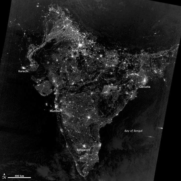
On Nov. 12, 2012, the Visible Infrared Imaging Radiometer Suite (VIIRS) on the Suomi NPP satellite captured this nighttime view of southern Asia.
Before the Blackout in New Jersey and New York
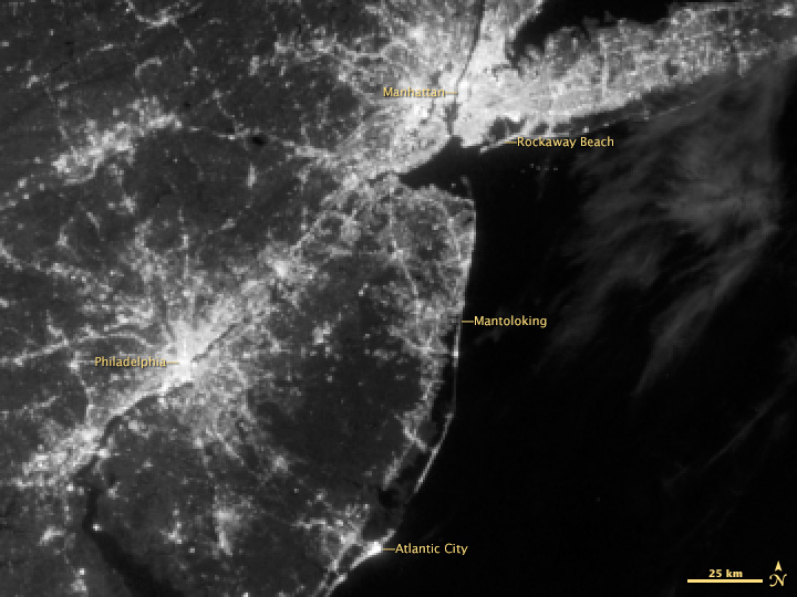
New Jersey, New York, and eastern Pennsylvania as viewed at night by the Visible Infrared Imaging Radiometer Suite (VIIRS) on the Suomi NPP satellite. This image was taken on Aug. 31, 2012.
Blackout in New Jersey and New York
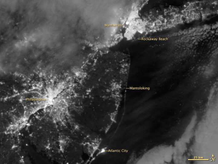
This image shows New Jersey, New York, and eastern Pennsylvania as viewed at night on Nov. 1, 2012.
Before Extensive Power Outages in Washington, DC Area
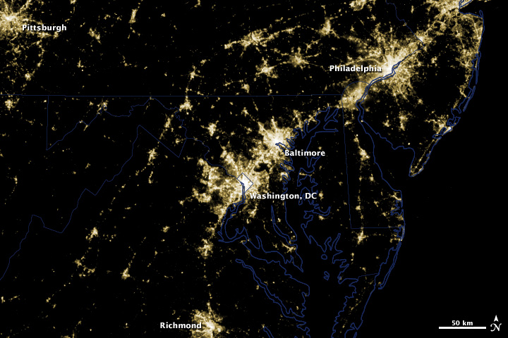
This image was taken before the power outages in the clear skies over Washington, DC and Baltimore that occurred as a result of a rare, fast-moving thunderstorm system on Friday, June 29th. The image was acquired June 28, 2012.
Get the Space.com Newsletter
Breaking space news, the latest updates on rocket launches, skywatching events and more!
Power Outages in Washington, DC Area
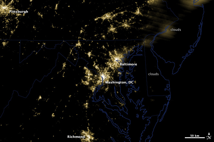
Extensive power outages in Washington, DC and Baltimore are visible in this image. Clouds obscure the lights of Philadelphia and other areas north and east of Baltimore. This image as acquired on June 30, 2012.
Overnight View of Hurricane Sandy
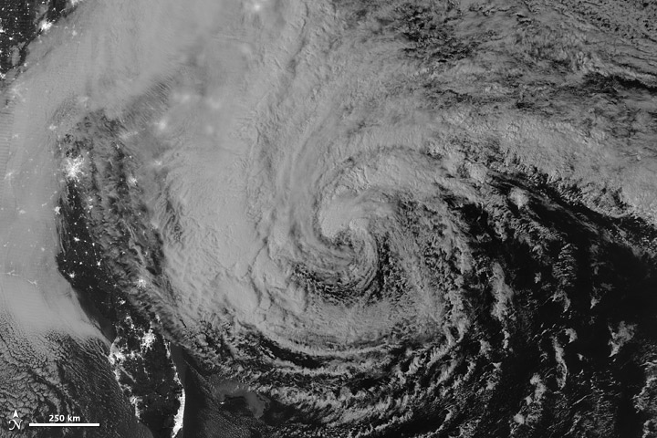
This image of Hurricane Sandy was acquired by the Visible Infrared Imaging Radiometer Suite (VIIRS) on the Suomi NPP satellite at 2:42 a.m. Eastern Daylight Time (06:42 Universal Time) on Oct. 28, 2012.
Sandy after Landfall
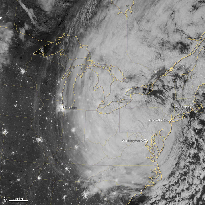
The Visible Infrared Imaging Radiometer Suite (VIIRS) on the Suomi NPP satellite acquired this image of the storm around 3:35 a.m. Eastern Daylight Time (7:35 Universal Time) on Oct. 30, 2012.
Join our Space Forums to keep talking space on the latest missions, night sky and more! And if you have a news tip, correction or comment, let us know at: community@space.com.

Space.com is the premier source of space exploration, innovation and astronomy news, chronicling (and celebrating) humanity's ongoing expansion across the final frontier. Originally founded in 1999, Space.com is, and always has been, the passion of writers and editors who are space fans and also trained journalists. Our current news team consists of Editor-in-Chief Tariq Malik; Editor Hanneke Weitering, Senior Space Writer Mike Wall; Senior Writer Meghan Bartels; Senior Writer Chelsea Gohd, Senior Writer Tereza Pultarova and Staff Writer Alexander Cox, focusing on e-commerce. Senior Producer Steve Spaleta oversees our space videos, with Diana Whitcroft as our Social Media Editor.
