Satellite Sees Tornado Clouds
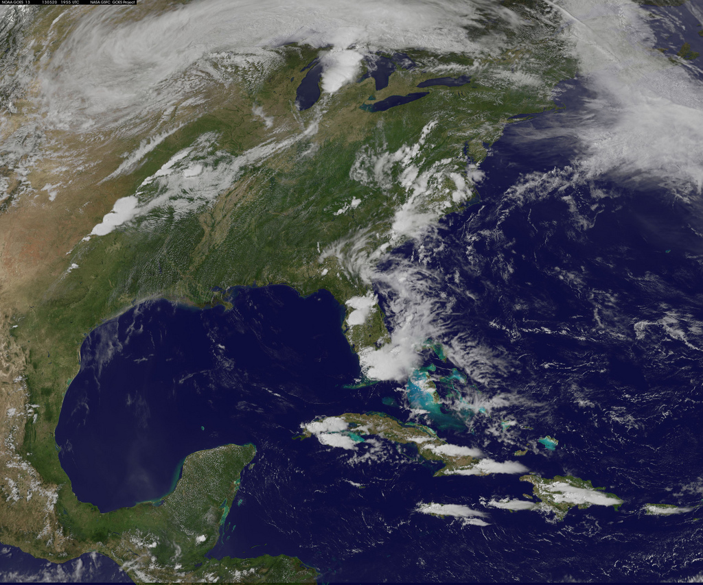
A line of thunderstorms that resembles an exclamation mark in this image from NOAA’s GOES-13 satellite gave rise to the Moore, Okla. tornado on May 20, 2013. The tornado was generated near the bottom of the line of clouds, NASA officials said.
Satellite Image of Moore Tornado
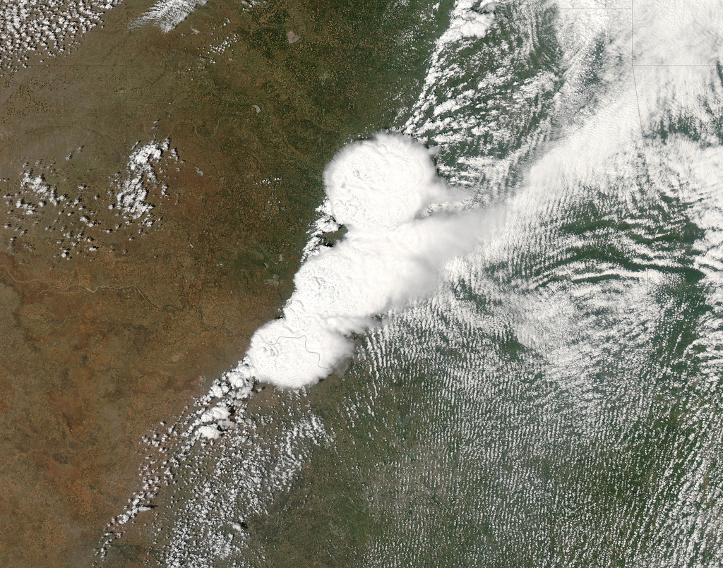
NASA'S MODIS satellite captured this image of the storm system that created the F-4 tornado in Moore, Okla. on May 20. The photo was taken at 2:40 p.m. CDT (3:40 p.m. EDT, or 1940 GMT), just before the twister touched down.
Moore, Oklahoma Tornadoes Seen on Full Earth Image
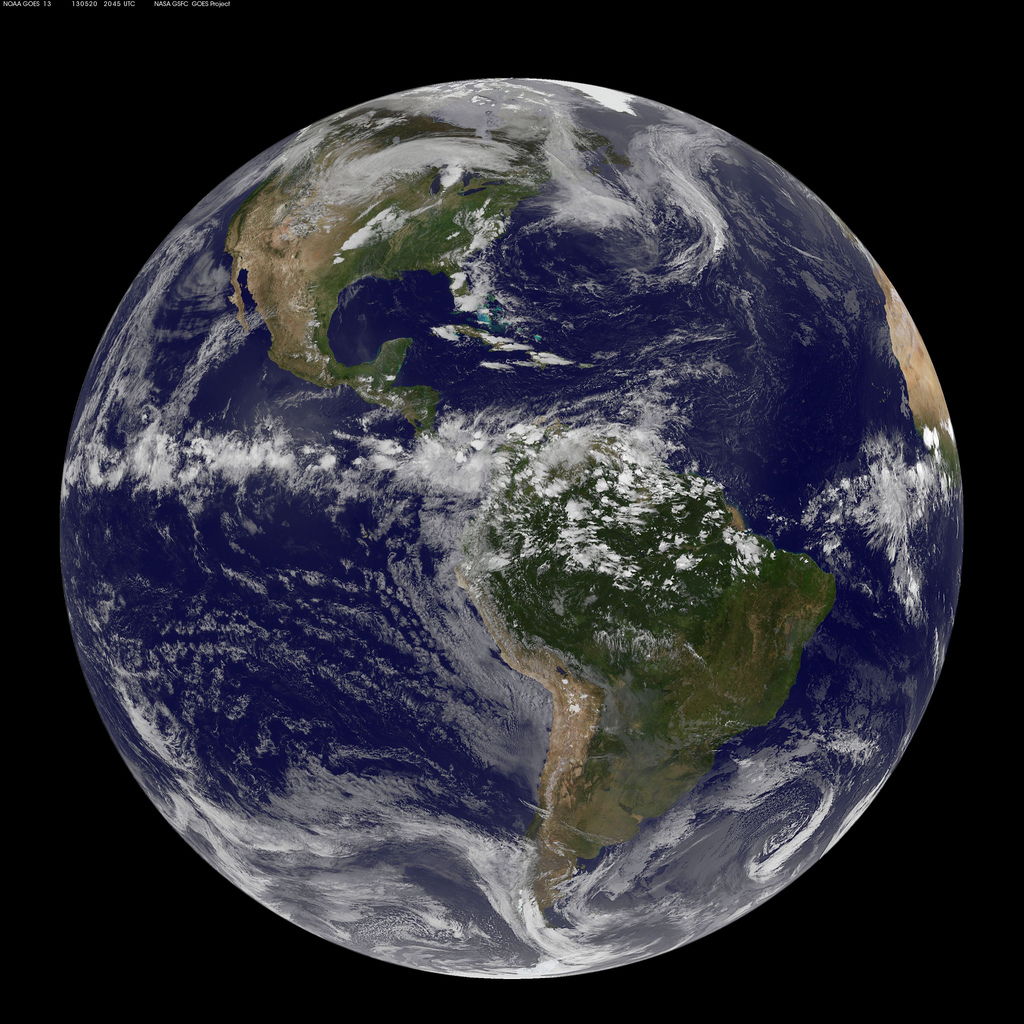
This full-disk image from NOAA’s GOES-13 satellite taken at 20:45 UTC (3:45 p.m. EDT) shows the storm system in the south-central US on May 20, 2013, that generated the Moore, Oklahoma, tornado.
Severe Thunderstorms, Tornado Strike Oklahoma
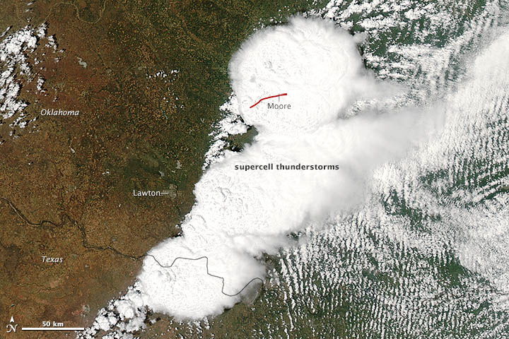
On May 20, 2013, a supercell thunderstorm in central Oklahoma spawned a destructive tornado that passed just south of Oklahoma City. The Moderate Resolution Imaging Spectroradiometer (MODIS) on NASA’s Aqua satellite acquired this image of the storm at 2:40 p.m. local time (19:40 UTC). The red line depicts the tornado’s track.
Nighttime Satellite View of Oklahoma City After Tornado
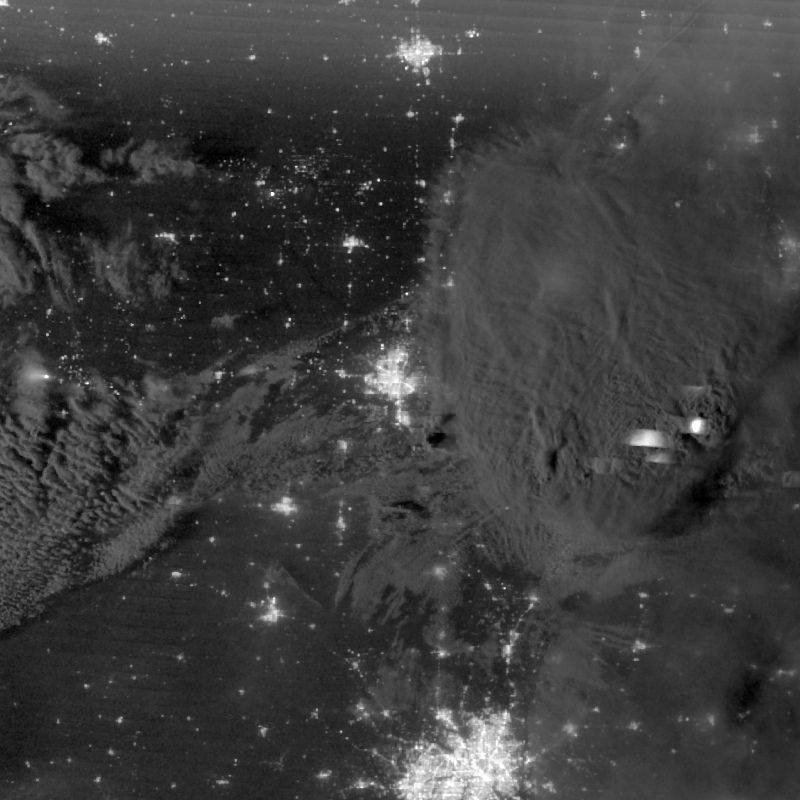
using illumination from natural (the moon, forest fires) and man-made sources (city lights, gas flares). This image was taken during the early morning of May 21 and shows city lights in the Oklahoma City area, but reduced light output in Moore, Okla. as a result of the major tornado that occurred during the afternoon of May 20, 2012. Image acquired by NASA-NOAA's Suomi NPP satellite.
Nighttime Satellite View of Oklahoma City Before Tornado
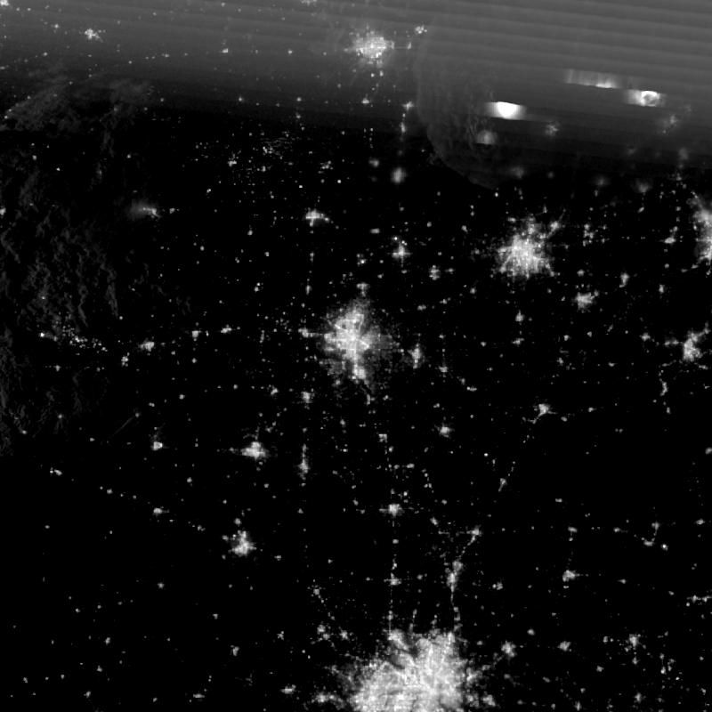
This image shows city lights, cloud cover, and lightning during the early morning hours of May 20, 2013, prior to the storms over Moore, OK, and the Oklahoma City area.
Nighttime Satellite View of Oklahoma Pre- and Post-Storm
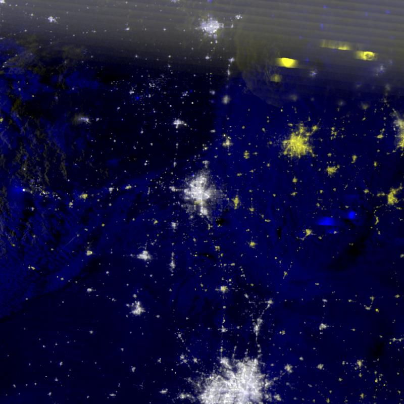
When pre- and post-storm Suomi NPP imagery are combined in a 24-bit composite (May 20 and May 21, 2013), power outages in the Moore, Okla. area are evident in shades of yellow. Other areas appear yellow, such as Tulsa, Okla., but this is a result of changes in cloud cover between the two scenes.
Get the Space.com Newsletter
Breaking space news, the latest updates on rocket launches, skywatching events and more!
Nighttime Satellite View of Oklahoma City Area
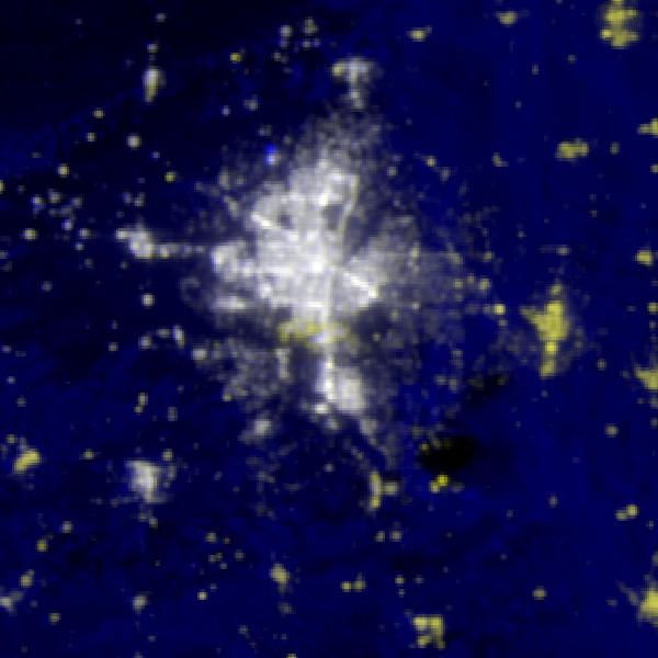
This image shows a zoomed in area of the outage (yellow areas) composite focusing on the Oklahoma City area on May 21, 2013.
Nighttime Before and After Views of Oklahoma City
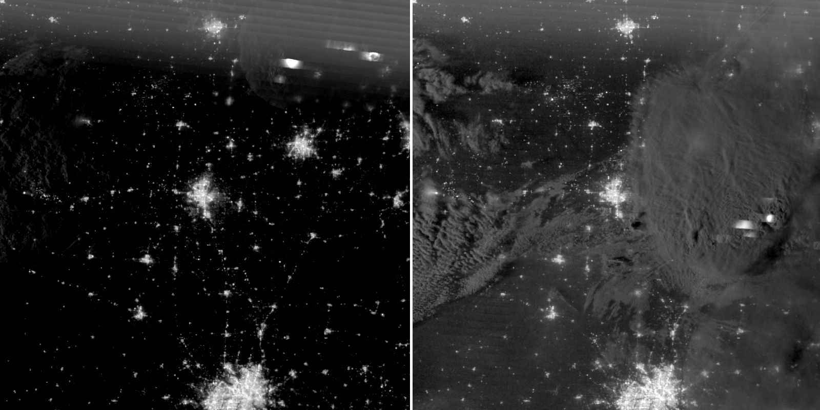
The Suomi NPP satellite image on the left shows city lights, cloud cover, and lightning during the early morning hours of May 20 prior to the storms over Moore, OK and the Oklahoma City area. The image on the right was taken during the early morning of May 21 and shows city lights in the Oklahoma City area, but reduced light output in Moore, Okla. as a result of the major tornado that occurred during the afternoon of May 20. Storms from earlier in the day had shifted eastward, still visible in the imagery.
Join our Space Forums to keep talking space on the latest missions, night sky and more! And if you have a news tip, correction or comment, let us know at: community@space.com.

