Winter Olympics Cities from Space: NASA Satellite Views (Photos)
Winter Olympics City: Lake Placid, New York, 1980 and 1932
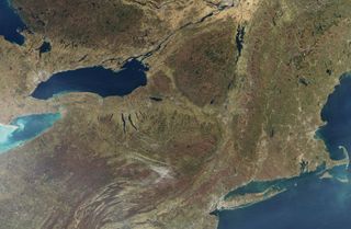
By November, the flame of red and orange that painted the forested mountains of the northeastern United States in the autumn has faded into subdued shades of orange and brown. The fall leaf season is coming to an end. This true-color image of the Adirondack and Green Mountains was captured on November 8, 2009, by the Moderate Resolution Imaging Spectroradiometer (MODIS) on NASA’s Aqua satellite. The mountains are brown, the farmed valleys, gold. The differences in color help reveal the unique geography of the region.
Winter Olympics City: Innsbruck, Austria 1976 and 1964
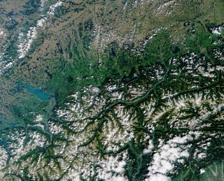
Innsbruck, Austia and the Lake Constance region was image by the MISR insturment on NASA's Terra satellite on August 8, 2001.
Winter Olympics City: Sapporo, Japan 1972
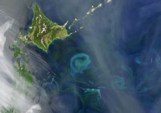
Spring Bloom Colors the Pacific Near Hokkaido -- In the northwest Pacific Ocean, the Oyashio Current flows down out of the Arctic, past Siberia and the Kamchatka Peninsula. Around the latitude of Hokkaido, Japan, it begins to veer eastward and converges with the warmer Kuroshio Current, flowing into the area from the south. This image from the Moderate Resolution Imaging Spectroradiometer (MODIS) on NASA’s Aqua satellite from May 21, 2009, illustrates how the convergence of these two currents affects phytoplankton.
Winter Olympics City: Grenoble, France 1968
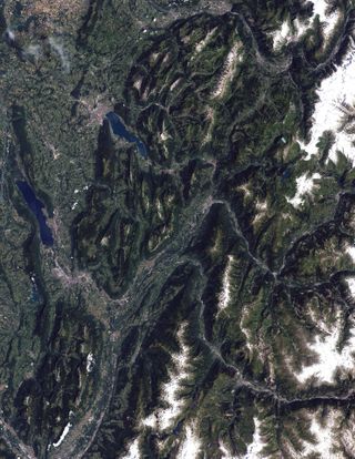
terrain of the mountainous terrain of the French Alps on July 21, 2001. Deep green forests line the lower slopes of mountains, while the summits of many of the peaks appear lighter green because they are beyond the elevation where trees can grow. Some of the summits are capped by glaciers. The rugged terrain is carved by gray ribbons of rivers and creeks.
Winter Olympics City: Squaw Valley, California 1960
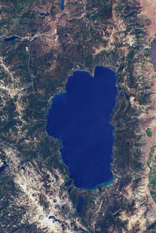
This image shows the Lake Tahoe Basin on Aug.17, 1999 by Landsat 7.
Winter Olympics City: Cortina d'Ampezzo, Italy 1956
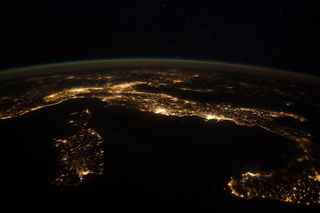
This nighttime panorama of much of Europe was photographed by one of the Expedition 30 crew members aboard the International Space Station flying approximately 240 miles above the Tyrrhenian Sea on Jan. 25, 2012.
Winter Olympics City: Oslo, Norway 1952
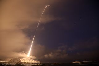
This image shows a four-stage Black Brant XII sounding rocket on Dec. 12, 2010, during the NASA-funded Rocket Experiment for Neutral Upwelling (RENU). The rocket was launched from Andøya Rocket Range near Andenes, Norway, and carried instruments about 200 miles (320 kilometers) into the atmosphere to observe the aurora and the associated flow of heat, particles, and electromagnetic energy.
Get the Space.com Newsletter
Breaking space news, the latest updates on rocket launches, skywatching events and more!
Winter Olympics City: St. Moritz, Switzerland 1928 and 1948
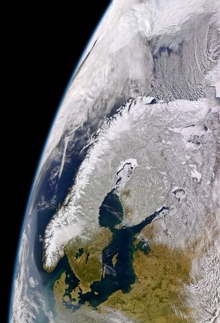
April 1, 2004, was a sunny spring day for most of Scandinavia and the Baltic States, though a region of hazy air lurked offshore to the west and to the south. The cloud-free skies gave the Sea-viewing Wide Field-of-view Sensor (SeaWiFS) on the OrbView-2 satellite a clear view of the Baltic region. On the left, the lingering snow highlights the varied geology of the Scandinavian Peninsula.
Winter Olympics City: Garmisch-Partenkirchen, Germany 1936
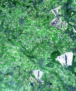
This simulated natural color scene shows a 30 by 36 km (19 by 22 miles) region in the German state of North Rhine Westphalia (located about 700 km from Garmisch-Partenkirchen, Germany). The myriad rectangular patches are agricultural fields; light green hues show where crops are growing and grey hues show bare soil. Darker green hues show forested areas. The various blue-grey clusters of pixels seemingly linked together by dark thin lines are towns and villages connected by roads. The data used to produce this scene were acquired by the Advanced Spaceborne Thermal Emission and Reflection Radiometer (ASTER), flying aboard NASA's Terra satellite, on August 26, 2000.
Winter Olympics City: Chamonix, France 1924
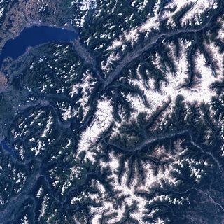
Mount Blanc is the highest mountain in Western Europe. The eastern boundary of Europe is debated as there is no clear division between Europe and Asia as landmasses. This image was acquired by Landsat 7’s Enhanced Thematic Mapper plus (ETM+) sensor on July 30, 2001.
Join our Space Forums to keep talking space on the latest missions, night sky and more! And if you have a news tip, correction or comment, let us know at: community@space.com.

Space.com is the premier source of space exploration, innovation and astronomy news, chronicling (and celebrating) humanity's ongoing expansion across the final frontier. Originally founded in 1999, Space.com is, and always has been, the passion of writers and editors who are space fans and also trained journalists. Our current news team consists of Editor-in-Chief Tariq Malik; Editor Hanneke Weitering, Senior Space Writer Mike Wall; Senior Writer Meghan Bartels; Senior Writer Chelsea Gohd, Senior Writer Tereza Pultarova and Staff Writer Alexander Cox, focusing on e-commerce. Senior Producer Steve Spaleta oversees our space videos, with Diana Whitcroft as our Social Media Editor.
