NASA's Mars rover Curiosity has reached its next study area and is now scoping out rocks that it will take an up-close look at over the next few weeks.
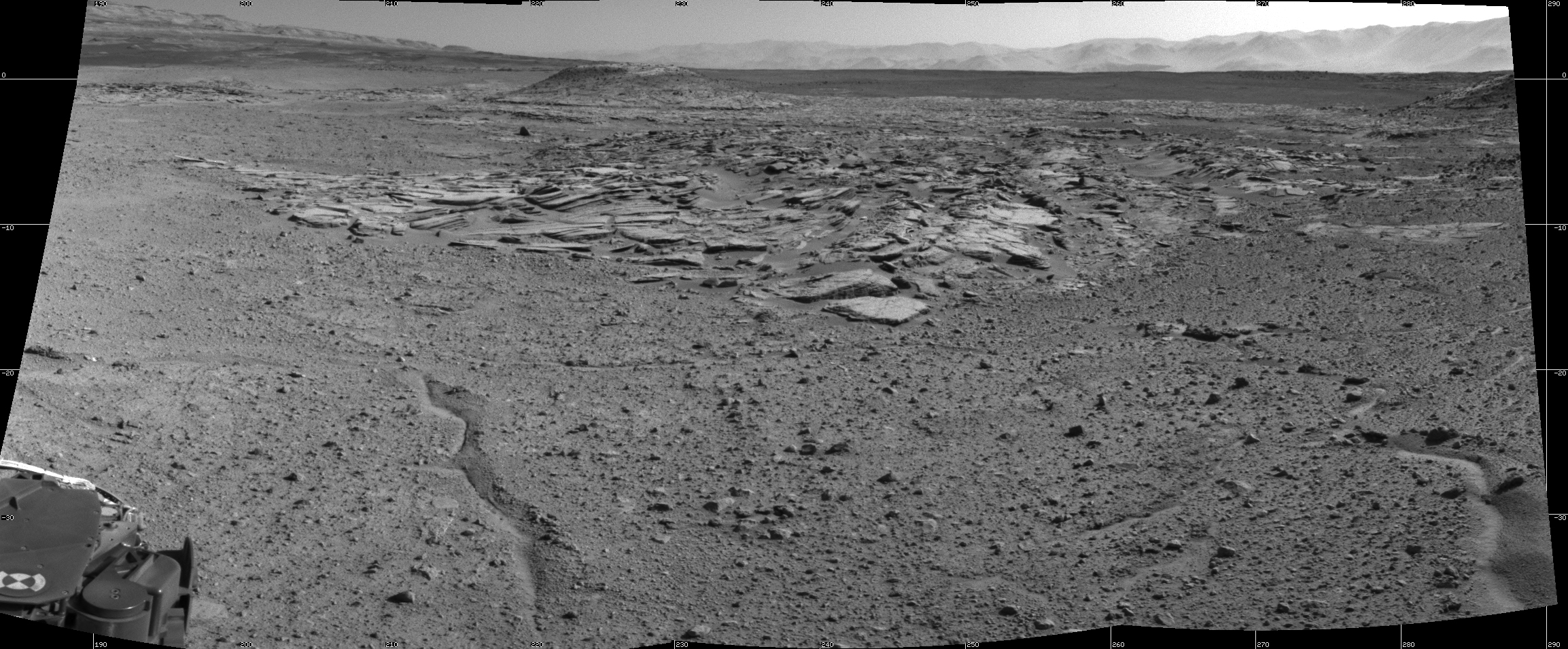
The Curiosity rover snapped new photos of Mars after driving 98 feet (30 meters) on Wednesday (April 2) and topping a small hill that affords a good view of the surrounding area, which NASA scientists have dubbed "the Kimberley," officials said.
"This is the spot on the map we've been headed for, on a little rise that gives us a great view for context imaging of the outcrops at the Kimberley," Melissa Rice of the California Institute of Technology in Pasadena, the science team lead for Curiosity's work at the site, said in a statement.
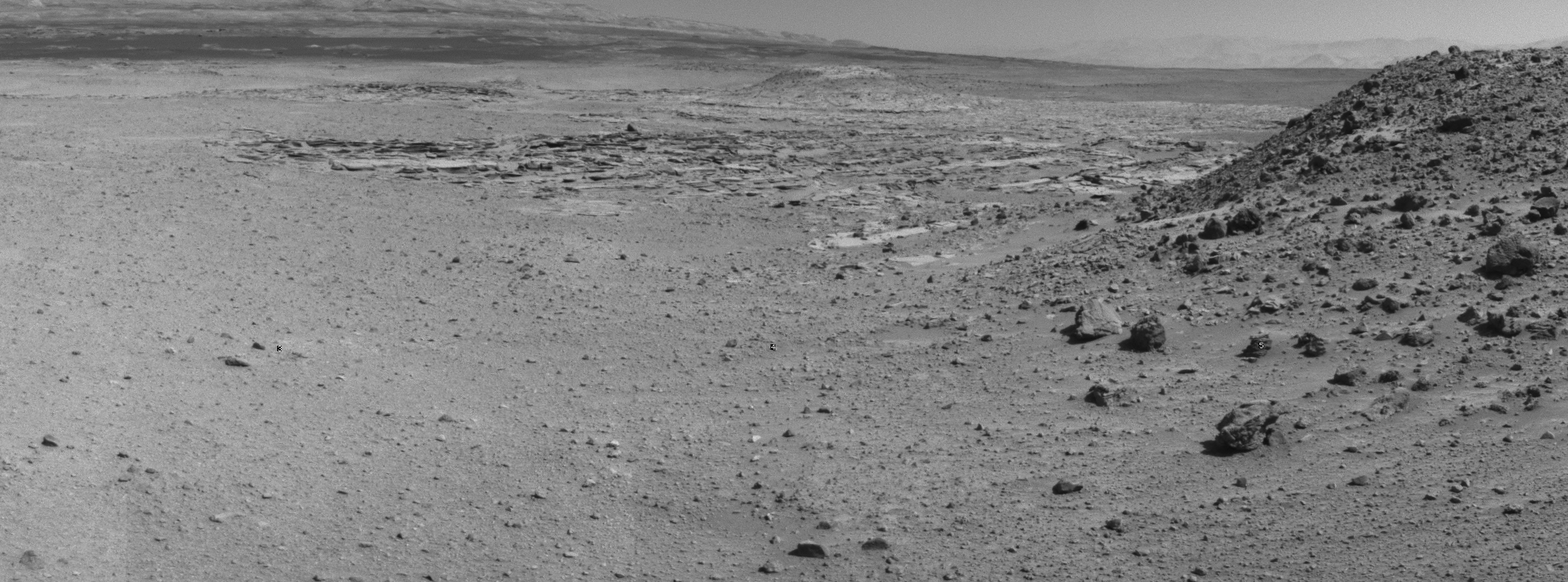
Four different types of rock intersect at the Kimberley, providing Curiosity with a wealth of material to study. The rover is expected to do a great deal of work at the site, conducting its most extensive analyses since leaving a spot called "Yellowknife Bay" last year, NASA officials said.
Curiosity found evidence of an ancient stream-and-lake system at Yellowknife Bay, suggesting that the area could have supported microbial life billions of years ago.
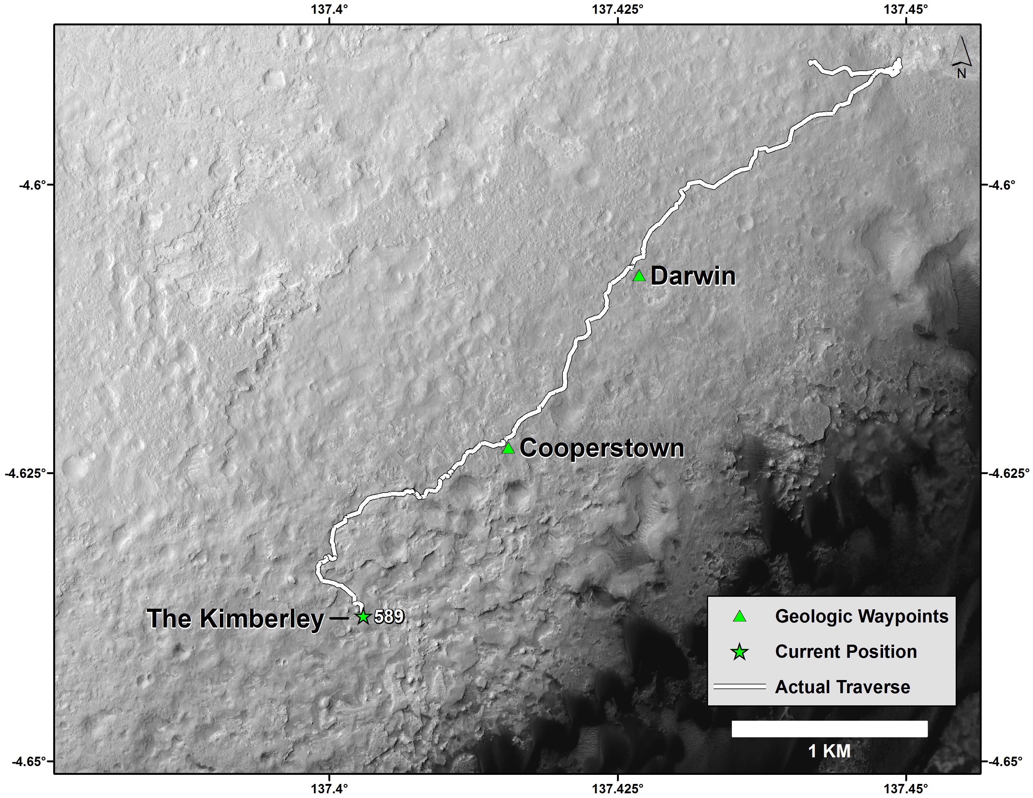
The activities at the Kimberley represent a pause in Curiosity's long drive to the towering Mount Sharp, which has been the rover's main science destination since before its November 2011 launch. Mount Sharp's foothills record a history of Mars' changing environmental conditions over time, and mission officials want Curiosity to read that history like a book as it climbs up through the mountain's lower reaches.
The Curiosity rover has now driven a total of 3.8 miles (6.1 kilometers) since touching down inside the Red Planet's huge Gale Crater in August 2012.
Get the Space.com Newsletter
Breaking space news, the latest updates on rocket launches, skywatching events and more!
The rover has a ways to go yet before reaching Mount Sharp, however. The trek from Yellowknife Bay to the mountain's foothills will cover more than 5 miles (8 km); Curiosity should get there around the middle of this year, mission officials have said.
Follow Mike Wall on Twitter @michaeldwall and Google+. Follow us @Spacedotcom, Facebook or Google+. Originally published on Space.com.
Join our Space Forums to keep talking space on the latest missions, night sky and more! And if you have a news tip, correction or comment, let us know at: community@space.com.

Michael Wall is a Senior Space Writer with Space.com and joined the team in 2010. He primarily covers exoplanets, spaceflight and military space, but has been known to dabble in the space art beat. His book about the search for alien life, "Out There," was published on Nov. 13, 2018. Before becoming a science writer, Michael worked as a herpetologist and wildlife biologist. He has a Ph.D. in evolutionary biology from the University of Sydney, Australia, a bachelor's degree from the University of Arizona, and a graduate certificate in science writing from the University of California, Santa Cruz. To find out what his latest project is, you can follow Michael on Twitter.
