Japan Launches Satellite with Night-Vision Mapping Radar
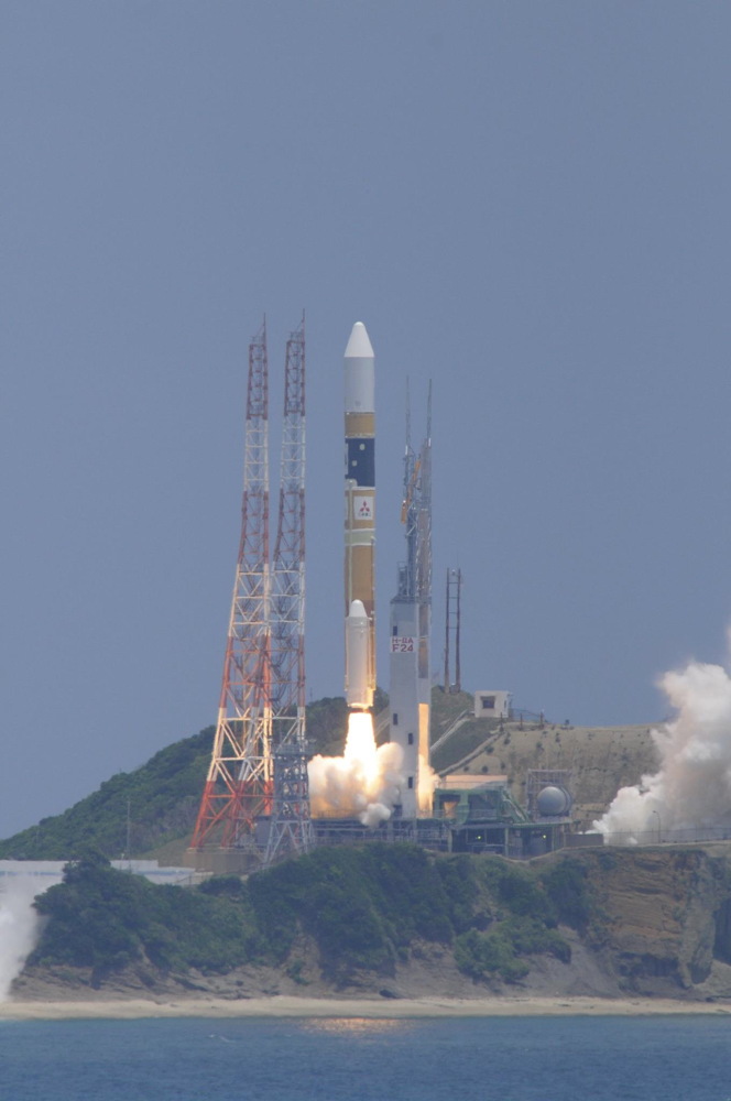
A Japanese satellite equipped with a sharp-eyed synthetic aperture radar launched Saturday on a mission to map the globe every two weeks, helping authorities respond to natural disasters, track agricultural yields and monitor shipping lanes.
Weighing approximately 2.3 tons, the spacecraft took off at 0305:14 GMT Saturday (11:05:14 p.m. EDT Friday) from the Tanegashima Space Center, Japan's primary rocket launching facility at the southwestern end of the country. Liftoff occurred at 12:05 p.m. Japan Standard Time.
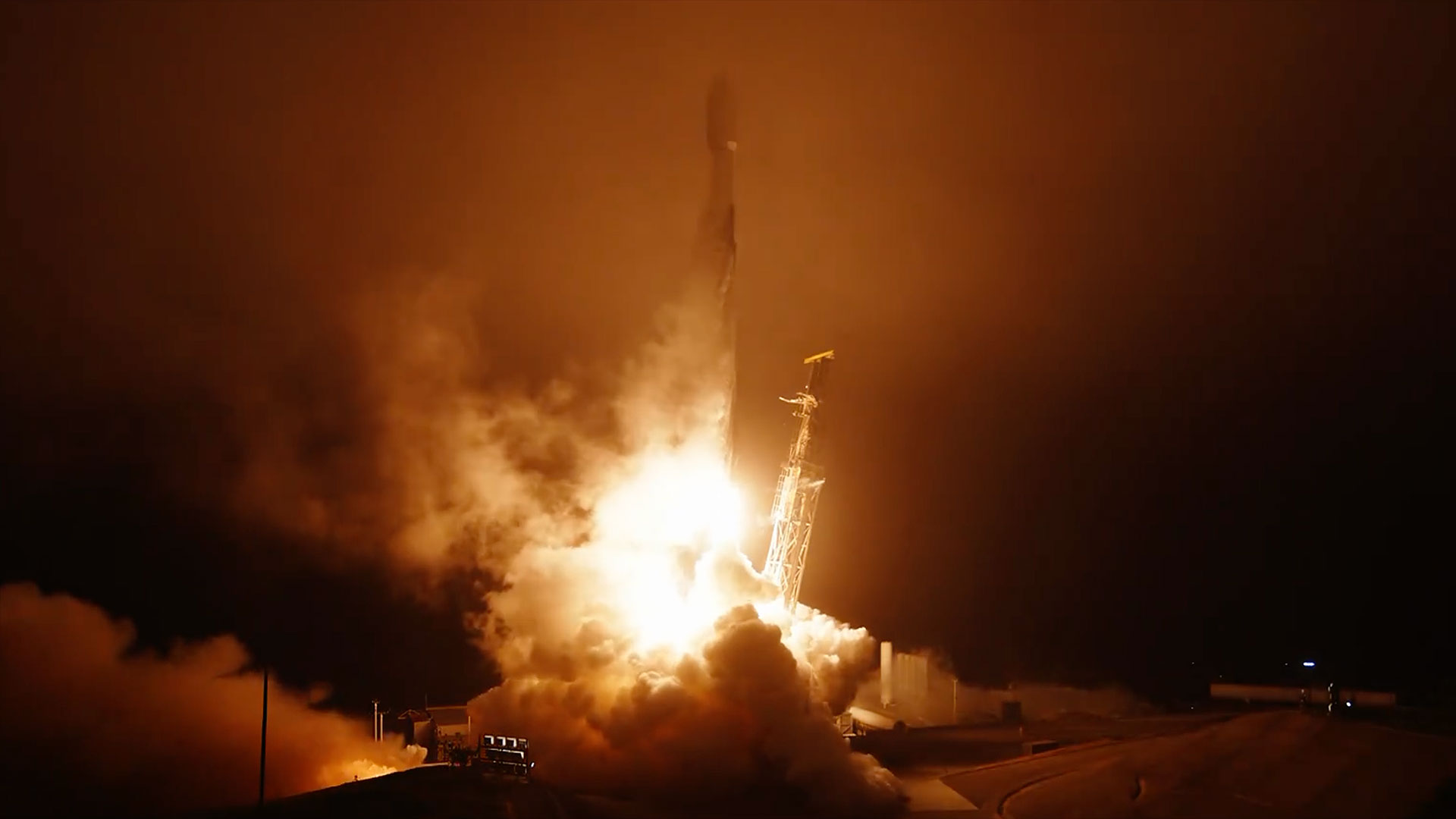
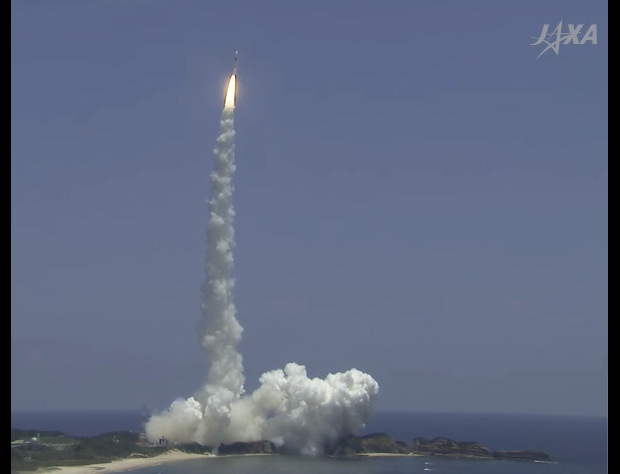
The 17-story H-2A rocket streaked into the midday sky, depositing a trail of fire and smoke in its wake. The H-2A launcher's hydrogen-fueled LE-7A engine and twin solid-fueled boosters collectively produced 1.6 million pounds of thrust to loft the orange and white rocket into the upper atmosphere. [Amazing Rocket Launches of 2014 (Photos)]
The rocket shed its two boosters about two minutes after liftoff, jettisoned its 13.1-foot-diameter (4-meter) nose a couple of minutes later, then shut down the first stage main engine at a velocity of 7,000 mph.
The second stage's LE-5B engine ignited for an eight-minute firing to place ALOS 2 and four small secondary payloads in orbit 400 miles above Earth.
The rocket deployed ALOS 2, also dubbed Daichi 2 for the Japanese word for land, at 0321 GMT (11:21 p.m. EDT).
While the H-2A rocket released four university-built microsatellites a few minutes later, ALOS 2 extended two electricity-generating solar arrays to a wingspan of 54 feet to begin charging the craft's batteries.
Get the Space.com Newsletter
Breaking space news, the latest updates on rocket launches, skywatching events and more!
Designed to last at least five years, ALOS 2 follows Japan's previous land-mapping mission, which operated from 2006 to 2011 before suffering a catastrophic power failure. Japan lost the ALOS mission just six weeks after it was tasked with observing damage in the aftermath of the March 2011 earthquake and tsunami that ravaged the Japanese coastline north of Tokyo, killing thousands and triggering the crisis Fukushima nuclear power plant.
The first ALOS satellite carried an optical stereo camera system, a radiometer and an L-band radar, combining the sensors aboard a single spacecraft.
The Japan Aerospace Exploration Agency decided to launch the follow-up ALOS 2 satellite with an enhanced version of the L-band radar carried aboard the first mission. Another spacecraft, named ALOS 3, is set for launch in 2016 with a high-resolution optical imaging payload.
Before it can start its mapping mission, ALOS 2 must complete a three-step procedure to deploy the satellite's L-band microwave radar antenna. The rectangular-shaped array, consisting of radar transmitters and receivers, measures more than 30 feet long and about 10 feet wide.
The schedule called for the antenna's release from the satellite's main body about 13 hours after launch, then the unfurling of the array's two wings at 24 hours and 34 hours after launch, according to a mission press kit released by JAXA.
Two X-band antennas needed to relay the radar data to ground stations on Earth will deploy two days after launch. The communications antennas will send data at a rate six times faster than the first ALOS mission.
ALOS took 46 days to revisit a location on Earth, while ALOS 2 will fly over the same place at least once every two weeks. ALOS 2's radar also sports enhancements from the instrument flown on ALOS, giving it higher resolution to produce sharper imagery and a wider viewing swath to cover more territory on each orbit.
ALOS 2 can also tilt left and right while flying in space to image locations on both sides of its ground track. The new satellite also flies lower than its predecessor.
"In short, we will be able to image an area in need of observation much more quickly than before," said Shinichi Suzuki, ALOS 2 project manager, an an interview transcript posted on JAXA's website. "In most cases, the satellite will be able to observe an area in Japan's vicinity within 12 hours of a request ... and an area elsewhere in Asia within 24 hours. We plan to provide the standard products about an hour after the downlink."
Radars mounted on satellites can see the ground day and night and in all weather conditions, overcoming the limitations of optical cameras.
In a specialized observing mode called spotlight, ALOS 2's radar images will have a resolution of 1 to 3 meters (3.3 to 9.8 feet), allowing users to focus in localized regions facing emergencies. [Complete Mission Status Center from Spaceflight Now]
Using a standard mapping mode, the satellite's radar will produce imagery with a resolution of 6 meters, or about 20 feet, in strips about 50 kilometers, or 31 miles, wide.
Other modes programmed into ALOS 2's radar are tailored to monitor floods and detect the wakes of ships.
"Using [radar] to scan the Earth's surface through clouds and vegetation is similar to using X-rays or a CT scan to examine our bodies," Suzuki said. "Also, the annual contraction of forests and polar glaciers have unknown effects on climate change -- this is like the lifestyle-related diseases that affect us humans as we live longer. For humans, getting regular check-ups can help prevent disease. This project is based on the idea that in this sense, the Earth too needs a health check."
Scientists tracking seismic activity will use ALOS 2 to keep watch on volcanoes when airplanes are unable to make observations, such as in darkness or when a toxic ash cloud obscures the volcano's crater.
"When volcanic activity increases, it's difficult to know whats happening inside the crater," said Jun Funasaki of the Japan Meteorological Agency's seismology and volcanology department. "The same problem arises at nighttime or in bad weather, but those conditions don't interfere with images taken by the synthetic aperture radar system, and by improving resolution capability and increasing image taking frequency, we hope to get more details on crustal deformations regularly."
"One thing we expect from ALOS 2 is the ability to perform observations rapidly," said Tomokazu Kobayashi of the Geography and Crustal Dynamics Research Center at the Geospatial Information Authority of Japan. "After the 2011 megaquake and tsunami, ALOS took about one month to obtain a complete data set for a ground surface conditions study. But ALOS 2 should be able to give us the same amount of information over a few days when it uses the mode observing over a wide area."
ALOS 2's radar, named PALSAR 2, works by sending radio waves toward Earth and collecting the signals that are reflected back into space.
"Another thing we expect from ALOS 2 is improved spatial resolution," Kobayashi said in a video interview released on JAXA's website.
Other applications include enforcement of laws against illegal logging, cataloging land use, quantifying food yields from crops and detecting oil spills.
Follow Stephen Clark on Twitter: @StephenClark1 and Spaceflight Now @SpaceflightNow and on Facebook. Copyright 2013 SpaceflightNow.com, all rights reserved.

Join our Space Forums to keep talking space on the latest missions, night sky and more! And if you have a news tip, correction or comment, let us know at: community@space.com.
Stephen Clark is the Editor of Spaceflight Now, a web-based publication dedicated to covering rocket launches, human spaceflight and exploration. He joined the Spaceflight Now team in 2009 and previously wrote as a senior reporter with the Daily Texan. You can follow Stephen's latest project at SpaceflightNow.com and on Twitter.

