See the Antares Rocket's 1st Night Launch from East Coast (Visibility Maps)
UPDATE for Oct. 28, 7 a.m. ET: Orbital Sciences is set to try a second attempt to launch its Antares rocket and Cygnus cargo ship today at 6:22 p.m. EDT (2222 GMT) from NASA's Wallops Flight Facility in Virginia. NASA's live webcast to begin at 5:30 p.m. EDT and the launch should be visible to potentially millions of skywatchers along the U.S. East Coast, weather permitting. Skywatching Story: How to See the Antares Rocket's First Night Launch. You can also watch live online here . See the visibility maps below (directions of view are in bold) to learn how to spot the rocket streak into space:
Maximum Elevation Map: This map shows the maximum elevation that Orbital's Antares rocket will reach during its first-stage engine burn. This elevation in the evening sky depends heavily on where you are observing from, but the chart above lists the elevation in terms of degrees. Your closed fist held outstretched at arm's length covers about 10 degrees of the night sky. So for observers in Washington, D.C., the rocket will be 12 degrees above the horizon (just over one fist-width), while for observers in Boston, Massachuchusetts, the launch will appear just 5 degrees above the horizon, or half of a fist-width). Credit: Orbital Sciences
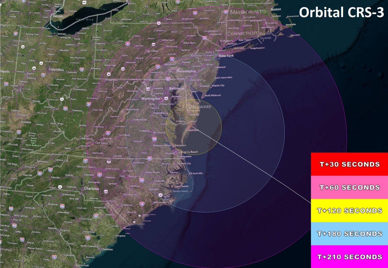
This NASA-issued map shows a more detailed view of the cities within the visibility area for the Oct. 27 Antares launch. The time (listed in seconds after liftoff) is also shown. This will be the first nighttime-launch of an Antares rocket from Virginia's Eastern Shore. It is the largest rocket that launches from the Wallops Flight Facility, and could be a spectacularly bright sight for observers, weather permitting. Credit: NASA/Wallops Mission Planning Lab.
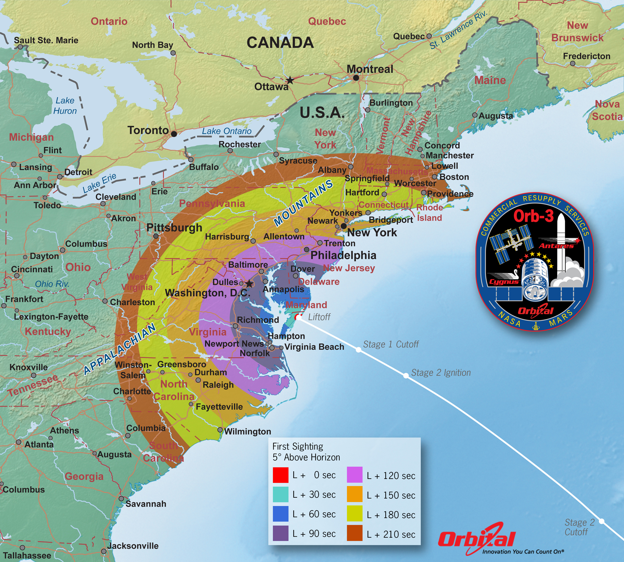
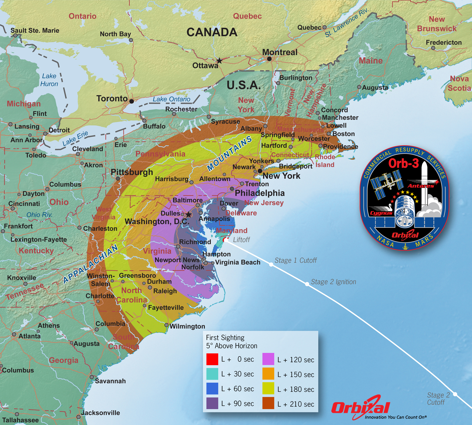
This Antares launch visiblity map released by Orbital Sciences also lists the visibility times for different East Coast regions, based on the number of seconds after a 6:45 p.m. EDT (2245 GMT) launch. This the color-coding of this map makes it a useful tool for determining when and where to look from your location. Credit: Orbital Sciences.
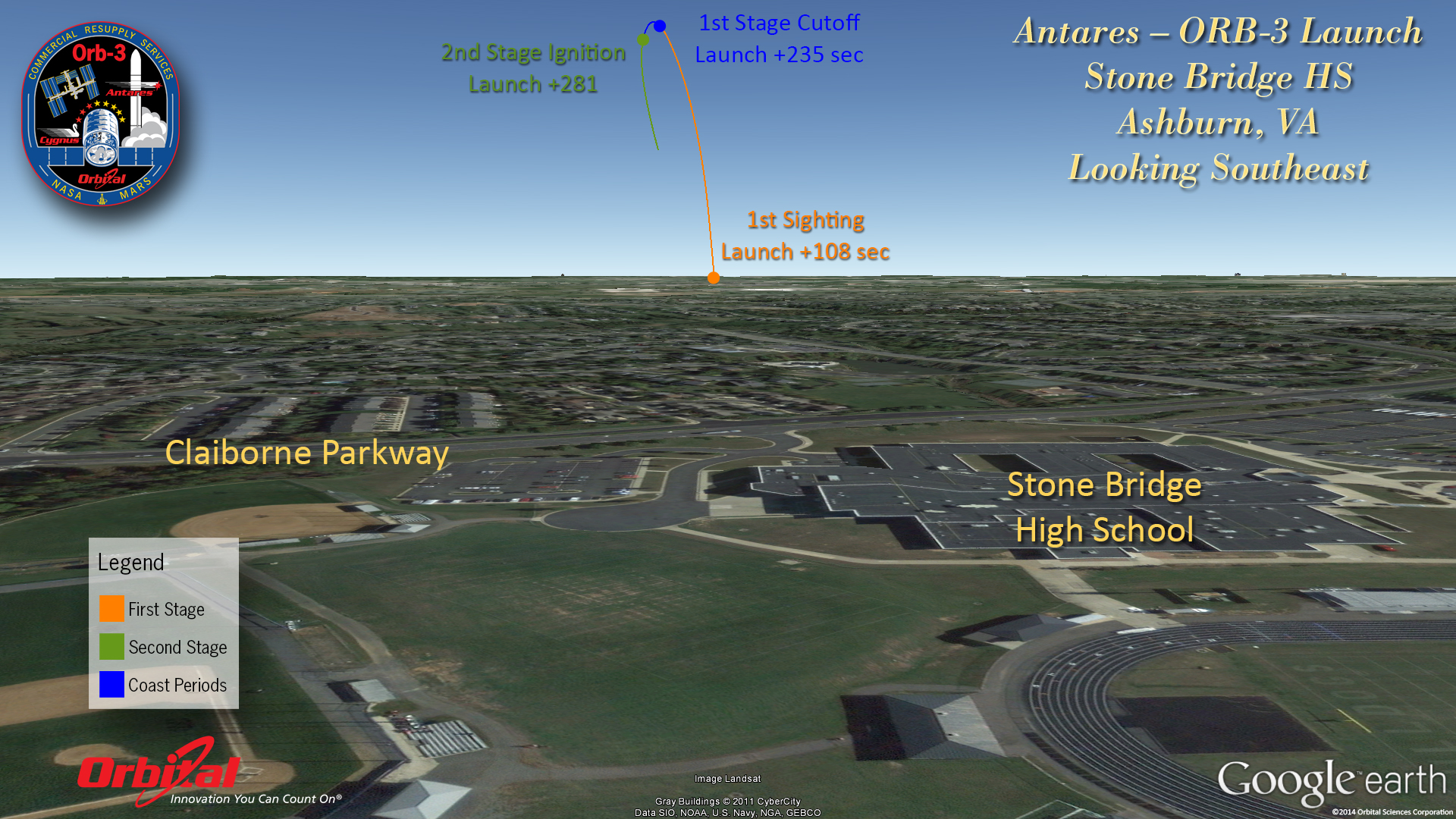
In addition to providing general visibility maps for the Antares launch, Orbital Sciences has also prepared a series of viewing maps for the different cities along the U.S. East Coast that show the rocket's trajectory as seen from those locations. This visiblity map shows how the visiblity path for the Antares rocket for observers looking southeast from the city of Ashburn, Virginia. Credit: Orbital Sciences.
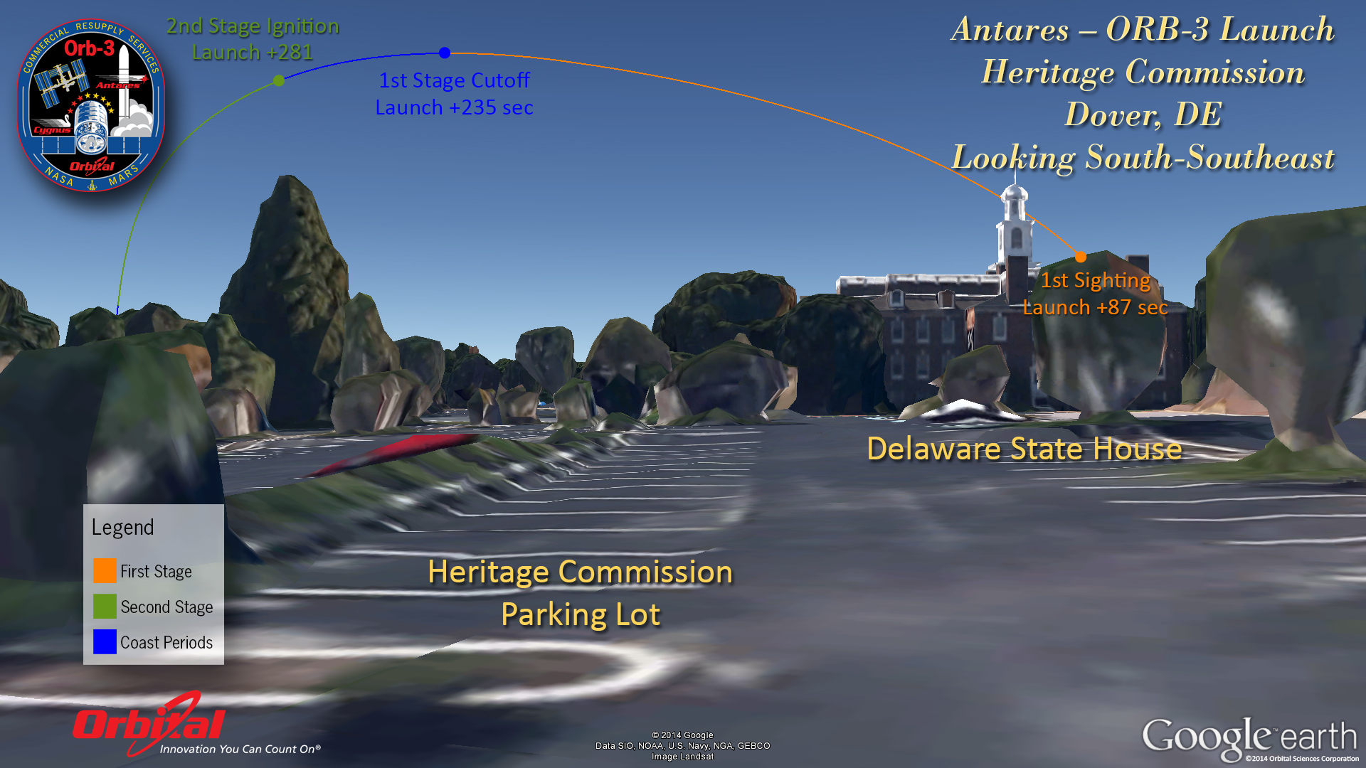
To see the Antares rocket launch from Dover, Delaware, observers should look south-southeast as shown in this visibility map of the view from the Heritage Commission parking lot near the Delaware State House. The first sighting of the rocket should come about 87 seconds after liftoff. Credit: Orbital Sciences/Google Earth.
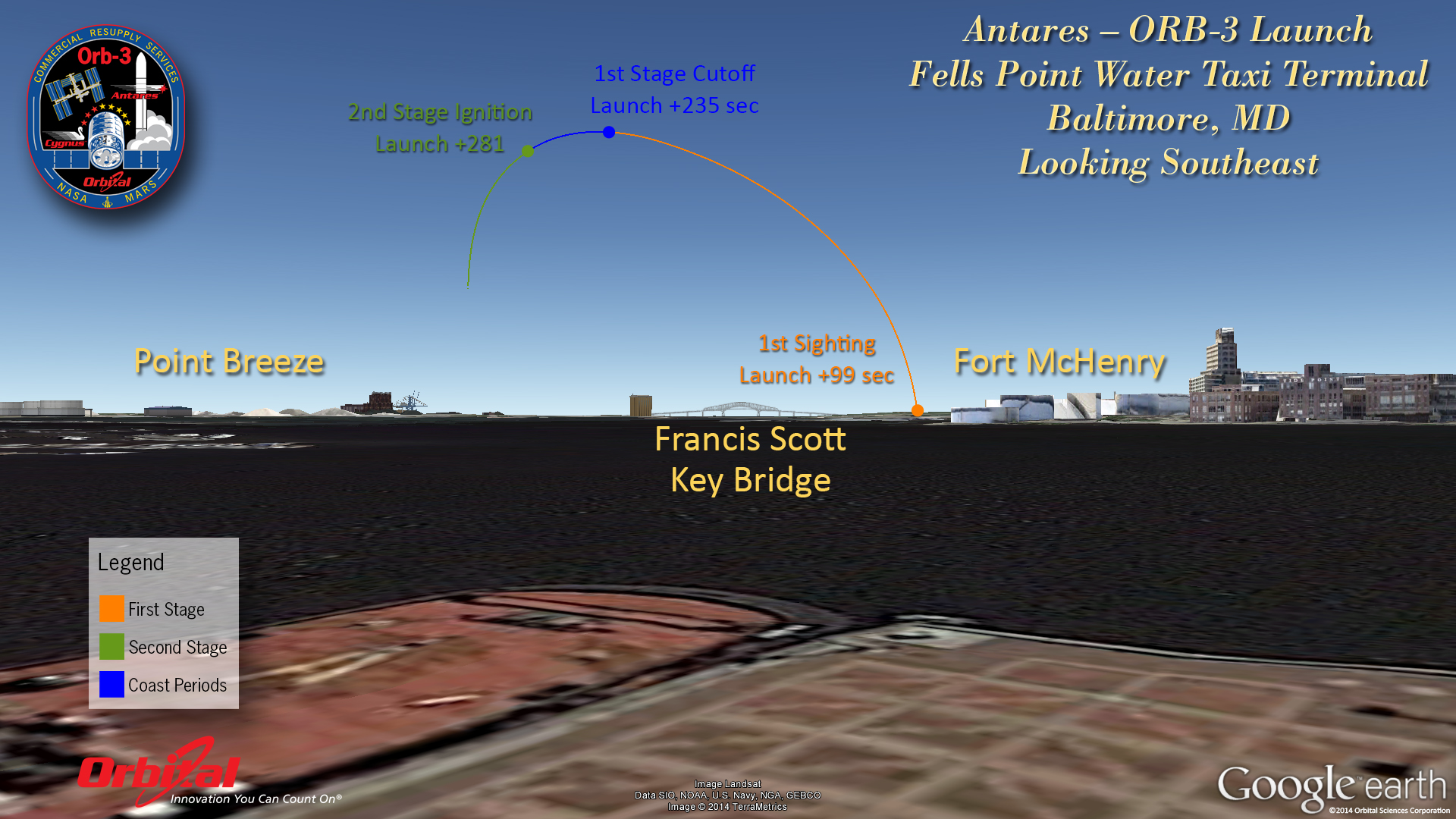
The Antares rocket launch will be visible in the southeast sky from Baltimore, Maryland. This map shows where and when to look from Baltimore's Fells Point Water Taxi Terminal. the rocket should first become visible about 99 seconds after liftoff. Credit: Orbital Sciences/Google Earth.
Get the Space.com Newsletter
Breaking space news, the latest updates on rocket launches, skywatching events and more!
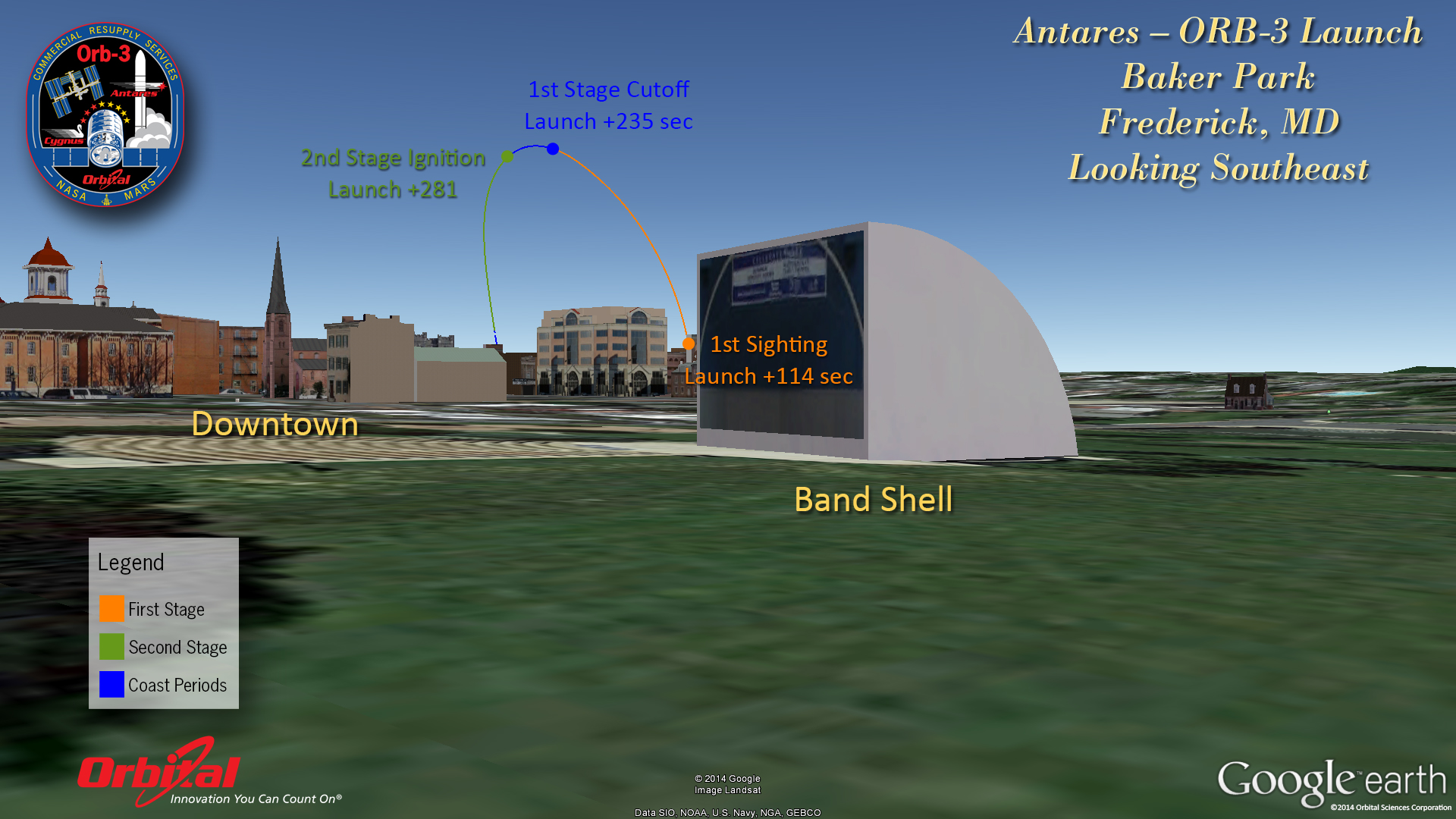
This image shows where the Antares rocket will be visible in the southeast sky from Frederick, Maryland for observers at Baker Park. The rocket should first become visible about 114 seconds after liftoff. Credit: Orbital Sciences/Google Earth.
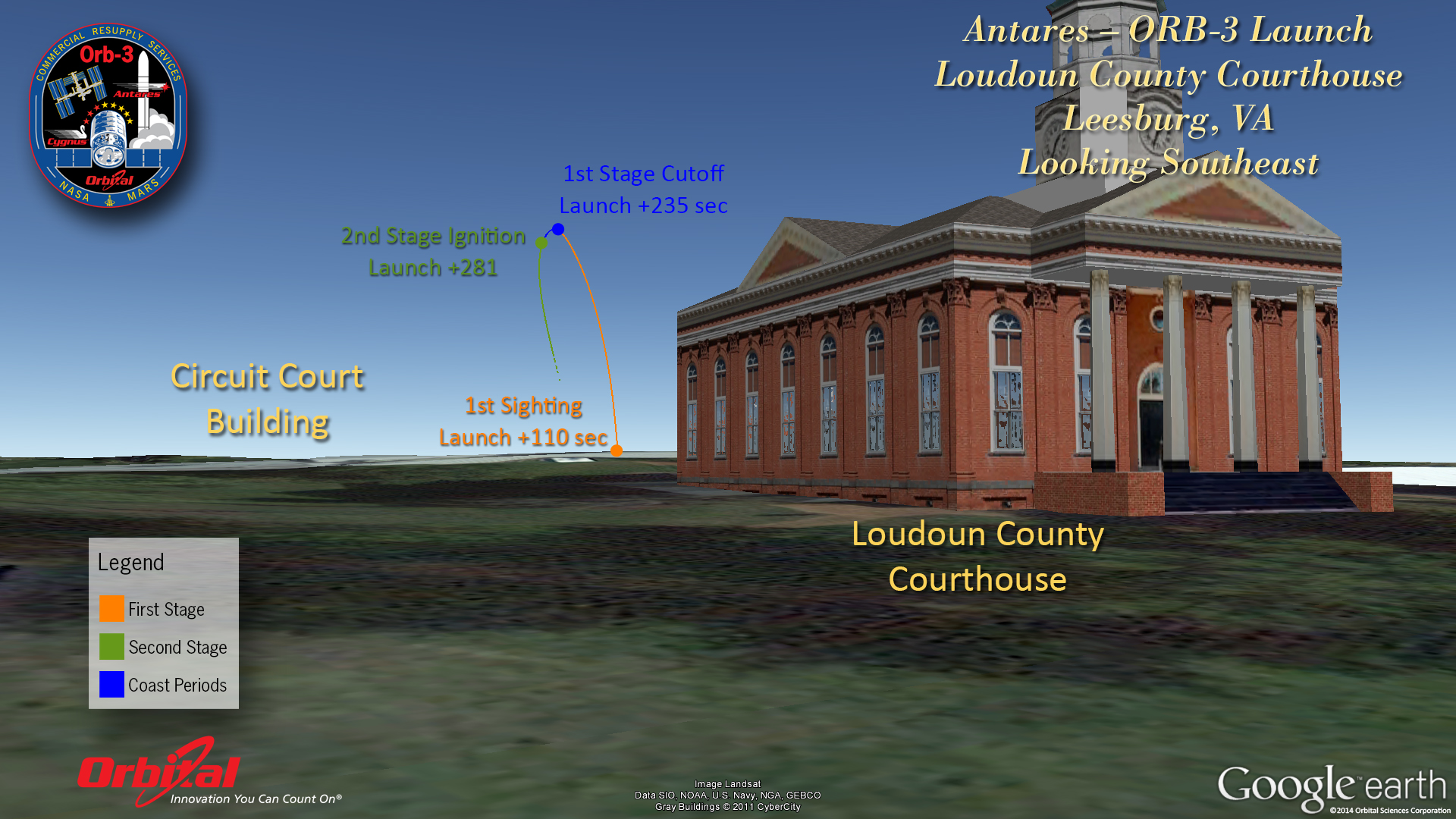
The Antares rocket should be visible in the southeast sky from Leesburg, Virginia, beginning about 110 seconds after the 6:45 p.m. EDT liftoff. This visibility map shows the rocket's trajectory as it will appear from near the Loudoun County Courthouse in Leesburg. Credit: Orbital Sciences/Google Earth.
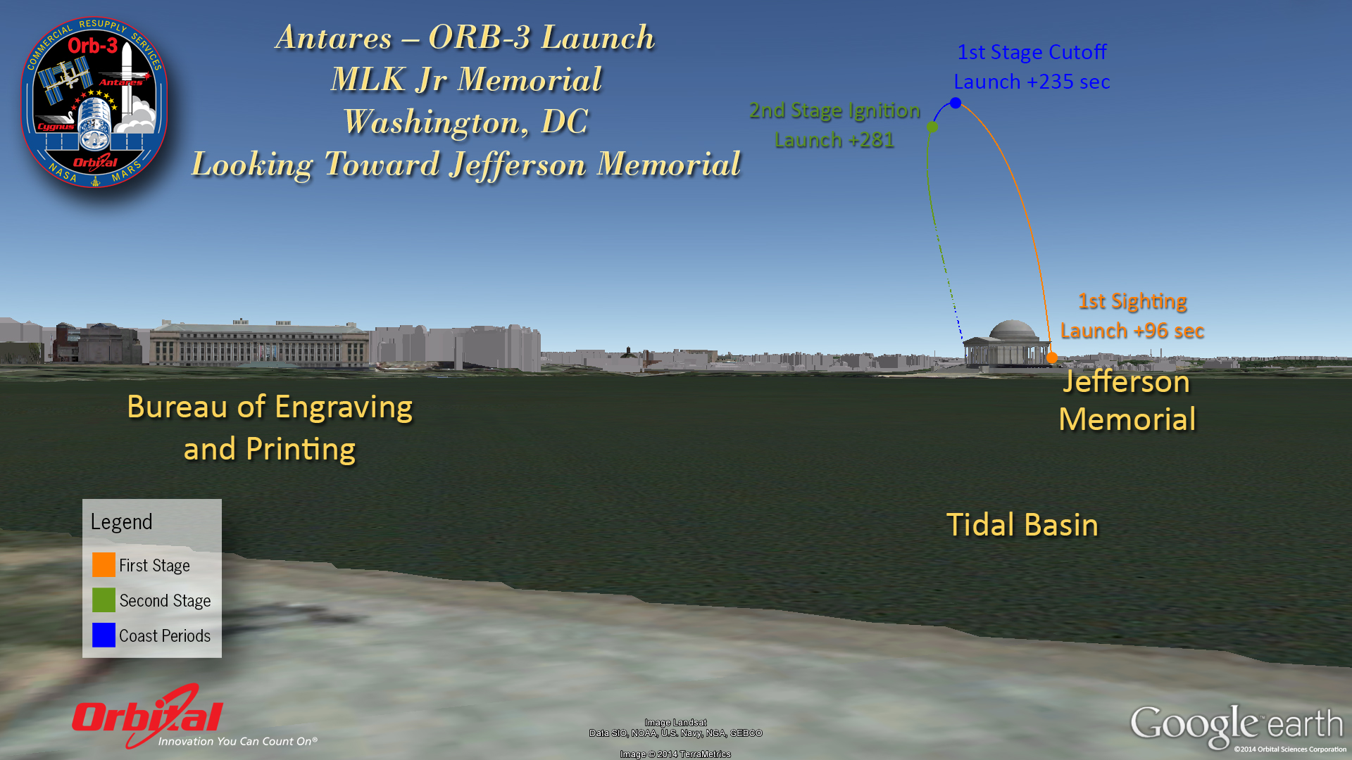
This Antares rocket sighting guide is for observers in Washington, D.C. This view shows where and when to see the rocket from the Martin Luther King, Jr. Memorial. Observers should look toward the Jefferson Memorial to see the rocket when it becomes visible about 96 seconds after launch. Credit: Orbital Sciences/Google Earth.
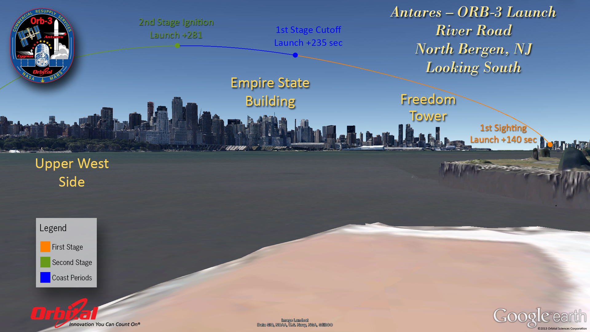
Antares rocket observers should look due south to see the night launch from New York City and northern New Jersey. This map shows how the rocket will appear to soar over the New York City skyline as seen from River Road in North Bergen, New Jersey. The rocket will be visible about 140 seconds (just over 2 minutes) after liftoff. Credit: Orbital Sciences/Google Earth.
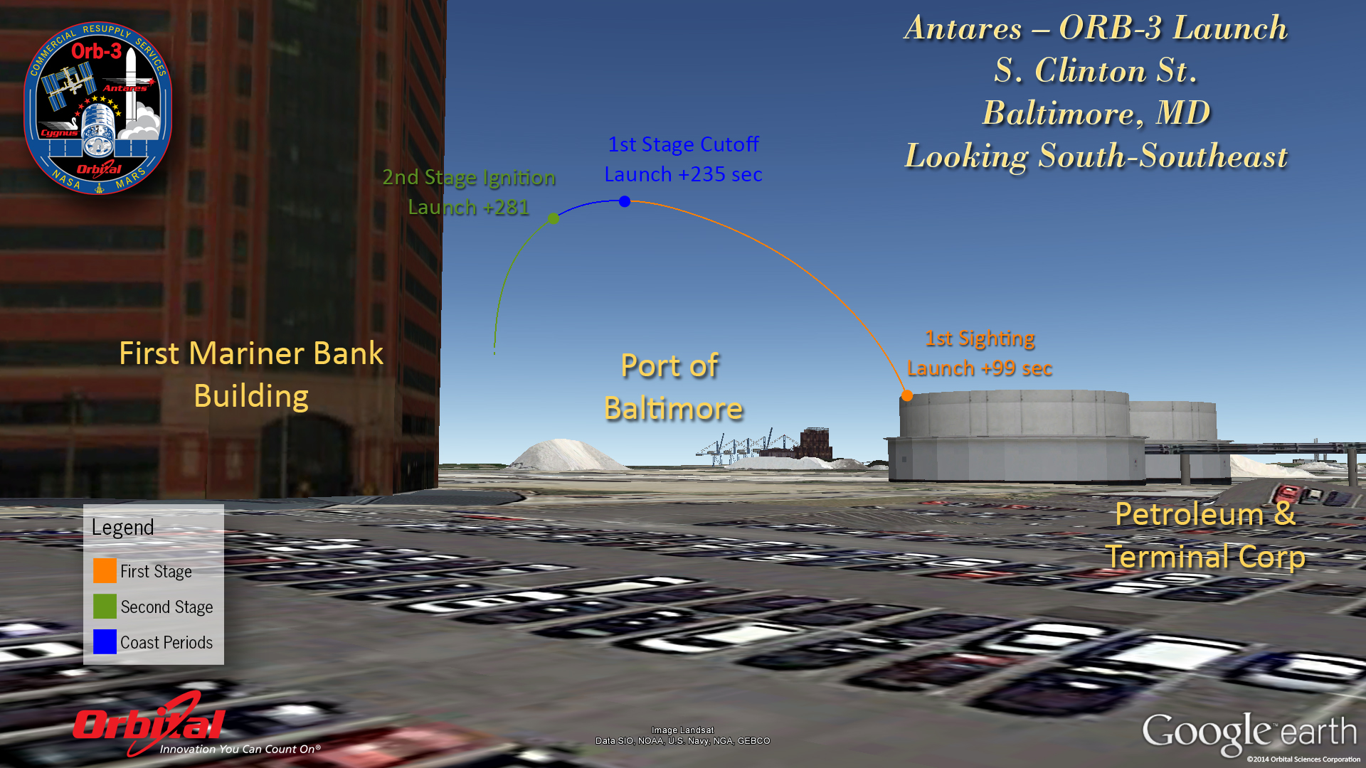
This visibility guide for the Antares rocket launch shows where to look in the south-southeast sky from South Clinton Street in Baltimore, Maryland. The rocket should become visible about 99 seconds after liftoff. Credit: Orbital Sciences/Google Earth.
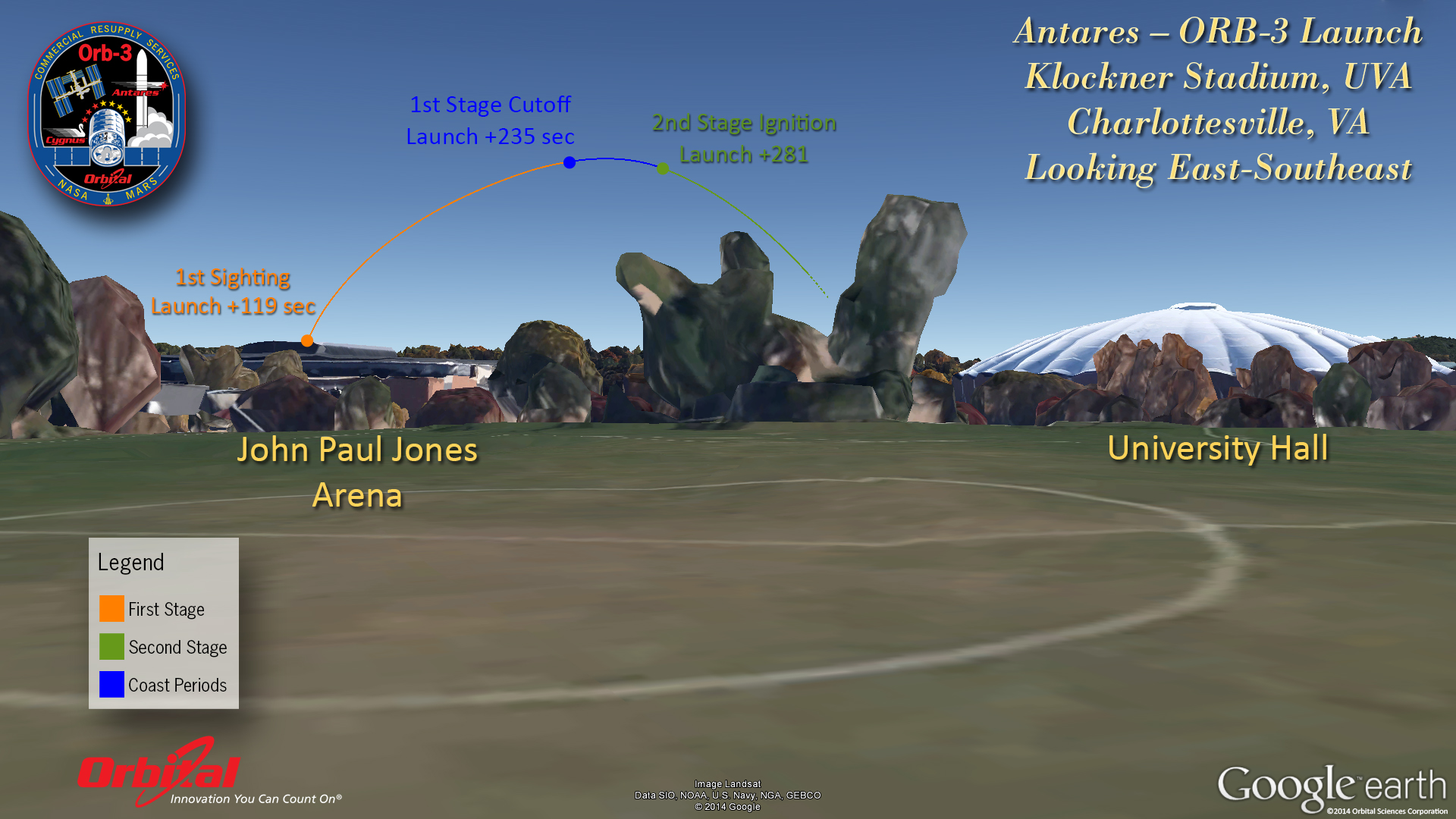
Skywatchers in Charlottesville, Virginia, should look east-southeast to see the Antares launch on Monday, Oct. 27. This sky map from Orbital Sciences shows the path of the rocket across the sky as seen from Klockner Stadium at the University of Virginia in Charlottesville. Credit: Orbital Sciences/Google Earth.
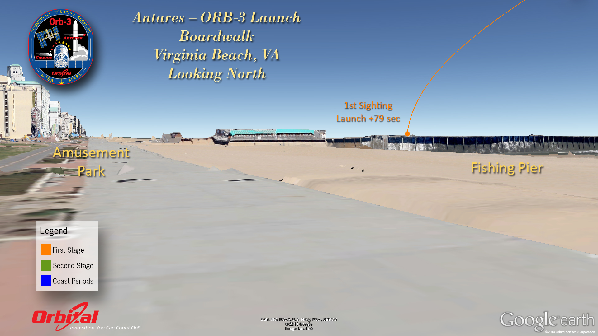
This sky map shows where and when to look to see the Antares rocket launch on Oct. 27 from Virginia Beach in Virginia. Observers should look north from the boardwalk of Virginia Beach as shown in this view. Credit: Orbital Sciences/Google Earth.
As of late Sunday, the weather forecast for Monday's Antares launch is extremely favorable for liftoff, with a 98-percent chance of good weather at launch time.
Editor's Note: If you snap a photo of the Antares rocket launch of Oct. 27, and would like to share it for a gallery or story, you can send omments and images to managing editor Tariq Malik and the Space.com team by emailing: spacephotos@space.com.
Email Tariq Malik at tmalik@space.com or follow him @tariqjmalik and Google+. Follow us @Spacedotcom, Facebook and Google+.
Join our Space Forums to keep talking space on the latest missions, night sky and more! And if you have a news tip, correction or comment, let us know at: community@space.com.

Tariq is the Editor-in-Chief of Space.com and joined the team in 2001, first as an intern and staff writer, and later as an editor. He covers human spaceflight, exploration and space science, as well as skywatching and entertainment. He became Space.com's Managing Editor in 2009 and Editor-in-Chief in 2019. Before joining Space.com, Tariq was a staff reporter for The Los Angeles Times covering education and city beats in La Habra, Fullerton and Huntington Beach. In October 2022, Tariq received the Harry Kolcum Award for excellence in space reporting from the National Space Club Florida Committee. He is also an Eagle Scout (yes, he has the Space Exploration merit badge) and went to Space Camp four times as a kid and a fifth time as an adult. He has journalism degrees from the University of Southern California and New York University. You can find Tariq at Space.com and as the co-host to the This Week In Space podcast with space historian Rod Pyle on the TWiT network. To see his latest project, you can follow Tariq on Twitter @tariqjmalik.


