Surveyor 1: NASA's 1st Lunar Landing Success in Pictures
Surveyor 1: NASA's First Lunar Soft Landing
On June 2, 1966, the United States reached a key milestone in its moon program — soft-landing a robotic craft on the lunar surface. The Surveyor 1 spacecraft (and the program as a whole) was key to helping Apollo astronauts reach the moon's surface in 1969. It wasn't the first spacecraft to land on the moon — that record is held by the Soviet Luna 9 lander that touched down on Feb. 3, 1966 — but the Surveyor program accomplished several major objectives, such as showing what the surface conditions were like and how to communicate long-distance back to Earth.
The images were collected on tapes and stored away long before computers were commonplace. This means that today, there are few pictures on the Internet showing Surveyor 1's historic feat in 1966. That's about to change, however. An intrepid group at the University of Arizona Lunar and Planetary Laboratory's Space Imager Center have painstakingly digitized more than 93,000 photographs from the Surveyor program. In a few months, these pictures should be available to the public.
This slideshow shows a handful of those photos, along with commentary from the team that made their re-emergence possible.
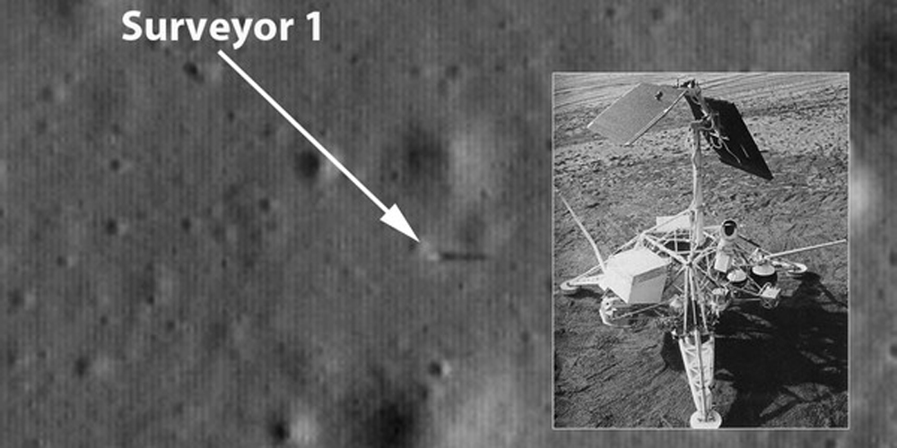
The location of Surveyor 1, in the Oceanus Procellerum region of the moon, as seen by NASA's Lunar Reconnaissance Orbiter in 2009 and (inset) a mock-up of the lander on the lunar surface.
Originally published on Discovery News.
Only in Shadows
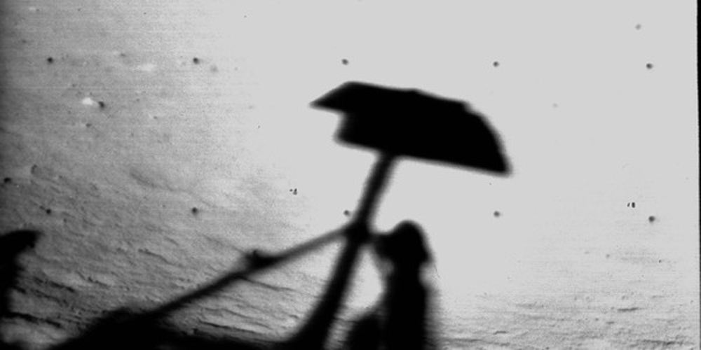
A search for Surveyor 1 photos today on the Internet usually reveals this photo, which is a goosebump-inducing image of Surveyor 1's shadow in Flamsteed Crater, in southwest Oceanus Procellarum. This picture was taken on the eve of its first lunar nightfall in 1966, at which point the spacecraft sent a stunning 10,338 photos back to Earth in just 12 days, according to NASA.
Surveyor 1 also got data on how reflective teh lunar surface is, and how much weight the regolith (soil) can take. The spacecraft resumed photo-taking on July 7, 1966. Its mission was terminated July 13 due to battery issues, and engineering work continued until January 1967. The program continued with six more launched; four other spacecraft made it safely (with the last spacecraft, Surveyor 7, arriving in 1969).
Get the Space.com Newsletter
Breaking space news, the latest updates on rocket launches, skywatching events and more!
A view of the lunar horizon with the shadow of Surveyor 1's antenna and solar panel, captured June 13, 1966.
Buried in History
The more than 93,000 images from Surveyor 1 sat idle on tape reels for decades, until Shane Byrne (an associate professor at the University of Arizona who studies planetary surface processes) spoke with original Surveyor team member Justin Rennilson. "In his mind these images weren't publicly available on the Internet, and that was unfortunate because it was hugely expensive and a great achievement to get them," Byrne told Discovery News.
The university has a regional proprietary image facility that pulls photographs from nine NASA centers. Among the countless photographs were original 70 mm film reels that weren't available anywhere, and in the collection for decades. Byrne and his team wrote a funding proposal in 2013 to NASA arguing the merits of scanning the data set. When they received a grant, they started work at the beginning of 2015.
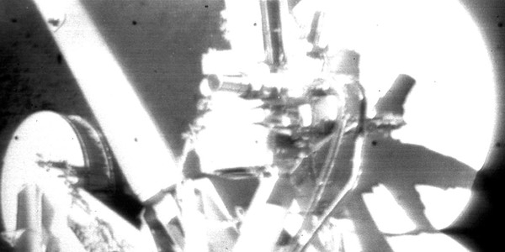
A self-portrait of Surveyor 1 on June 5, 1966.
Challenging but Worth It
There were many challenges in scanning the film, said John Anderson a team member who worked on scanning images and decoding their info. For example, several different types of film were used to record the images, which affected the amount of light needed for each type to be scanned.
Sometimes, a reel of tape would have 3 or 4 different types of film stock taped together. The team also discovered size variants and spacing variants on the film, making it difficult sometimes to scan more than 10 or 15 photos at once. The scanning process took six months with mostly John doing it by himself, with occasional help from team member Maria Schuchardt (who runs the center) and a summer student.
The team also acknowledges the help of Texas-based Stokes Imaging, which calibrated the imaging system for digitizing the Surveyor photos and provided assistance with technical issues.
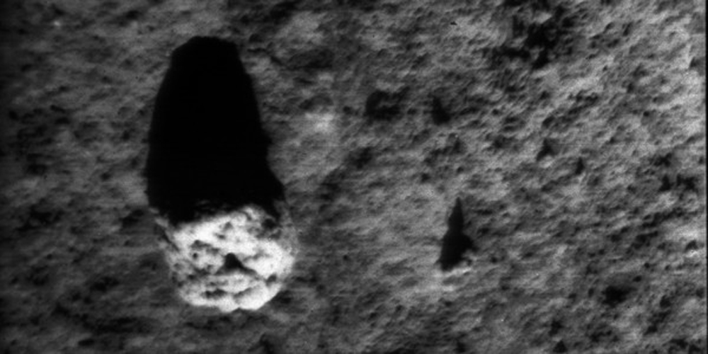
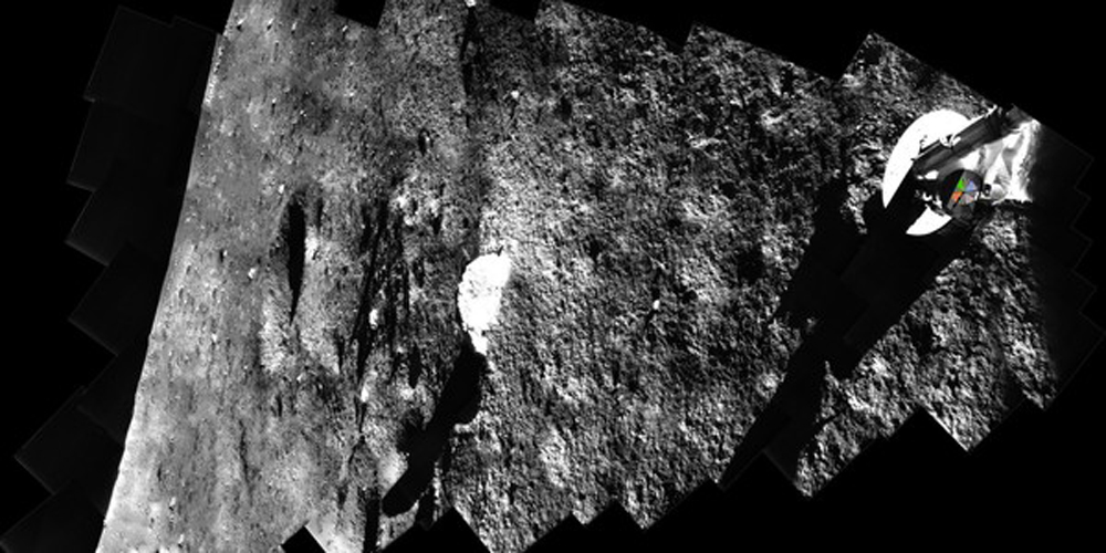
The lunar surface near Surveyor 1, taken June 11, 1966.
Piecing Together the Cosmos
A modern digital camera includes information on every photo known as "metadata," which shows information such as when the picture was taken, what kind of camera was used and what settings the camera employed. A more primitive version of this was available on the Surveyor photos, but they were in a n obsolete kind of code. Every image had a set of dots and bars with this information. Rennilson knew how to decode the dots, but it took about 1-2 hours to do this by hand. With 93,000 images, something speedier was needed.
Team member Leon Palafox developed software to automatically extract the dot info from the scans. The team is now able to decode the dots on a single image in about one minute. The bar code still required more decoding, but with Anderson's help (who has a background in broadcast and electronic engineering) they figured it out. The code shows which ground station the image was received at, the time the images was made, and the spacecraft mission. A program is being written now to translate this automatically.
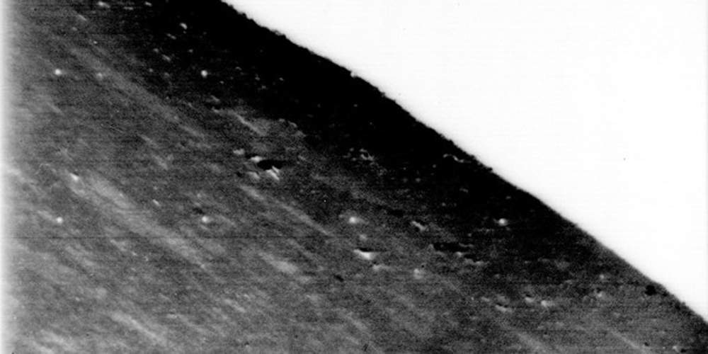
A mosaic of images taken by Surveyor 1 on June 13, 1966 that stretches to the lunar horizon (image rotated counterclockwise.)
5 Decades
While the images are 50 years old, Byrne said they do contain valuable information that would be useful for planetary science today. For example, they show close-up areas of the "highlands" of the moon, which is unique because the Apollo astronauts stayed in the safer lowlands. The images also show the moon at different times of day, whereas the Apollo images were mostly from the middle of the day. One thing the scientists hope to see is electrostatically charged dust that levitates on the moon around sunrise and sunset.
The team plans to have the imagery ready for publication around the end or 2016 or beginning of 2017, both on the Space Imagery Center website and NASA's Planetary Data System website.
A Surveyor 1 observation of the moon that was captured on June 6, 1966.
Join our Space Forums to keep talking space on the latest missions, night sky and more! And if you have a news tip, correction or comment, let us know at: community@space.com.

Elizabeth Howell (she/her), Ph.D., was a staff writer in the spaceflight channel between 2022 and 2024 specializing in Canadian space news. She was contributing writer for Space.com for 10 years from 2012 to 2024. Elizabeth's reporting includes multiple exclusives with the White House, leading world coverage about a lost-and-found space tomato on the International Space Station, witnessing five human spaceflight launches on two continents, flying parabolic, working inside a spacesuit, and participating in a simulated Mars mission. Her latest book, "Why Am I Taller?" (ECW Press, 2022) is co-written with astronaut Dave Williams.
