NASA's Hurricane Microsatellite Fleet is Launching Soon
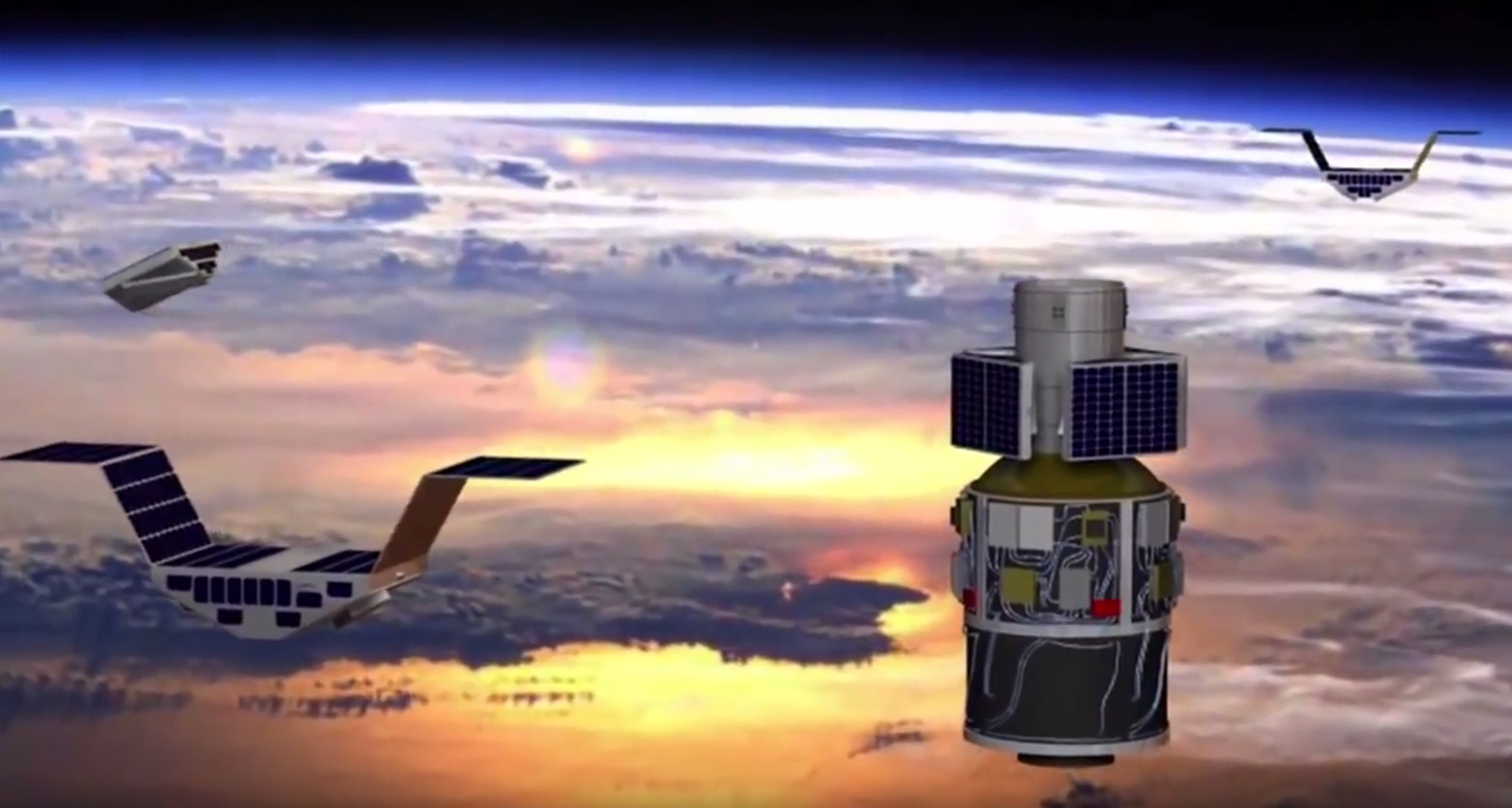
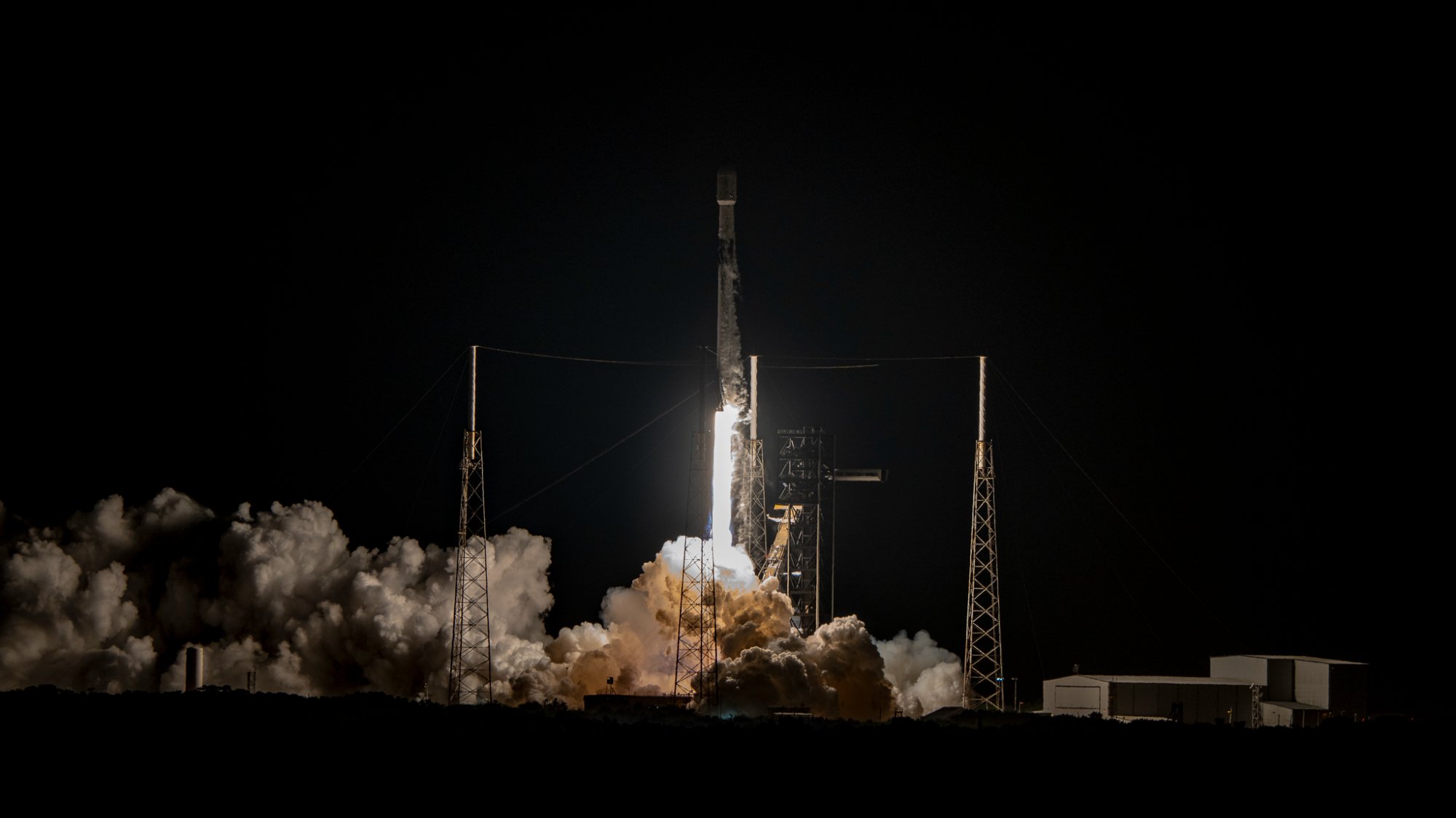
NASA scientists are gearing up for the Dec. 12 launch of the Cyclone Global Navigation Satellite System (CYGNSS), a dedicated fleet of storm-watching microsatellites that will track hurricane evolution over Earth's oceans. Agency researchers discussed the new mission in a news conference today (Nov. 10).
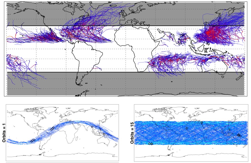
CYGNSS will be an octet of 64-lb. (29-kg) microsatellites, each slightly larger than a carry-on suitcase, set in Earth orbit to monitor developing hurricanes and tropical cyclones. While a single orbiting satellite could only provide updates on a given location every few days, the eight together will be able to report on developing storms every few hours as they pass overhead. The system is low-cost, coming in at $162 million to build and run.
"We're doing real science with a spacecraft that can literally sit on your desk," John Scherrer, CYGNSS' project manager at the Southwest Research Institute in San Antonio, said at the briefing. "Not just one of them, but eight — they'll be orbiting in the tropics where the hurricanes are, and every 90 minutes they'll be making another measurement." [NASA's CYGNSS Hurricane-Tracking Satellites in Images]
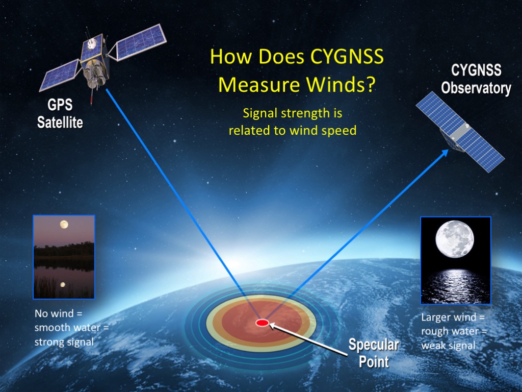
NASA's previous hurricane-measuring tools, like that on the TRMM satellite which fell from space in June after being retired from use, measured wind speeds over the ocean using wavelengths of light that could be scattered by raindrops, meaning that such tools couldn't gather data where rainfall was too heavy, like the hurricane's inner core. Plus, hurricanes evolve on shorter timescales than single orbiting satellites can handle. There are also airplane-carried devices that can monitor both the rain and the water below it (which indicates the wind speed) — but that technology can't be scaled to space, the researchers said.
The CYGNSS microsatellites pick up signals that are released from GPS satellites after they bounce off of the water. The way the signals reflect let the satellites measure the ocean's roughness — and therefore the wind speed over the surface. Each microsatellite can measure the reflections from four spots simultaneously as they orbit through the tropics.
The GPS transmitters operate at long microwave wavelengths that pass through raindrops, letting the microsatellites pick up reflections even through the storms' chaotic hearts and heavy rain.
"It's as if each satellite was making the type of measurements that four different P3 hurricane-hunter airplanes were making," said Chris Ruf, CYGNSS' principal investigator at the University of Michigan, Ann Arbor. "We have eight of the satellites, and four measurements each, so it's like having 32 virtual airplanes flying around somewhere in the tropics, making measurements simultaneously." The satellites will re-measure a given spot within 7 hours — monitoring the tropics at all times for at least a two-year mission.
Get the Space.com Newsletter
Breaking space news, the latest updates on rocket launches, skywatching events and more!
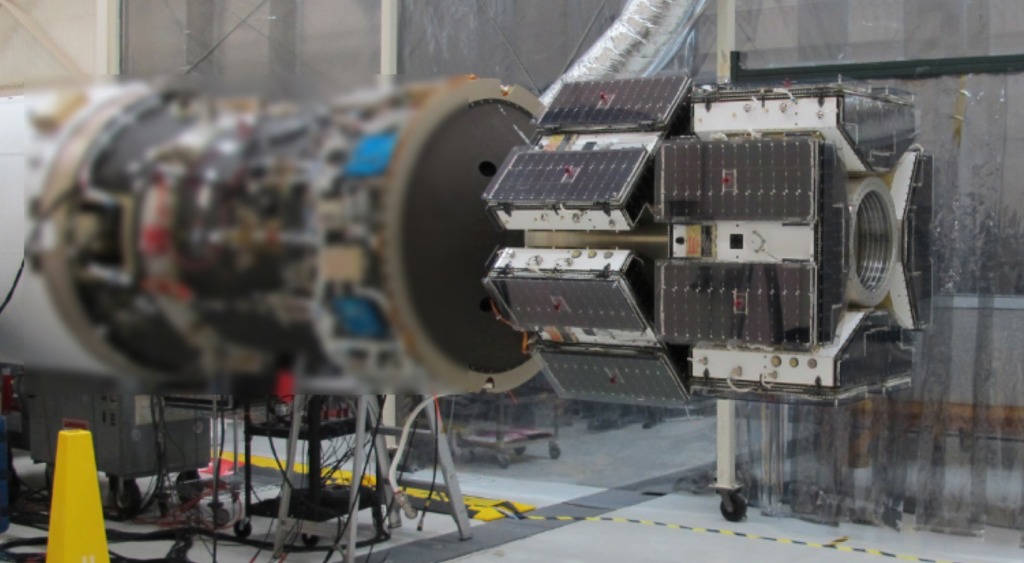
When the microsatellites are deployed Dec. 12, their launch vehicle, the Pegasus, will be dropped from an L-1011 aircraft at 40,000 feet, where it will wait 5 seconds before the rocket engines ignite. The satellites will be released opposite each other in pairs, every 30 seconds, until all eight are separated. Ten minutes later, the solar arrays extend out and the satellites get to work. They will transmit data down to ground stations in Hawaii, Chile and Australia.
Mary Morris, a doctoral student at the University of Michigan, Ann Arbor, demonstrated an accompanying Storm Intersection Forecast Tool, which will reveal where the satellites will encounter a developing hurricane and predict how fast they will be able to transmit the data down to Earth. Using the example of the recent Hurricane Mathew, she demonstrated that less than an hour after passing over the storm, the satellite would have travelled over the Australian ground station to pass down the measurements.
"CYGNSS is a tool that will provide us 24/7 coverage of the tropical cyclone zone, and it will improve our knowledge of how hurricanes grow so that we can better prepare and protect the people in the path of each hurricane as it comes," said Christine Bonniksen, CYGNSS program executive with the Science Mission Directorate's Earth Science Division at NASA Headquarters.
Email Sarah Lewin at slewin@space.com or follow her @SarahExplains. Follow us @Spacedotcom, Facebook and Google+. Original article on Space.com.
Join our Space Forums to keep talking space on the latest missions, night sky and more! And if you have a news tip, correction or comment, let us know at: community@space.com.

Sarah Lewin started writing for Space.com in June of 2015 as a Staff Writer and became Associate Editor in 2019 . Her work has been featured by Scientific American, IEEE Spectrum, Quanta Magazine, Wired, The Scientist, Science Friday and WGBH's Inside NOVA. Sarah has an MA from NYU's Science, Health and Environmental Reporting Program and an AB in mathematics from Brown University. When not writing, reading or thinking about space, Sarah enjoys musical theatre and mathematical papercraft. She is currently Assistant News Editor at Scientific American. You can follow her on Twitter @SarahExplains.

