Shadow Maps Show Where Sunlight Does Not Fall
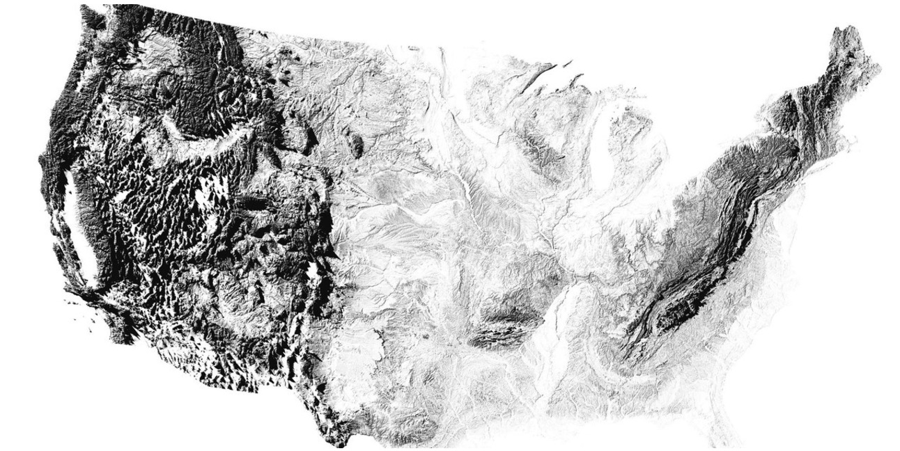
The maps most of us are familiar with feature landmarks that stand out — like mountains, roads, lakes and rivers. But a Ph.D. candidate of geospacial science in Australia thought it would be interesting to focus on what doesn't stand out, but is cast in shadow.
"The idea of mapping the landscape using only sunset shadows came to me as a way to focus purely on the natural shape, structure and texture of the landscape, and make an incredibly minimalist map without any additional distractions," explained Robbi Bishop-Taylor of University of New South Wales in Sydney, Australia, in a statement he shared with Seeker.
At top is a stunning overview of shadows cast by hills and mountains just before sunset in the continental United States.
"My hope is by showing the familiar features of the planet — hills, mountains, rivers — from a new, more unfamiliar perspective, my maps can help introduce others to the incredibly beauty of geography that might otherwise go unseen," Bishop-Taylor said.
Below is a map showing shadows cast in the Great Basin, a region bounded by the Wasatch Mountains to the east, the Sierra Nevada to the west, and the Snake River Plain to the north.
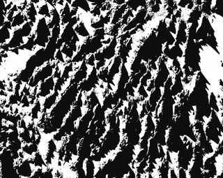
Bishop-Taylor produces his maps using digital elevation data from NASA's Shuttle Radar Topography Mission. He said the data "essentially contains data on the height of every 30x30-meter piece of land across the entire planet."
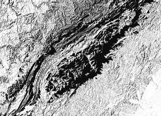
The Southern Appalachian Mountains, shown below in shadows, blanket the western third of North Carolina, part of a chain of ancient peaks and valleys stretching more than 1,500 miles from Canada to central Alabama.
Get the Space.com Newsletter
Breaking space news, the latest updates on rocket launches, skywatching events and more!
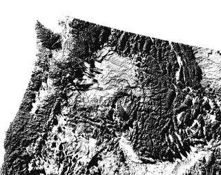
Dark shadows cast by the steep peaks of Cascade Range and the Rocky Mountains are seen in the map, below, of the Pacific Northwest.
Of course, to cast a shadow, elevated features are required. Some areas in the United States have fewer high features to cast shadows, including the Great Plains, below. The Great Plains are the broad expanse of flat land, mostly prairie, steppe and grasslands that stretch west of the Mississippi River and east of the Rocky Mountains. The level landscape yields a shadow map of a decidedly lighter hue.

The Edwards Plateau in west-central Texas, below, also features lighter hues of lower shadows, but this moderately flat land is elevated. Grey shadows reveal the rolling grassland in the region.

Alaska's Brooks Range is depicted by the dark shadows its mountains cast in the map below. The Brooks Range stretches some 700 miles from west to east across northern Alaska into Canada's Yukon Territory.

Bishop-Taylor sells ultra-high resolution versions of these maps for poster and canvas printing on Etsy. He said the sales are helping him fund his effort to earn his Ph.D.
Originally published on Seeker.
Join our Space Forums to keep talking space on the latest missions, night sky and more! And if you have a news tip, correction or comment, let us know at: community@space.com.
