Earth from Space: The Amazing Photos by the GOES-16 Satellite
This Island Earth
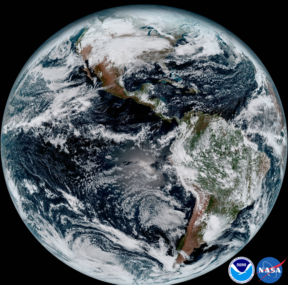
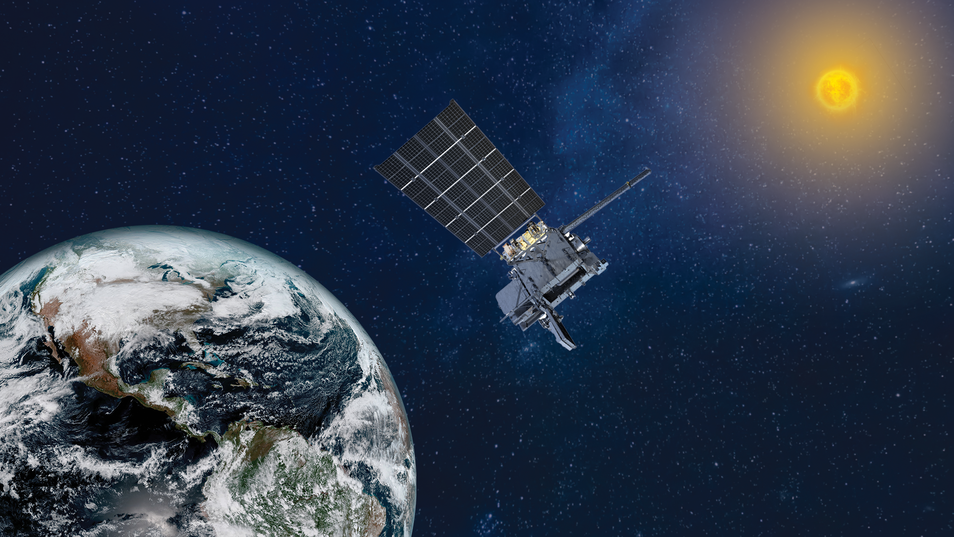
The first photos of Earth from space by the NOAA/NASA GOES-16 satellite are simply spectacular. Take a look at the images in our full gallery here.
In this image, the entire Earth is visible in a composite color visible image is from 1:07 p.m. EDT on Jan. 15, 2017 and was created using several of the 16 spectral channels available on the GOES-16 Advanced Baseline Imager (ABI) instrument. The image shows North and South America and the surrounding oceans. GOES-16 observes Earth from an equatorial view approximately 22,300 miles high, creating full disk images like these, extending from the coast of West Africa, to Guam, and everything in between. Read the full story here.
GOES-16 Nor'easter March 7, 2018
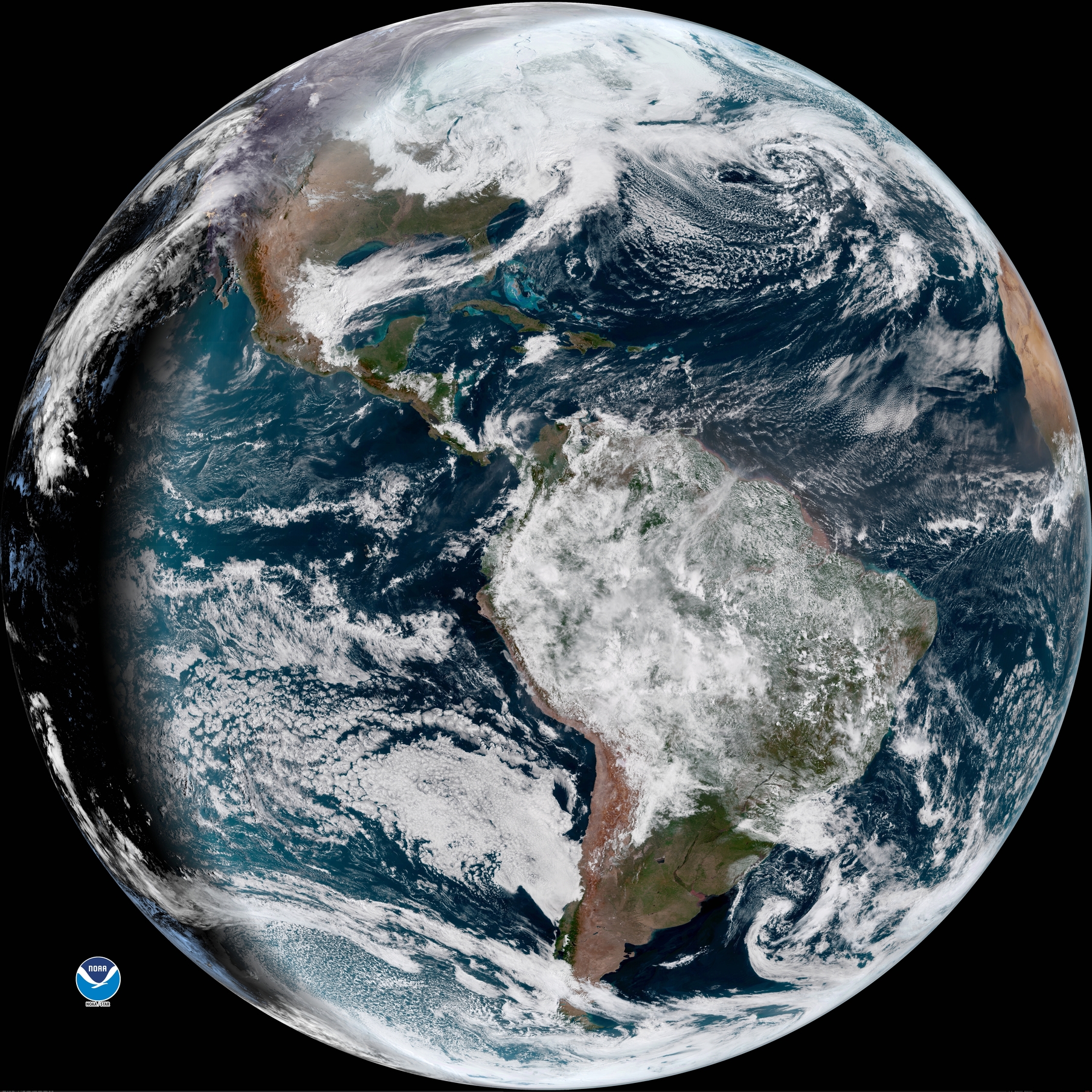
A full-disk view of the Earth on March 7, 2018 as seen by the GOES-16 weather satellite at 10:26 a.m. EST (1526 GMT).
GOES-16 Snowstorm Convective Clouds
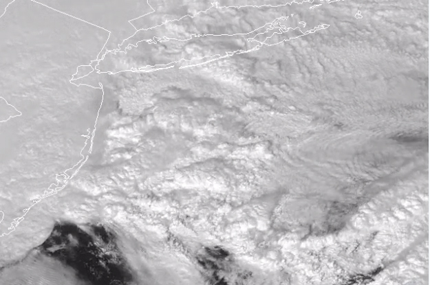
Convective clouds add a touch of fluffy beauty to the powerful snowstorm over the northeastern United States on March 7, 2018 in this view from the GOES-16/GOES-East weather satellite.
GOES-16 Close View of March 7 Storm
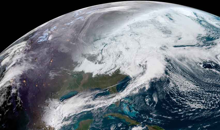
This close-up view from a full Earth image by GOES-16 weather satellite shows the powerful nor'easter bringing snow to the northeastern U.S. on March 7, 2018 at 10:26 a.m. EST (1526 GMT).
Bomb Cyclone Storm Size
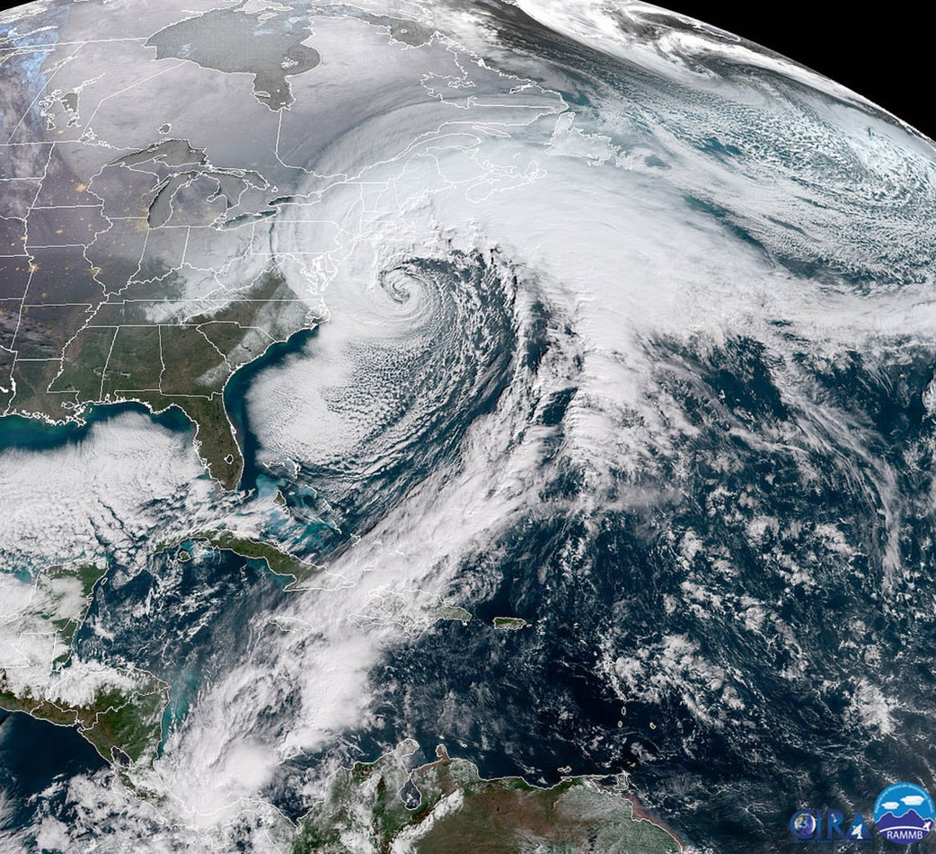
The massive size of a powerful nor'easter, called a bomb cyclone, on the U.S. East Coast is seen in this image by the GOES-East weather satellite taken on Jan. 4, 2018.
A Lunar Photobomb
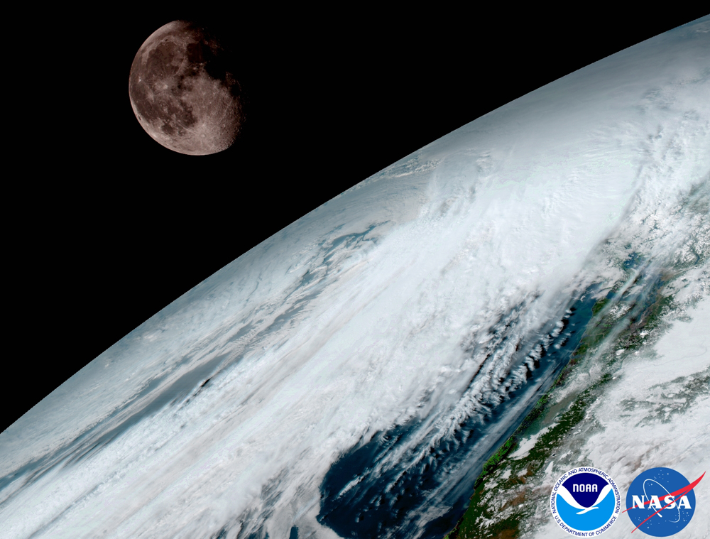
The moon photobombed this view of the Earth as GOES-16 looked across the surface of the Earth on January 15. GOES-16 will use the moon for calibration, a method also used by its predecessors.
Get the Space.com Newsletter
Breaking space news, the latest updates on rocket launches, skywatching events and more!
GOES 16 in Space
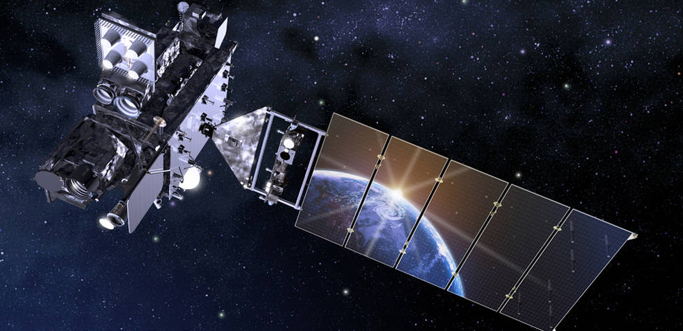
GOES-16 launched into space on Nov. 19, 2016 and was formerly known as GOES-R. Eventually, it will be known as either GOES-East or GOES-West.
North America from Space
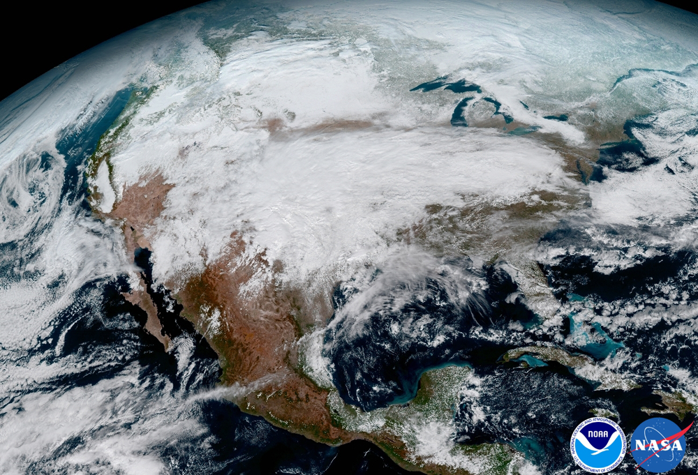
This GOES-16 view clearly shows the significant storm system that crossed North America. It was taken on Jan. 15, 2017 during a weather event that caused freezing and ice in dangerous conditions across the United States that resulted in loss of life.
Advanced Baseline Imager
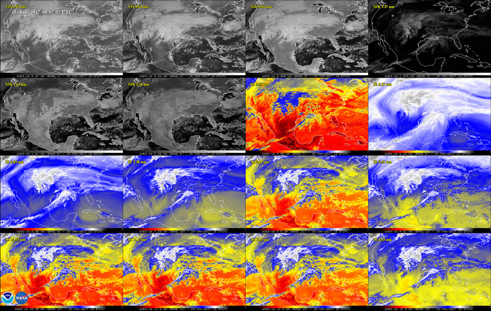
This 16-panel image from GOES-16 shows the continental United States in the two visible, four near-infrared and 10 infrared channels on ABI. According to NOAA, these channels help forecasters distinguish between differences in the atmosphere like clouds, water vapor, smoke, ice and volcanic ash. GOES-16 has three-times more spectral channels than earlier generations of GOES satellites.
Dust Off of Africa
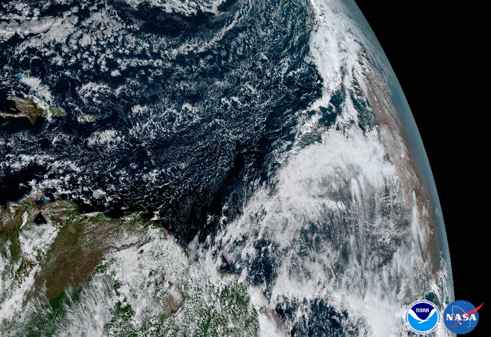
Here, the Saharan Dust Layer can be discerned in the far right edge of this image of Earth. According to a NOAA description, this dry air from the coast of Africa can have impacts on tropical cyclone intensity and formation. GOES-16 can observe this phenomenon with 16 spectral channels to allow forecasters to study related hurricane intensification as storms approach North America.
The Caribbean
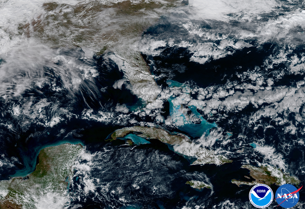
The GOES-16 satellite captured this image of the Caribbean and Florida as they appear from orbit. The satellite captures the shallows waters of the Caribbean, which appears as a lighter blue.
Join our Space Forums to keep talking space on the latest missions, night sky and more! And if you have a news tip, correction or comment, let us know at: community@space.com.

Space.com is the premier source of space exploration, innovation and astronomy news, chronicling (and celebrating) humanity's ongoing expansion across the final frontier. Originally founded in 1999, Space.com is, and always has been, the passion of writers and editors who are space fans and also trained journalists. Our current news team consists of Editor-in-Chief Tariq Malik; Editor Hanneke Weitering, Senior Space Writer Mike Wall; Senior Writer Meghan Bartels; Senior Writer Chelsea Gohd, Senior Writer Tereza Pultarova and Staff Writer Alexander Cox, focusing on e-commerce. Senior Producer Steve Spaleta oversees our space videos, with Diana Whitcroft as our Social Media Editor.
