Hurricane Harvey: Photos of the Massive Storm from Space
Hurricane Harvey from ISS Cupola
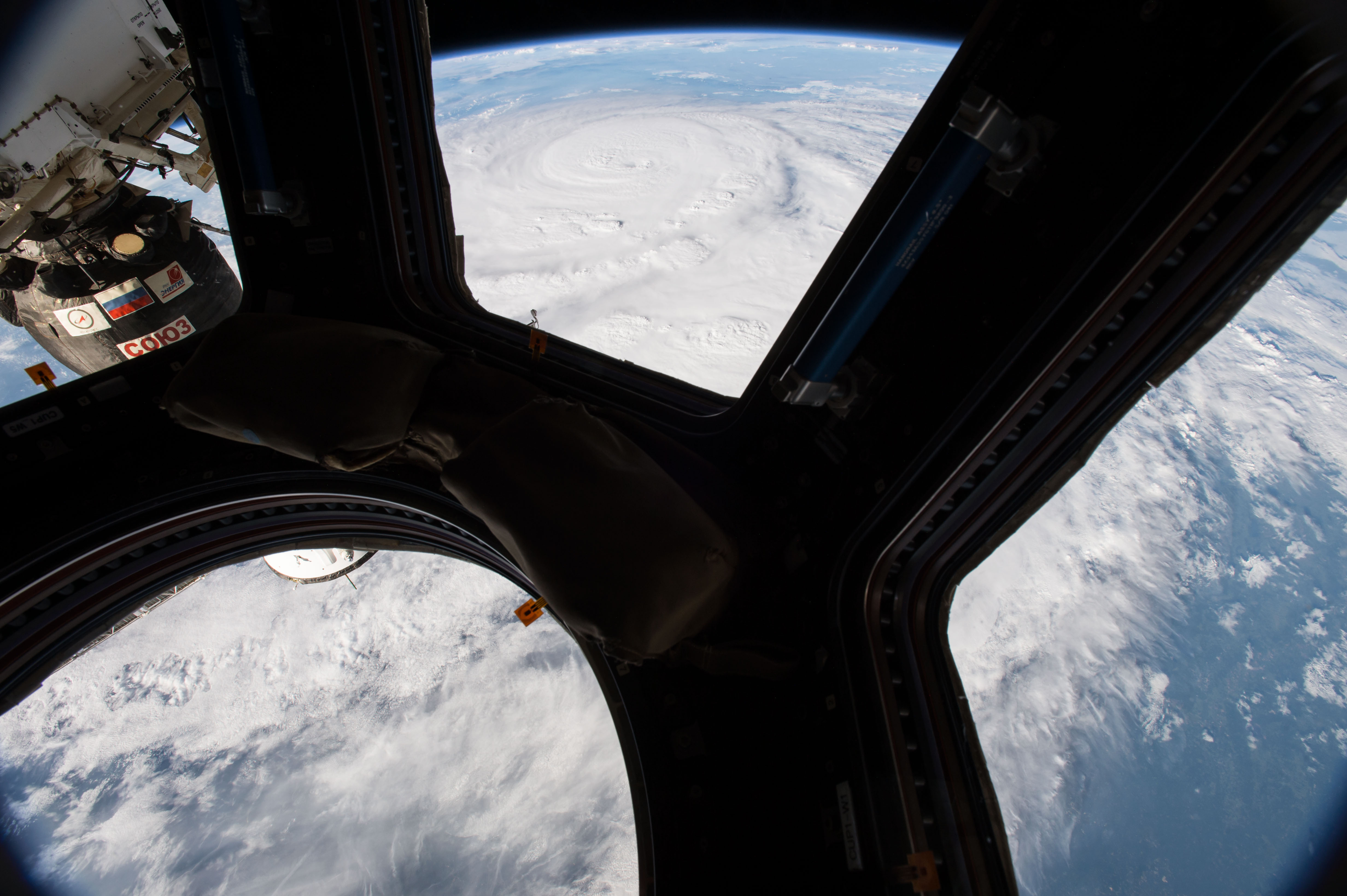
On Aug. 25, 2017, NASA astronaut Jack Fischer photographed Hurricane Harvey from the cupola module aboard the International Space Station as it intensified on its way toward the Texas coast.
Hurricane Harvey from Space
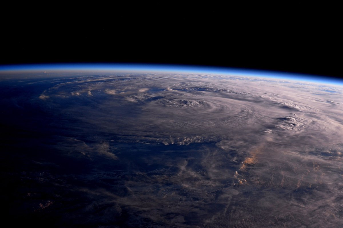
A snapshot of Hurricane Harvey captured by astronaut Jack Fischer and posted on Aug. 26.
Tropical Storm Harvey in the Gulf of Mexico
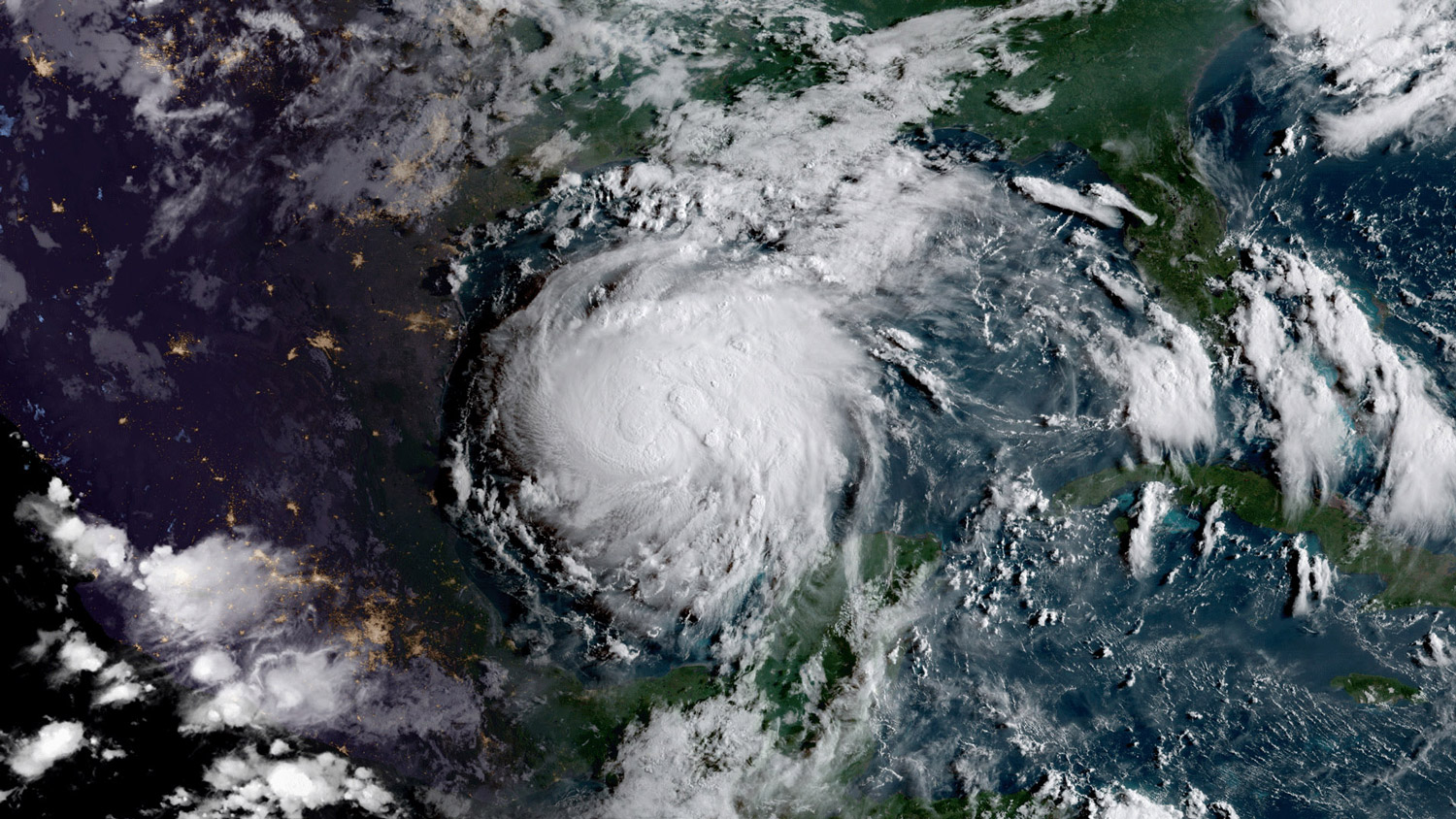
The GOES-16 satellite captured this geocolor image of Tropical Storm Harvey in the Gulf of Mexico on Aug. 24, 2017. Geocolor imagery enhancement shown here displays geostationary satellite data in different ways depending on whether it is day or night. This image, captured as daylight moves into the area, offers a blend of both, with nighttime features on the left side of the image and daytime on the right.
Hurricane Harvey Temperature Map
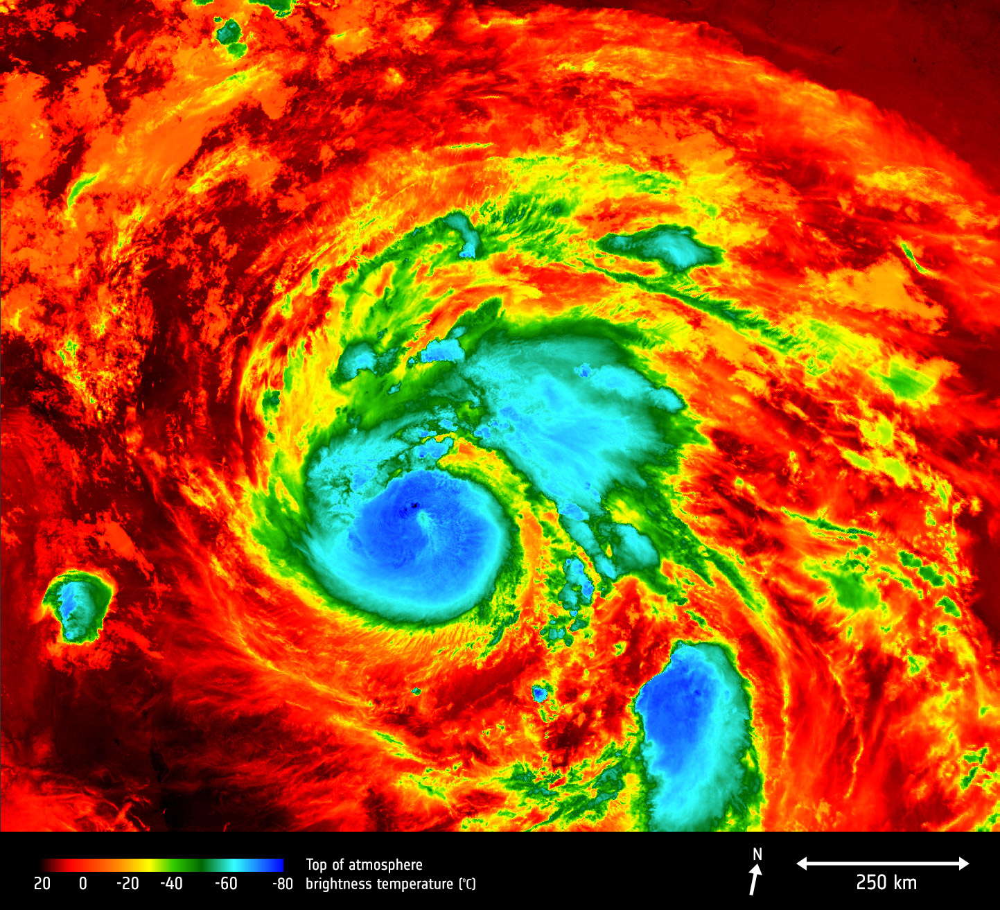
Europe’s Copernicus Sentinel-3A satellite saw the temperature at the top of Hurricane Harvey drop just after midnight EDT on Aug. 25 (0400 GMT) as the storm approached Texas.
GOES East View of Hurricane Harvey
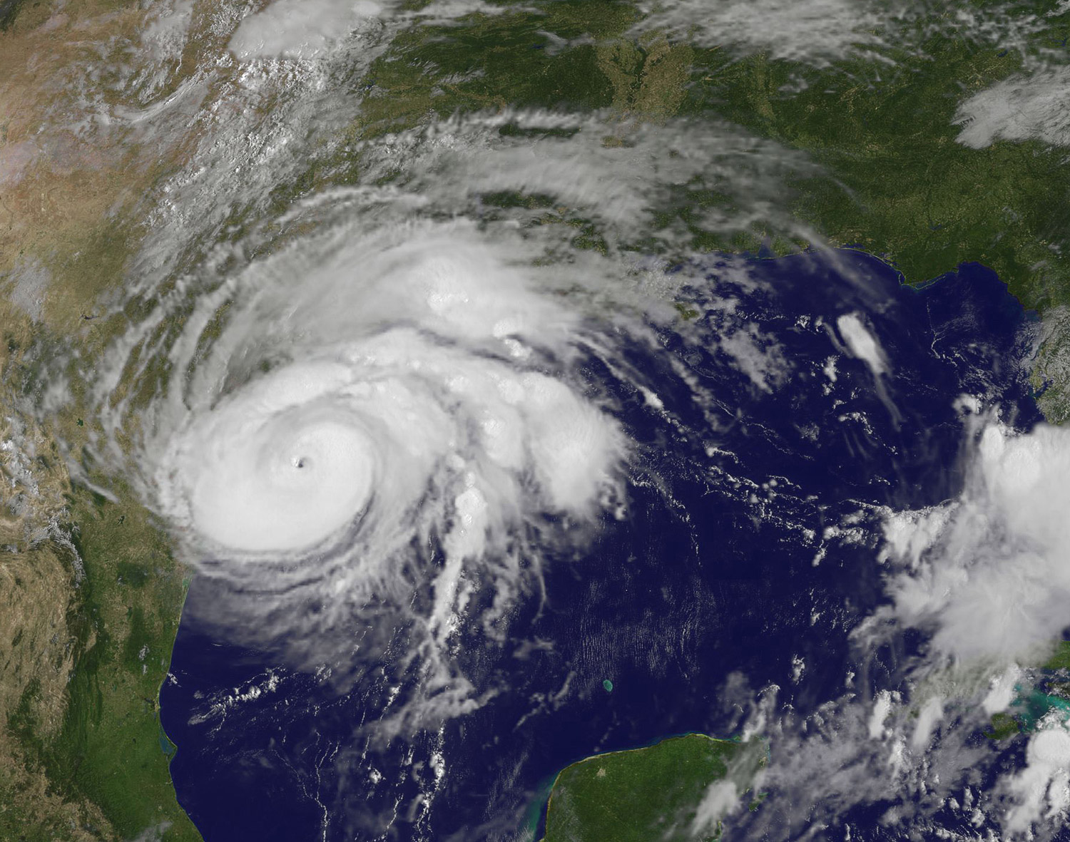
This visible-light image of Hurricane Harvey taken from NOAA’s GOES East satellite on Aug. 25 at 10:07 a.m. EDT (1407 GMT) clearly shows the storm’s eye as the storm nears landfall on Texas’ southeast coast.
Tropical Storm Harvey Aug 27
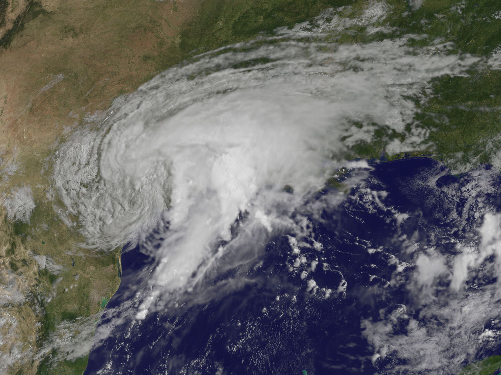
NOAA's GOES-East satellite captured this visible image of Tropical Storm Harvey over Texas on Aug. 27 at 10:30 a.m. EDT (1430 UTC).
Tropical Storm Harvey - Aug. 28, 2017
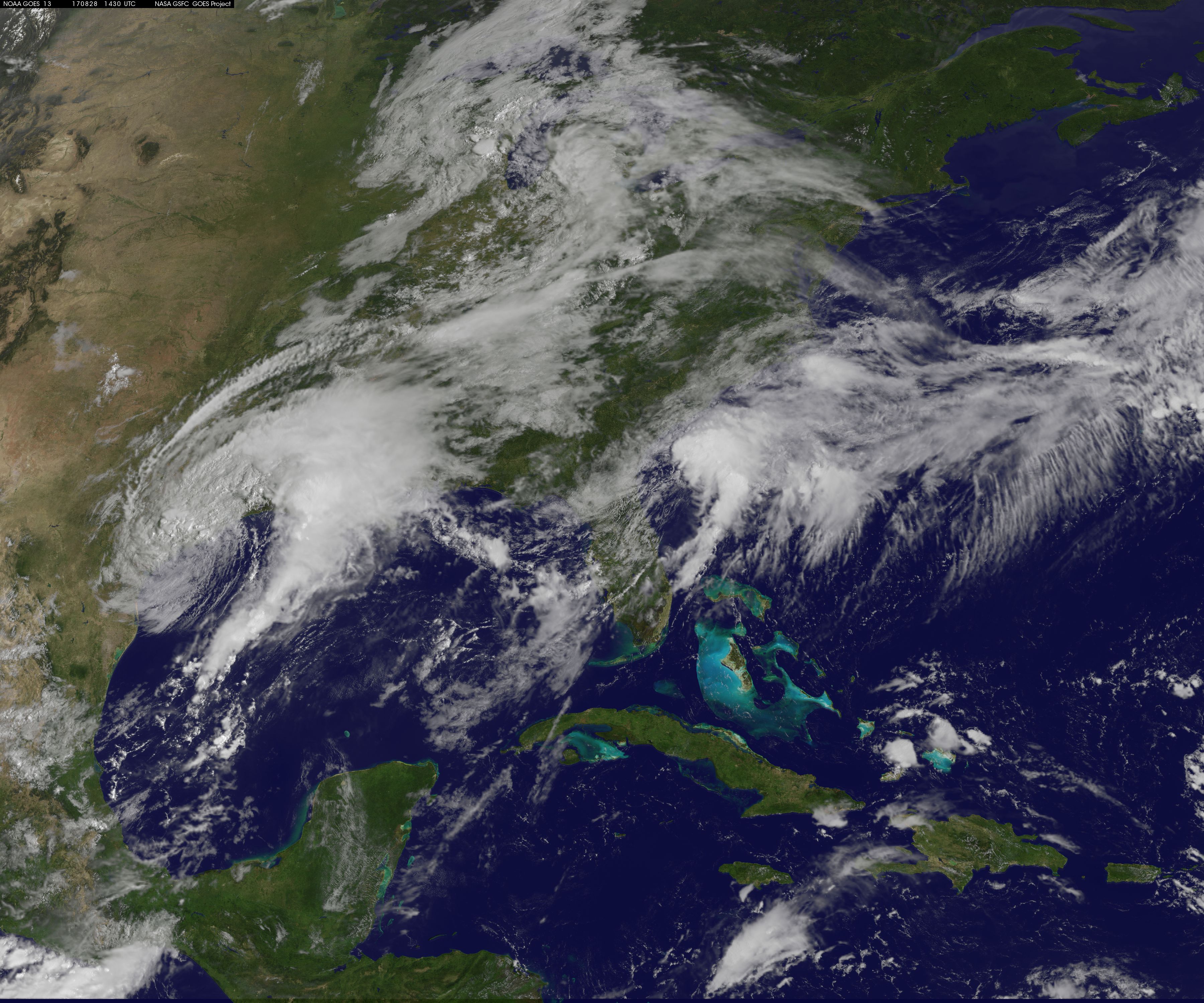
Tropical Storm Harvey is seen early Aug. 28, 2017 as it moves back toward the Gulf of Mexico in this NASA image from the GOES Earth-observation satellites.
Get the Space.com Newsletter
Breaking space news, the latest updates on rocket launches, skywatching events and more!
Analyzing Harvey’s Rainfall
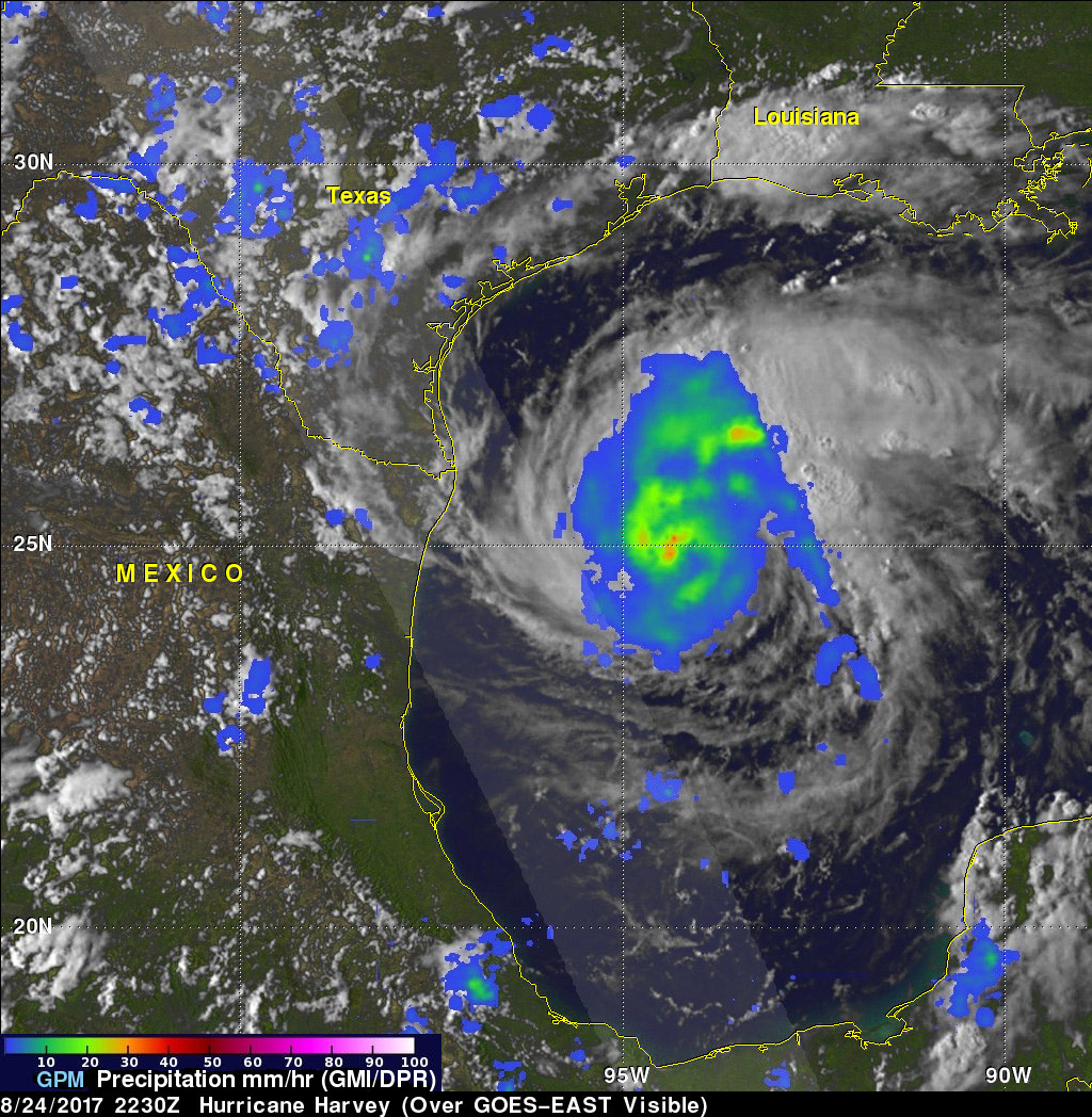
The Global Precipitation Mission (GPM) core observatory satellite flew almost directly above intensifying Hurricane Harvey on Aug. 24, 2017 at 6:30 p.m. EDT (2230 GMT) and indicated that powerful storms in the hurricane were dropping rain at a rate of over 2.1 inches (5.4 centimeters) per hour.
Infrared View of Tropical Storm Harvey
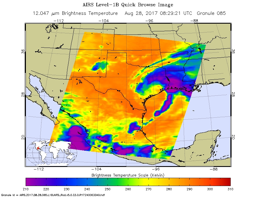
This infrared view of Tropical Storm Harvey was captured Aug. 28, 2017 by NASA's Aqua satellite. The strongest storms appear in purple and stretch from southeastern Texas to Louisiana, and into the Gulf of Mexico.
Tropical Storm Harvey Aug 27 am
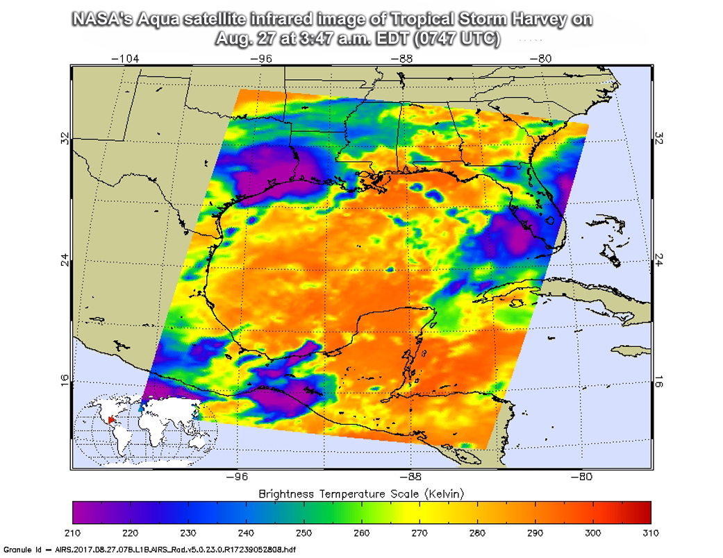
NASA's Aqua satellite passed over Tropical Storm Harvey on Aug. 27 at 3:47 a.m. EDT (0747 UTC) gathering temperature data in infrared light (purple).
Join our Space Forums to keep talking space on the latest missions, night sky and more! And if you have a news tip, correction or comment, let us know at: community@space.com.

Space.com is the premier source of space exploration, innovation and astronomy news, chronicling (and celebrating) humanity's ongoing expansion across the final frontier. Originally founded in 1999, Space.com is, and always has been, the passion of writers and editors who are space fans and also trained journalists. Our current news team consists of Editor-in-Chief Tariq Malik; Editor Hanneke Weitering, Senior Space Writer Mike Wall; Senior Writer Meghan Bartels; Senior Writer Chelsea Gohd, Senior Writer Tereza Pultarova and Staff Writer Alexander Cox, focusing on e-commerce. Senior Producer Steve Spaleta oversees our space videos, with Diana Whitcroft as our Social Media Editor.


