Hurricane Irma in Photos: Space Views of a Monster Storm
Hurricane Irma
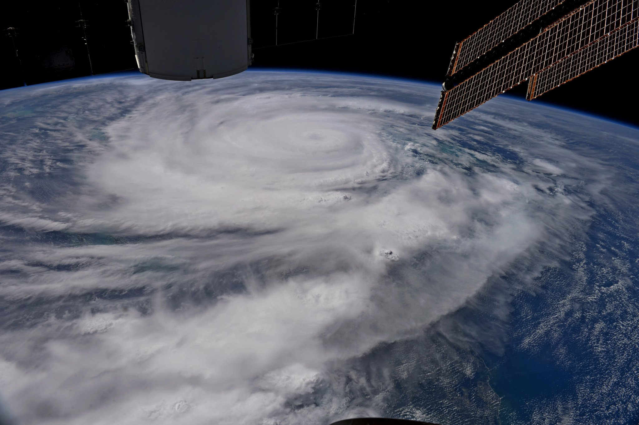
See photos of Hurricane Irma, a monster Category 5 storm, as it makes its way across the Atlantic Ocean in to the Caribbean toward the U.S. mainland in September 2017.
Shown here: Hurricane Irma approaches Florida on Sept. 9, 2017 in this view from the International Space Station by NASA astronaut Randy Bresnik.
Irma Passes by Cuba
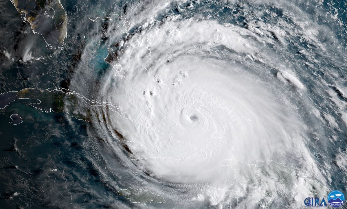
The NOAA's Goes-16 weather satellite captured this geocolor image of Hurricane Irma passing by the east coast of Cuba early Friday morning (Sept. 8).
Hurricane Irma GOES East Sept. 9
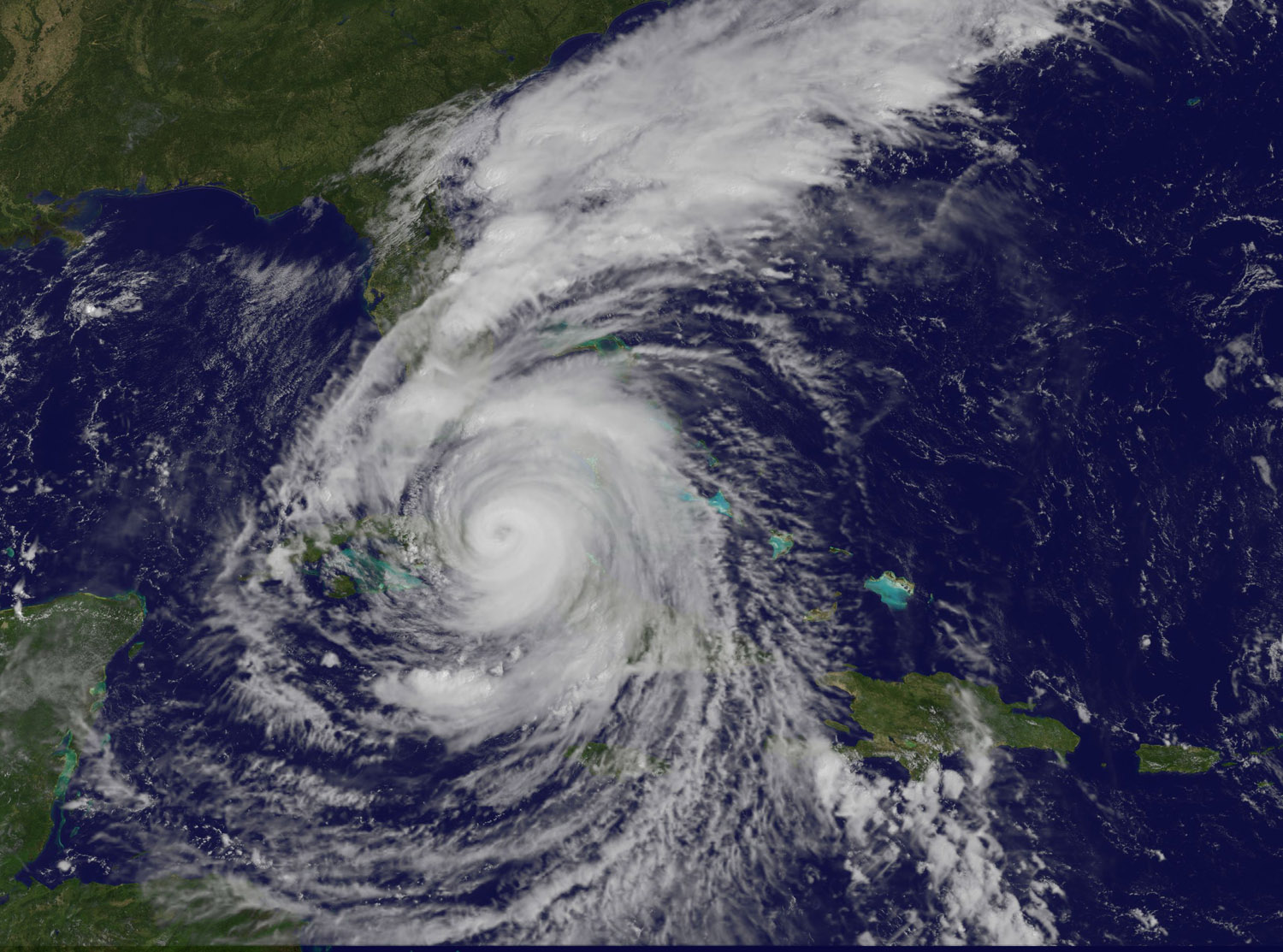
The National Oceanic and Atmospheric Administration's GOES East satellite captured this visible image of Category 4 Hurricane Irma on Saturday (Sept. 9) at 10:37 a.m. EDT (1437 GMT).
Hurricane Irma Over Florida
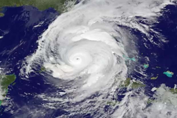
NOAA's GOES-13 satellite captured this view of Hurricane Irma as a Category 4 storm on Saturday, Sept. 9, 2017.
Hurricane Irma - Aqua Satellite - Sept. 9
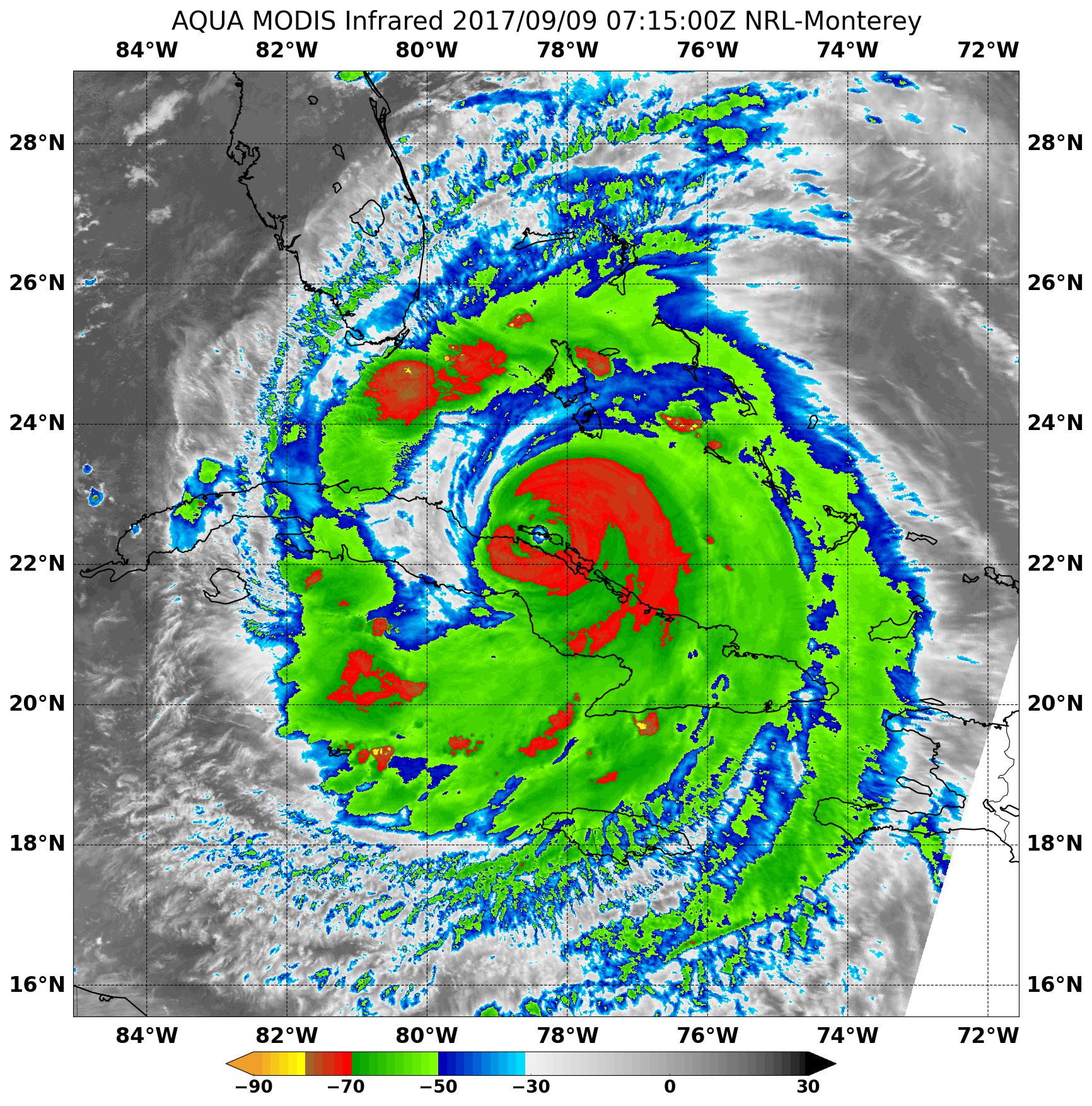
This infrared image from the MODIS instrument aboard NASA's Aqua satellite shows extremely cold temperatures (red) in thunderstorms surrounding the eye of Hurricane Irma as it traveled along Cuba's northern coast on Sept. 9 at 3:15 a.m. EDT (0715) GMT).
Hurricane Irma's Lightning Storms
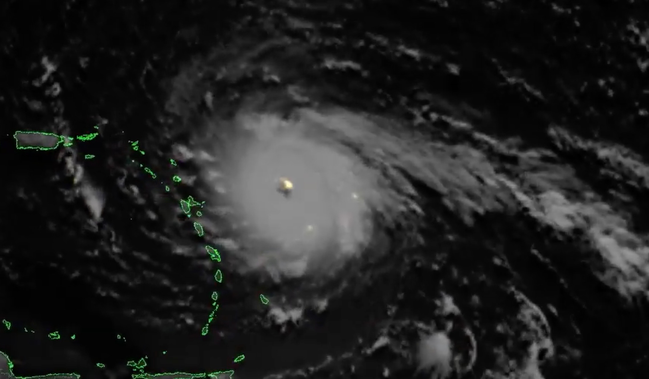
Lightning storms within Hurricane Irma, as seen by the NOAA/NASA GOES-16 satellite from Sept. 4 to Sept. 7, 2017.
Get the Space.com Newsletter
Breaking space news, the latest updates on rocket launches, skywatching events and more!
Hurricane Irma GOES-16 GIF
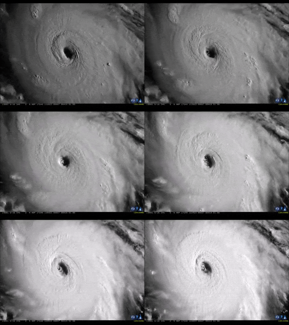
This GOES-16 satellite captured this visible imagery of Hurricane Irma's eye on Sept. 5.
Earth, Irma and Jose
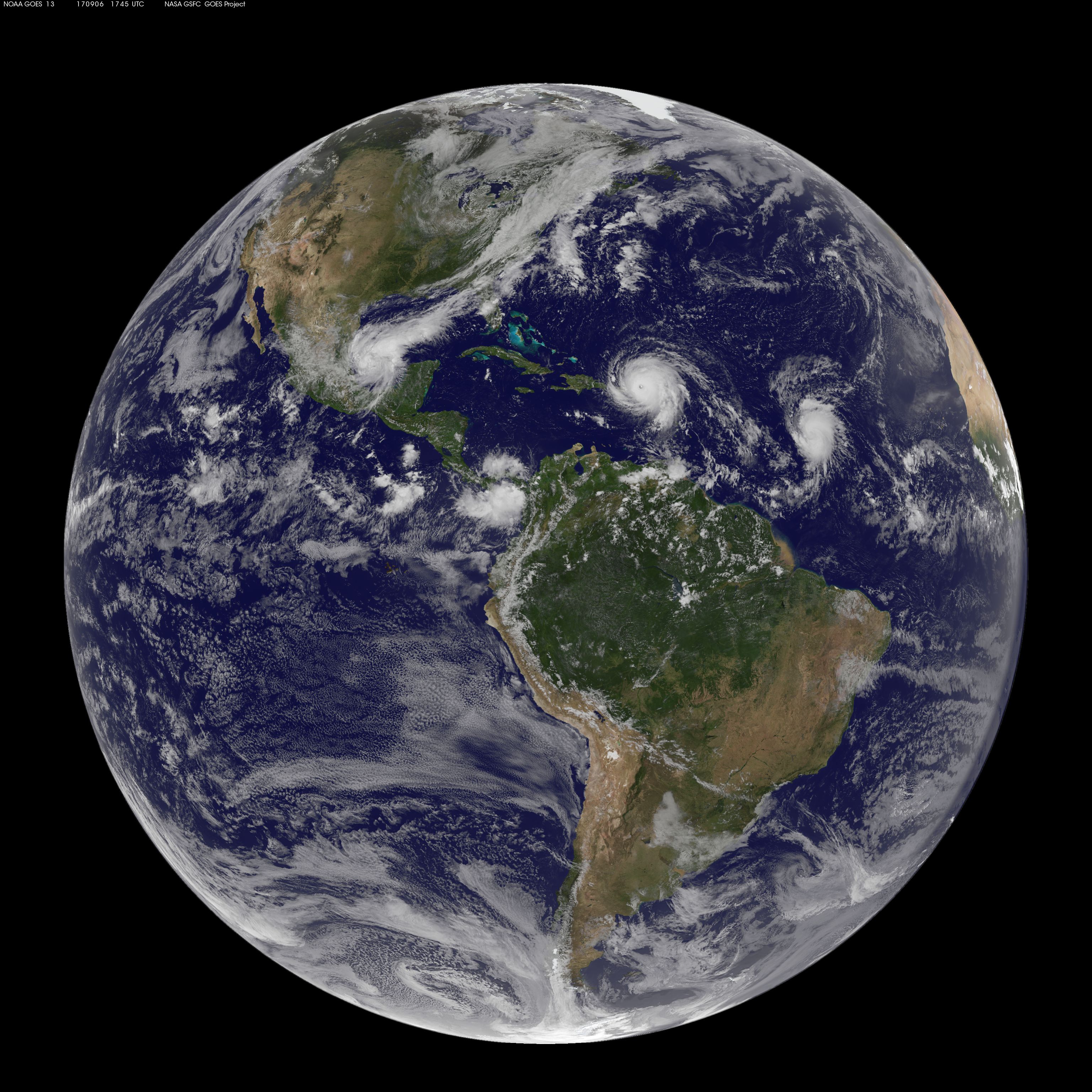
The U.S. weather satellite GOES East captured this full-disk view of the Western Hemisphere at 7:45 a.m. EDT (1145 GMT) on Wednesday (Sept. 6), as Category-5 Hurricane Irma passed over the island of St. Martin and made its way toward the British Virgin Islands. To the east of Hurricane Irma is Tropical Storm Jose, which is strengthening in the Atlantic Ocean and is also heading toward the Caribbean. [Full Story]
Irma and Jose
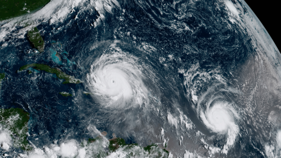
This geocolor image from the GOES-16 weather satellite shows Hurricane Irma (left) and Hurricane Jose (right) whirling over the Atlantic Ocean on Thursday (Sept. 7).
Irma at night
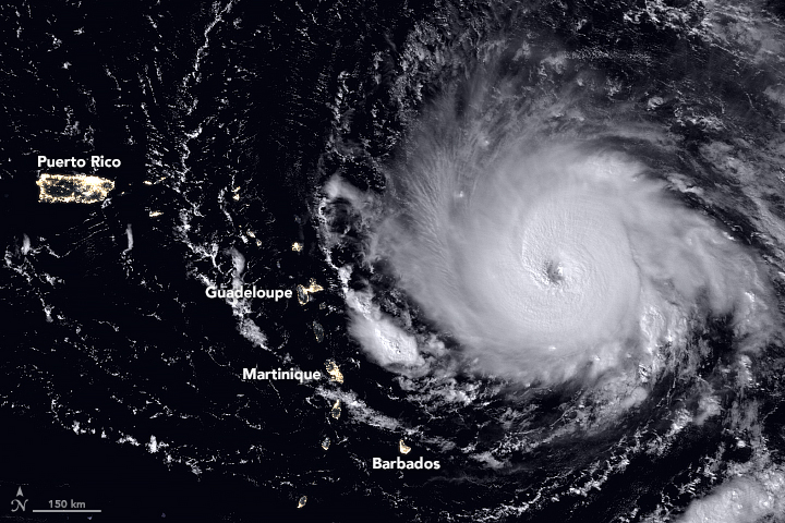
The Suomi NPP satellite captured this nighttime view of Hurricane Irma as the storm approached the northern Leeward Islands on Tuesday (Sept. 5).
Hurricane Irma Suomi NPP Day Night Band Imagery
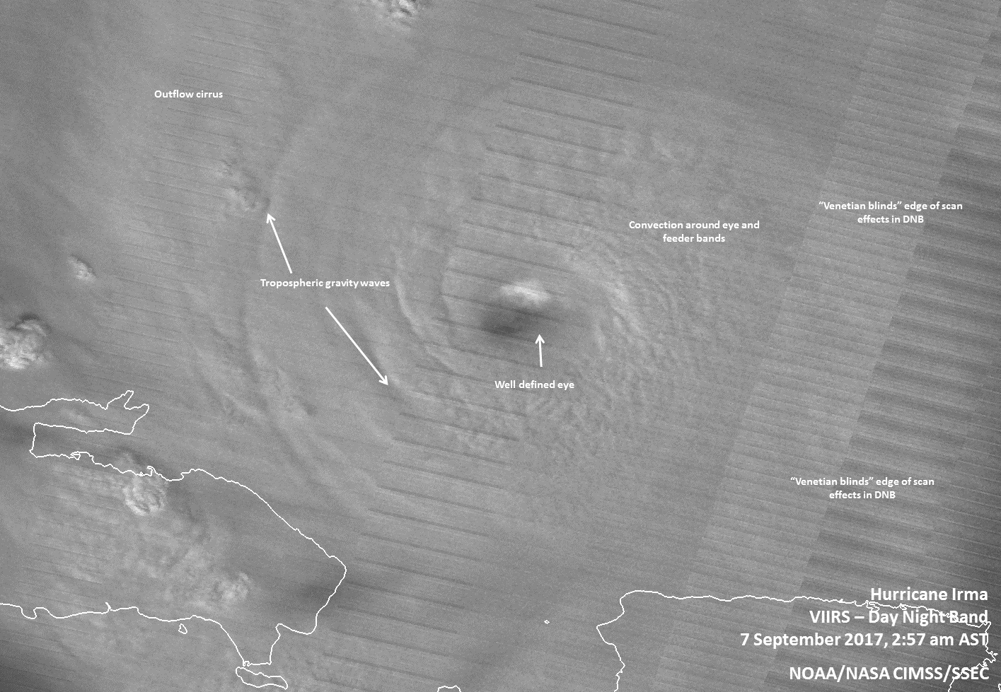
At 2:57 a.m. AST/EDT on Sept. 7, Suomi NPP's Day Night Band imagery and the waning gibbous moon highlighted the convection around Irma's eye, and tropospheric gravity waves were present around the well-defined eye wall.
Join our Space Forums to keep talking space on the latest missions, night sky and more! And if you have a news tip, correction or comment, let us know at: community@space.com.

Christine Lunsford joined the Space.com team in 2010 as a freelance producer and later became a contributing writer, covering astrophotography images, astronomy photos and amazing space galleries and more. During her more than 10 years with Space.com, oversaw the site's monthly skywatching updates and produced overnight features and stories on the latest space discoveries. She enjoys learning about subjects of all kinds.

