Tropical Storm Irma and Hurricane Jose: See the Latest Videos from Space
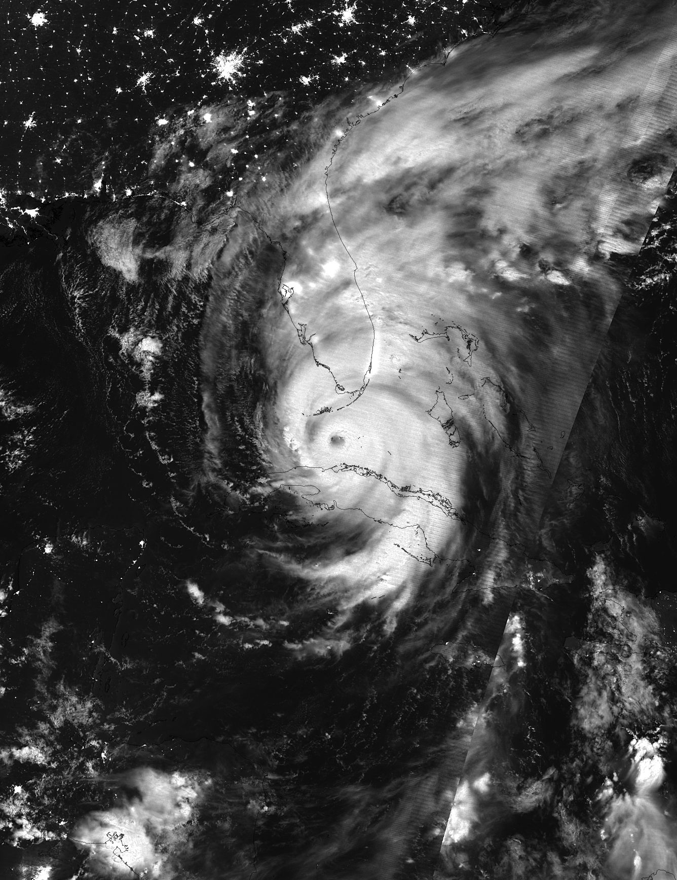
Update Sept. 11: Irma was downgraded to a tropical storm as it moves northward after battering the Florida peninsula. National Oceanic and Atmospheric Administration (NOAA) satellites have been capturing imagery of Irma, Jose and Katia since they first began to form in the Atlantic Ocean and Gulf of Mexico. Cameras on the International Space Station have also shown Hurricane Irma through the eyes of astronauts. Scroll down to seee the latest videos of Hurricane Irma, as well as Jose and Katia. See complete Hurricane Irma coverage from our sister site Live Science.
Sept 11: Tropical Storm Irma and Hurricane Jose
NOAA GOES-13 views of Irma and Jose from Sept. 10-11, 2017.
Sept 10: Hurricane Irma moving north over Florida
NOAA GOES-13 satellite's view of hurricanes Irma and Jose from 6am EDT to 8:15pm EDT on Sept. 10.
Sept. 10: Hurricane Irma covers Florida, Hurricane Jose moves away from Caribbean
NOAA GOES-13 satellite's view of hurricanes Irma and Jose from 8:15pm EDT on Sept. 9 to 6:45am EDT on Sept. 10.
Get the Space.com Newsletter
Breaking space news, the latest updates on rocket launches, skywatching events and more!
Late Sept. 9: Hurricane Irma over Florida
NOAA GOES-13 satellite's view of hurricanes Irma and Jose from 8:45pm EDT on Sept. 8 to 8:45pm EDT on Sept. 9.
Sept. 9: Hurricanes Irma, Jose and Katia
NOAA GOES-13 view of the storms from Sept. 7-9, 2017. Irma hit Cuba as a Category 5 hurricane, but has since weakened to a still powerful and dangerous Category 4 storm. It is expected to strengthen again as it approaches the U.S. mainland in Florida. Hurricane Jose is a Category 4 hurricane and Katia was downgraded to a tropical storm.
Sept. 8: Hurricanes Jose and Irma from the International Space Station:
The Space Station's external cameras captured imagery of the two storms.
Sept. 4-8: Unusual Lightning Around Hurricane Irma's Eye
NOAA's GOES-16 satellite's Geostationary Lightning Mapper (GLM) has captured imagery of lightning flashes in the churning clouds of Hurricane Irma over the course of 80 hours (Sept 4-8, 2017). "Hurricanes don't often exhibit a great deal of lightning, because their winds are mostly horizontal, not vertical," according to NOAA.
Sept. 7-8: NOAA GOES-13 satellite
As of Sept. 8, Irma is category 4 hurricane, Jose is category 3 hurricane, and Katia is a category 1 hurricane.
Sept. 7: Hurricane Irma from the International Space Station
Irma was a category 5 hurricane when this video was shot.
Sept. 4-7: Irma and Jose
Watch as Jose develops into a hurricane behind Irma.
Sept. 5-6: Hurricane Irma Envelops Caribbean Islands
Antigua and Barbuda, St. Kitts and Nevis, the British Virgin Islands, the US Virgin Islands and more Caribbean nations come under Hurricane Irma’s wrath.
Sept. 5: Hurricane Irma from Space Station
Sept. 2-5: Watch Hurricane Irma Turn Into Category 5 Storm
Follow Steve Spaleta @stevespaleta. Follow us @Spacedotcom, Facebook and Google+.
Join our Space Forums to keep talking space on the latest missions, night sky and more! And if you have a news tip, correction or comment, let us know at: community@space.com.

Steve Spaleta is Space.com's Senior Producer. Since 2007, Steve has produced and edited space, science and entertainment-related videos for Space.com. He is also the producer/writer/editor of Space.com's CosMix series on space-enthused artists. He studied psychology at the State University of New York at Stony Brook and is originally from Zadar, Croatia by way of Astoria, NY. To see Steve's latest project, follow him on Twitter and follow Space.com's VideoFromSpace YouTube Channel.
