Satellites Tracking Powerful Hurricane Maria From Space
A number of satellites are keeping tabs on Hurricane Maria as the dangerous storm churns its way through the Caribbean.
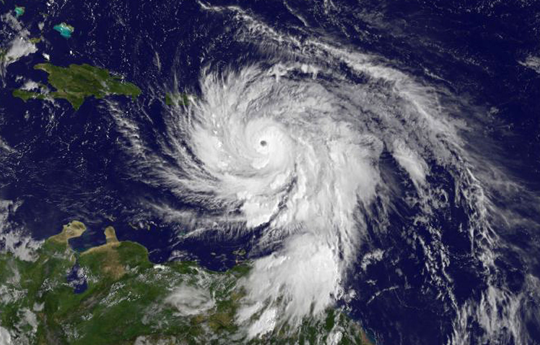
Imagery captured over the past four days by the GOES East satellite, for example, shows Maria strengthening to a Category 5 hurricane — the most powerful type — and slamming into the island of Dominica last night (Sept. 18).
Maria is currently a "potentially catastrophic hurricane" moving west-northwest with maximum sustained wind speeds of 160 mph (260 km/h), according to the latest update from the U.S. National Hurricane Center (NHC). The storm is expected to move near or over the Virgin Islands and Puerto Rico tomorrow (Sept. 20), NHC officials wrote. [See Videos of Hurricane Maria from Space]
The storm's impending arrival has forced the huge Arecibo Observatory, a 1,000-foot-wide (305 meters) radio dish in Puerto Rico, to cease operations through Thursday (Sept. 21).
The Global Precipitation Measurement (GPM) satellite — a joint effort of the Japan Aerospace Exploration Agency and NASA — got a dramatic look at Maria's turbulent interior yesterday. GPM's observations revealed a thunderstorm cell inside Maria that reached up into the stratosphere.
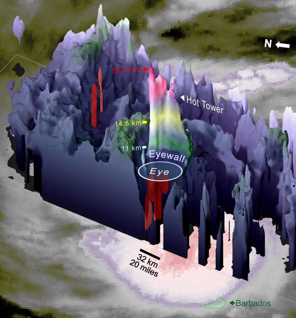
"Enough water vapor was condensing into rain inside of this cell that rapid updrafts developed, rapid enough to lift the precipitation until it froze and then even higher until it penetrated into the lower stratosphere at 16.75 kilometers [10.4 miles] altitude," Owen Kelley, of NASA Goddard's Precipitation Processing System, said in a statement.
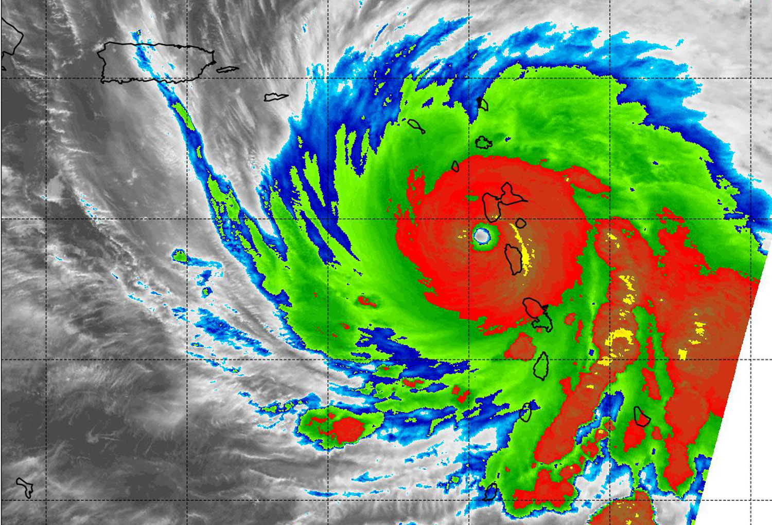
And, early this morning, NASA's Aqua satellite got a look at Maria in infrared light. Measurements by Aqua's Moderate Resolution Imaging Spectroradiometer instrument found cloud-top temperatures of thunderstorms in the hurricane's eyewall to be a maximum of minus 80 degrees Fahrenheit (minus 62 degrees Celsius).
Get the Space.com Newsletter
Breaking space news, the latest updates on rocket launches, skywatching events and more!
"Cloud-top temperatures that cold indicate strong storms that have the capability to create heavy rain," NASA officials wrote in the same statement.
The photos by GOES East — which is operated by the U.S. National Oceanic and Atmospheric Administration and NASA — also show Hurricane Jose moving north, a few hundred miles off the U.S. East Coast. ("GOES" is short for "Geostationary Operational Environmental Satellite.")
Jose is a Category 1 hurricane, with maximum sustained winds near 75 mph (120 km/h), according to NHC officials. Forecasts predict that Jose will remain offshore of the American mainland, but the storm has brought high swells and increased rainfall to much of the Eastern Seaboard.
Follow Mike Wall on Twitter @michaeldwall and Google+. Follow us @Spacedotcom, Facebook or Google+. Originally published on Space.com.
Join our Space Forums to keep talking space on the latest missions, night sky and more! And if you have a news tip, correction or comment, let us know at: community@space.com.

Michael Wall is a Senior Space Writer with Space.com and joined the team in 2010. He primarily covers exoplanets, spaceflight and military space, but has been known to dabble in the space art beat. His book about the search for alien life, "Out There," was published on Nov. 13, 2018. Before becoming a science writer, Michael worked as a herpetologist and wildlife biologist. He has a Ph.D. in evolutionary biology from the University of Sydney, Australia, a bachelor's degree from the University of Arizona, and a graduate certificate in science writing from the University of California, Santa Cruz. To find out what his latest project is, you can follow Michael on Twitter.
