In Photos: Hurricane Maria Seen from Space
Hurricane Maria Nears the Bahamas
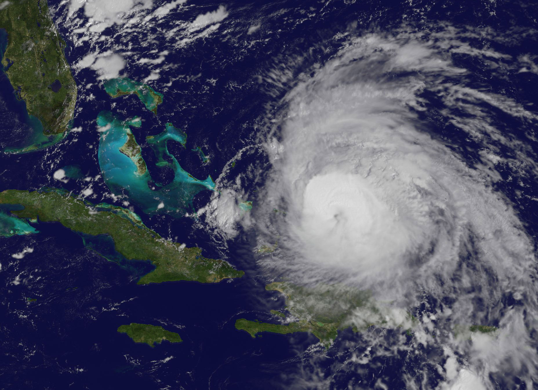
This visible image of Hurricane Maria was taken from NOAA's GOES East satellite on Friday (Sept. 22) at 10 a.m. EDT (1400 GMT) as it was nearing the Bahamas.
Thermal Image of Maria Nearing the Bahamas
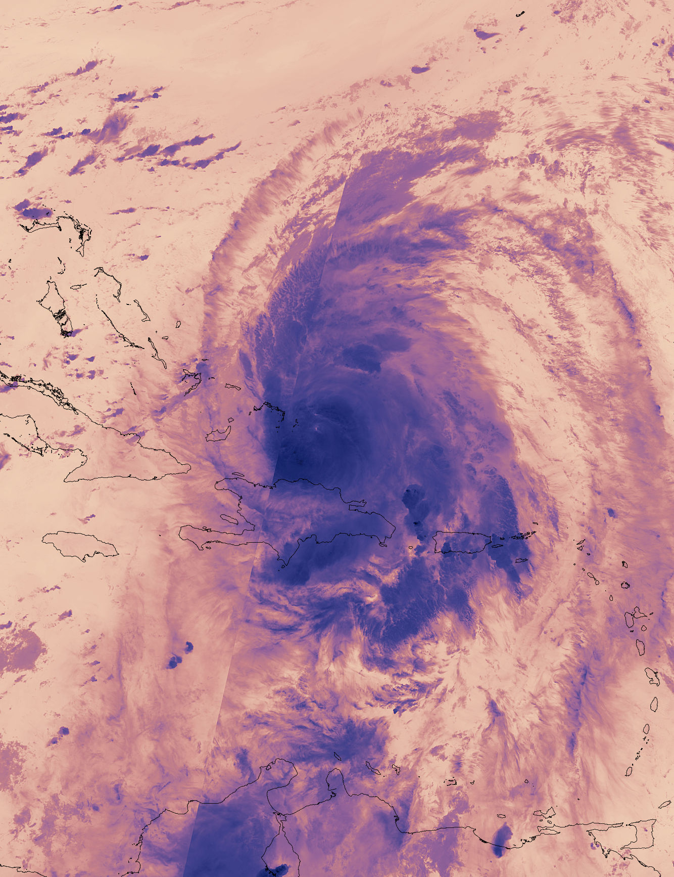
On Friday (Sept. 22) at 3:18 a.m. EDT (0718 GMT) the Visible Infrared Imaging Radiometer Suite (VIIRS) instrument aboard the NASA/NOAA Suomi NPP satellite provided this thermal image of Hurricane Maria north of Hispaniola and nearing the Bahamas.
Hurricane Maria from NOAA GOES-13
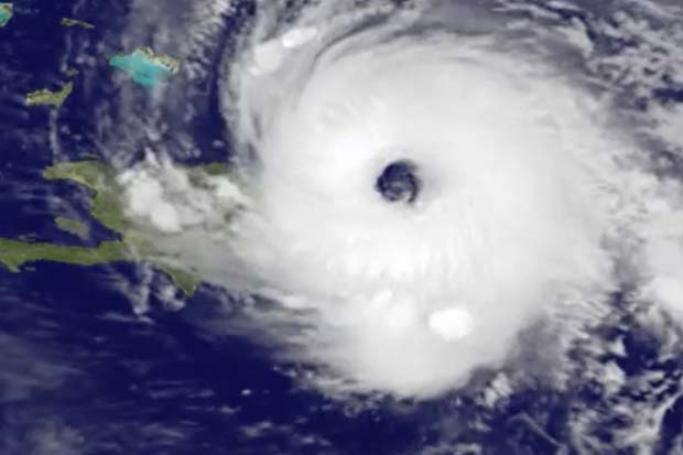
NOAA GOES-13 satellite imagery of Hurricane Maria on Sept. 21.
Hurricane Maria's Raging Intensity
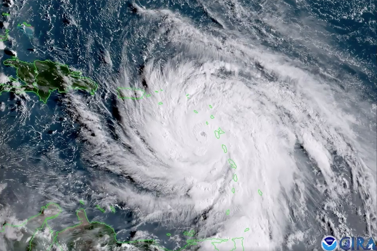
Hurricane Maria developed into a Category 5 storm for a second time on Sept. 19, the morning after it made landfall over the Caribbean island of Dominica. The storm weakened to a Category 4 after making landfall but quickly regained strength once it moved back over the warm ocean water. This view of the hurricane was acquired by the GOES-16 satellite, which is operated by NASA and the National Oceanic and Atmospheric Administration (NOAA).
Hitting the Virgin Islands

On Sept. 20, Hurricane Maria traveled east of the American Virgin Islands and partially over Puerto Rico.
A View from the ISS
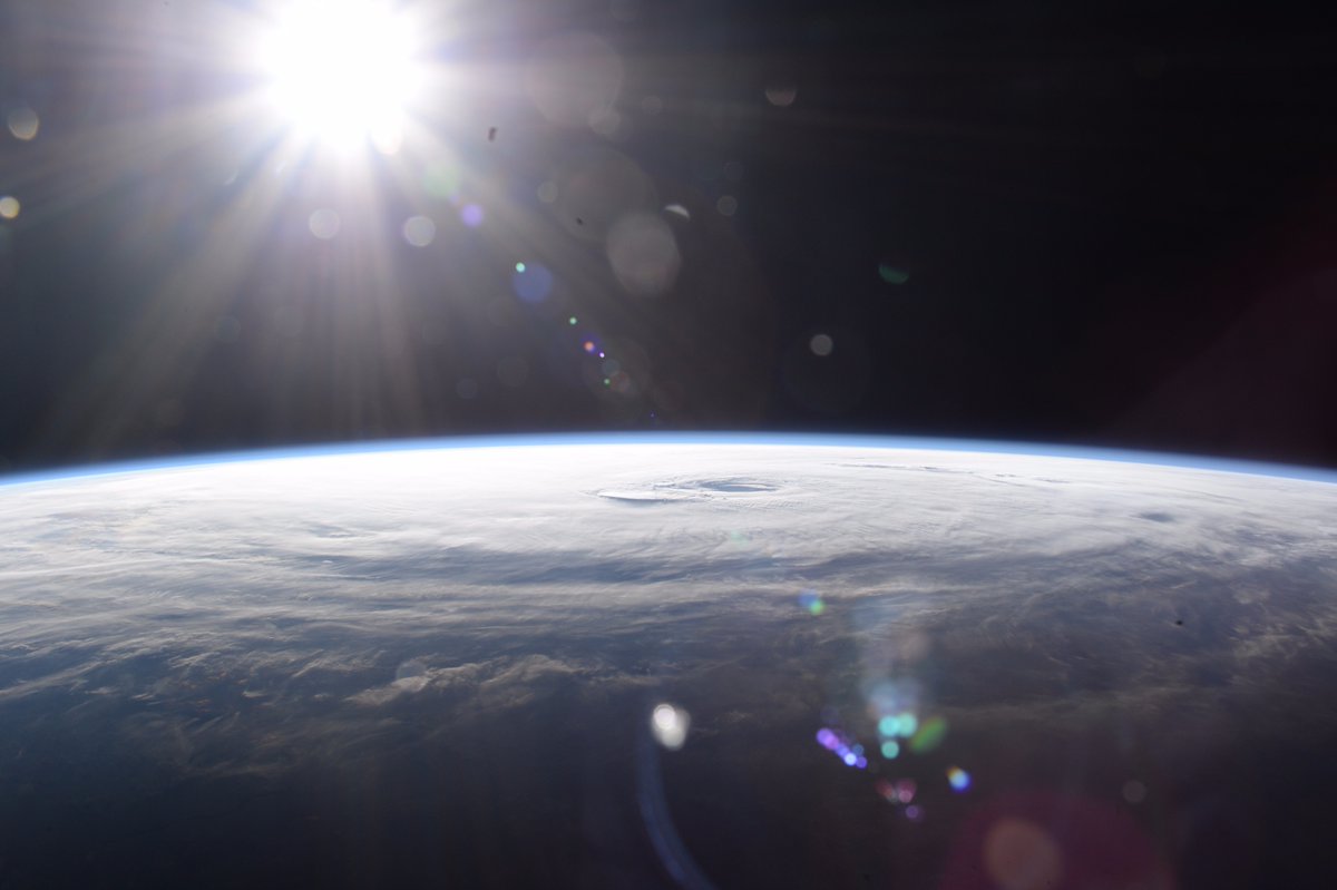
The sun shines down on Hurricane Maria in this photo taken by NASA astronaut Randy Bresnik at the International Space Station.
The Eye of the Storm
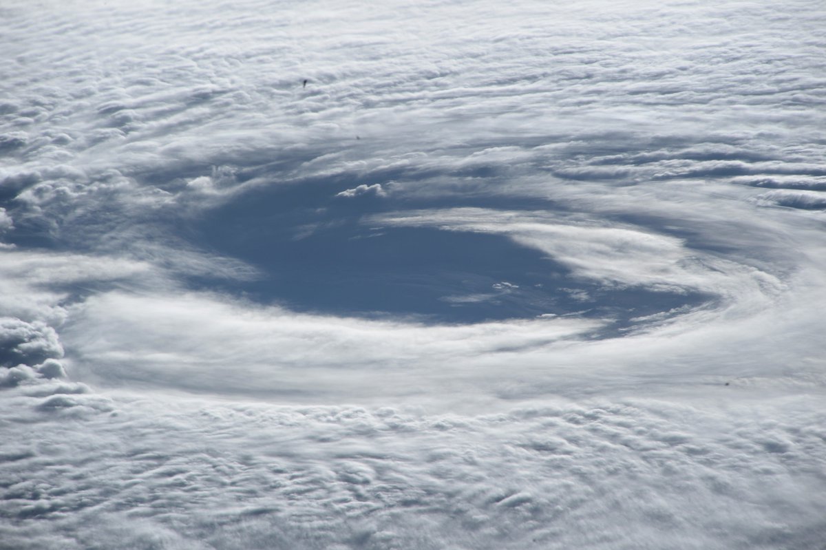
The eye of Hurricane Maria spins beneath the International Space Station in this close-up shot captured by NASA astronaut Randy Bresnik.
Get the Space.com Newsletter
Breaking space news, the latest updates on rocket launches, skywatching events and more!
Maria on the Horizon
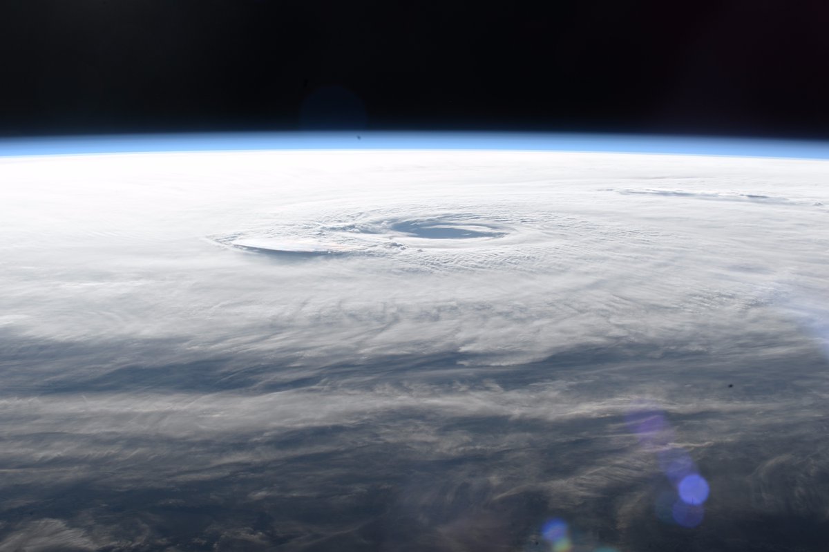
Astronaut Randy Bresnik's photos from the Space Station show the enormous storm stretching across the horizon like a thick blanket of snow.
Space Station Photobomb
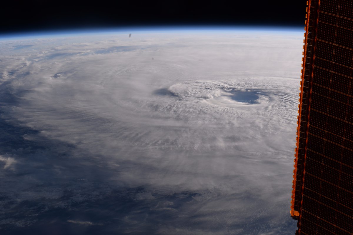
One of the space station's solar panels photobombs a photo of Hurricane Maria.
Hurricane Maria
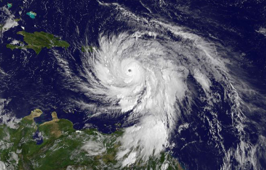
The massive Category 5 storm boiled across the Caribbean Sea on Sept. 19. NOAA's GOES East satellite captured this visible-light image at 11 a.m. EDT (1500 GMT).
Frigid Cloud Tops
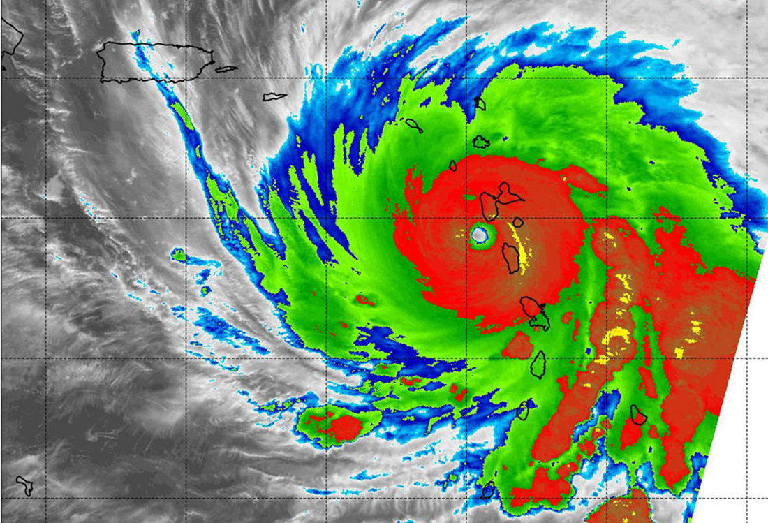
On Sept. 19 at 2:15 a.m. EDT (0615 UTC), the Moderate Resolution Imaging Spectroradiometer (MODIS) instrument aboard NASA's Aqua satellite measured the temperatures of Hurricane Maria's cloud tops. The data showed temperatures consistent with strong thunderstorms in Maria's eyewall at about minus 80 degrees Fahrenheit (minus 62.2 Celsius).
Join our Space Forums to keep talking space on the latest missions, night sky and more! And if you have a news tip, correction or comment, let us know at: community@space.com.

Christine Lunsford joined the Space.com team in 2010 as a freelance producer and later became a contributing writer, covering astrophotography images, astronomy photos and amazing space galleries and more. During her more than 10 years with Space.com, oversaw the site's monthly skywatching updates and produced overnight features and stories on the latest space discoveries. She enjoys learning about subjects of all kinds.
