NASA's Earthquake 'Damage Map' Shows Destruction in Mexico

A new satellite-imagery map could help Mexico respond more effectively to Tuesday's (Sept. 19) powerful Raboso earthquake, which killed hundreds of people and damaged countless buildings.
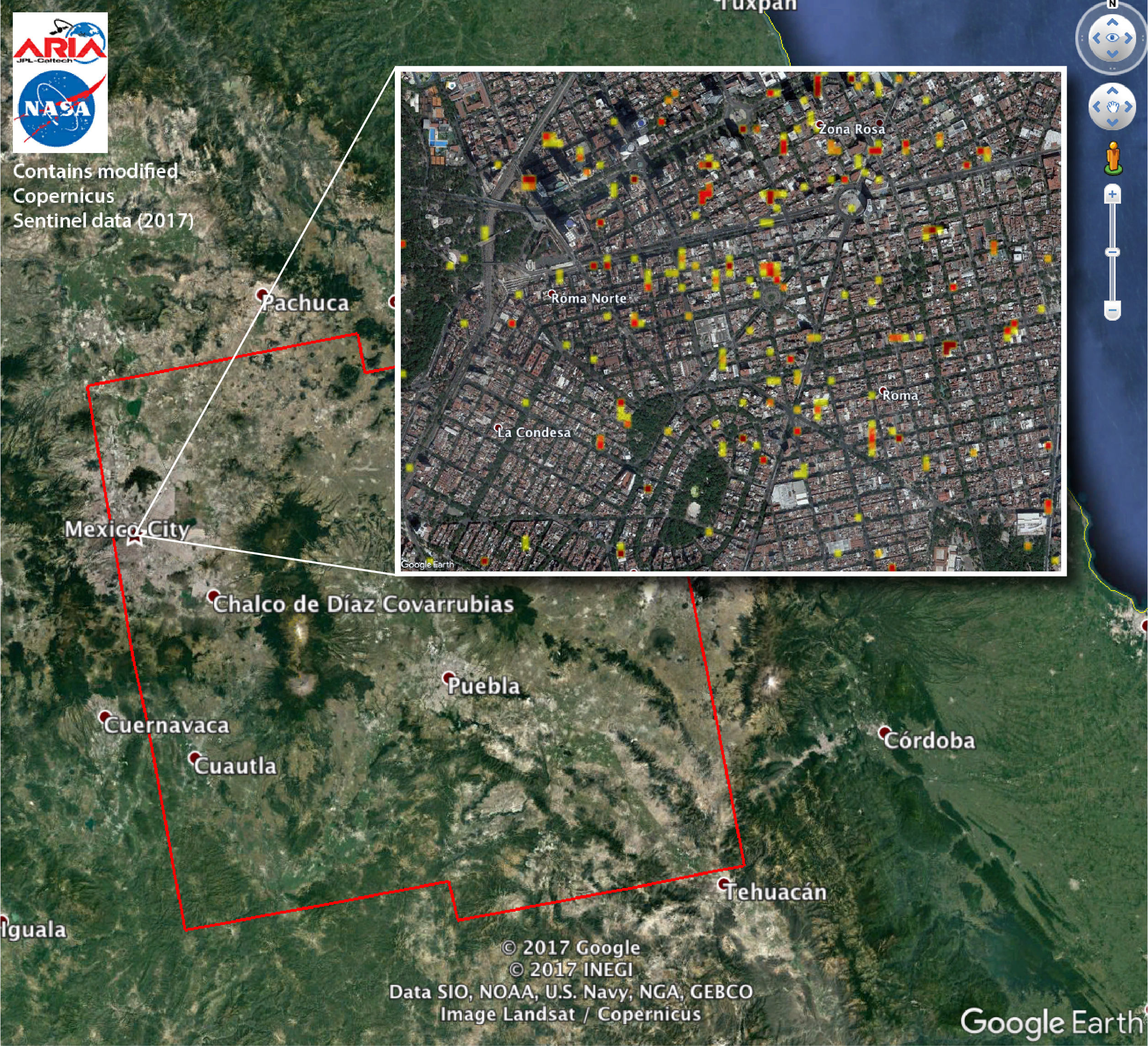
The magnitude-7.1 Raboso quake hit about 75 miles (120 kilometers) southeast of Mexico City. Scientists at the California Institute of Technology and NASA's Jet Propulsion Laboratory (JPL) produced the new "damage proxy map" using radar imagery of central Mexico that the European Space Agency's Copernicus Sentinel-1A and Sentinel-1B satellites gathered before and after the temblor.
"The views indicate the extent of damage caused by the earthquake and subsequent aftershocks, based on changes to the ground surface detected by radar," NASA officials wrote in a statement. [The 10 Biggest Earthquakes in History]
"The color variations from yellow to red indicate increasingly more significant ground and building surface change," they added. "The map should be used as guidance to identify damaged areas, and may be less reliable over vegetated areas."
NASA has given the map to Mexican authorities, agency officials said. A full-resolution version of it is available here: https://www.jpl.nasa.gov/spaceimages/details.php?id=pia21963
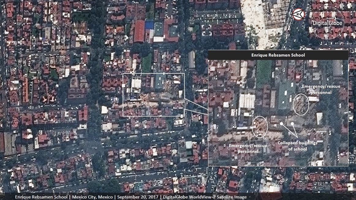
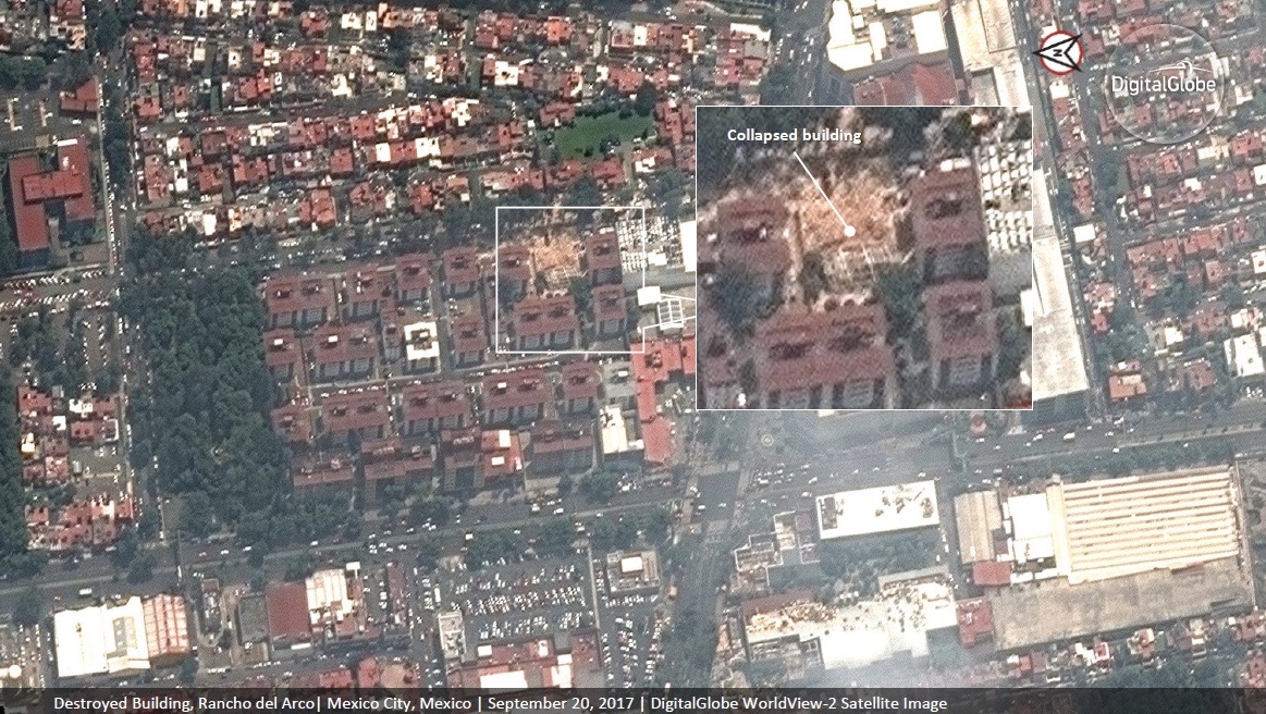
Sentinel-1A and Sentinel-1B aren't the only satellites that have been eyeing Mexico after this week's quake. The WorldView-2 satellite, which is operated by Colorado-based company DigitalGlobe, captured its own views Wednesday (Sept. 20).
DigitalGlobe has publicly released pre- and post-quake imagery to help with the response effort, company representatives said.
Breaking space news, the latest updates on rocket launches, skywatching events and more!
The Caltech and JPL team — who work together as part of the NASA-funded Advanced Rapid Imaging and Analysis project — also created a damage proxy map after a magnitude-8.1 earthquake struck the Pacific coast of southern Mexico on Sept. 7. You can see that map, which also used Sentinel-1A and Sentinel-1B data, here: https://photojournal.jpl.nasa.gov/catalog/PIA21956
Follow Mike Wall on Twitter @michaeldwall and Google+. Follow us @Spacedotcom, Facebook or Google+. Originally published on Space.com.

Michael Wall is a Senior Space Writer with Space.com and joined the team in 2010. He primarily covers exoplanets, spaceflight and military space, but has been known to dabble in the space art beat. His book about the search for alien life, "Out There," was published on Nov. 13, 2018. Before becoming a science writer, Michael worked as a herpetologist and wildlife biologist. He has a Ph.D. in evolutionary biology from the University of Sydney, Australia, a bachelor's degree from the University of Arizona, and a graduate certificate in science writing from the University of California, Santa Cruz. To find out what his latest project is, you can follow Michael on Twitter.


