New Weather-Watching Satellite Brings Suite of Advanced Tools
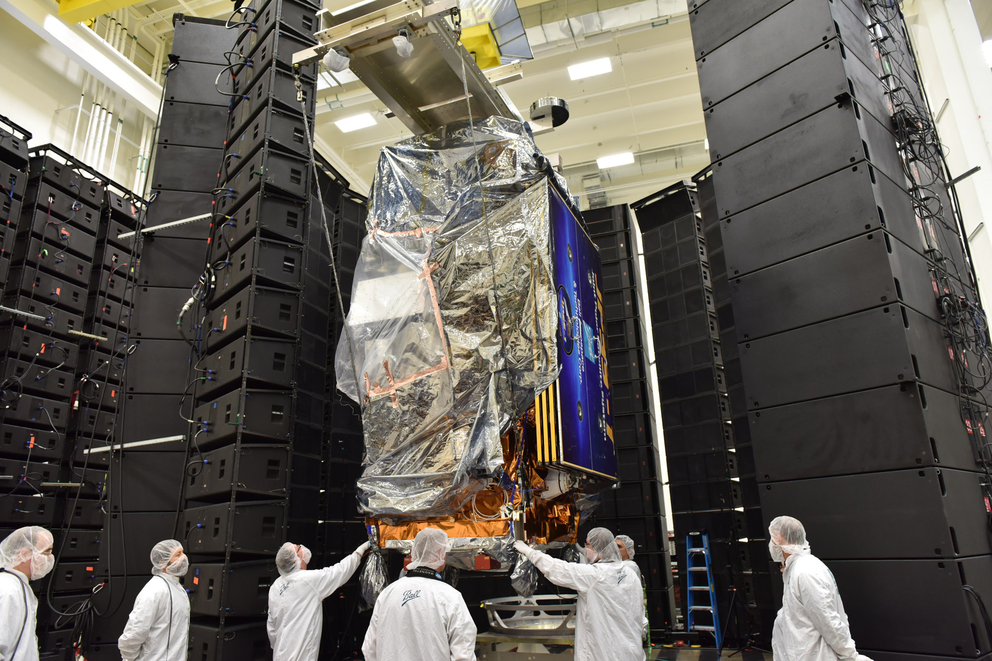
Say hello to the Joint Polar Satellite System 1 (JPSS-1), a new satellite that does everything from providing seven-day weather forecasts to average citizens to helping NASA scientists study long-term changes to Earth's environment.
JPSS-1 is the first in a series of upgraded weather satellites operated by the National Oceanic and Atmospheric Administration (NOAA), in partnership with NASA. The five scientific instruments aboard the JPSS-1 can provide information about Earth's atmosphere, oceans and land. The instruments measure temperature, moisture, rainfall, snow and ice cover, vegetation cover, and ozone levels, providing images that can be used to track things like fires, volcanic eruptions, floods and droughts.
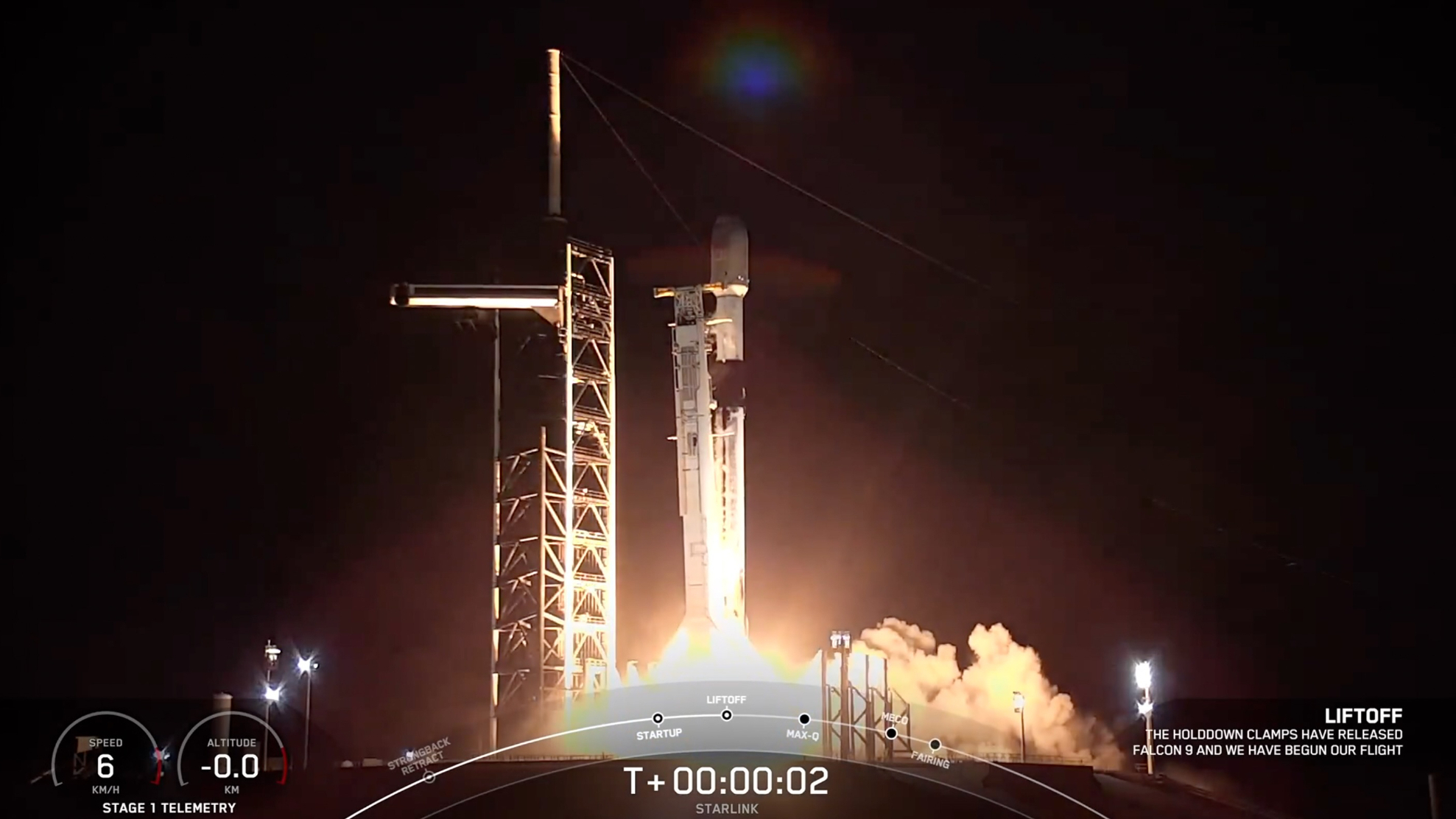
The $1.6 billion satellite mission is scheduled to launch tomorrow (Nov. 14) on a United Launch Alliance Delta II rocket from Vandenberg Air Force Base in California, with liftoff set for 4:47 a.m. EST (1:47 a.m. PST/0947 GMT). Once it reaches orbit, the satellite will be renamed NOAA-20. You can watch the launch live here beginning at 4:15 a.m. EST (0915 GMT), courtesy of NASA TV. [Satellite Quiz: Do You Know What's Up There?]
At a news conference yesterday (Nov. 12), a group of experts said that JPSS-1 will continue the work done by other NOAA satellites, but with improved sensitivity in some of its instruments and an upgraded ground system that allows more data to be transferred from the satellite to the Earth.
Weather watchers
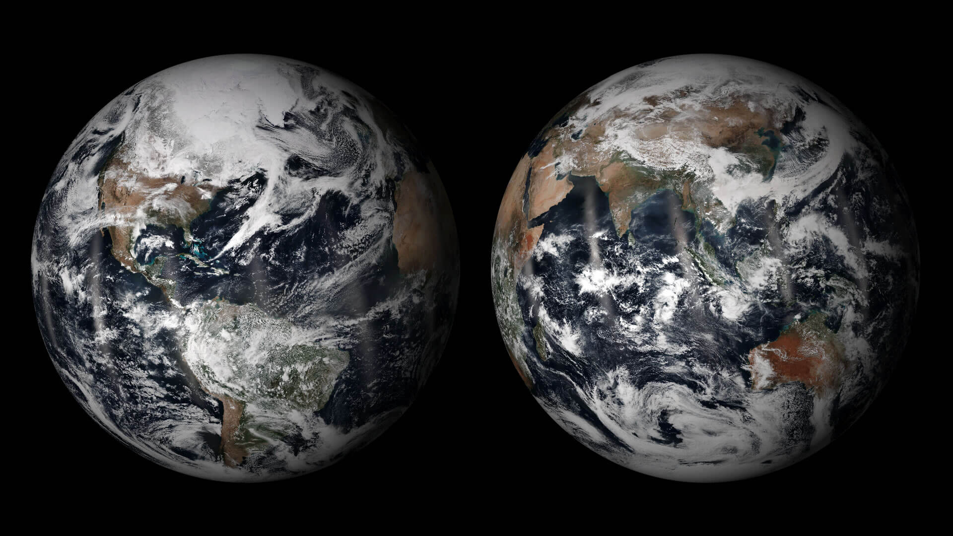
At an altitude of about 512 miles (824 kilometers) above sea level, JPSS-1 will loop around the Earth in a polar orbit, going from North Pole to South Pole multiple times per day, as the planet rotates underneath the spacecraft. This allows the satellite to collect data from every point on the globe, which is especially important for providing those long-range, seven-day weather forecasts, according to Mitch Goldberg, NOAA's chief program scientist for JPSS.
Extreme weather events tend to originate very far away from where they materialize, he said. So, for example, a "disturbance off the coast of Africa" may cause a hurricane off the coast of Florida, or a "typhoon off the coast of Japan … will feed atmospheric moisture plumes from one side of the planet to the other side of the planet." Thus, anticipating the hurricane requires global observations of things like temperature, precipitation and cloud formation.
Researchers will primarily use two of the instruments aboard JPSS-1 for weather forecasts: the Advanced Technology Microwave Sounder (ATMS), which primarily provides large-scale measurements of temperature, moisture levels, precipitation and cloud cover across the globe, and the Cross-track Infrared Sounder (CrIS), which will provide more-detailed measurements of temperature and moisture. The CrIS instrument has six times the accuracy of a similar instrument on NOAA's previous generation of weather satellites, Goldberg said.
Get the Space.com Newsletter
Breaking space news, the latest updates on rocket launches, skywatching events and more!
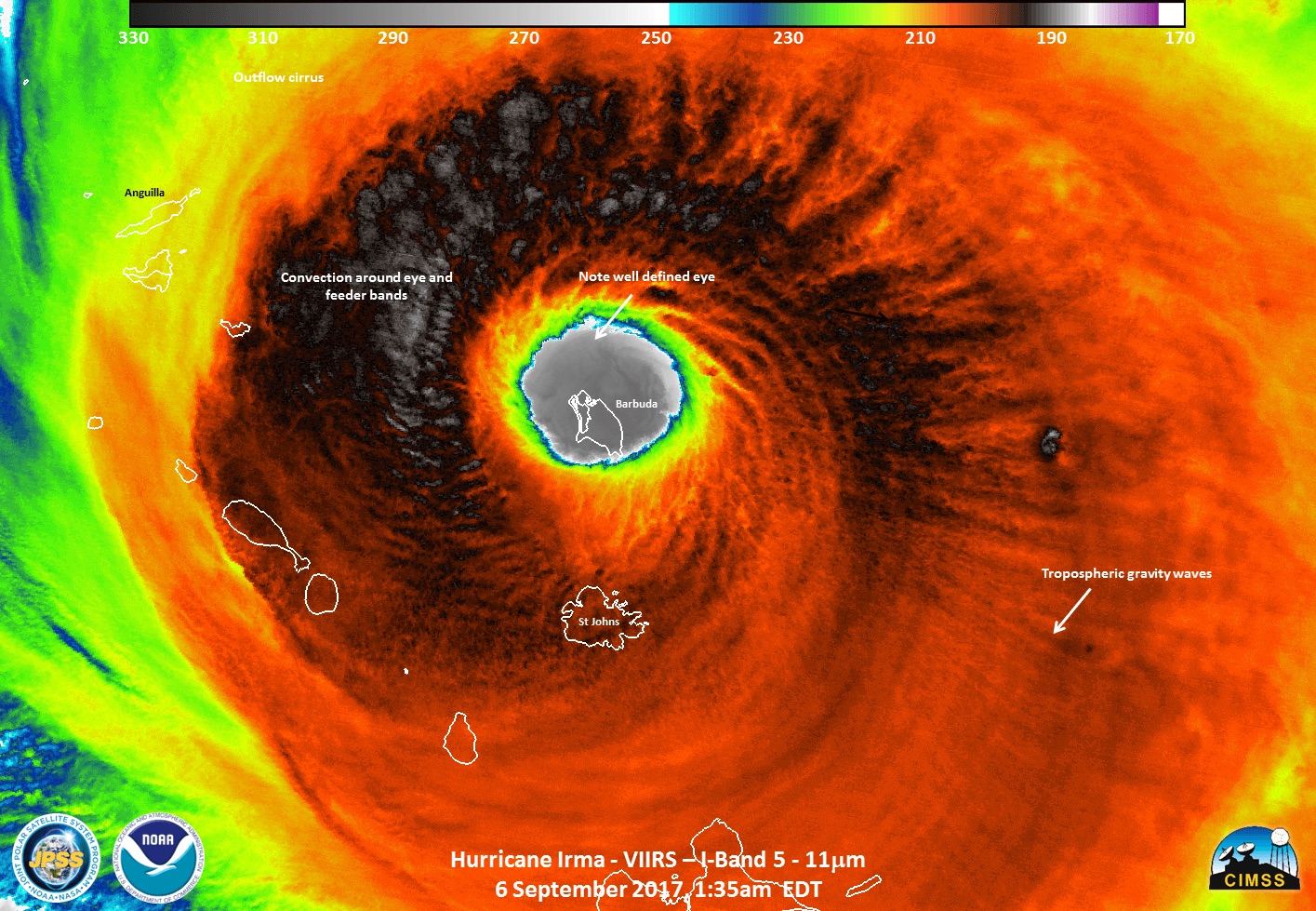
JPSS-1 will also provide visible and infrared images of Earth's surface with the Visible Infrared Imaging Radiometer Suite (VIIRS). VIIRS can show scientists the location of a hurricane's eye (it's center) with an accuracy of about 20 meters (66 feet), which is important because hurricane-prediction models rely heavily on that piece of information, said Joe Pica, director of NOAA’s National Weather Service Office of Observations, who also spoke at the news conference.
JPSS is the first in a series of next-generation satellites that will work as part of NOAA's current suite of weather-tracking satellites. The use of multiple satellites with different instruments on board and with different orbits around the planet provides a wider range of information for scientists to draw on. For example, NOAA scientists can anticipate extreme weather events with polar-orbiting satellites like JPSS-1, but researchers can then monitor extreme weather events uninterrupted with geostationary satellites, like the Geostationary Operational Environmental Satellite 16, or GOES-16, Goldberg said. (Geostationary satellites remain above the same portion of the planet at all times.)
"[Geostationary satellites] are always overhead, always observing weather in real time," Goldberg said. "[They] provide us with information as weather unfolds, while … polar satellites provide the critical data in order [for us] to forecast extreme weather events out to seven days."
Watching for wildfires
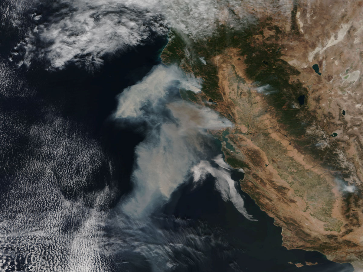
At the news conference, Jana Luis, division chief of predictive services for the California Department of Forestry and Fire Protection, discussed how images from VIIRS, as well as JPSS's contributions to weather forecasting, directly impact efforts to fight forest fires.
"We base almost all of our decisions … on weather," Luis said. "So, having current and accurate weather [forecasts] is huge to us."
Luis said her department relies on daily weather reports to anticipate how likely it is that fires will break out and how fast they will spread. Weather and environmental conditions help the department anticipate how long "fire season" will last for a given year; generally, the season goes from May to October, but with drought plaguing many parts of California for the past four to five years, the season has lasted the entire calendar year in some areas, she said.
On Oct. 8, 2017, Luis' department was alerted to weather conditions — including very strong winds — that would occur across much of Northern California, which could cause fires to start and spread. Sure enough, on Oct. 9 and 10, more than 15 fires broke out across the state. But the early warning, based on satellite data, meant the department was ready to respond.
"We were able to put out four incident-management teams by morning based on this information and our preparedness," Luis said. "Once the fires start, the [satellite] information keeps coming in, and it allows our incident meteorologist as well as our fire-behavior people to show us where the fire growth may be and the intensity of [the fires]. So, we're constantly getting this data, using this data and making very important decisions for our department as well as the public."
Weather forecasts, combined with visual images of where existing fires are located, help fire departments decide what information to provide to members of the public, whether it's simply a warning to clean up dry leaves and dry grass from around homes or instructions to pack a bag and be ready for evacuation orders, Luis said. JPSS-1 will continue to assist in the observation of wildfires and other extreme events, including floods and droughts, the speakers said.
Asking big questions
NASA and NOAA have collaborated on Earth-observing missions since the 1970s, according to James Gleason, NASA senior project scientist for JPSS, who spoke at the news conference. Together, the two agencies have attempted to answer the question, "Can we observe and then quantify how the global Earth system is changing?" according to Gleason.
"That's a big question, but we can sort of now break that down into smaller questions," he said. For example, NOAA and NASA satellites have been observing the ozone layer since the 1970s and have monitored the condition of hole in the ozone over Antarctica. That monitoring effort will continue with JPSS-1, which carries an instrument called the Ozone Mapping and Profiler Suite (OMPS).
With the help of JPSS-1, NASA scientists will also continue to study the global vegetation growth cycles, or when green vegetation appears and disappears with the seasons, both on land and in the sea. Decades of monitoring have shown that the length of the growing cycle has increased (perhaps due to rising global temperatures), Gleason said.
Finally, scientists are also monitoring the Earth's radiation budget, or how much heat the planet releases and how much solar heat it absorbs. Once again, decades of observation have revealed a pattern: The planet absorbs slightly more heat than it releases and that most of that heat is absorbed into the oceans, Gleason said. The Clouds and the Earth’s Radiant Energy System (CERES) on JPSS-1 will provided new data on the planet's energy budget.
Follow Calla Cofield @callacofield. Follow us @Spacedotcom, Facebook and Google+. Original article on Space.com.
Join our Space Forums to keep talking space on the latest missions, night sky and more! And if you have a news tip, correction or comment, let us know at: community@space.com.

Calla Cofield joined Space.com's crew in October 2014. She enjoys writing about black holes, exploding stars, ripples in space-time, science in comic books, and all the mysteries of the cosmos. Prior to joining Space.com Calla worked as a freelance writer, with her work appearing in APS News, Symmetry magazine, Scientific American, Nature News, Physics World, and others. From 2010 to 2014 she was a producer for The Physics Central Podcast. Previously, Calla worked at the American Museum of Natural History in New York City (hands down the best office building ever) and SLAC National Accelerator Laboratory in California. Calla studied physics at the University of Massachusetts, Amherst and is originally from Sandy, Utah. In 2018, Calla left Space.com to join NASA's Jet Propulsion Laboratory media team where she oversees astronomy, physics, exoplanets and the Cold Atom Lab mission. She has been underground at three of the largest particle accelerators in the world and would really like to know what the heck dark matter is. Contact Calla via: E-Mail – Twitter
