Satellite Images Capture Rare Snowfall in the Sahara Desert
Satellite photos show parts of Africa's Sahara Desert blanketed in snow following a rare winter storm earlier this month.
The European Space Agency's (ESA) Copernicus Sentinel-2 satellite captured stunning views of the snow-covered dunes in northwest Algeria, on the edge of the Sahara Desert — an area known to be one of the hottest places on Earth, according to a video from ESA.
The images, taken on Jan. 8, revealed that some areas of the desert were covered in up to 15 inches (40 centimeters) of snow, which fell across the arid region on Jan. 7, according to the video. [The Sahara Desert: Facts, Climate & Life]
"Most of the snow had melted by the end of the next day, but luckily, the Sentinel-2A satellite happened to be in the right place at the right time to record this rare event from space," ESA representative Kelsea Brennan-Wessels said in the video.
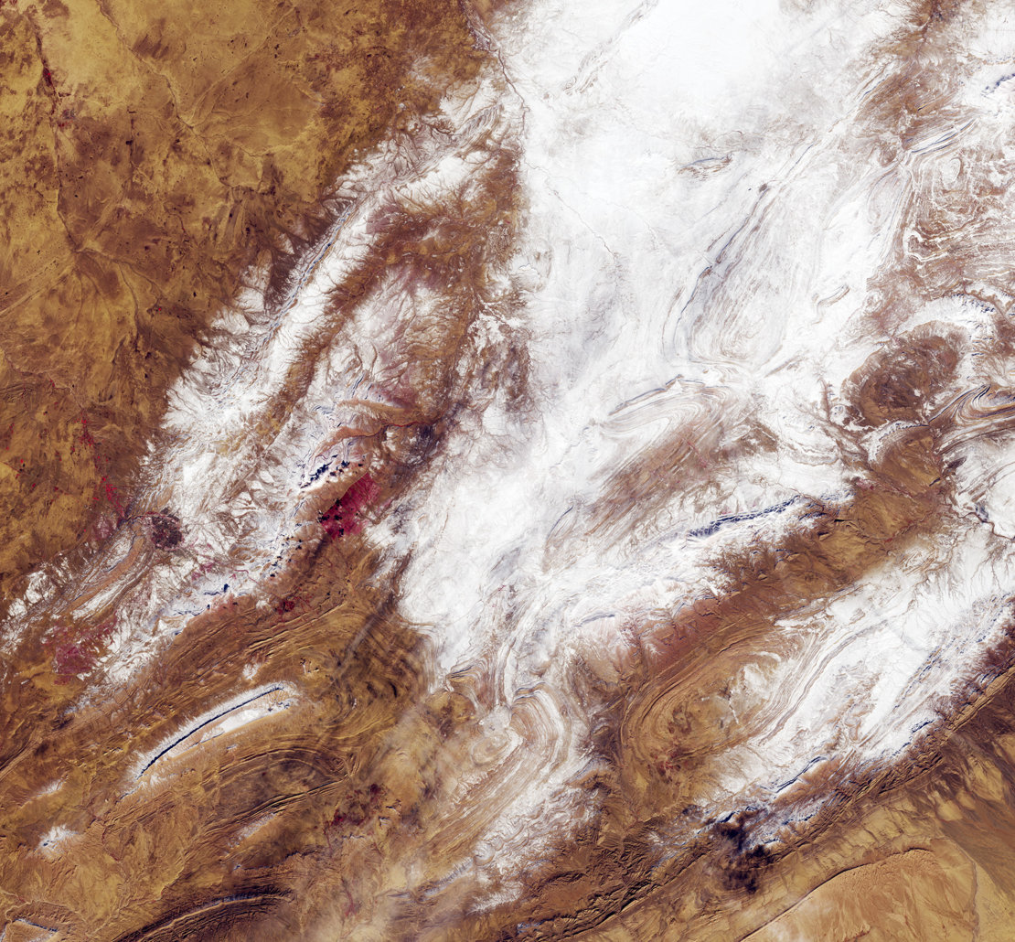
Specifically, the satellite images show that snow fell on the lower Saharan Atlas mountain range. While temperatures in this area can drop significantly at night, snowfall is very unusual in the Sahara Desert because the air is so dry.
In fact, the recent snowfall marks only the third time in 37 years that scientists have recorded powdered snow in this part of the desert, according to the ESA video. The previous storms that were recorded occurred in February 1979 and December 2016.
The Copernicus Sentinel-2 satellites are largely used to track changes in Earth's land and vegetation. The recent satellite images show that there is very little flora in the region, according to the video.
Get the Space.com Newsletter
Breaking space news, the latest updates on rocket launches, skywatching events and more!
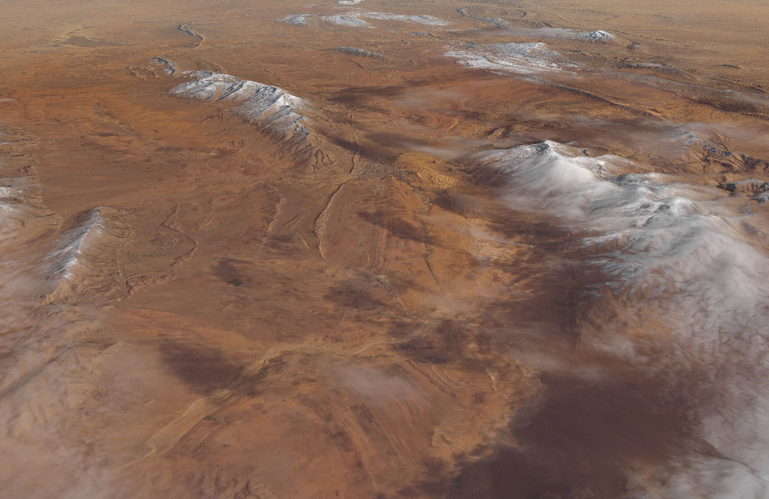
This rare Sahara snowfall was also photographed by the Landsat 8 satellite (a collaboration between NASA and the U.S. Geological Survey) on Jan. 8. The Landsat 8 images revealed a snow accumulation of between 4 and 12 inches (10 to 30 cm) in the desert near the northern Algerian town of Aïn Séfra, according to a statement from NASA.
Such snowfall is much more common in higher altitudes of the Sahara, including the High Atlas mountains in Morocco, which also saw a substantial amount of snow in February 2012 and January 2005, NASA officials said in the statement.
Follow Samantha Mathewson @Sam_Ashley13. Follow us @Spacedotcom, Facebook and Google+. Original article on Space.com.
Join our Space Forums to keep talking space on the latest missions, night sky and more! And if you have a news tip, correction or comment, let us know at: community@space.com.

Samantha Mathewson joined Space.com as an intern in the summer of 2016. She received a B.A. in Journalism and Environmental Science at the University of New Haven, in Connecticut. Previously, her work has been published in Nature World News. When not writing or reading about science, Samantha enjoys traveling to new places and taking photos! You can follow her on Twitter @Sam_Ashley13.

