In Photos: Guatemala's Deadly Fuego Volcano Eruption as Seen from Space
Exploding Volcano
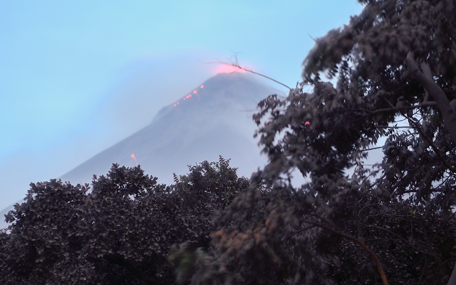
Guatemala's deadly Fuego volcano eruption is responsible for dozens of deaths and cast a vast ash cloud into the sky that's visible from space when it erupted Sunday, June 3, 2018. See photos of the massive volcano eruption as only satellites can. Read our full story on the volcano. Here, a view from the ground in Los Lotes, Rodeo, in Escuintla, south of Guatemala City. The Fuego Volcano can be seen erupting. The eruption on Jun. 4, 2018 resulted in ash and flows of lava that left at dozens of people people dead.
Flaring Up
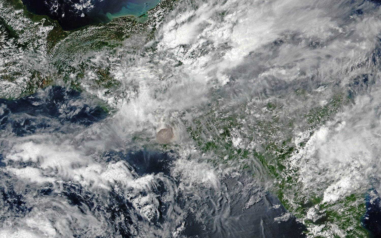
One of Central America's most active volcanoes, Guatemala's Fuego has puffed on and off for years. Occasionally exhibiting explosive activity, ash plumes, lava flows and pyroclastic flows.
Perspective
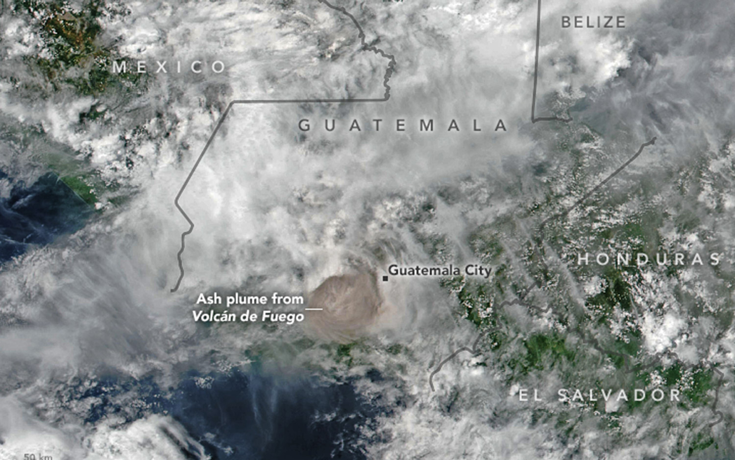
This annotated image reveals the size of the ash plume belched out by Fuego on Jun. 3, 2018. According to the Washington Volcanic Ash Advisory Center the plume rose 15 kilometers (9 miles). Winds pushed the plume east, depositing ash on communities as far as Guatemala City, 70 kilometers (40 miles) away.
Ongoing Dangers
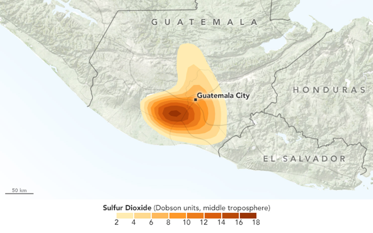
The Copernicus Sentinel-5P satellite evaluated sulphur dioxide levels from Fuego's plume. Hundreds were injured in the Jun. 3, 2018 eruption and 25 were killed. This is the deadliest event in Guatemala since 1902 when the Santa Maria volcano erupted killing thousands.
Verifying Data
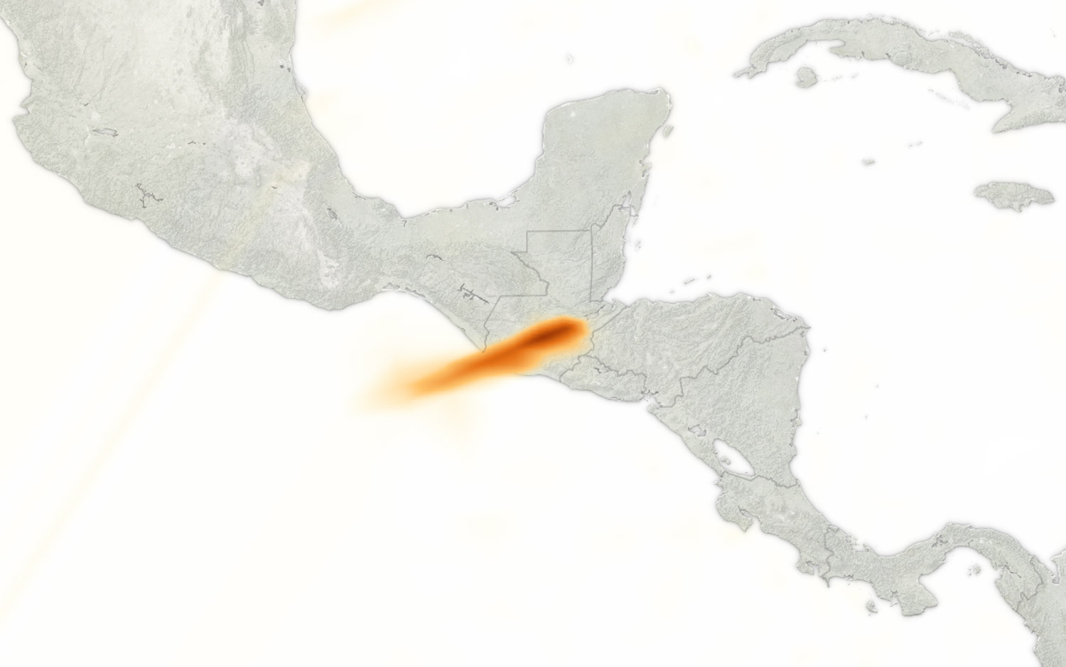
The Copernicus Sentinel-5P satellite was launched in October 2017 and its data are still being corroborated. The image, though, clearly exhibits high sulphur dioxide levels in the atmosphere around the volcano.
Watching the Spread
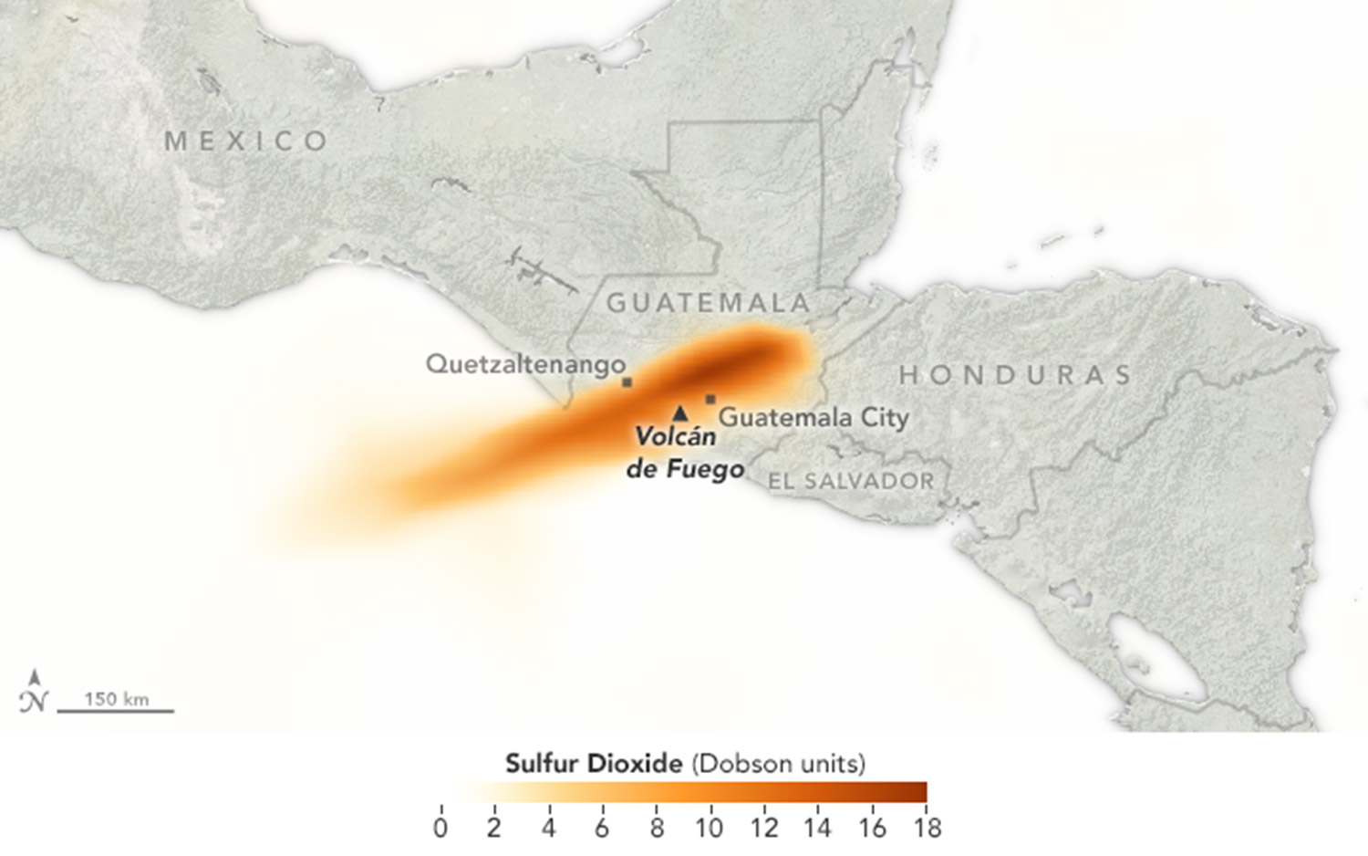
In this close-up and annotated version of the Copernicus Sentinel-5P image, the sulphur dioxide levels in the Fuego volcano's ash plume are clearly spreading across southern Guatemala.
Normal Yet Deadly
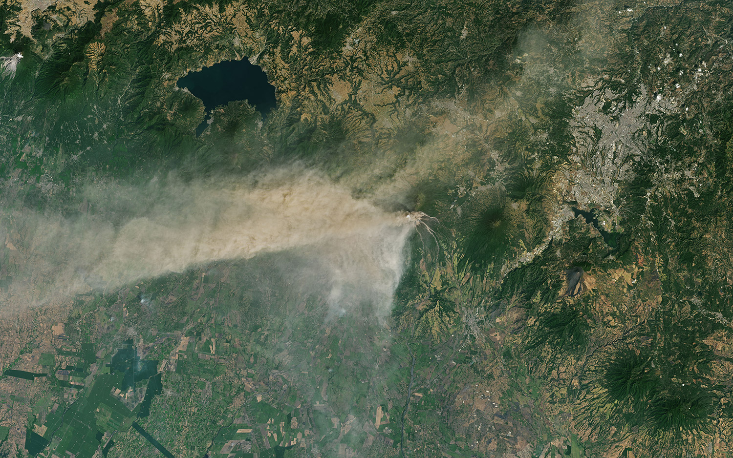
Because Fuego is a regularly active volcano, nearby communities have grown used to its continuous puffs interspersed with explosions, large ash plumes and even lava flows. The event pictured here began Jan. 31, 2018.
Get the Space.com Newsletter
Breaking space news, the latest updates on rocket launches, skywatching events and more!
Big Explosive Events
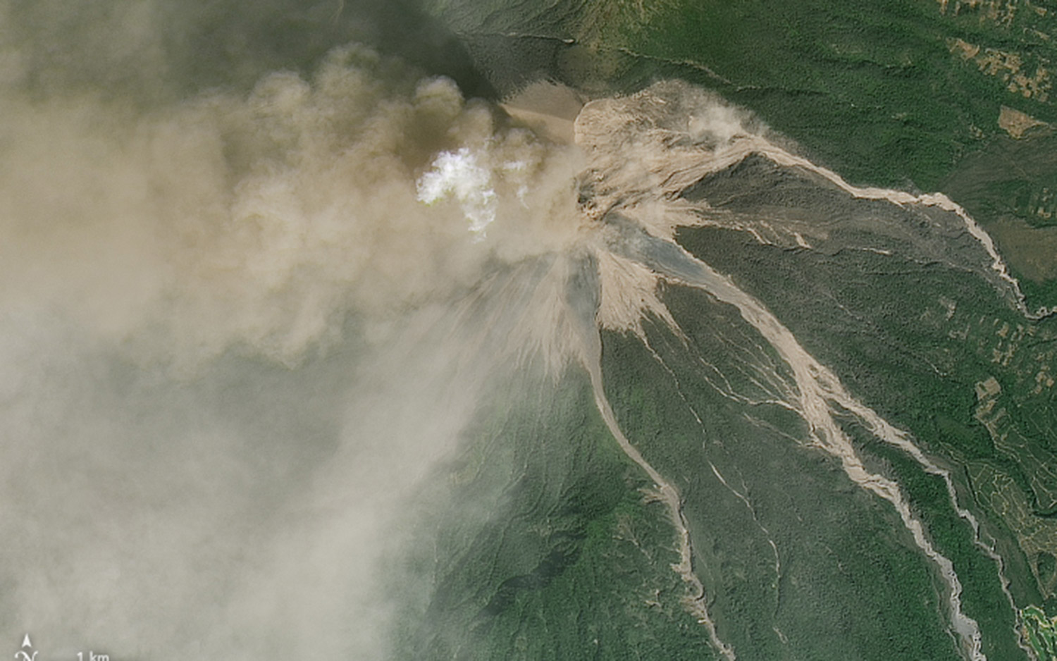
In a volcanic plume, ash typically appears gray or brown and steam visualizes white. Fuego is roughly 70 kilometers (40 miles) west of Guatemala City.
Contrasting Colors
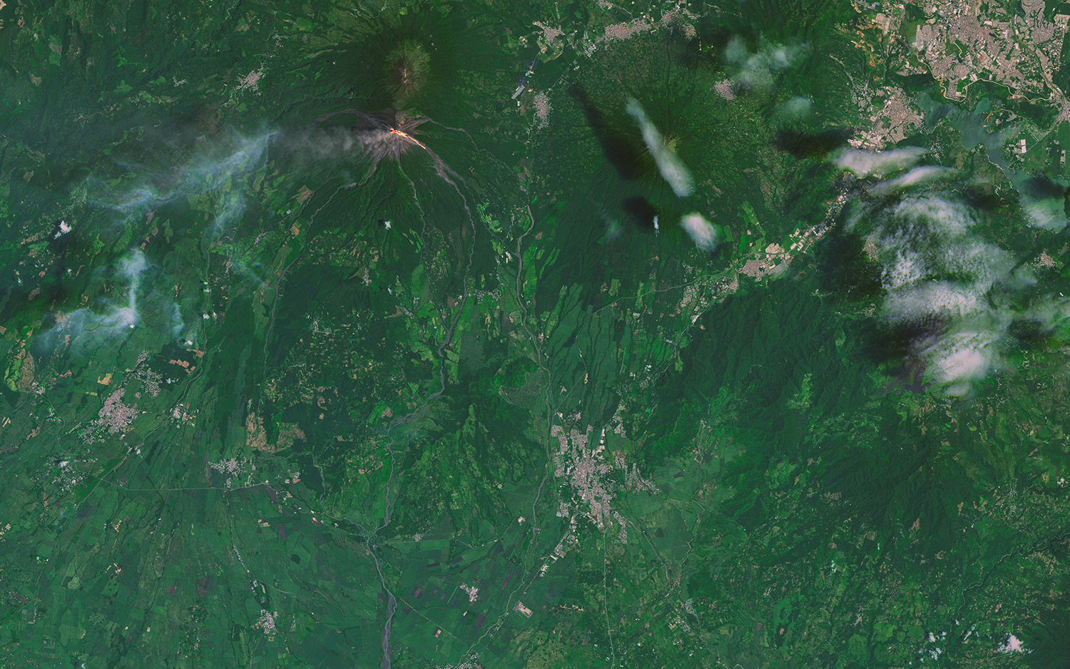
The Operational Land Imager (OLI) on Landsat 8 captured this photo of a green landscape broken by lava spilling down the slopes of Volcán de Fuego on Sept. 7, 2016.
Exploding Lava
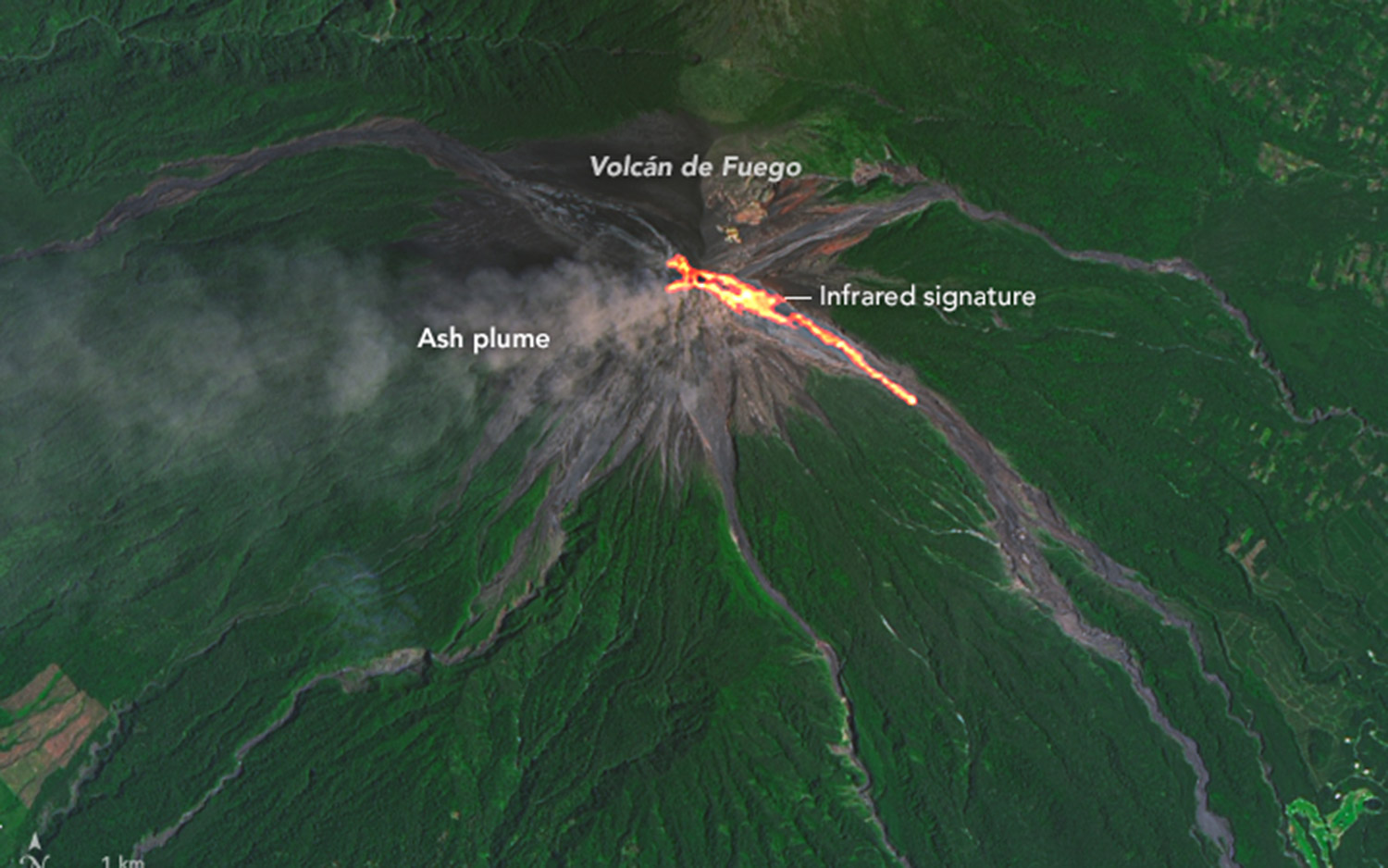
On Sept. 4, 2016, another event at Fuego began. According to the Instituto Nacional de Sismologia, Vulcanologia, Meteorologia, e Hidrologia, this event began when lava rose 200 meeters (650 feet) above the volcano's crater rim.
Join our Space Forums to keep talking space on the latest missions, night sky and more! And if you have a news tip, correction or comment, let us know at: community@space.com.

Christine Lunsford joined the Space.com team in 2010 as a freelance producer and later became a contributing writer, covering astrophotography images, astronomy photos and amazing space galleries and more. During her more than 10 years with Space.com, oversaw the site's monthly skywatching updates and produced overnight features and stories on the latest space discoveries. She enjoys learning about subjects of all kinds.
