Satellites show devastating toll of Australian wildfires on wildlife and human populations

New satellite images from NASA and the European Space Agency show the impacts of the deadly Australian wildfires on both people and wildlife.
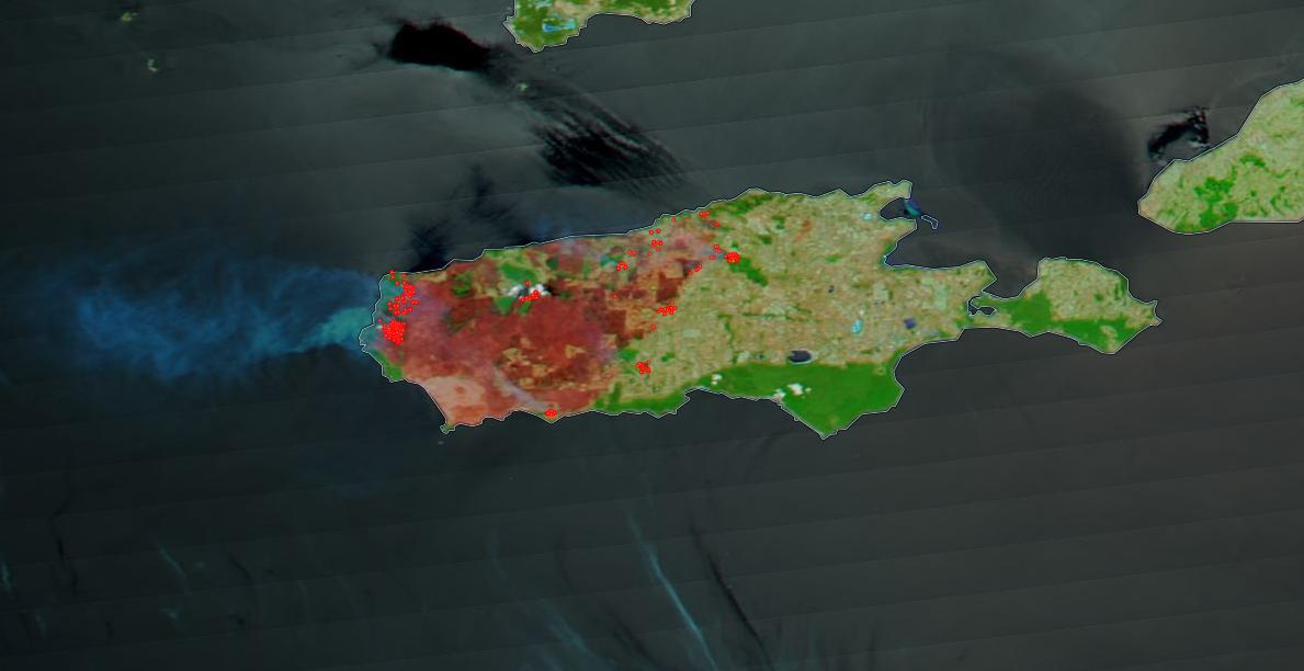
One-third of Kangaroo Island, located southwest of Adelaide and home to many protected species, has been scorched by the fires devastating the continent, as shown in views from NASA's Terra satellite. Images from the MODIS (Moderate Resolution Imaging Spectroradiometer) instrument on that mission show zones of deposited charcoal and ash and removal or alteration of vegetation, the agency stated.
Conservationists have pointed to the island, particularly Flinders Chase National Park, as important habitat for penguins, koalas and a colony of Ligurian honeybees, "which are the world's only pure-bred and disease-free population of this type of bee," NASA said in the statement.
Related: Australia's Deadly Wildfires in Photos: The View from Space
Yet, lightning strikes within the park sparked brush fires that have put these populations at risk. Park ecologists said that half of the island's population of 50,000 koalas have died in the devastation. "NASA's fleet of satellites are able to monitor … the extent of the damage and the areas continuing to burn, which assist firefighters in fighting these major disasters," NASA said.
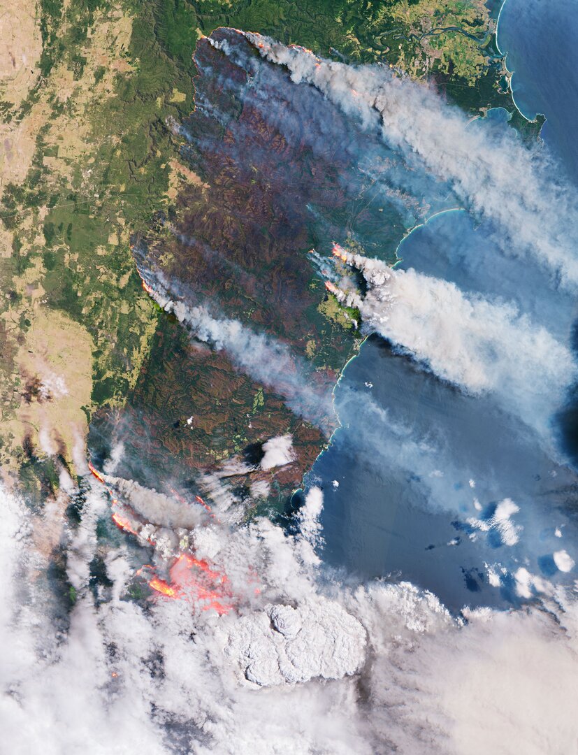
Across the Australian continent, around 25 people and half a billion animals are estimated to have died in this year's massive burns, which began in September, ESA said in a separate statement. The agency's Copernicus Sentinel-3 satellite captured photographs of smoke pouring off fires in New South Wales on Jan. 3.
Fires Ravage Kangaroo Island https://t.co/FjQpkZhnXC #NASAJanuary 10, 2020
Since the instrument can detect features about 0.6 miles (1 kilometer) across, ESA said, the images "actually underestimate the number of fires," because there are flames that are much smaller than what the satellite can see.
Breaking space news, the latest updates on rocket launches, skywatching events and more!
ESA also spotted burn scars and flames with the agency's older Sentinel-2 satellites and detected an increase in deadly carbon monoxide concentrations (another byproduct of the fires) using the Copernicus Sentinel-5 Precursor mission. "Naturally, once in the air, [carbon monoxide] can cause problems for humans by reducing the amount of oxygen that can be transported in the bloodstream," ESA added.
Australia's Bureau of Meteorology says 2019 was the country's warmest year on record, and the bureau attributes the fires to global warming.
- Astronauts Spot Australia's Deadly Wildfires from Space Station as Satellites Keep Watch
- Satellite Images Show Australia's Devastating Wildfires from Space
- Devastation from Deadly Camp and Woolsey Fires Seen from Space
Follow Elizabeth Howell on Twitter @howellspace. Follow us on Twitter @Spacedotcom and on Facebook.


Elizabeth Howell (she/her), Ph.D., was a staff writer in the spaceflight channel between 2022 and 2024 specializing in Canadian space news. She was contributing writer for Space.com for 10 years from 2012 to 2024. Elizabeth's reporting includes multiple exclusives with the White House, leading world coverage about a lost-and-found space tomato on the International Space Station, witnessing five human spaceflight launches on two continents, flying parabolic, working inside a spacesuit, and participating in a simulated Mars mission. Her latest book, "Why Am I Taller?" (ECW Press, 2022) is co-written with astronaut Dave Williams.

