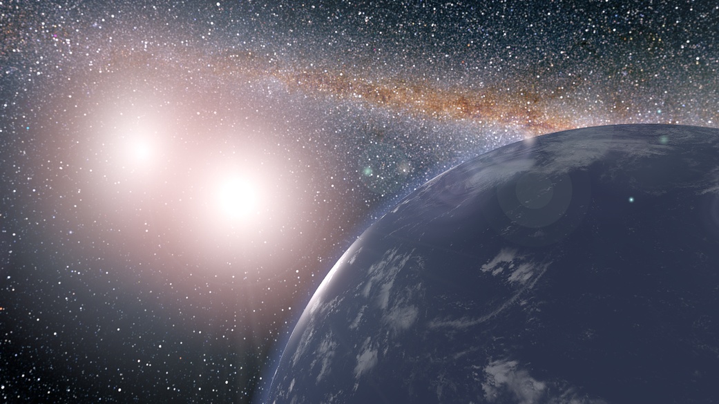
How did Earth crack? New study may explain origins of plate tectonics on our planet.

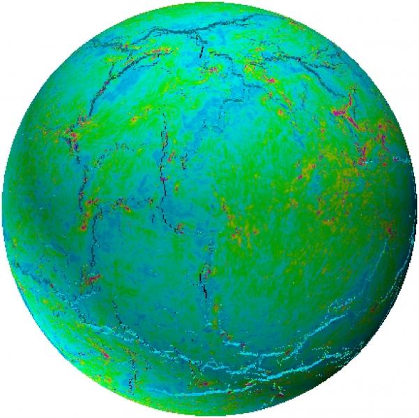
An image from a model used in a new study to investigate the origins of plate tectonics on Earth.  (Image credit: The University of Hong Kong)

Long ago, Earth's outer shell cracked into pieces, which we now call tectonic plates. In a new study, scientists investigated the origins of plate tectonics and found its history rooted in Earth.

Approximately 4.5 billion years ago our home planet formed and, not too soon after — about 3.2 billion years ago — Earth's shell cracked into these plates. Now, while scientists know how Earth's tectonic plates shift and move, exactly how they got started has remained somewhat of a mystery. 

In a new study, led by planetary scientist Alexander Webb at the University of Hong Kong, in collaboration with an international team of researchers, scientists have come up with a new idea to explain why Earth's crust cracked into pieces. 

Related: Plate tectonics may have begun a billion years after Earth's birth

According to the study, the early Earth's outer shell, or lithosphere, heated up, which caused it to expand and crack. This might seem like a simple explanation, but it contradicts many earlier theories. 

Previous studies have estimated that thermal expansion would be less likely to crack Earth's surface than thermal contraction, the opposite process by which Earth's outer shell shrinks as it cools. Because much of Earth's internal heat stems from radioactivity, radioactive decay would cause the planet's interior to cool over time, those studies have suggested.  

But, according to Webb, the answer to Earth's tectonic origins "lies in consideration of major heat-loss mechanisms that could have occurred during Earth's early periods," they said in a statement. "If volcanic advection, carrying hot material from depth to the surface, was the major mode of early heat-loss, that changes everything." 

Here, Webb referred to a method of heat loss involving volcanic advection, or the transfer of heat or matter via the movement of fluid. In this process, hot volcanic material would erupt and fall back onto the earth as the heat would escape to space and the material would cool and press into Earth's young crust, creating a cooling effect. The chilled lithosphere "would have been increasingly warmed via conduction from hot deep material below," according to the statement. 

Webb's team used 3D spherical models to simulate how Earth's outer shell may have fractured in response to thermal expansion amidst varying heating and cooling in Earth's early years. They found that while there was global cooling in Earth's early years, the outer shell was warming at the same time, which is the most likely cause behind our planet's crust breaking apart. 

This work was published July 17 in the journal Nature Communications. 

Email Chelsea Gohd at cgohd@space.com or follow her on Twitter @chelsea_gohd. Follow us on Twitter @Spacedotcom and on Face

Join our Space Forums to keep talking space on the latest missions, night sky and more! And if you have a news tip, correction or comment, let us know at: community@space.com.

Chelsea Gohd
Senior Writer

Chelsea “Foxanne” Gohd joined Space.com in 2018 and is now a Senior Writer, writing about everything from climate change to planetary science and human spaceflight in both articles and on-camera in videos. With a degree in Public Health and biological sciences, Chelsea has written and worked for institutions including the American Museum of Natural History, Scientific American, Discover Magazine Blog, Astronomy Magazine and Live Science. When not writing, editing or filming something space-y, Chelsea "Foxanne" Gohd is writing music and performing as Foxanne, even launching a song to space in 2021 with Inspiration4. You can follow her on Twitter @chelsea_gohd and @foxannemusic.
  • Fission
    There may be two significant flaws in this new theory about the origins of the tectonic plates. The Continental crust only covers 30% of the Earth's surface and, unless you include the crust that is underneath the oceans which is regularly recycled into the mantle, has no features similar to the Continental crust and structurally is more similar to Oceanic crust. If that is not included, then the paucity of Continental crust must be explained.

    My second issue is the statement that we know how the continental plates move. As far as I know, only mantle currents or mantle plumes are under consideration. Yet, neither of those mechanisms adequately explains the fissure that extends from the North to the South pole and separates Europe and Africa from the Americans.
    Reply
  • Torbjorn Larsson
    Fission said:

    There may be two significant flaws in this new theory about the origins of the tectonic plates. The Continental crust only covers 30% of the Earth's surface and, unless you include the crust that is underneath the oceans which is regularly recycled into the mantle, has no features similar to the Continental crust and structurally is more similar to Oceanic crust. If that is not included, then the paucity of Continental crust must be explained.


    My second issue is the statement that we know how the continental plates move. As far as I know, only mantle currents or mantle plumes are under consideration. Yet, neither of those mechanisms adequately explains the fissure that extends from the North to the South pole and separates Europe and Africa from the Americans.

    The intention was to explain why plate tectonics got started, which they do (as in proposing one among many earlier such explanations). I agree that the extent of continental crust and specifically its history remains to be better explained!

    Plate tectonics is mostly driven by subduction, meaning gravitational potential energy is responsible. How much of that mechanism builds from convection or from gravitational driven sorting and shrinkage in the mantle I don't know, that is why we have models covering the complexities, but it is AFAIK sourced by the heat flow out to space.

    There is no "fissure" extending between the poles. If we look at a map of the current plates, we can notice two general properties and one that apply today.

    1. Plate boundaries align the plates.
    2. There are so called mid oceanic ridges between ocean crusts "in the middle" of large oceans, where oceanic crust is made by as oceanic plates separates - this is where plates are mostly made. There are also coastal stretches of volcanic arcs, where oceanic plates are subducted beneath continental plates - this is where plates are mostly destroyed.
    3. Today the Antarctic continental plate covers the south pole and an Arctic oceanic plate the north pole - no polar plate boundaries.

    https://en.wikipedia.org/wiki/Plate_tectonics :

    https://upload.wikimedia.org/wikipedia/commons/a/aa/Tectonic_plates_boundaries_physical_World_map_Wt_180degE_centered-en.svg
    Reply
  • Helio
    Are the cracks located along prior volcanic activity? If so, how does this model account for that? Wouldn't the advection reduce the volume beneath the crust causing more contraction than expansion?
    Reply
  • Torbjorn Larsson
    I should add that the fit between the Americas and the Europe/Asian and African plates have long been noticed and was among the initial evidence for "continental drift" theory which later helped originate plate tectonic theory. The reason for the good fit is a recent and large continental separation, so geologists also see matching rock and fossils.

    But the modern biogeographical evidence is also exciting. The New World monkeys as well as its crocodiles were able to transit from Africa to South America (originally, I think) while the ocean was open but narrower and had more volcanic islands. But aside from island hopping - which would have meant several trips - and the hardiness of crocodiles, even "pregnant" such, in salt water - I think floating "islands" are the best bet for both instances. I was reminded today it is a constant problem among local lakes as water is regulated and lift off tens of meters of floating islands that persist for at least a season (birds use them for nesting and some can be walked albeit very risky of course). Similar stuff happens around river outlets when the wet lands get flooded.
    Reply
  • Torbjorn Larsson
    Helio said:
    Are the cracks located along prior volcanic activity? If so, how does this model account for that? Wouldn't the advection reduce the volume beneath the crust causing more contraction than expansion?

    Good questions!

    I haven't read the paper through, but I think either that or another article covering the paper discussed that both happens (so there likely is a competition here), but that their model can result in what they describe for some parts of the parameter space, I'm sure there is lots to criticize, I was waiting for the next series of papers where this model would be accepted or not. (Or sometimes people write a specific, immediate criticism.)
    Reply
  • Helio
    Thanks for your response.

    There are a lot of ways to look at this, which makes it that much more of an interesting topic.

    I'm no geologist, but I would guess that rock strata are more vulnerable to cracking under tension vs. compression, so contraction, if there was any, would make it easier to crack. But, on the other hand, contraction wouldn't paint much of a picture for initiating any subduction flows.

    Another guess is that we have maps showing the varying depths of the mantle, so the thin regions might be the more vulnerable locations, which would affect any model, no doubt.
    Reply
  • Fission
    Torbjorn Larsson said:
    The intention was to explain why plate tectonics got started, which they do (as in proposing one among many earlier such explanations). I agree that the extent of continental crust and specifically its history remains to be better explained!

    Plate tectonics is mostly driven by subduction, meaning gravitational potential energy is responsible. How much of that mechanism builds from convection or from gravitational driven sorting and shrinkage in the mantle I don't know, that is why we have models covering the complexities, but it is AFAIK sourced by the heat flow out to space.

    There is no "fissure" extending between the poles. If we look at a map of the current plates, we can notice two general properties and one that apply today.

    1. Plate boundaries align the plates.
    2. There are so called mid oceanic ridges between ocean crusts "in the middle" of large oceans, where oceanic crust is made by as oceanic plates separates - this is where plates are mostly made. There are also coastal stretches of volcanic arcs, where oceanic plates are subducted beneath continental plates - this is where plates are mostly destroyed.
    3. Today the Antarctic continental plate covers the south pole and an Arctic oceanic plate the north pole - no polar plate boundaries.

    https://en.wikipedia.org/wiki/Plate_tectonics :

    https://upload.wikimedia.org/wikipedia/commons/a/aa/Tectonic_plates_boundaries_physical_World_map_Wt_180degE_centered-en.svg
    Describing the mid Atlantic ridge can get confusing. Yes it is a mountainous ridge. However, it is due to the separation of the continents and is also a fissure which opens into the mantle. Magma flowing from the mantle subsequently created the ridge.
    Reply
  • Fission
    Torbjorn Larsson said:
    The intention was to explain why plate tectonics got started, which they do (as in proposing one among many earlier such explanations). I agree that the extent of continental crust and specifically its history remains to be better explained!

    Plate tectonics is mostly driven by subduction, meaning gravitational potential energy is responsible. How much of that mechanism builds from convection or from gravitational driven sorting and shrinkage in the mantle I don't know, that is why we have models covering the complexities, but it is AFAIK sourced by the heat flow out to space.

    There is no "fissure" extending between the poles. If we look at a map of the current plates, we can notice two general properties and one that apply today.

    1. Plate boundaries align the plates.
    2. There are so called mid oceanic ridges between ocean crusts "in the middle" of large oceans, where oceanic crust is made by as oceanic plates separates - this is where plates are mostly made. There are also coastal stretches of volcanic arcs, where oceanic plates are subducted beneath continental plates - this is where plates are mostly destroyed.
    3. Today the Antarctic continental plate covers the south pole and an Arctic oceanic plate the north pole - no polar plate boundaries.

    https://en.wikipedia.org/wiki/Plate_tectonics :

    https://upload.wikimedia.org/wikipedia/commons/a/aa/Tectonic_plates_boundaries_physical_World_map_Wt_180degE_centered-en.svg
    "There is no "fissure" extending between the poles. "
    Torbjorn Larsson said:
    The intention was to explain why plate tectonics got started, which they do (as in proposing one among many earlier such explanations). I agree that the extent of continental crust and specifically its history remains to be better explained!

    Plate tectonics is mostly driven by subduction, meaning gravitational potential energy is responsible. How much of that mechanism builds from convection or from gravitational driven sorting and shrinkage in the mantle I don't know, that is why we have models covering the complexities, but it is AFAIK sourced by the heat flow out to space.

    There is no "fissure" extending between the poles. If we look at a map of the current plates, we can notice two general properties and one that apply today.

    1. Plate boundaries align the plates.
    2. There are so called mid oceanic ridges between ocean crusts "in the middle" of large oceans, where oceanic crust is made by as oceanic plates separates - this is where plates are mostly made. There are also coastal stretches of volcanic arcs, where oceanic plates are subducted beneath continental plates - this is where plates are mostly destroyed.
    3. Today the Antarctic continental plate covers the south pole and an Arctic oceanic plate the north pole - no polar plate boundaries.

    https://en.wikipedia.org/wiki/Plate_tectonics :

    https://upload.wikimedia.org/wikipedia/commons/a/aa/Tectonic_plates_boundaries_physical_World_map_Wt_180degE_centered-en.svg"There is no "fissure" extending between the poles." This can be confusing. How can a fissure be a mountain ridge. As Torbjorn Larsson pointed out, the longitudinal ridge is the point where the continental plates separate, i.e. a fissure. Magma from the mantle rises through the fissure and creates the mountainous ridge which does extend almost the entire distance between the poles. My point is that this structure which defines the tectonic motion of the continents on either side of it, does not correspond either to the mantle current or mantle plume theories and, as one the most remarkable oceanic structures, does not have a good explanation.
    Reply
  • Fission
    "There is no "fissure" extending between the poles." This can be confusing. How can a fissure be a mountain ridge. As Torbjorn Larsson pointed out, the longitudinal ridge is the point where the continental plates separate, i.e. a fissure. Magma from the mantle rises through the fissure and creates the mountainous ridge which does extend almost the entire distance between the poles. My point is that this structure which defines the tectonic motion of the continents on either side of it, does not correspond either to the mantle current or mantle plume theories and, as one the most remarkable oceanic structures, does not have a good explanation.
    Reply