Earth Day 2019: These Amazing NASA Images Show Earth from Above
Celebrate Earth Day with photos of our planet's natural beauty.
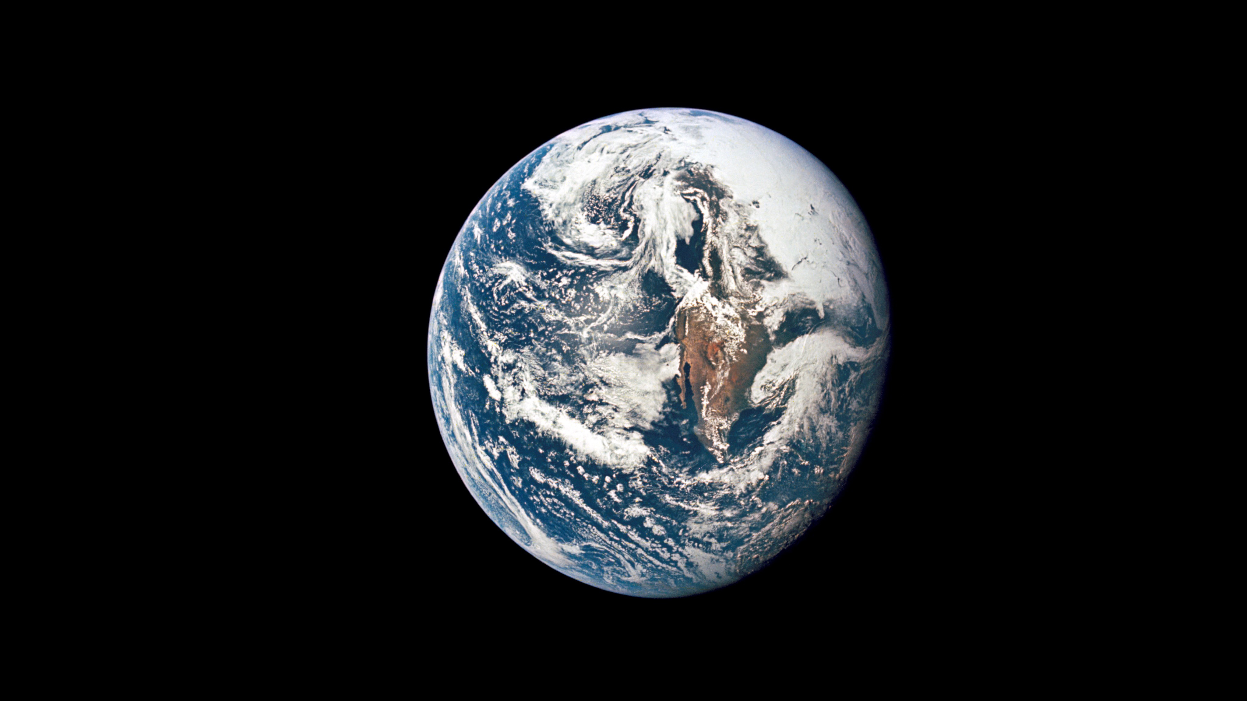
NASA is celebrating Earth Day today (April 22) by sharing some really incredible photos of Earth from satellites, aircraft and deep-space missions.
Space.com has picked 10 of our favorite views from NASA's Earth Day gallery and featured them here. For even more amazing NASA photos of Earth, you can find NASA's entire collection of Earth Day photos here.
You can also share your own Earth Day Photos with NASA for a chance to have them featured in NASA videos and social media posts.
Related: Celebrate Earth Day 2019 with This Animated Google Doodle
Icy mountains in Antarctica
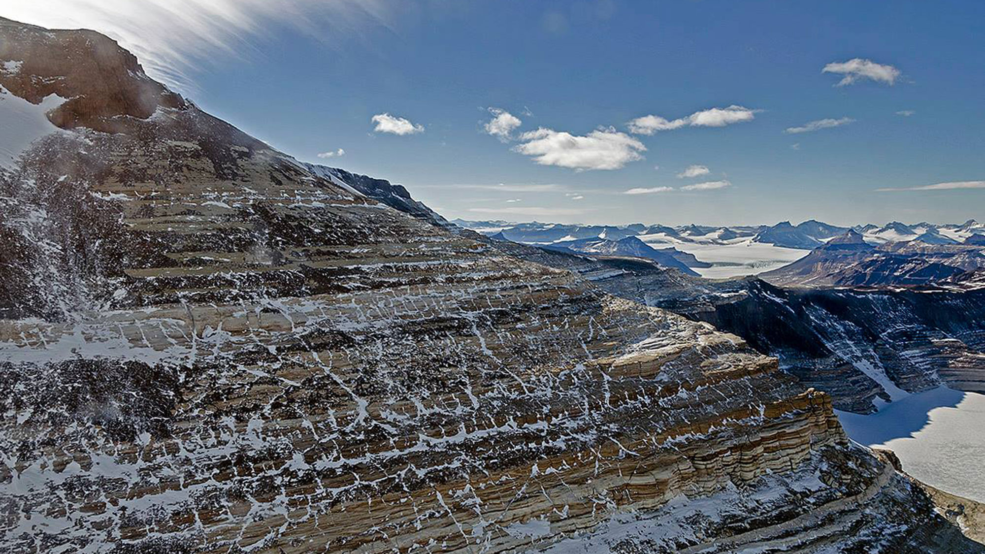
While NASA is most known for its space missions, the agency also dedicates its time and resources to studying planet Earth. Operation IceBridge monitors polar ice by flying research aircraft over the Arctic and the Antarctic. This image was taken from the NASA P-3 airborne laboratory on Nov. 27, 2013, as the aircraft flew by Mount Feather, part of the Transantarctic Mountains that run from east to west across Antarctica.
'Anvil' cloud over Africa
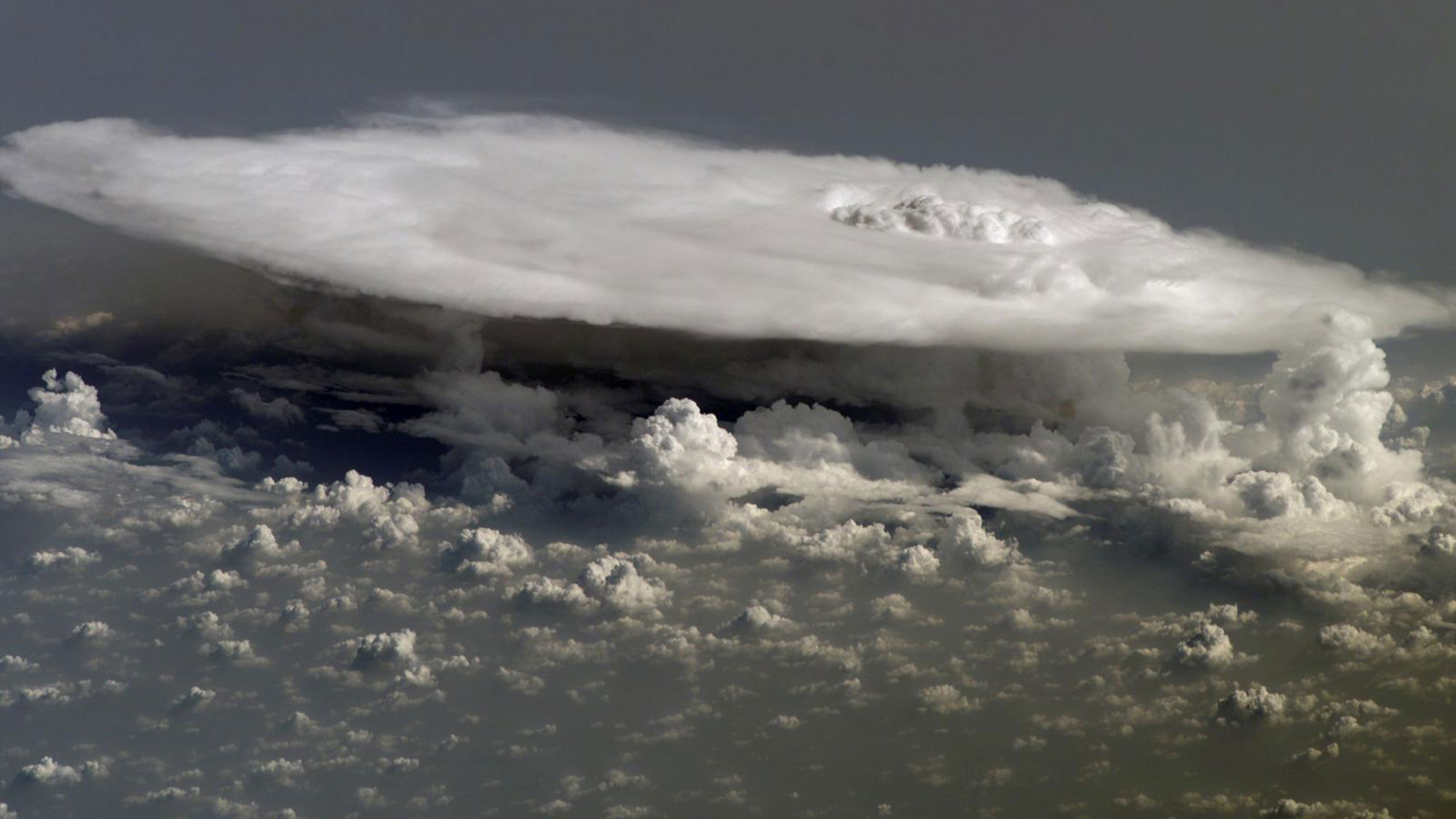
Looming high above a layer of fluffy, popcorn-like clouds over Africa is a large cumulonimbus cloud, which looks like an enormous shelf of water vapor. This image was captured by an Expedition 16 crewmember of the International Space Station. Due to its shape, this type of cloud formation is often referred to as an "anvil cloud."
Chunky sea ice
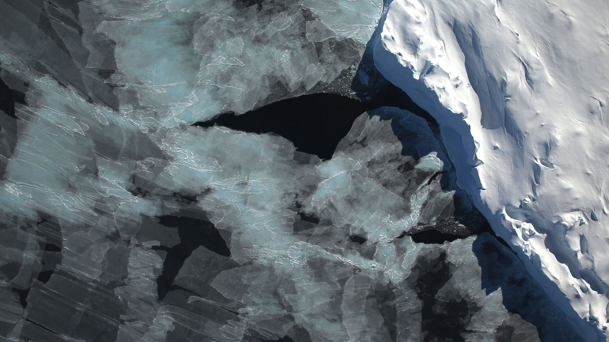
An aerial photo captured during NASA's Operation IceBridge on Nov. 5, 2014 shows the distribution of ice in the Bellingshausen Sea, located on the west side of the Antarctic Peninsula. "The block of ice on the right side of the image is older, thicker, and was once attached to the Antarctic Ice Sheet," NASA officials said in a statement. "By the time this image was acquired, however, the ice had broken away to form an iceberg."
Get the Space.com Newsletter
Breaking space news, the latest updates on rocket launches, skywatching events and more!
Rub' al Khali
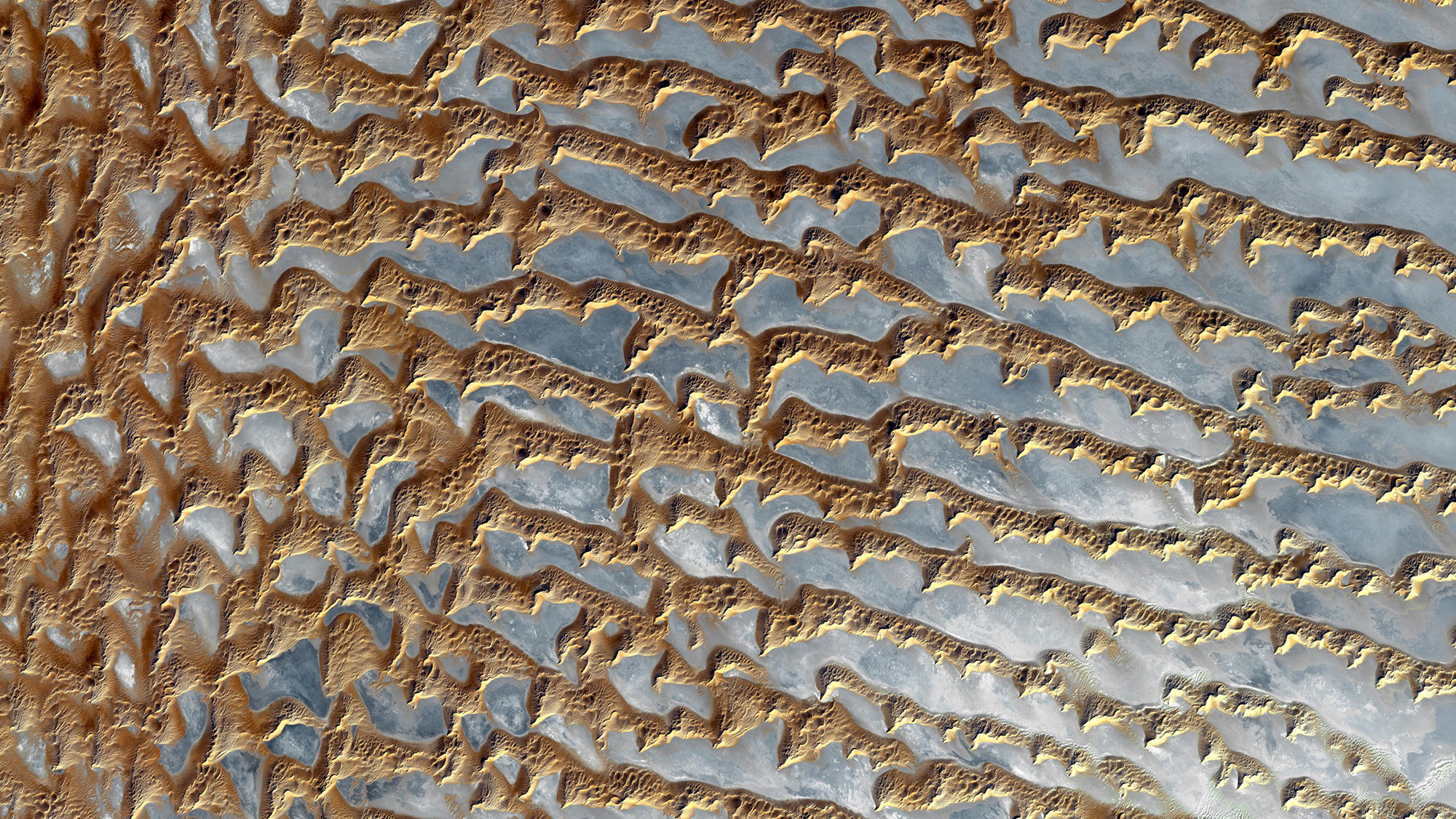
NASA's Terra satellite captured these squiggly features glistening across the desert of Rub' al Khali on Dec. 5, 2005. This is one of the largest sandy deserts in the world, and it covers about one-third of the Arabian Peninsula, including Oman, Yemen and the United Arab Emirates.
The Bahamas
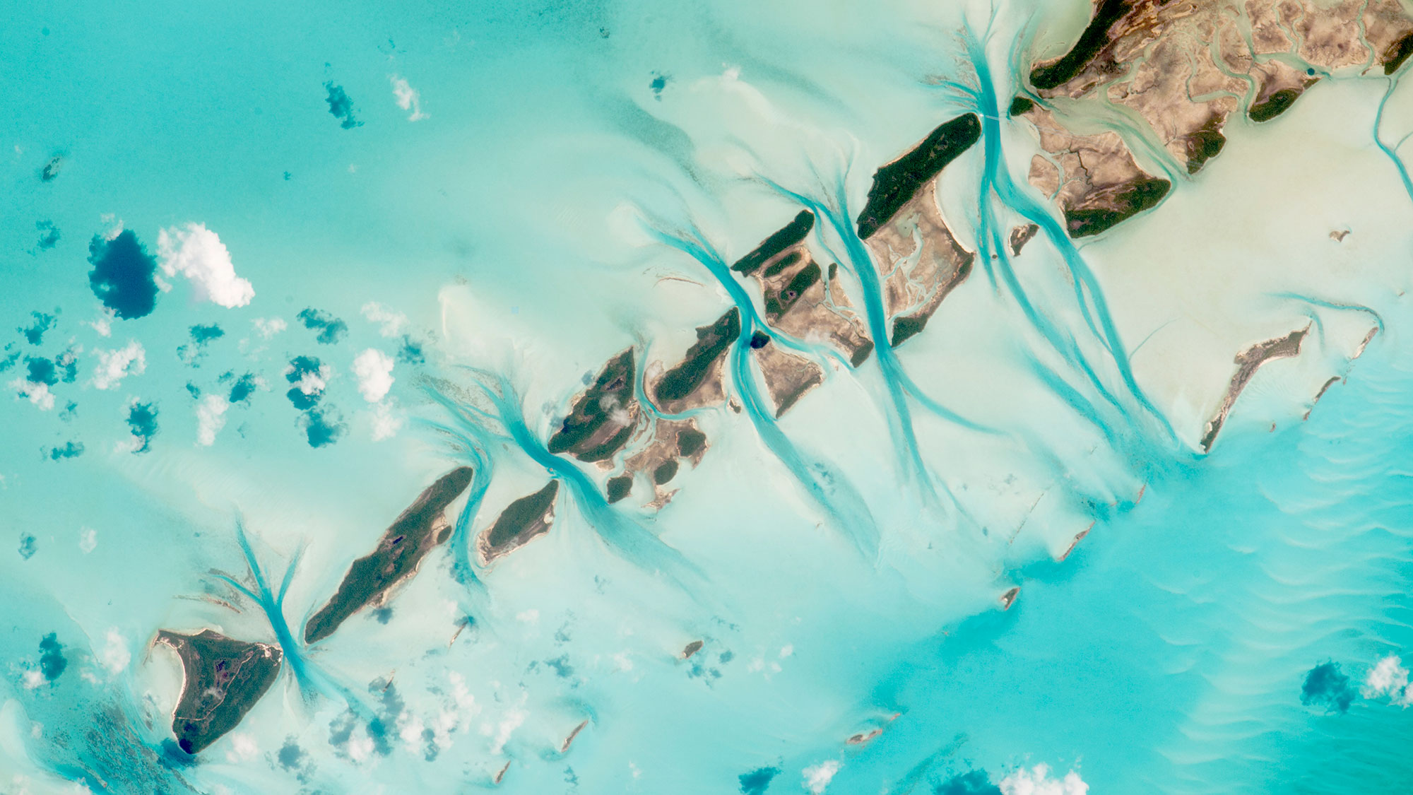
As the teal waters of the Caribbean Sea flows between this chain of islands, the water takes on an even darker shade of blue in the deeper parts of the channels. This photo shows a few small island cays in the Exuma district of the Bahamas, and it was taken by an Expedition 44 astronaut at the International Space Station on July 19, 2015.
Conservation efforts seen from space
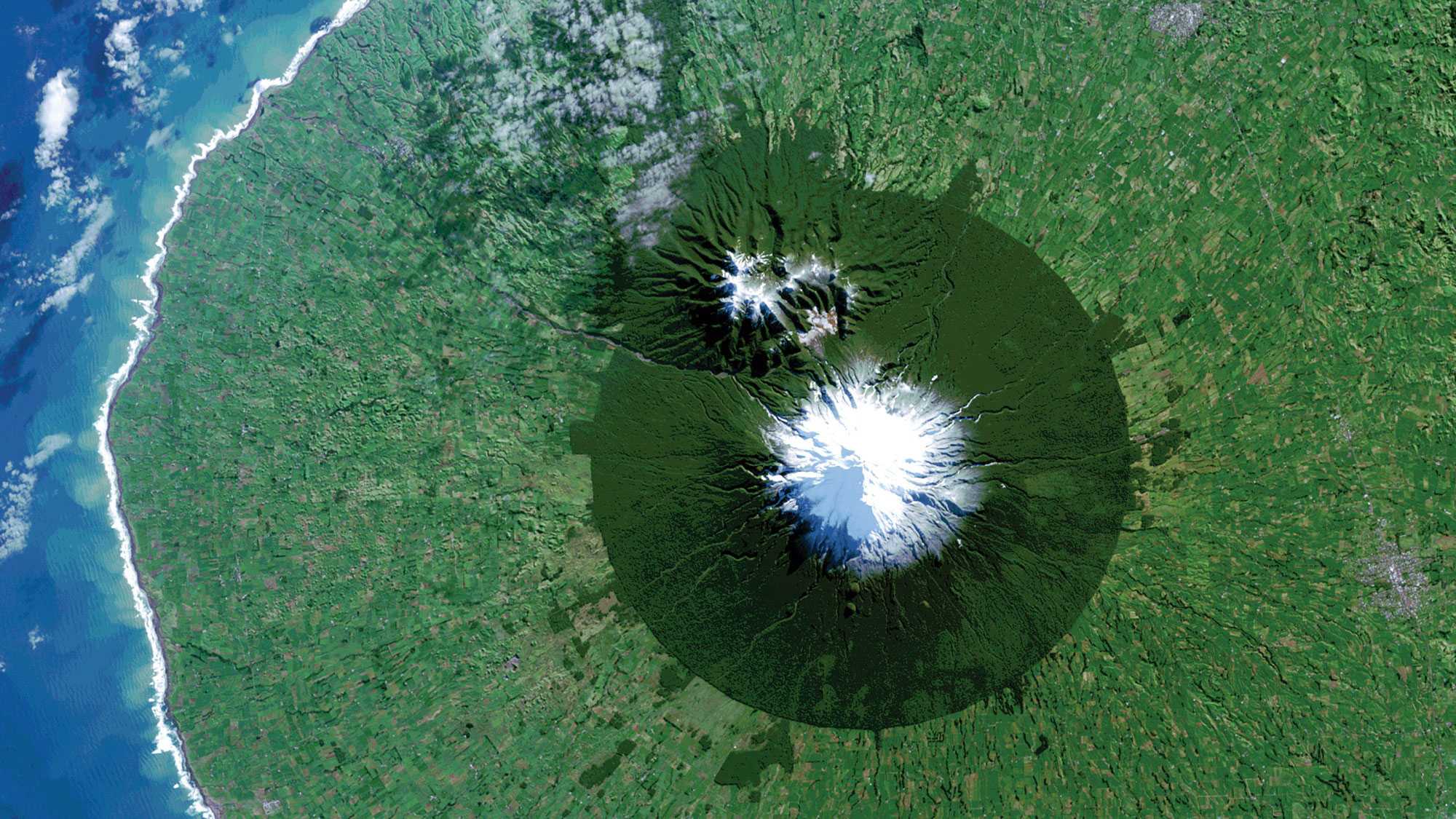
That snowy peak towering over its grassy surroundings is Mount Taranaki, a stratovolcano on New Zealand's North Island in a protected area known as Egmont National Park. The protected area of forest has a darker shade of green than the surrounding pasture lands. This view was captured by NASA's Landsat 8 Earth-observation satellite on July 3, 2014.
'Black Marble'
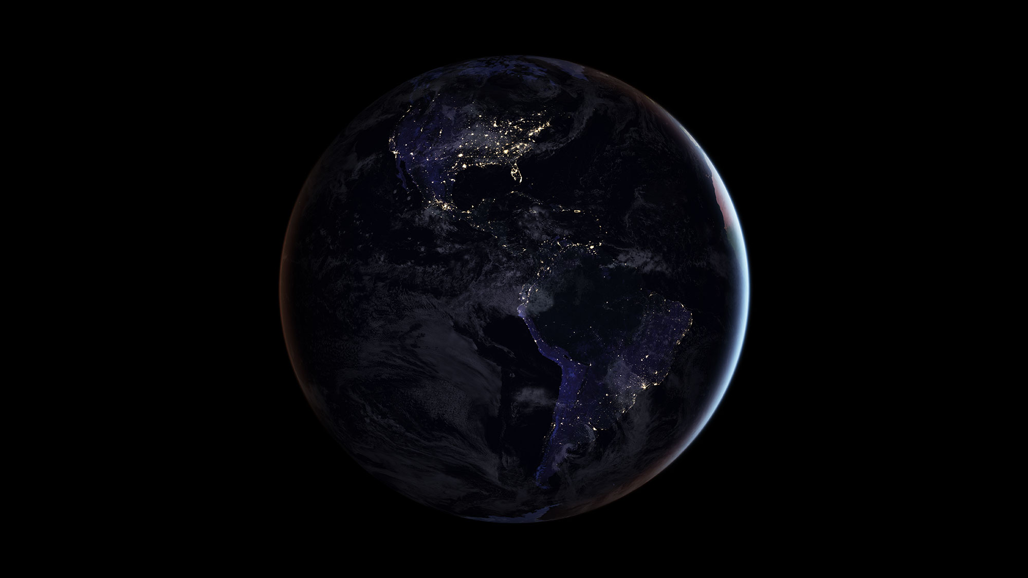
Earth looks like a glittering "black marble" in this full-disk view from the NASA-NOAA Suomi National Polar-orbiting Partnership (NPP) satellite. You can see even more views of Earth at night in our Black Marble photo gallery!
Earthrise 2.0
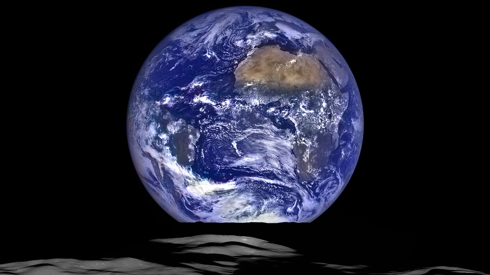
Nearly 50 years after Apollo 8 astronauts took the famous "Earthrise" photos of Earth from the moon, NASA's Lunar Reconnaissance Orbiter recreated the astronauts' beautiful view of Earth with this composite view.
Full story: This New 'Earthrise' Photo from NASA Is Simply Breathtaking
The view of Earth from Mars
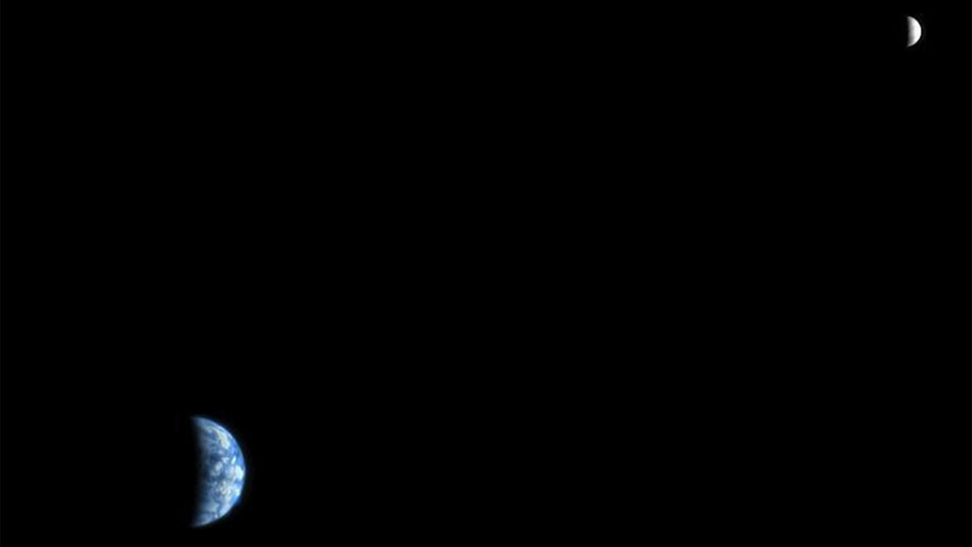
In a photo from NASA's Mars Reconnaissance Orbiter (MRO), Earth and the moon look like tiny crescents in the night sky. MRO captured this historic image on Oct. 3, 2007, when the Red Planet was about 88 million miles (142 million kilometers) away from Earth.
Related: Wow! Mars Probe Snaps Stunning Photo of Earth and Moon
'The Day the Earth Smiled'
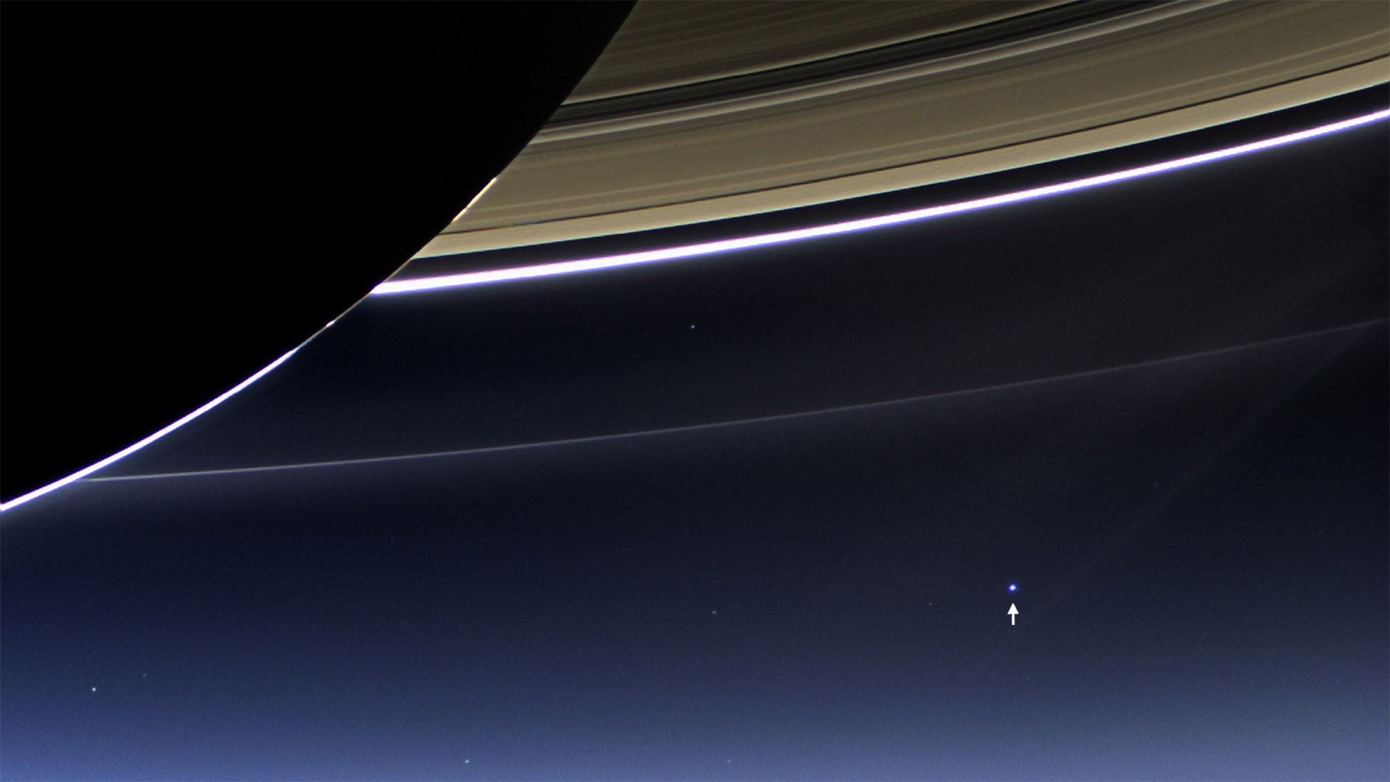
Yes, this is a photo of Saturn's rings. But if you look really closely, you can see Earth and the moon here, too! NASA's Cassini spacecraft took this long-distance photo of Earth from 898 million miles (1.44 billion kilometers) away on July 19, 2013.
Full Story: Wow! NASA Probes See Earth & Moon from Saturn, Mercury (Photos)
- Earth From Space: Amazing Astronaut Photos
- Astronaut's-Eye Time Lapse Offers Incredible View of Earth from Space
- Earth From Space: The Secret of NASA's Amazing 'Blue Marble' Photos
Email Hanneke Weitering at hweitering@space.com or follow her @hannekescience. Follow us on Twitter @Spacedotcom and on Facebook. Original article on Space.com.
Join our Space Forums to keep talking space on the latest missions, night sky and more! And if you have a news tip, correction or comment, let us know at: community@space.com.

Hanneke Weitering is a multimedia journalist in the Pacific Northwest reporting on the future of aviation at FutureFlight.aero and Aviation International News and was previously the Editor for Spaceflight and Astronomy news here at Space.com. As an editor with over 10 years of experience in science journalism she has previously written for Scholastic Classroom Magazines, MedPage Today and The Joint Institute for Computational Sciences at Oak Ridge National Laboratory. After studying physics at the University of Tennessee in her hometown of Knoxville, she earned her graduate degree in Science, Health and Environmental Reporting (SHERP) from New York University. Hanneke joined the Space.com team in 2016 as a staff writer and producer, covering topics including spaceflight and astronomy. She currently lives in Seattle, home of the Space Needle, with her cat and two snakes. In her spare time, Hanneke enjoys exploring the Rocky Mountains, basking in nature and looking for dark skies to gaze at the cosmos.
