GPS satellites can provide faster alerts when big earthquakes strike, scientists say
A GPS-based system can provide earlier alerts than seismic sensors when devastating earthquakes strike.
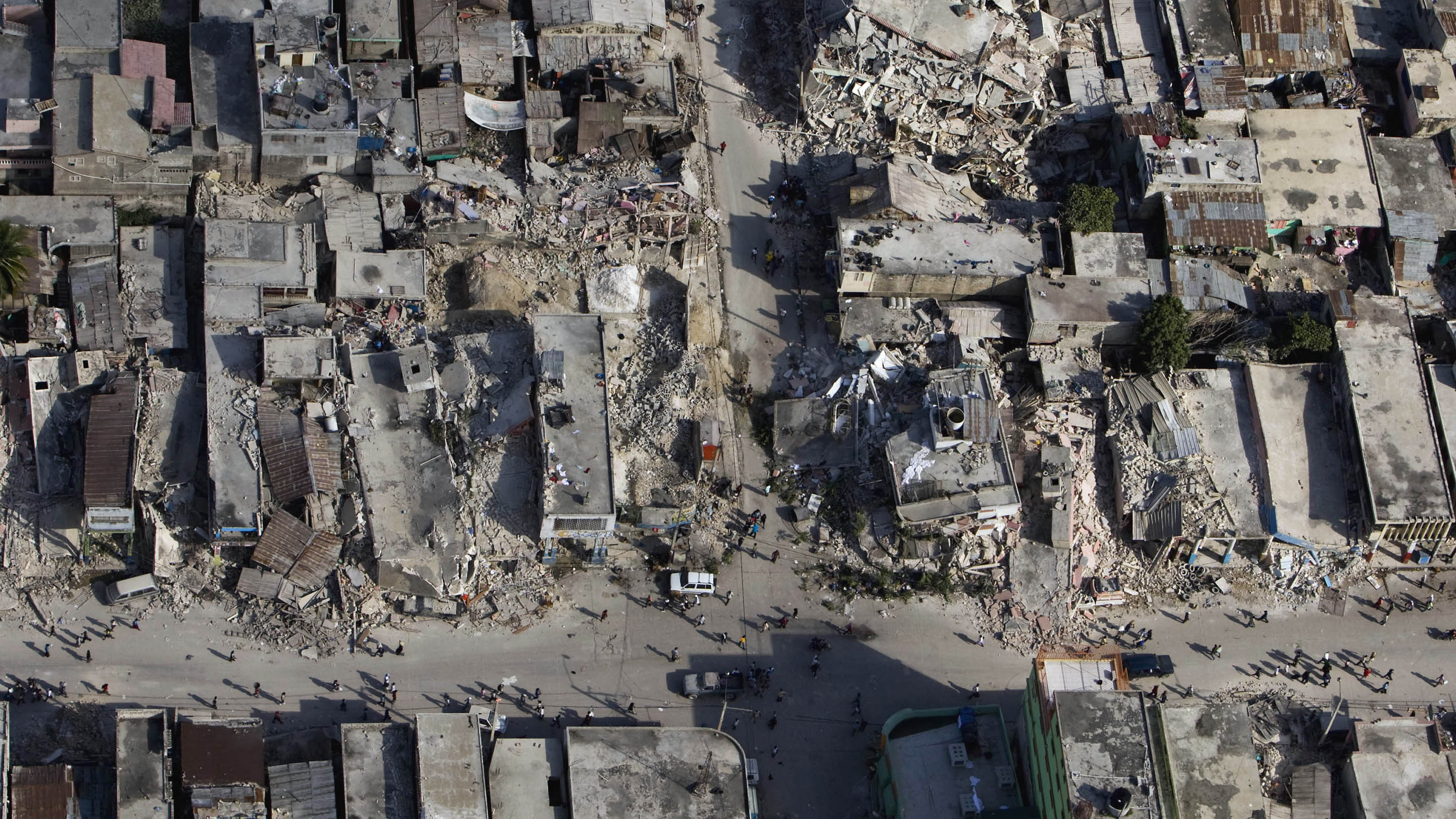
A global GPS-based earthquake monitoring system can provide timelier and more accurate warnings than traditional seismic networks when powerful earthquakes strike, a new study suggests. It could also reduce the frequency of false alerts.
In the new study, published this month in the Bulletin of Seismological Society of America, a team of researchers detailed new progress in the development of a global earthquake warning system that measures the displacement of Global Positioning System (GPS) satellite receiver stations when an earthquake deforms the Earth's crust. The system assesses the magnitude of an earthquake within seconds and issues alerts in under two minutes from the first detection of the ground movement.
According to lead author Timothy Melbourne, professor of geology at Central Washington University, the GPS-based detection system can provide earlier and more accurate alerts than the traditional seismic sensors distributed in tectonically active regions, which can be overwhelmed with an initial surge of data when seismic waves first emerge.
Related: Earthquakes in Puerto Rico changed the landscape. Satellites see it from space.
"The problem is that when earthquakes get very big, the seismic networks traditionally have a very hard time understanding what has happened in the first minutes after the event," Melbourne told Space.com. "What you find even with a medium-sized earthquake is a very complicated seismic trace. The seismic waves radiate into the earth, they bounce around inside the earth, and interact with structures. It gets really complicated to tease out what was the source of the waves versus what is the effect of all the reverberations in the crust."
Seismologists, Melbourne added, usually wait for the waves to spread further away from the center and scale the earthquake from afar. But waiting is not an option with the threat of high-magnitude earthquakes and potentially devastating tsunamis that could kill thousands of people.
In 2019, for example, the U.S. earthquake warning app ShakeAlert failed to warn Los Angeles citizens when a magnitude-6.4 earthquake hit Southern California on Independence Day because it incorrectly assessed the force of the tremors. On the other hand, false alerts can trigger panic and reduce trust in the system in the future.
Get the Space.com Newsletter
Breaking space news, the latest updates on rocket launches, skywatching events and more!
"That's what happened in Japan in 2011," Melbourne said. "The tsunami sirens went off, all the warnings happened, but they had had three or four of those in the previous years. So people didn't take it seriously."
The GPS-based monitoring system, which measures the accurate position of the receiver, doesn't have to deal with the tangle of seismic waves. It measures how much the earthquake deformed the ground, shifting the position of the receivers.
"If you go back through catalogs in the last 20 years, and look at a plot of how much the ground deformed versus the magnitude of the earthquake, it's extremely linear," Melbourne said. "In Tohoku (the region closest to the epicenter of the 2011 earthquake in Japan), some of the [GNSS] stations moved over five meters."
The receivers send the signal in real time via the internet, cellular or satellite networks to the central system, which evaluates the shift within seconds and informs local authorities about the scale of the earthquake.
Melbourne says the effectiveness of the GPS-based system (it can use data from other navigation satellite systems, or GNSS, too) in the early assessments of powerful earthquakes lies in its "bluntness" and limited sensitivity compared to the seismic sensors.
"It's like listening to an orchestra and only wanting to know how loud it is," Melbourne said. "You don't want to hear the violins or the French horns, you only want to make that one measurement."
Scientists have studied movements of the Earth’s crustal plates using GPS data since the 1980. But a truly global early warning space-based system has only become possible fairly recently, Melbourne said, thanks to the proliferation of fixed GPS stations, frequently used for land-surveying and construction work.
"The speed at which the global distribution of GPS receivers is growing is astonishing," Melbourne said. "It's growing by thousands of new stations a year and these all provide very high-quality positioning data."
In the future, the system might be able to incorporate data from smartphones and mobile devices. Although these are designed to move around, artificial intelligence algorithms already exist that would be able to distinguish patterns typical for Earth tremors, Melbourne added.
For now, the researchers are trying to convince countries from around the globe to share data from their stations to enable alerts and help improve the science behind the technology. The research is detailed in the May 11 edition of the Bulletin of the Seismological Society of America.
Follow Tereza Pultarova on Twitter @TerezaPultarova. Follow us on Twitter @Spacedotcom and on Facebook.
Join our Space Forums to keep talking space on the latest missions, night sky and more! And if you have a news tip, correction or comment, let us know at: community@space.com.
Tereza is a London-based science and technology journalist, aspiring fiction writer and amateur gymnast. Originally from Prague, the Czech Republic, she spent the first seven years of her career working as a reporter, script-writer and presenter for various TV programmes of the Czech Public Service Television. She later took a career break to pursue further education and added a Master's in Science from the International Space University, France, to her Bachelor's in Journalism and Master's in Cultural Anthropology from Prague's Charles University. She worked as a reporter at the Engineering and Technology magazine, freelanced for a range of publications including Live Science, Space.com, Professional Engineering, Via Satellite and Space News and served as a maternity cover science editor at the European Space Agency.
