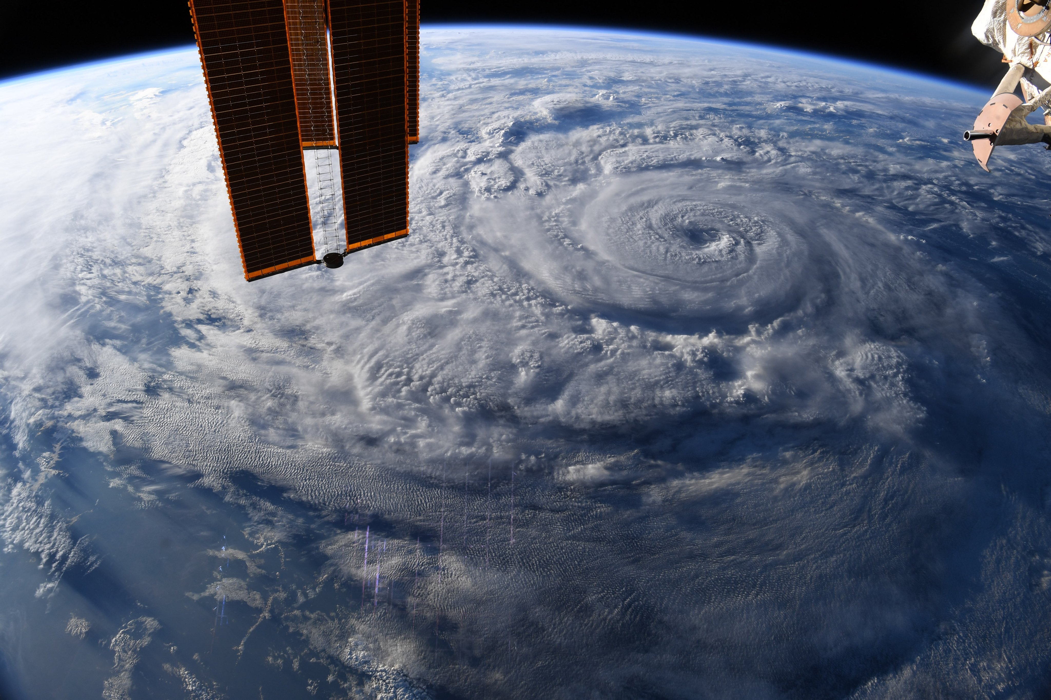
Hurricane season kicks off. Expect higher-than-normal storm activity.
The season is expected to bring about 13 to 20 named storms.

Breaking space news, the latest updates on rocket launches, skywatching events and more!
You are now subscribed
Your newsletter sign-up was successful
Want to add more newsletters?
The 2021 Atlantic hurricane season has officially begun, and it's expected to bring a higher-than-average number of storms in the months ahead.
There is a 60% chance that the Atlantic hurricane season, which runs from Tuesday (June 1) to Nov. 30, will be an "above-normal" season, the National Oceanic and Atmospheric Administration (NOAA) said in a statement on May 20.
The season will likely bring 13 to 20 named storms, or storms with winds of 39 mph (63 km/h) or higher, according to NOAA. Of those storms, six to 10 could become hurricanes with winds of 74 mph (119 km/h) or higher, with three to five becoming "major" hurricanes with winds of 111 mph (179 km/h) or higher.
Article continues belowAn average hurricane season brings about 14 named storms, including three major hurricanes and four weaker hurricanes, according to the statement.
Related: Hurricane season: How long it lasts and what to expect
This year's hurricane season follows on the heels of an extremely active 2020 hurricane season that broke records with 30 named storms; by September, the National Hurricane Center (NHC) ran out of pre-set names for the storms and started naming them after Greek letters, Live Science previously reported. Last year wasn't the first time that has happened: in 2005, the NHC also had to use Greek letters when an extremely active hurricane season brought 28 named storms.
"Although NOAA scientists don't expect this season to be as busy as last year, it only takes one storm to devastate a community," Ben Friedman, acting NOAA administrator, said in the statement. "The forecasters at the National Hurricane Center are well-prepared with significant upgrades to our computer models, emerging observation techniques and the expertise to deliver the life-saving forecasts that we all depend on during this, and every, hurricane season."
Breaking space news, the latest updates on rocket launches, skywatching events and more!
This year's first Atlantic storm will be named "Ana," the second "Bill," followed by "Claudette, Danny, Elsa, Fred, Grace" and so on; the last storm on the list is "Wanda," according to the National Hurricane Center and the Central Pacific Hurricane Center.
Since the 1980s, the intensity, frequency and duration of North Atlantic hurricanes have increased; and as climate change continues to warm the planet, storm intensity and rainfall rates are expected to continue to increase, according to NASA.
This year's increased activity is a combination of an "ongoing high-activity era," warmer-than-average sea-surface temperatures, weaker wind shear in the tropical Atlantic Ocean (which when strong can zap energy from storms), more west African monsoon activity and a neutral climate pattern called El Niño Southern Oscillation that won't suppress hurricane activity, according to NOAA.
Though the Atlantic will likely be hit with a higher-than-average number of storms, the Central Pacific will likely have an average or below-average number of storms, with only about two to five tropical cyclones expected to form; the average for the region is four to five tropical cyclones, according to NOAA. The Central Pacific hurricane season also runs from June 1 to Nov. 30.
To prepare for the hurricane season, people should visit the Federal Emergency Management Agency's (FEMA's) Ready.gov website and also visit the NHC's hurricanes.gov to stay up-to-date on hurricane warnings throughout the season, according to the statement.
Originally published on Live Science.
The 2021 Atlantic hurricane season has officially begun, and it's expected to bring a higher-than-average number of storms in the months ahead.
There is a 60% chance that the Atlantic hurricane season, which runs from Tuesday (June 1) to Nov. 30, will be an "above-normal" season, the National Oceanic and Atmospheric Administration (NOAA) said in a statement on May 20.
The season will likely bring 13 to 20 named storms, or storms with winds of 39 mph (63 km/h) or higher, according to NOAA. Of those storms, six to 10 could become hurricanes with winds of 74 mph (119 km/h) or higher, with three to five becoming "major" hurricanes with winds of 111 mph (179 km/h) or higher.
An average hurricane season brings about 14 named storms, including three major hurricanes and four weaker hurricanes, according to the statement.
Related: Hurricane season: How long it lasts and what to expect
This year's hurricane season follows on the heels of an extremely active 2020 hurricane season that broke records with 30 named storms; by September, the National Hurricane Center (NHC) ran out of pre-set names for the storms and started naming them after Greek letters, Live Science previously reported. Last year wasn't the first time that has happened: in 2005, the NHC also had to use Greek letters when an extremely active hurricane season brought 28 named storms.
"Although NOAA scientists don't expect this season to be as busy as last year, it only takes one storm to devastate a community," Ben Friedman, acting NOAA administrator, said in the statement. "The forecasters at the National Hurricane Center are well-prepared with significant upgrades to our computer models, emerging observation techniques and the expertise to deliver the life-saving forecasts that we all depend on during this, and every, hurricane season."
This year's first Atlantic storm will be named "Ana," the second "Bill," followed by "Claudette, Danny, Elsa, Fred, Grace" and so on; the last storm on the list is "Wanda," according to the National Hurricane Center and the Central Pacific Hurricane Center.
Since the 1980s, the intensity, frequency and duration of North Atlantic hurricanes have increased; and as climate change continues to warm the planet, storm intensity and rainfall rates are expected to continue to increase, according to NASA.
This year's increased activity is a combination of an "ongoing high-activity era," warmer-than-average sea-surface temperatures, weaker wind shear in the tropical Atlantic Ocean (which when strong can zap energy from storms), more west African monsoon activity and a neutral climate pattern called El Niño Southern Oscillation that won't suppress hurricane activity, according to NOAA.
Though the Atlantic will likely be hit with a higher-than-average number of storms, the Central Pacific will likely have an average or below-average number of storms, with only about two to five tropical cyclones expected to form; the average for the region is four to five tropical cyclones, according to NOAA. The Central Pacific hurricane season also runs from June 1 to Nov. 30.
To prepare for the hurricane season, people should visit the Federal Emergency Management Agency's (FEMA's) Ready.gov website and also visit the NHC's hurricanes.gov to stay up-to-date on hurricane warnings throughout the season, according to the statement.
Originally published on Live Science.


