August 2021
Radar images reveal aftermath of Hurricane Ida in vulnerable parish

Tuesday, August 31, 2021: This GIF composed of synthetic aperture radar (SAR) images captured by satellites of Finnish operator ICEYE shows the Terrebonne Parish in Louisiana before and after the landfall of Hurricane Ida on Sunday (Aug 29). The coastal parish southwest of New Orleans is one of the worst affected regions by Ida, which hit the area as a category 4 hurricane on the 16th anniversary of the devastating hurricane Katrina.
Unlike optical satellites, SAR can see through clouds. ICEYE was therefore able to capture how flooding spread throughout the area as rainwater submerged streets and storm surge pushed rivers and canals out of their banks.
The images used in this GIF were taken on Aug 28 and Aug 29 at 2:01 pm local time on both days, just before and after the hurricane struck.
Ida is the first hurricane of the 2021 season to have hit the Gulf Coast, but it did so with wind speeds of 150 mph, which is even higher than those of Katrina, the most devastating hurricane in American history. Meteorologists, however, say that while Ida was a stronger storm in terms of wind force, it was fortunately much smaller than its 2006 predecessor. The storm surge Ida has produced was described as considerably smaller than that of Katrina, partly thanks to the improvements to the floodgate and levee system protecting the coastal areas. So far, two casualties have been reported after Ida, compared to the 1,833 of Katrina. Still, the storm cut power to 1 million people, tore roofs from houses and destroyed power lines. The damage is still being assessed. -- Tereza Pultarova
Hurricane Ida from 1 million miles away

Monday, August 28, 2021: The massive Hurricane Ida is easily visible on Earth from 1 million miles away as seen by NOAA's Deep Space Climate Observatory in orbit at a stable Lagrange point on Aug. 29, 2021 as the storm made landfall in Louisiana as a Category 4 storm.
Ida made landfall near Port Fourchon, Louisiana as a terrifying Category 4 hurricane, slamming into the state 16 years to the day of the devastating Hurricane Katrina in 2005. The storm knocked out power to thousands across the state and was expected to cause flooding from storm surge and torrential rain, as well as wind damage.
Two NASA centers, the Michoud Assembly Facility in New Orleans and Stennis Space Center in Mississippi were placed on emergency lockdown during the storm, with only essential personnel on hand to ride out the hurricane. -- Tariq Malik
Get the Space.com Newsletter
Breaking space news, the latest updates on rocket launches, skywatching events and more!
Japanese astronauts Akihiko Hoshide busy at work at space station
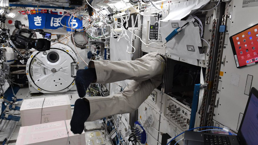
Friday, August 27, 2021: The legs sticking out of the wall of the Japanese Kibo module of the International Space Station belong to Japan's astronaut Akihiko Hoshide. What tasks he was performing with the upper part of his body inside the wall of the orbiting laboratory has not been revealed.
The image was posted on Twitter by Hoshide's colleague, European astronaut Thomas Pesquet on Thursday (Aug 26).
"@Aki_Hoshide is immersed in his work," Pesquet said in a Tweet. "Is it science? Maintenance? Maybe @ESA_CAVES flashbacks?" the Frenchman added, referring to the astronaut training course by the European Space Agency, which sees astronauts live inside a secluded cave system for several weeks in preparation for the isolation aboard the space station. -- Tereza Pultarova
A landslide on Mars captured by Europe's probe

Thursday, August 26, 2021: The European Space Agency's (ESA) ExoMars Trace Gas Orbiter spotted a 3-mile-long (5 km) landslide at the edge of a crater in the Aeolis region on Mars.
The image, taken on April 13, 2021, but only released on August 25, captures a mass of material shorn off the rim of the 22-mile-wide (35 km) crater. However, ESA said in a statement, that the landslide is not recent and it is impossible to accurately date it.
The image shows interesting geomorphological features including flow ridges that extend throughout the length of the landslide. The exact area from where the mass collapsed is not visible in this image.
The ExoMars Trace Gas Orbiter arrived at Mars in 2016 together with the failed Schiaparelli lander. The orbiter's full science mission began in 2018. In addition to its scientific program, it will also provide communication with Earth for the delayed ExoMars Rosalind Franklin Rover, expected to land on the Red Planet in 2023. -- Tereza Pultarova
Pepper plants flower on Space Station
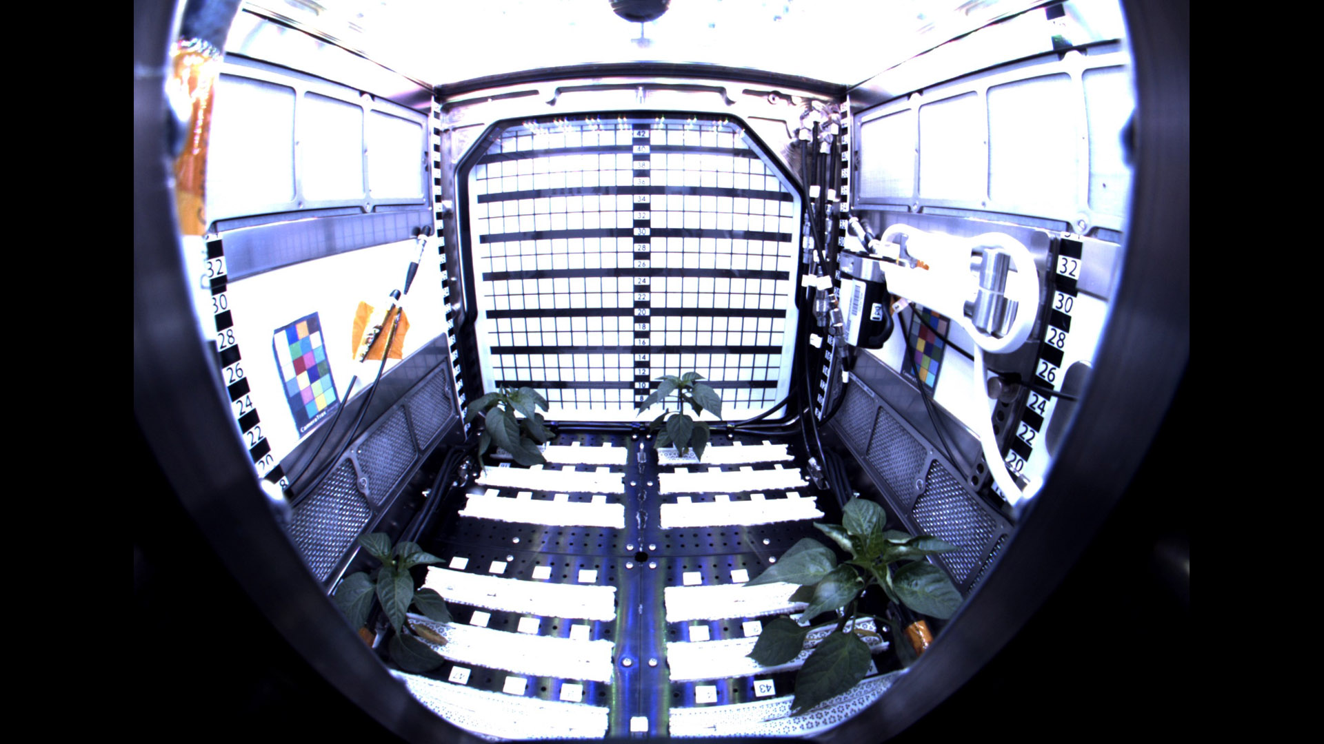
Wednesday, August 25, 2021: Pepper seeds delivered to the International Space Station in early June have grown into plants and recently started flowering, NASA announced on Twitter.
The 48 Hatch chile pepper seeds arrived at the orbital outpost with the SpaceX Dragon CRS-22 commercial resupply mission. Since then they have been growing in baked clay, being fed a fertilizer specially formulated for peppers and released in a controlled way.
The plants, part of the Plant Habitat-04 experiment, are placed inside the Advanced Plant Habitat, the largest of the three plant chambers currently aboard the space station. The plants are now almost ready for pollination. Since there are no bees in space, a special fan installed in the high-tech growing box will take care of the task.
A team of scientists monitors the experiment remotely from Earth, controlling watering, lighting, and other environmental conditions. Hatch chile peppers have been chosen for the experiment because of their nutritional value. Currently, astronauts mostly rely on food with long shelf life that is regularly brought from Earth. Fresh produce is a welcome change in the sometimes dull diet. In future long duration missions, such as trips to Mars, astronauts will have to grow most of their food as regular resupplies will not be possible. -- Tereza Pultarova
Curiosity takes an upside down selfie on Mars
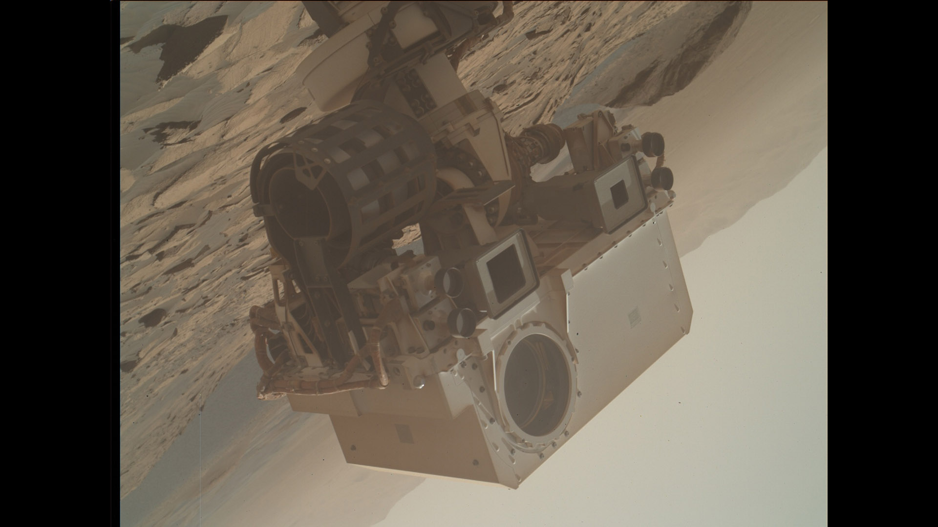
Tuesday, August 24, 2021: NASA's rover Curiosity took this upside down selfie on Mars with a camera attached to the end of its robotic arm.
The selfie, taken on Sunday, August 22, Curiosity's 3,215 sol (Martian day) on the Red Planet, shows the rover as it approaches the Rafael Navarro Mountain in Gale Crater. The Mars Hand Lens Imager (MAHLI) used to acquire this image frequently requires additional illumination by LED panels but this selfie was captured with the sun as the only source of light.
Curiosity is currently examining bedrock in the area, preparing to drill for samples. It also prepares to take images of Mars' moon Phobos, also using the MAHLI imager. -- Tereza Pultarova
Carbon emissions from California wildfires reach record levels
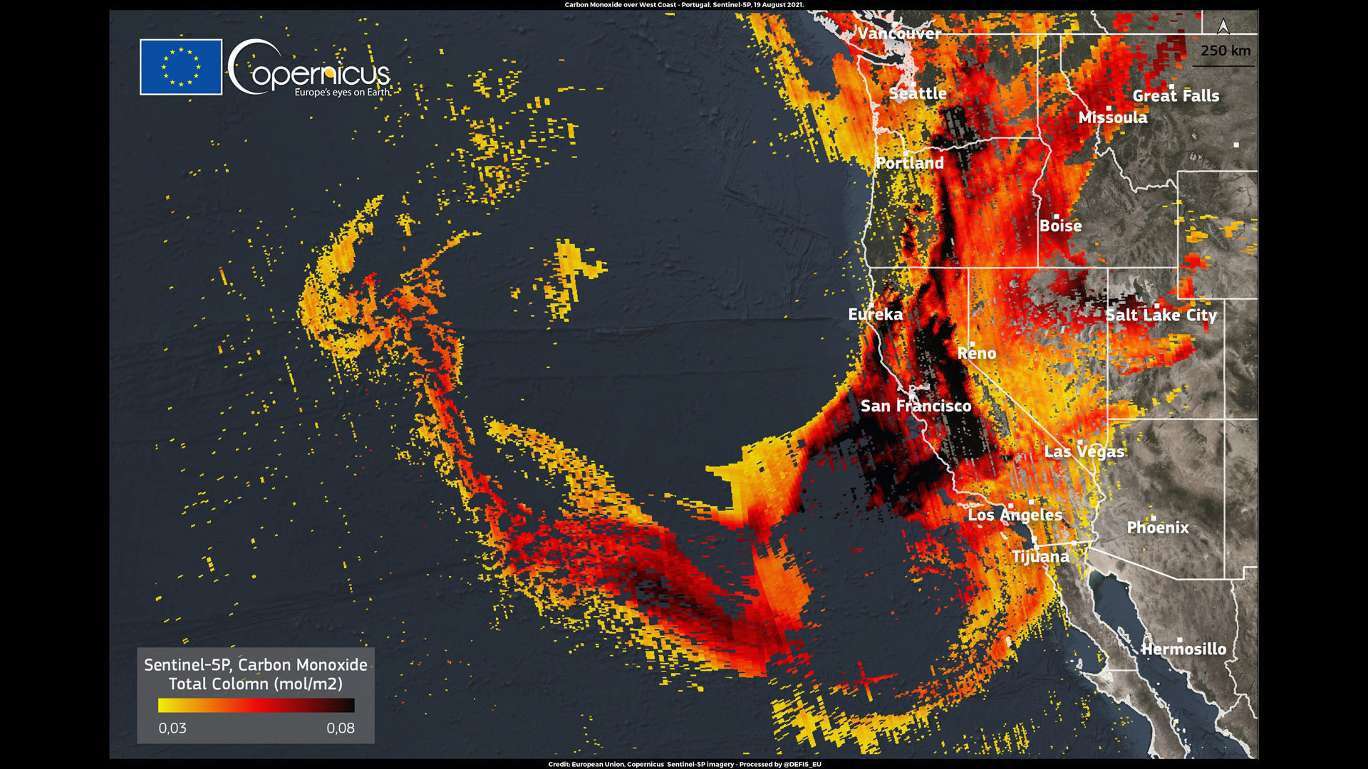
Monday, August 23, 2021: A cloud of carbon monoxide produced by wildfires ravaging California covers an area greater than 1.2 million square miles (3 million square kilometers) in this image based on measurements from the European satellite Sentinel 5P.
According to data from the European Copernicus Atmosphere Monitoring Service, which uses the Sentinel imagery, carbon emissions from the ongoing Californian wildfires are the highest recorded since 2003 for this period of the year.
The satellite’s TROPOspheric Monitoring Instrument (TROPOMI) recorded carbon monoxide concentrations of 0.08 mol/m2 near San Francisco on Friday (Aug 20) as fire crews continued battling multiple blazes in the area.
The Caldor fire, which erupted over a week ago near Lake Tahoe , has devoured about 100,000 acres of land and forest. The Dixie Fire, the worst blaze in California’s history, continues to spread after more than five weeks, fuelled by dry and hot weather. Since July 13, the fire has destroyed nearly 1,800 square miles (3,000 square kilometers) of land and forest. -- Tereza Pultarova
Storm Henri's lightings flicker in a view from space
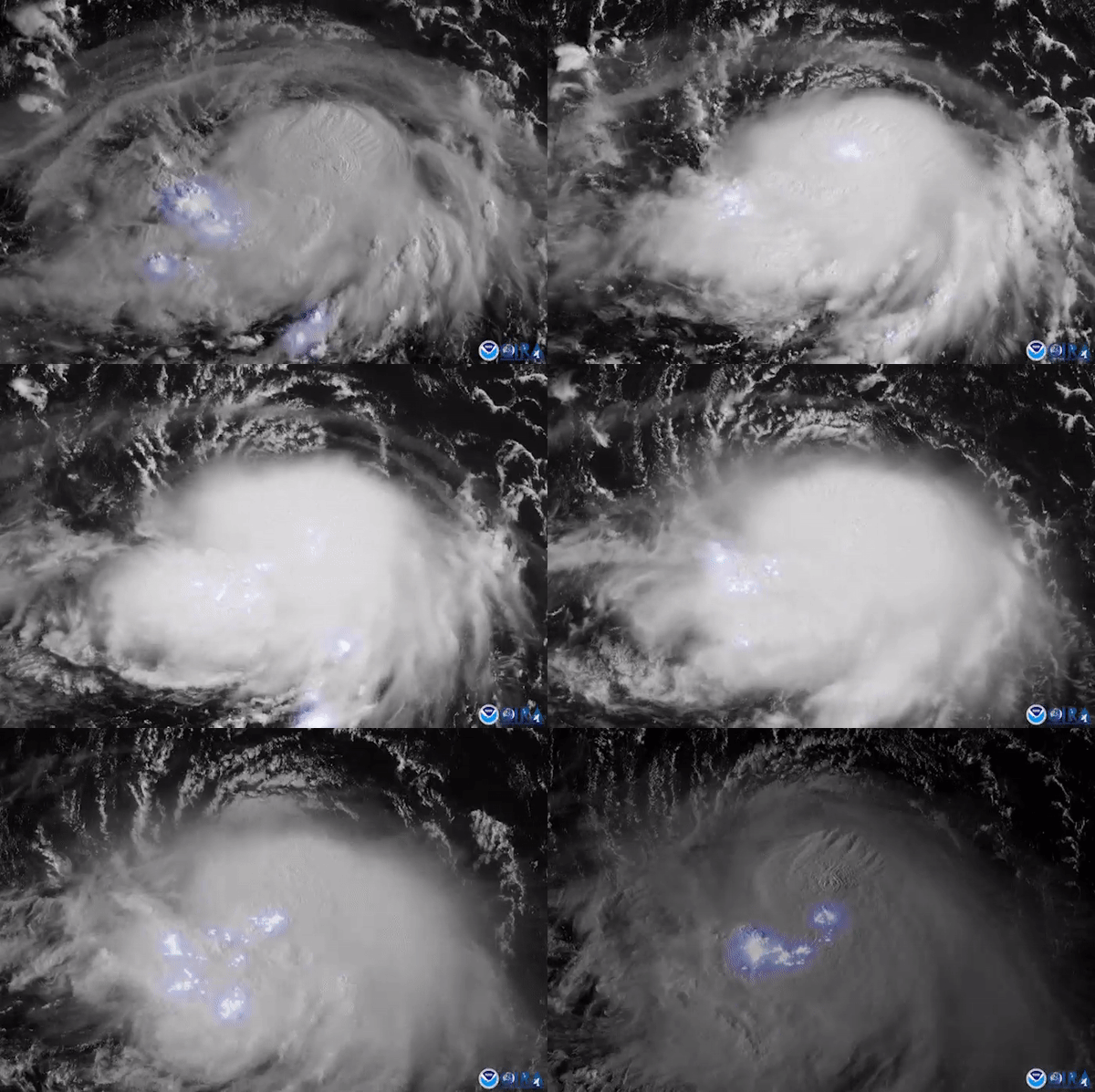
Friday, August 20, 2021: The flickering of lighting produced by the swirling tropical storm Henri can be seen in this video captured by the GOES 16 satellite as the cyclone strengthened above the Atlantic Ocean.
GOES 16, or the Geostationary Operational Environmental Satellite, operated by the U.S. National Oceanic and Atmospheric Organization (NOAA), sits at the altitude of 22,000 miles (36,000 km) above Earth's surface. From this vantage point, the satellite has a stable view over the American continent as its orbital speed matches the rotation of the planet.
GOES 16’s lighting mapper instrument, used to generate this image, can not only detect lightings but also fireballs, according to researchers.
Henri is currently a tropical storm with sustained winds near 65 mph (100 km/h). But NOAA predicts the storm will intensify into a hurricane by Saturday, with wind speeds over 74 mph (120 km/h).
The storm is moving towards the northwest along the U.S. Atlantic coast. It will bring increased swells and rough surf to the area over the upcoming week, according to Accurweather. A storm surge warning is in place for parts of Long Island, NOAA said. -- Tereza Pultarova
James Webb Telescope rocket on its way to launchsite
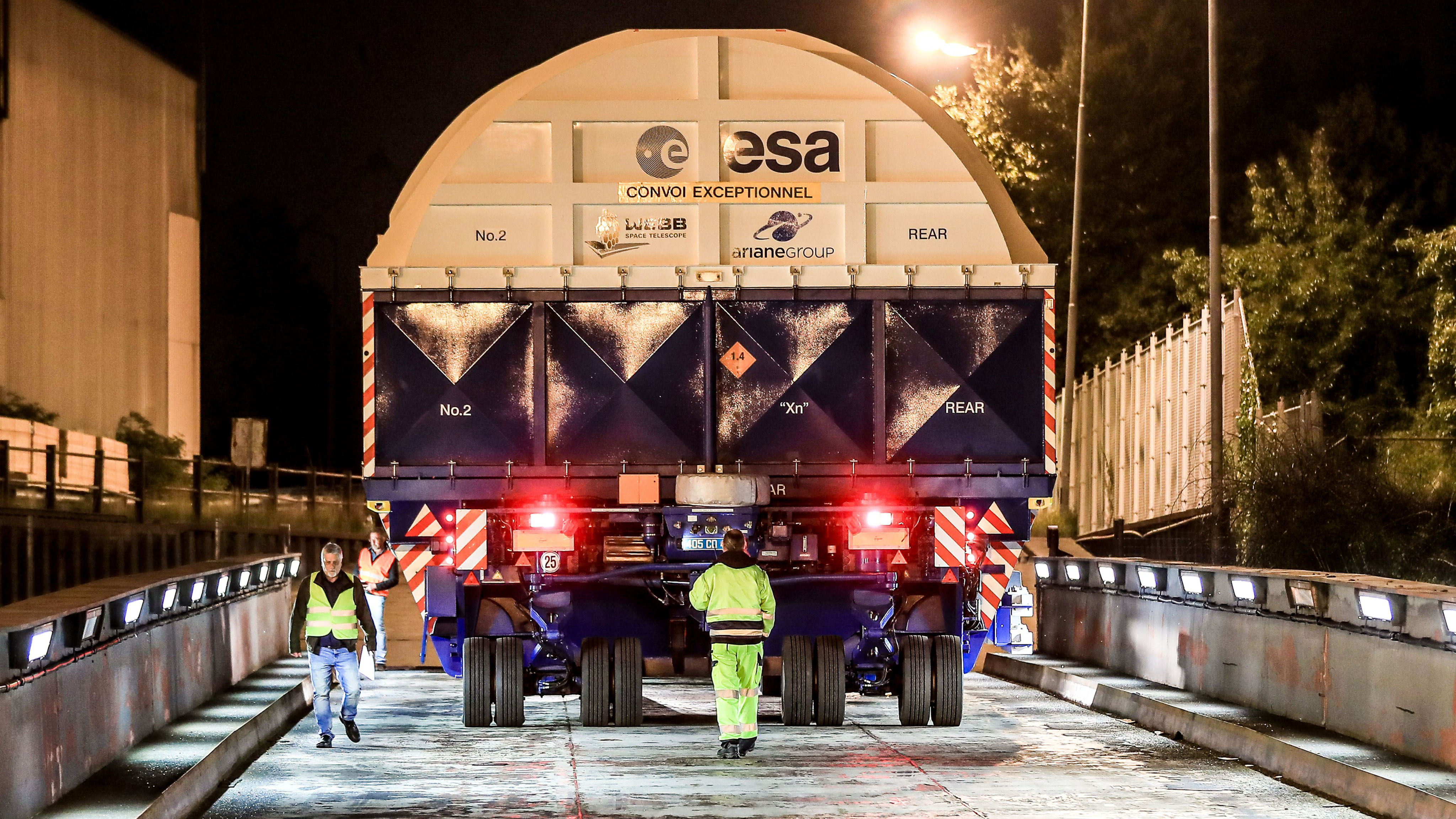
Thursday, August 19, 2021: The upper stage of the Ariane 5 rocket that will deliver the James Webb Telescope to orbit later this year has been dispatched from Germany to Europe’s spaceport in Kourou, French Guiana, to commence launch preparations.
The stage left the premises of Europe’s rocket maker Ariane Group in Bremen, Germany, yesterday night, sealed inside a giant safety container. A large truck delivered the stage to the nearby Neustadt port, where it was loaded onto the MN Toucan cargo vessel.
To be able to launch the 7.1 ton (6,5 metric tonnes) James Webb, the largest and most powerful telescope to be put to space, the rocket required modifications to its fairing, which were carried out in cooperation with the European Space Agency. -- Tereza Pultarova
European antenna network captures most detailed images of distant galaxies
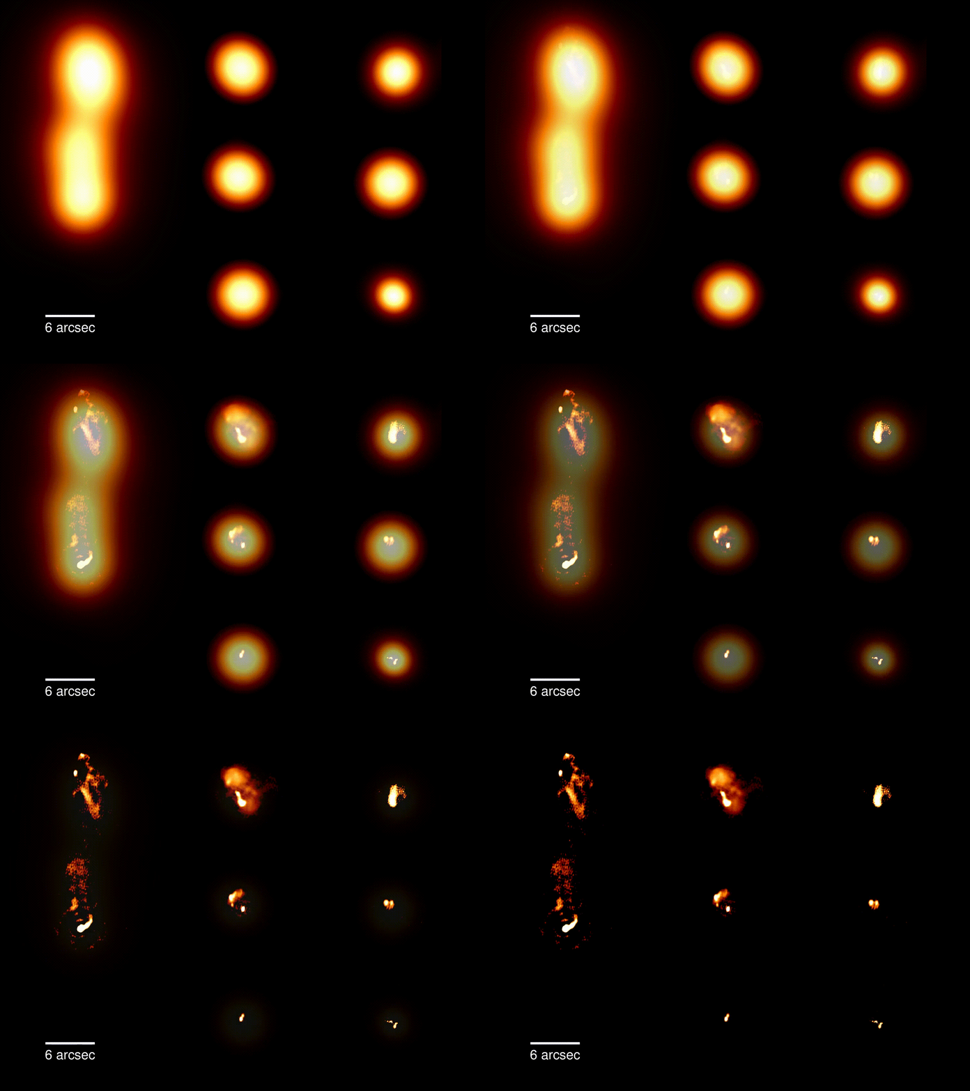
Wednesday, August 18, 2021: European astronomers have obtained the most detailed radio images of distant galaxies ever using a network of 70,000 radio antennas spread across nine European countries.
The GIF above shows the difference between the standard resolution images of galaxies obtained by the network, called Low Frequency Array (LOFAR), and the new high resolution images.
The images, published in a special edition of the journal Astronomy & Astrophysics, are a product of almost a decade of work. They show the Universe invisible to the human eye. By focusing on the radio emissions of celestial objects, they circumvent the dust and gas clouds that obscure the view of optical telescopes.
The LOFAR network, managed by the Netherlands Institute for Radio Astronomy, detects low frequency radio signals that are then digitised and combined into a single image. LOFAR usually uses only antennas located in the Netherlands. But for the purposes of the new study, the astronomers included antennas in other European countries, which enabled them to increase the diameter of the virtual telescope to almost 1,240 miles (2,000 kilometers). By doing that, they achieved a twenty-fold improvement in the resolution of the images.
The images reveal the inner workings of galaxies including the black holes that lurk at their centers.
“These high resolution images allow us to zoom in to see what’s really going on when supermassive black holes launch radio jets, which wasn’t possible before at frequencies near the FM radio band,” Neal Jackson of The University of Manchester, one of the astronomers working on the project, said in a statement. -- Tereza Pultarova
Fake lunar regolith helps NASA to prepare for moon landing
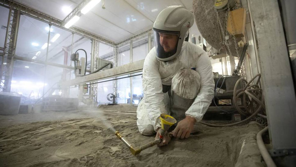
Tuesday, August 17, 2021: Engineers at NASA’s Kennedy Space Center are preparing simulated lunar regolith for experiments that will help predict the behaviour of rocket engines during a moon landing.
Rocket engines help a lander to decelerate as it approaches the lunar surface. The flow of material from the engine, however, will stir up a large amount of dust, which might cause various problems, for example due to reduced visibility. NASA engineers therefore want to understand precisely what to expect during a future lunar landing to make the process safe.
Lunar regolith is different from sand and dust that can be found on Earth as it has been spared the effects of weathering. It is therefore much more abrasive with sharp edges and corners.
The NASA team is using a lunar regolith simulant made of volcanic material from the Black Point lava flow in northern Arizona.
120 tons of the regolith simulant are required to fill the Granular Mechanics and Regolith Operations (GMRO) lab at Kennedy, also dubbed ‘the big bin’. In this image, NASA Kennedy Space Center researcher Austin Langton creates a fine spray of the regolith simulant to perform testing with a Millimeter Wave Doppler Radar. -- Tereza Pultarova
Smoke from record-breaking wildfires in Siberia reaches Alaska
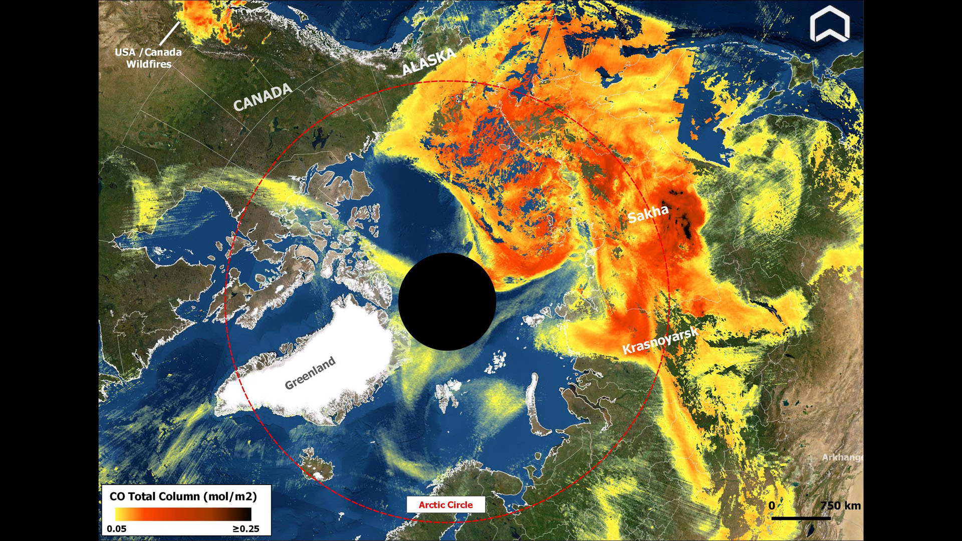
Monday, August 16, 2021: Smoke from wildfires in Siberia has been detected crossing the Arctic Ocean and reaching Alaska over the weekend.
The image, taken on Saturday (Aug 14) by the European Sentinel 5P satellite, shows the massive plume of carbon monoxide emissions (in red and yellow) covering almost a quarter of the area within the Arctic Circle.
Emissions from wildfires in California and Canada can also be seen in the image (the red-yellow spot in the upper left corner).
According to Mark Parrington, senior scientists at the European Copernicus Atmosphere Monitoring Service, high concentrations of carbon monoxide from the wildfires have been detected at altitudes of more than 3 miles (5 kilometers) as the smoke circulated around the North Pole.
Record-breaking wildfires have been raging in Siberia since late spring this year. Last week, scientists revealed that the carbon dioxide emissions generated by those wildfires have already broken records set in 2020. The largely uncontained wildfires in the northeast of Russia have this year already produced as much of the climate-warming greenhouse gas as the biggest European polluters produce in a year. --Tereza Pultarova
Solar Orbiter sends postcard from Venus

Friday, August 13, 2021: Sun-exploring spacecraft Solar Orbiter has captured this video of a glowing crescent of Venus as it flew past the planet at a distance of 4,967 miles (7,995 kilometers) during a gravity-assist flyby on Monday (Aug 9).
Solar Orbiter, a joint mission of the European Space Agency (ESA) and NASA, will take the closest ever images of the star at the center of the solar system and provide the first ever detailed look at its poles. To get to its desired orbit, which will take it as close as 42 million kilometers from the sun's surface (about a quarter of the sun-Earth distance), the spacecraft has to perform multiple gravity-assist maneuvers, harnessing the gravitational pull of planets to adjust its trajectory.
The Monday flyby took place only a day before another inner-solar-system explorer zipped by the boiling, cloudy planet. On Tuesday (Aug 10), the Mercury-bound BepiColombo, a joint mission of ESA and the Japan Aerospace Exploration Agency (JAXA), passed Venus at a distance of only 340 miles (550 kilometers).
The Solar Orbiter video was taken with its Heliospheric Imager, or SoloHI. Just like BepiColombo's selfie cameras, SoloHI, too, struggled with the extreme brightness of Venus.
"Ideally, we would have been able to resolve some features on the nightside of the planet, but there was just too much signal from the dayside," Phillip Hess, astrophysicist at the Naval Research Laboratory in Washington, D.C., said in a statement. "Only a sliver of the dayside appears in the images, but it reflects enough sunlight to cause the bright crescent and the diffracted rays that seem to come from the surface."
Early in the sequence, the stars Omicron Tauri (on the right) and Xi Tauri (on the left), both part of the Taurus constellation, pass through SoloHI's view.
The Monday flyby was already the second at Venus for Solar Orbiter. The spacecraft will revisit the planet regularly between 2022 and 2030 when its operators will use Venus’ gravity to tilt the spacecraft’s orbit out of the ecliptic plane (in which planets orbit), to enable it to view the star’s poles. -- Tereza Pultarova
NASA photographer snaps peaking Perseid meteor shower
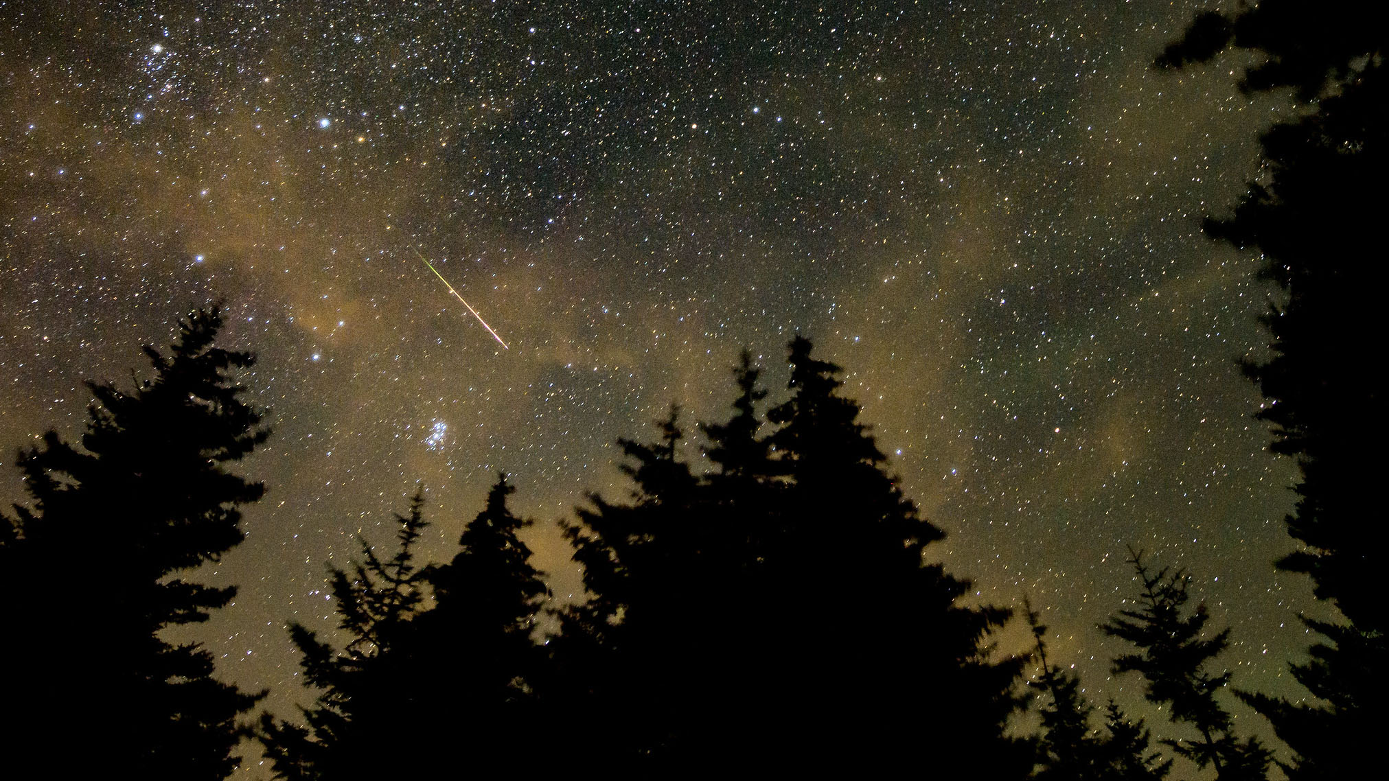
Thursday, August 12, 2021: NASA photographer Bill Ingalls captured this image of a meteor streaking across the starry night sky during the peak of the annual Perseid meteor shower on Wednesday, August 11.
Ingalls took the image from Spruce Knob, West Virginia, with a Nikon D6 camera using a 30 second exposure.
The Perseid meteor shower takes place every year in August when Earth passes through the trail of comet Swift-Tuttle. The meteors providing the celestial spectacle are debris shed by the comet.
First Perseids could be observed as early as mid-July but the shower peaks in the second week of August. This year, the highest intensity of meteor streaks occurs on the mornings of August 11, 12 and 13. The experience could be especially rewarding as the moon has just passed its new phase and won’t be outshining the shooting stars. In years without moonlight, observers can see higher rates of meteors per hour. -- Tereza Pultarova
Spacecraft snaps selfie with Venus en route to Mercury

Wednesday, August 11, 2021: A spacecraft en route to Mercury has snapped a selfie with Venus during a close flyby performed to slow it down before it reaches its destination.
BepiColombo, a joint European/Japanese mission, is only the second spacecraft in history designed to orbit Mercury, the smallest and innermost planet of the solar system. To get to its destination, BepiColombo has to follow a complicated trajectory involving nine flyby maneuvers (one at Earth, two at Venus and six at Mercury itself). These maneuvers will enable the spacecraft, which consists of two satellites that will orbit Mercury separately, to eventually approach the planet in the desired way.
The flyby on August 10 was the second at Venus and took Bepi Colombo as close as 340 miles (552 kilometers) to the surface of the planet. This image was taken after the closest approach when the spacecraft was 977 miles (1,573 km) away from Venus.
BepiColombo used one of its three black and white monitoring cameras, which provide a resolution of 1024 x 1024 pixels, to capture the image. The satellite, named after Italian physicist Giuseppe (Bepi) Colombo, will get its first glimpse of Mercury this October when it will perform the first of its six flyby maneuvers at the scorched rocky planet. The last spacecraft to image Mercury was NASA’s Messenger, which orbited the planet between 2011 and 2015.
Scientists behind the mission hope the two new orbiters, fitted with a combined 16 high-tech scientific instruments, will shed light on some of the most mind-boggling mysteries of Mercury. For example, whether it really has water in its polar craters. -- Tereza Pultarova
Astronauts treated to mesmerizing aurora displays
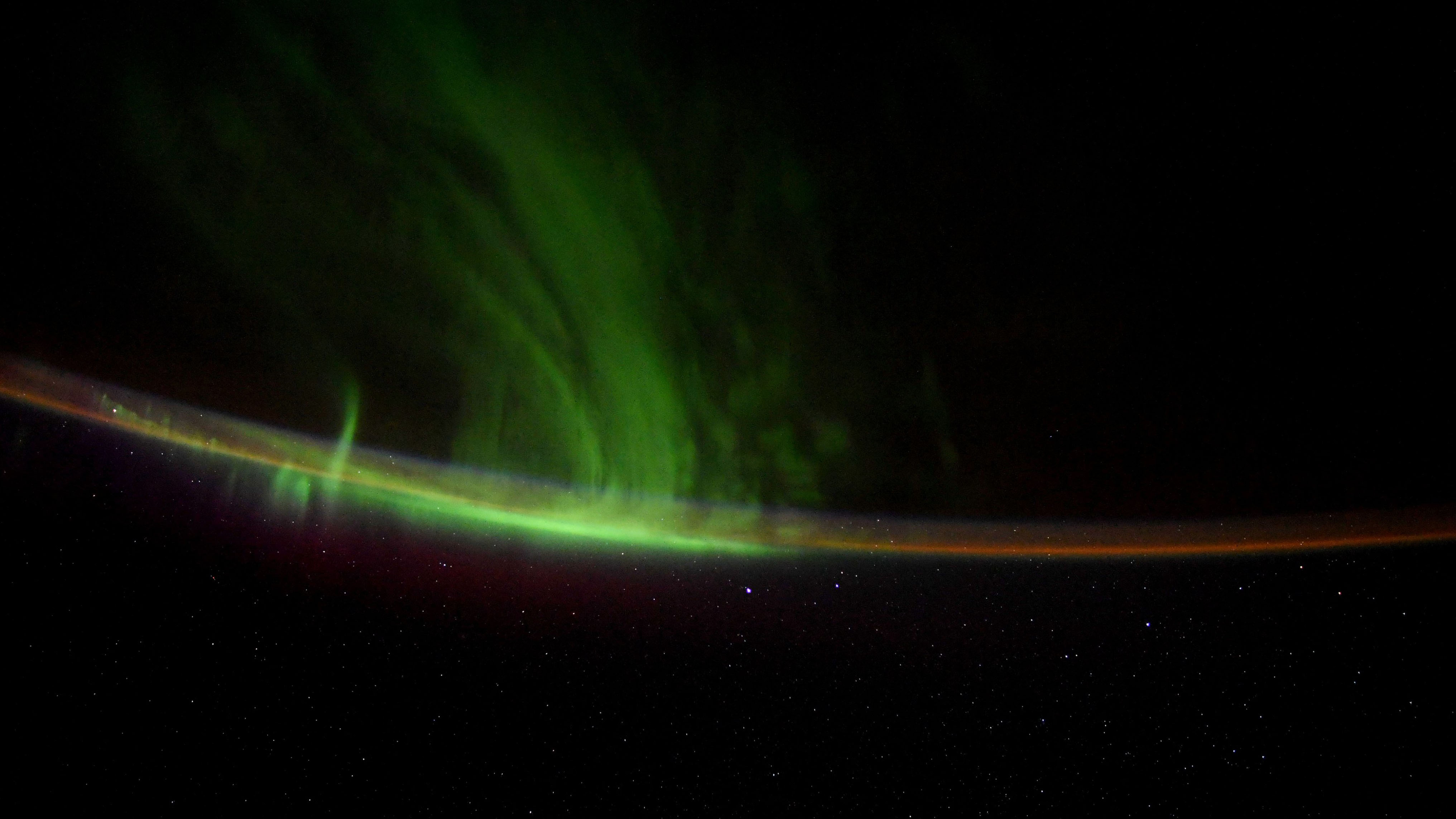
Tuesday, August 10, 2021: Astronauts and cosmonauts on the International Space Station get to enjoy some really unique views. The sightings of aurora australis (the southern lights) and aurora borealis (the northern lights) are very rare for Earth-bound humans. But the occupants of the orbital outpost get treated to those mesmerizing displays fairly regularly.
On Monday, August 9, NASA astronaut Shane Kimbrough shared a photograph of auroras captured from the International Space Station over the weekend.
“Magical aurora sightings this weekend from @Space_Station,” Kimbrough tweeted. “The white dots on the bottom half of the pic are stars – millions of them!”
Auroras, also called polar lights, occur in the sky at high latitudes around the Arctic and Antarctica as a result of the interaction between Earth’s magnetosphere and solar wind, charged particles emitted by the sun during solar flares and eruptions. -- Tereza Pultarova
Fire ravages Greek island amid worst heatwave in three decades
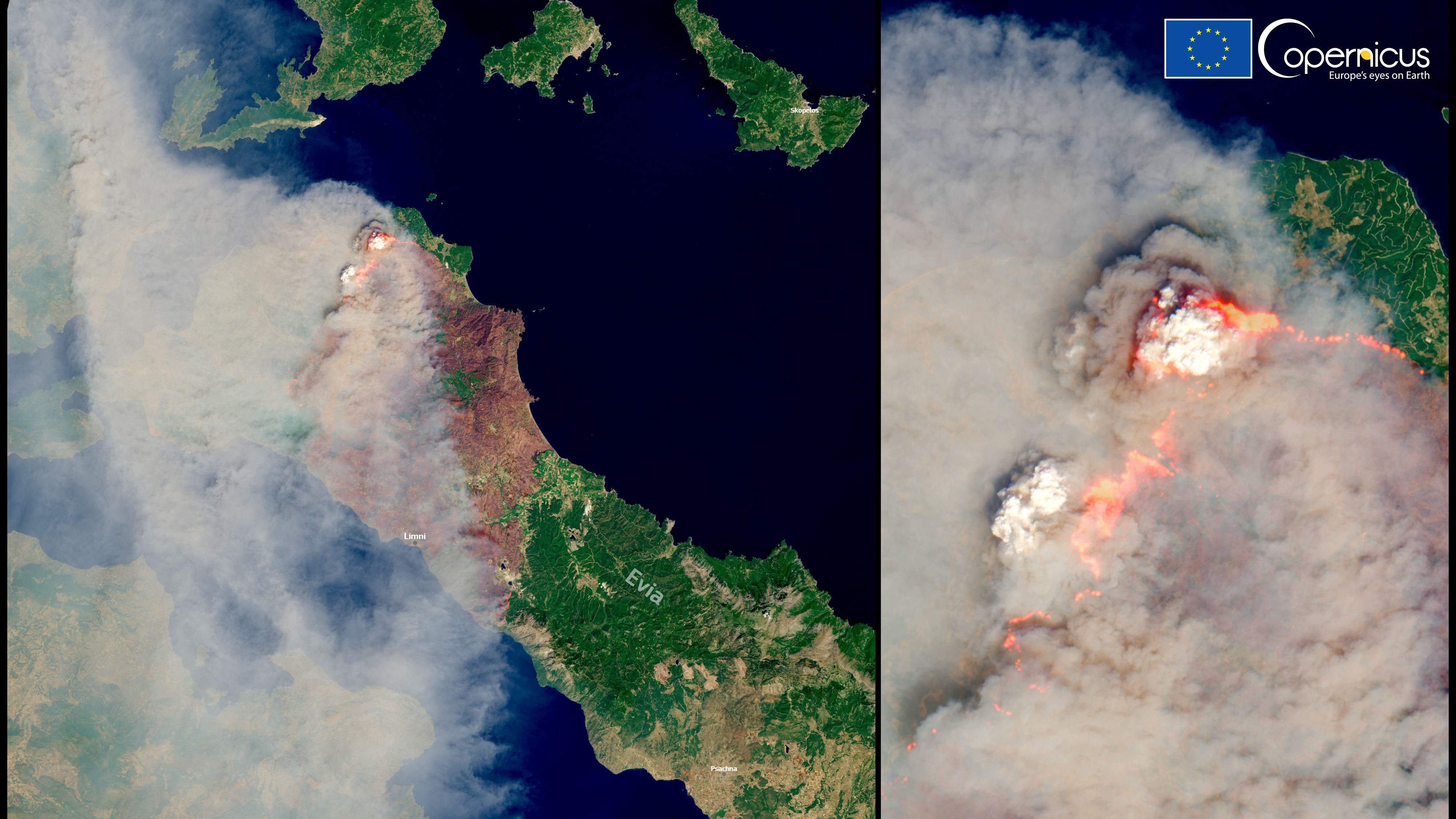
Monday, August 9, 2021: Europe’s Sentinel-2 satellite captured a massive wildfire ravaging the Greek island of Evia on Sunday, August 8, which broke out amid the worst heatwave in 30 years.
The Evia fire is currently the worst of dozens raging across the Mediterranean country, having forced the evacuation of more than 2,000 people. Located about 60 miles (100 kilometers) away from the country’s capital Athens, Evia is Greece’s second largest island and a popular holiday destination.
The fire, which broke out on Tuesday (August 3), is still out of control despite a nearly week-long fire-fighting effort.
The thick plume of smoke, visible in this image, is contributing to worsening air quality in the region. The Copernicus Atmosphere Monitoring Service (CAMS) reported that concentrations of dangerous PM2.5 particles, which can penetrate deep into human lungs, are increasing as a result of the wildfires. Moreover, CAMS said, carbon emissions generated by wildfires in Greece are their highest in 13 years.
The Mediterranean region has been suffering from extreme heat for weeks. In Greece, temperatures have soared to 115 degrees Fahrenheit (45 degrees Celsius), but some areas in Turkey and Cyprus have reported even higher temperatures, over 120 degrees F (50 degrees C). Turkey is also battling wildfires, which have been described as the worst in at least a decade.
The Mediterranean wildfires are only the latest disaster in what has been a summer of extreme weather events worldwide. According to the Sixth Assessment Report by the United Nations’ Intergovernmental Panel on Climate Change (IPCC), the situation is only bound to get worse in the coming years. Released today, the report states that some of the most extreme weather events that in the past would occur only once in a century, could soon come as often as once a year. The report, however, suggests that humankind still has time to act and reduce greenhouse gas emissions to levels that would prevent further dangerous warming and its consequences. It could, however, take 20 to30 years to see global temperatures stabilize, the IPCC said. -- Tereza Pultarova
A trio of Martian craters
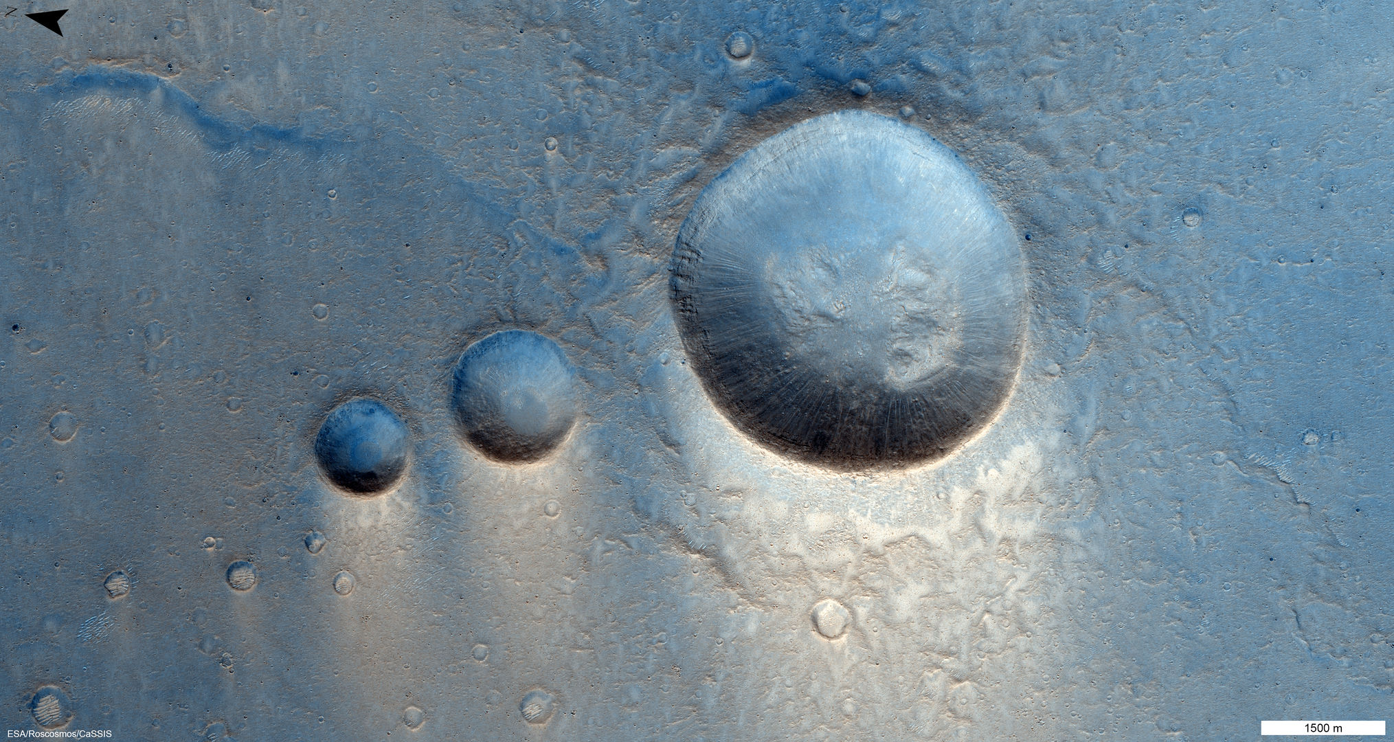
Friday, Aug. 6, 2021: In this image, snapped March 22, 2021 by the CaSSIS camera on the ESA-Roscosmos ExoMars Trace Gas Orbiter (TGO), you can see a trio of Martian craters in the Lunae Planum region on the Red Planet.
This area on Mars is covered in lava deposits from, scientists think, the nearby Tharsis Montes volcanoes. These three impact craters are surrounded by what appear to be much smaller impact craters.
A triplet galactic system
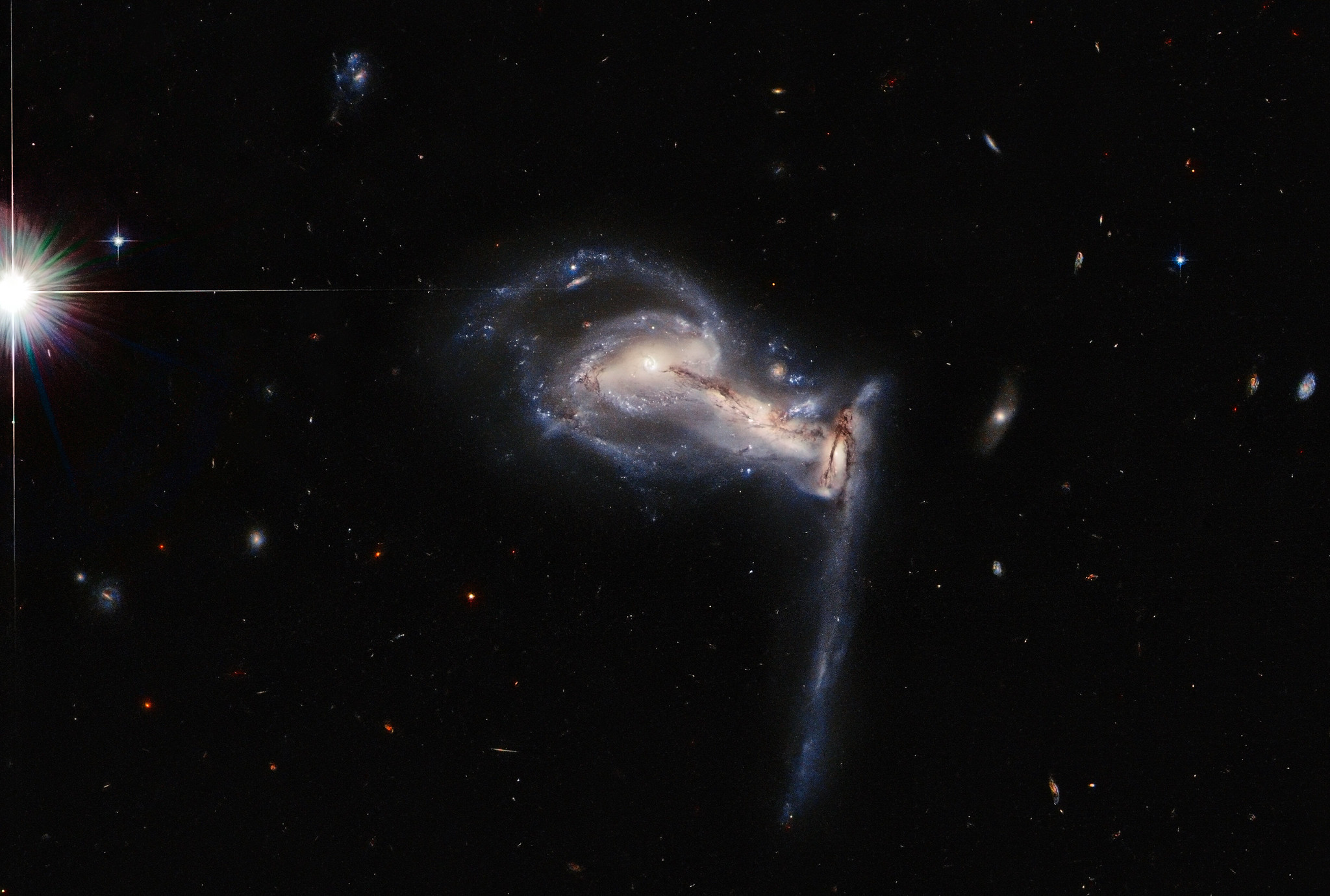
Thursday, Aug. 5, 2021: In this image captured by the Hubble Space Telescope, you can see a trio of galaxies, a system known as Arp 195, that is helping scientists to better understand the cosmos.
By snapping this image of this system, as it encompasses three different galaxies all tugging back and forth with one another using gravitational forces, astronomers hope to identify even more interesting points in space to study using Hubble in the future, according to NASA.
Exploring Kennedy
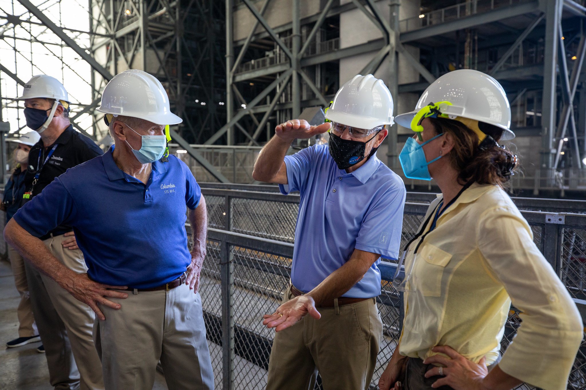
Tuesday, Aug. 3, 2021: (From left to right), NASA Administrator Bill Nelson, associate administrator Bob Cabana and NASA chief of staff Susie Perez Quinn tour the Vehicle Assembly Building (VAB) at NASA's Kennedy Space Center in Florida. The trio visited the agency's Space Launch System (SLS) megarocket as they prepare for the first launch of the Artemis program, which aims to return humans to the lunar surface.
Today, at Space Launch Complex 41, NASA's Commercial Crew Program partner Boeing was set to launch its Starliner spacecraft on the uncrewed OFT-2 test flight. However, an issue with valve placement within the craft's propulsion system caused the flight to be delayed. The next available launch date is tomorrow (Aug. 4). -- Chelsea Gohd
Starliner gets ready to launch ... again

Monday, Aug. 2, 2021: Last Thursday (July 29), Boeing's Starliner spacecraft rolled out to the Space Launch Complex 41 launch pad atop a United Launch Alliance (ULA) Atlas V rocket. The launch, which was set to take place on Friday (July 30), ended up being delayed to Tuesday (Aug. 3) because of ongoing concerns with Roscosmos' Nauka module that made an unplanned thruster firing after docking with the International Space Station Thursday morning.
Now, after this delay, Starliner and the Atlas V it will ride to space are rolling back out to prepare for launch, which is now set for Tuesday at 1:20 p.m. EDT (1720 GMT). -- Chelsea Gohd
Can't find the date you're looking for? It may have been a weekend or holiday, when we don't normally update our Image of the Day.
Click 'NEXT PAGE' below for September >
Check out our Image of the Day Archives for more awesome photos.
Image of the Day 2023 Archive
Image of the Day 2022 Archive
Image of the Day 2021 Archive
Image of the Day 2020 Archive
Image of the Day 2019 Archive
Join our Space Forums to keep talking space on the latest missions, night sky and more! And if you have a news tip, correction or comment, let us know at: community@space.com.
Space.com is the premier source of space exploration, innovation and astronomy news, chronicling (and celebrating) humanity's ongoing expansion across the final frontier. Originally founded in 1999, Space.com is, and always has been, the passion of writers and editors who are space fans and also trained journalists. Our current news team consists of Editor-in-Chief Tariq Malik; Editor Hanneke Weitering, Senior Space Writer Mike Wall; Senior Writer Meghan Bartels; Senior Writer Chelsea Gohd, Senior Writer Tereza Pultarova and Staff Writer Alexander Cox, focusing on e-commerce. Senior Producer Steve Spaleta oversees our space videos, with Diana Whitcroft as our Social Media Editor.
