Landsat 9 has opened its eyes.
The next-generation Earth-observation satellite, which launched on Sept. 27, snapped its first photos of our planet on Oct. 31, NASA and the U.S. Geological Survey (USGS) announced on Friday (Nov. 5).
The two agencies, which work together on Landsat 9, have released the initial imagery. It depicts the Florida Panhandle; Detroit and its surrounding area; Navajo Country in northern Arizona; the high Himalayas; and the Kimberley region of Western Australia.
In photos: NASA launches Landsat 9 Earth observation satellite
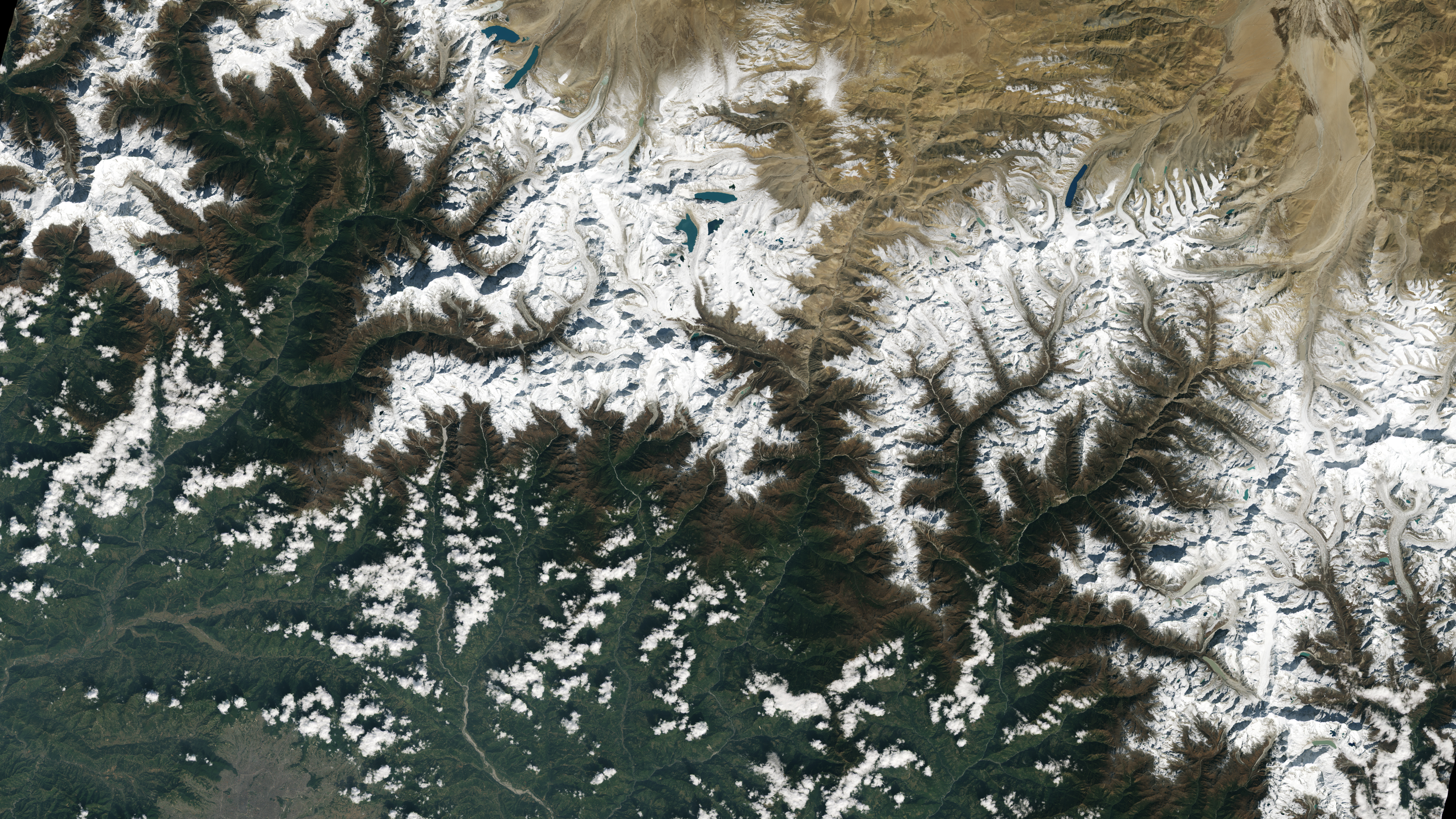
"Landsat 9's first images capture critical observations about our changing planet and will advance this joint mission of NASA and the U.S. Geological Survey that provides critical data about Earth's landscapes and coastlines seen from space," NASA Administrator Bill Nelson said in a statement.
"This program has the proven power to not only improve lives but also save lives," Nelson added. "NASA will continue to work with USGS to strengthen and improve accessibility to Landsat data so decision makers in America — and around the world — better understand the devastation of the climate crisis, manage agricultural practices, preserve precious resources and respond more effectively to natural disasters.”
As its name suggests, Landsat 9 is the ninth satellite in the Landsat program, which has been studying our planet from orbit since 1972. It's just the eighth to reach orbit, however; Landsat 6 was lost to a launch failure in 1993.
Get the Space.com Newsletter
Breaking space news, the latest updates on rocket launches, skywatching events and more!

Landsat 9 will work together with the similar Landsat 8, which launched in 2013, to image the entire Earth once every eight days. The new satellite is replacing the aging Landsat 7, which lifted off in 1999. And this is a big upgrade. For example, Landsat 9 can differentiate more than 16,000 shades of a given color of light, compared to just 256 for Landsat 7, NASA officials said.
Landsat 9 has two Earth-imaging instruments. One detects thermal radiation, which will allow researchers to track surface temperatures, and the other picks up visible, near-infrared and shortwave-infrared light in nine different wavelengths, NASA officials said.

NASA is currently checking out Landsat 9 and its instruments, systems and subsystems, a process expected to take 100 days. In January, the space agency will hand mission operations over to the USGS, which will make the satellite's images freely available to the public at its Landsat website.
"The data and images from Landsat 9 are expanding our capability to see how Earth has changed over decades," Karen St. Germain, director of NASA's Earth Science Division, said in the same statement. "In a changing climate, continuous and free access to Landsat data, and the other data in NASA's Earth observing fleet, helps data users, including city planners, farmers and scientists, plan for the future."
Mike Wall is the author of "Out There" (Grand Central Publishing, 2018; illustrated by Karl Tate), a book about the search for alien life. Follow him on Twitter @michaeldwall. Follow us on Twitter @Spacedotcom or Facebook.
Join our Space Forums to keep talking space on the latest missions, night sky and more! And if you have a news tip, correction or comment, let us know at: community@space.com.

Michael Wall is a Senior Space Writer with Space.com and joined the team in 2010. He primarily covers exoplanets, spaceflight and military space, but has been known to dabble in the space art beat. His book about the search for alien life, "Out There," was published on Nov. 13, 2018. Before becoming a science writer, Michael worked as a herpetologist and wildlife biologist. He has a Ph.D. in evolutionary biology from the University of Sydney, Australia, a bachelor's degree from the University of Arizona, and a graduate certificate in science writing from the University of California, Santa Cruz. To find out what his latest project is, you can follow Michael on Twitter.

