Meet 'The Blobs': Two Continent-Size Mountains in Earth's Deep Mantle That Nobody Understands
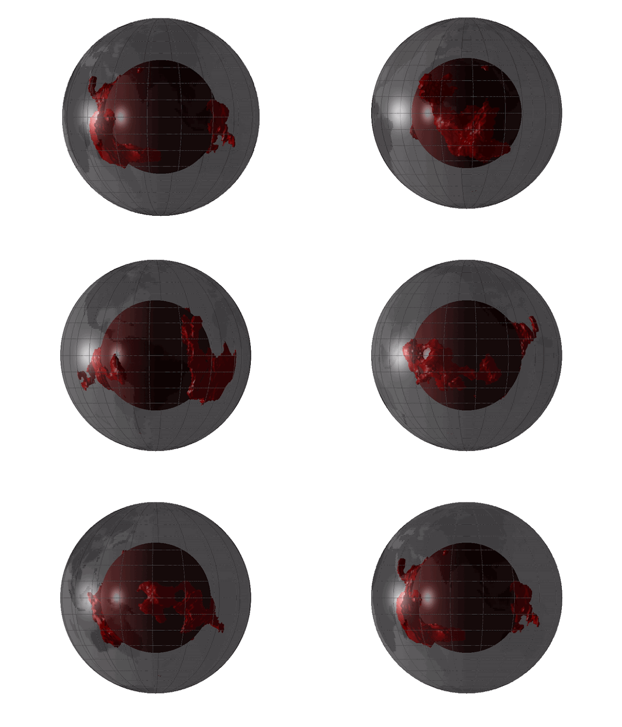
About halfway between your feet and the center of Earth, two continent-size mountains of hot, compressed rock pierce the gut of the planet — and scientists know almost nothing about them.
Technically, these mysterious hunks of rock are called "large low-shear-velocity provinces" (LLSVPs), because seismic waves shuddering through Earth always slow down when passing through these structures.
A mesmerizing image, featured in an article on Eos (the official news site of the American Geophysical Union, or AGU), gives us one of the most detailed views yet of these rocky anomalies — which most scientists simply call "the blobs." [Earth's 8 Biggest Mysteries]
Geophysicists have known about the blobs since the 1970s but aren't much closer to understanding them today.
"They're among the largest things inside the Earth," University of Maryland geologist Ved Lekic told Eos reporter Jenessa Duncombe, "and yet we literally don't know what they are, where they came from, how long they've been around, or what they do."
This much is evident: The blobs begin thousands of miles below Earth's surface, where the planet's rocky lower mantle meets the molten outer core. One blob lurks deep below the Pacific Ocean, the other beneath Africa and parts of the Atlantic. Both are massive, stabbing up about halfway through the mantle and measuring as long as continents. According to Duncombe, each blob stretches about 100 times higher than Mount Everest; if they sat on the planet's surface, the International Space Station would have to navigate around them.
To get a better sense of their shape and scale, take a look at the stunning 3D map of the blobs that Lekic and University of Cambridge seismologist Sanne Cottaar created in 2016 (shown above). The blobs' vast, cascading plains have been likened to mountains of sand or interconnected pits of gravel, Duncombe wrote, but whether they're lower- or higher-density than the surrounding mantle remains a point of contention among scientists.
Get the Space.com Newsletter
Breaking space news, the latest updates on rocket launches, skywatching events and more!
Equally mysterious is how, if at all, the blobs affect geological functions such as plate tectonics and volcanism. A more recent map of the structures, presented by University of Oxford doctoral student Maria Tsekhmistrenko at the 2018 annual meeting of the AGU, suggests that the tips of the blobs might branch into plumes of hot material that brush up against volcanic hotspots just below Earth's surface. What does this mean? Nobody knows. It may take many more decades to better understand the enigma near the heart of our planet. Luckily, the blobs don't seem to be going anywhere.
You can read Duncombe's article here.
- Earth Quiz: Mysteries of the Blue Marble
- The World's Weirdest Geological Formations
- 7 Ways Earth Changes in the Blink of an Eye
Originally published on Live Science.
Join our Space Forums to keep talking space on the latest missions, night sky and more! And if you have a news tip, correction or comment, let us know at: community@space.com.

Brandon has been a senior writer at Live Science since 2017, and was formerly a staff writer and editor at Reader's Digest magazine. His writing has appeared in The Washington Post, CBS.com, the Richard Dawkins Foundation website and other outlets. He holds a bachelor's degree in creative writing from the University of Arizona, with minors in journalism and media arts. He enjoys writing most about space, geoscience and the mysteries of the universe.

