In Australia, Rain Falls, But Wildfires Expected to Intensify, NASA Says
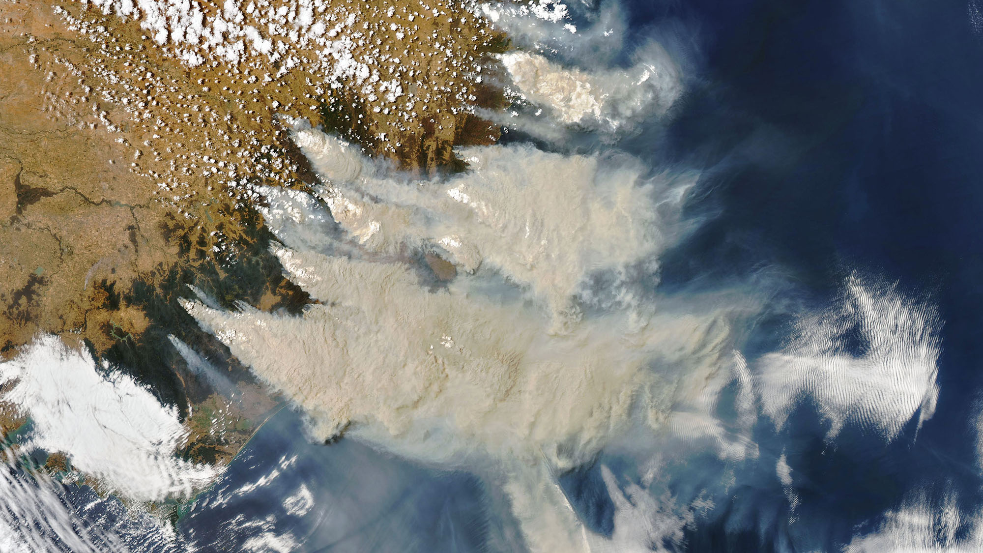
Rain passed over southeastern Australia on Sunday (Jan. 5), offering a brief moment of relief from the deadly wildfires that have been raging across the continent for months.
NASA satellites have been tracking the widespread fires from space, watching as smoke and aerosols spread across areas of New South Wales and Victoria. While the rain gave residents in the area a moment to regroup, the fires are expected to quickly regain their strength by Thursday (Jan. 9), when forecasters predict hot, dry weather and winds will return, according to a statement from NASA.
Forecasters have also warned that haze and smoke in the area remain hazardous after the rainstorm. When the hot winds return, there is also a chance that the fires could grow and merge, creating "mega-fires" that would further devastate the area, according to the statement.
Related: Australia's Deadly Wildfires in Photos: The View from Space
Before the rainfall, satellites captured images of burning fires and billowing smoke on Jan. 4. The image shows three distinct plumes of smoke rising from the fires. The Ozone Mapping and Profiler Suite (OMPS) instrument on the Suomi NPP satellite, which is jointly operated by NASA and the National Oceanic and Atmospheric Administration (NOAA), also observed the area and recorded massive amounts of particles within the smoke. The satellite data revealed traces of soot, dust, and aerosols at or above the highest levels that the OMPS instrument can measure, according to the statement.
The Moderate Resolution Imaging Spectroradiometer (MODIS) instrument on NASA's Aqua satellite also captured a detailed view of smoke plumes as they obscured much of the country's southeastern coast on Jan. 4.
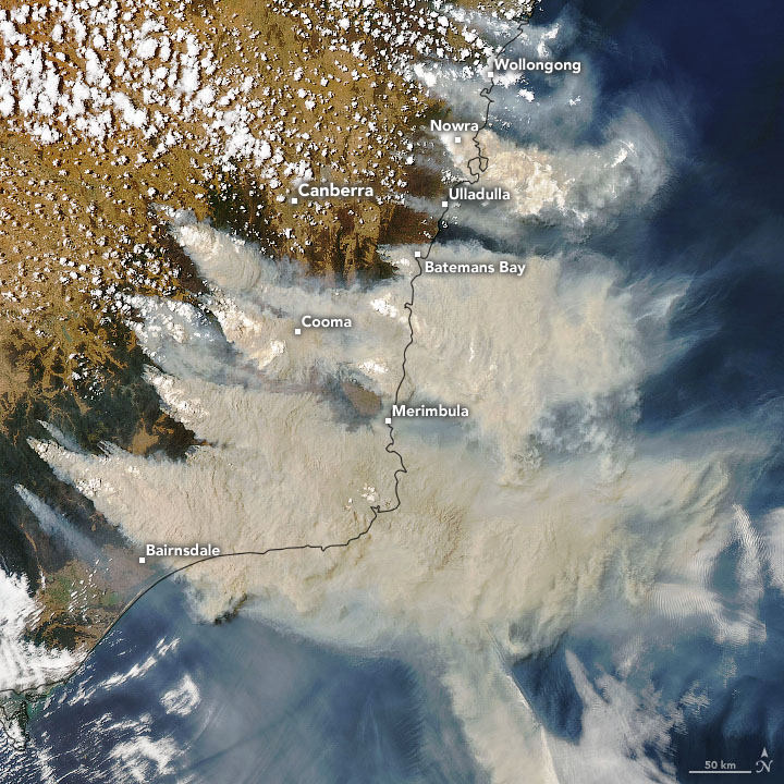
In the image, the clouds are bright white, while the smoke appears to have a tan color and is trailing off to the east. The white patches of clouds above the smoke are believed to be pyrocumulonimbus clouds, which are created by heat rising from the fires below, according to a statement from NASA Earth Observatory.
Get the Space.com Newsletter
Breaking space news, the latest updates on rocket launches, skywatching events and more!
Data from the MODIS instrument also suggests that strong wind currents have started to carry clouds of smoke toward the neighboring country of New Zealand, which is just over a thousand miles away. Images from Jan. 5 captured the tan clouds as they moved eastward.
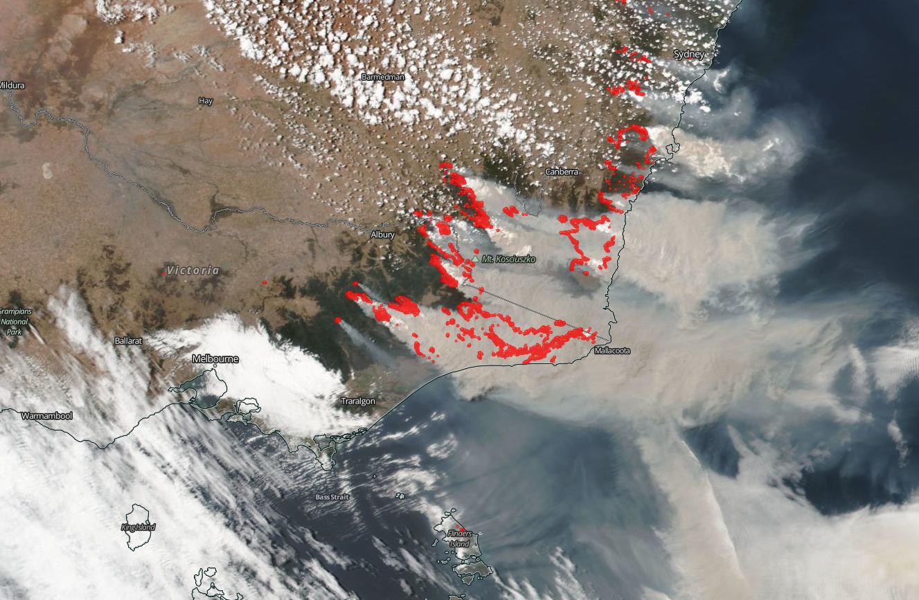
"The skies over New Zealand, once clear, are now turning a very dangerous orange hue and by Sunday, Jan. 5, the sun had been blotted out in Auckland, New Zealand," according to the statement from NASA. "Beyond coloring the sky an angry orange, dirty orange-brown soot can now be found on the glaciers in South Island, New Zealand."
NASA satellites will continue to track the evolution of the wildfires and spreading smoke as conditions worsen during the heatwave expected later this week. At least 25 people have died in the fires, which have burned millions of acres, according to a report from NPR. Meanwhile, at least half a billion animals have also perished in the fire, according to the report.
- These Mesmerizing Images Show 'Invisible Gravity Waves' Rippling Over Australia
- Looking Up from Down Under: Australia Partners with Boeing to Boost Its Young Space Program
- In Photos: Brilliant Fireball Over Perth, Australia of Aug. 28, 2018
Follow Samantha Mathewson @Sam_Ashley13. Follow us on Twitter @Spacedotcom and on Facebook.

Join our Space Forums to keep talking space on the latest missions, night sky and more! And if you have a news tip, correction or comment, let us know at: community@space.com.

Samantha Mathewson joined Space.com as an intern in the summer of 2016. She received a B.A. in Journalism and Environmental Science at the University of New Haven, in Connecticut. Previously, her work has been published in Nature World News. When not writing or reading about science, Samantha enjoys traveling to new places and taking photos! You can follow her on Twitter @Sam_Ashley13.
