Volcano Erupts in Stunning Images Captured by Russian Satellite
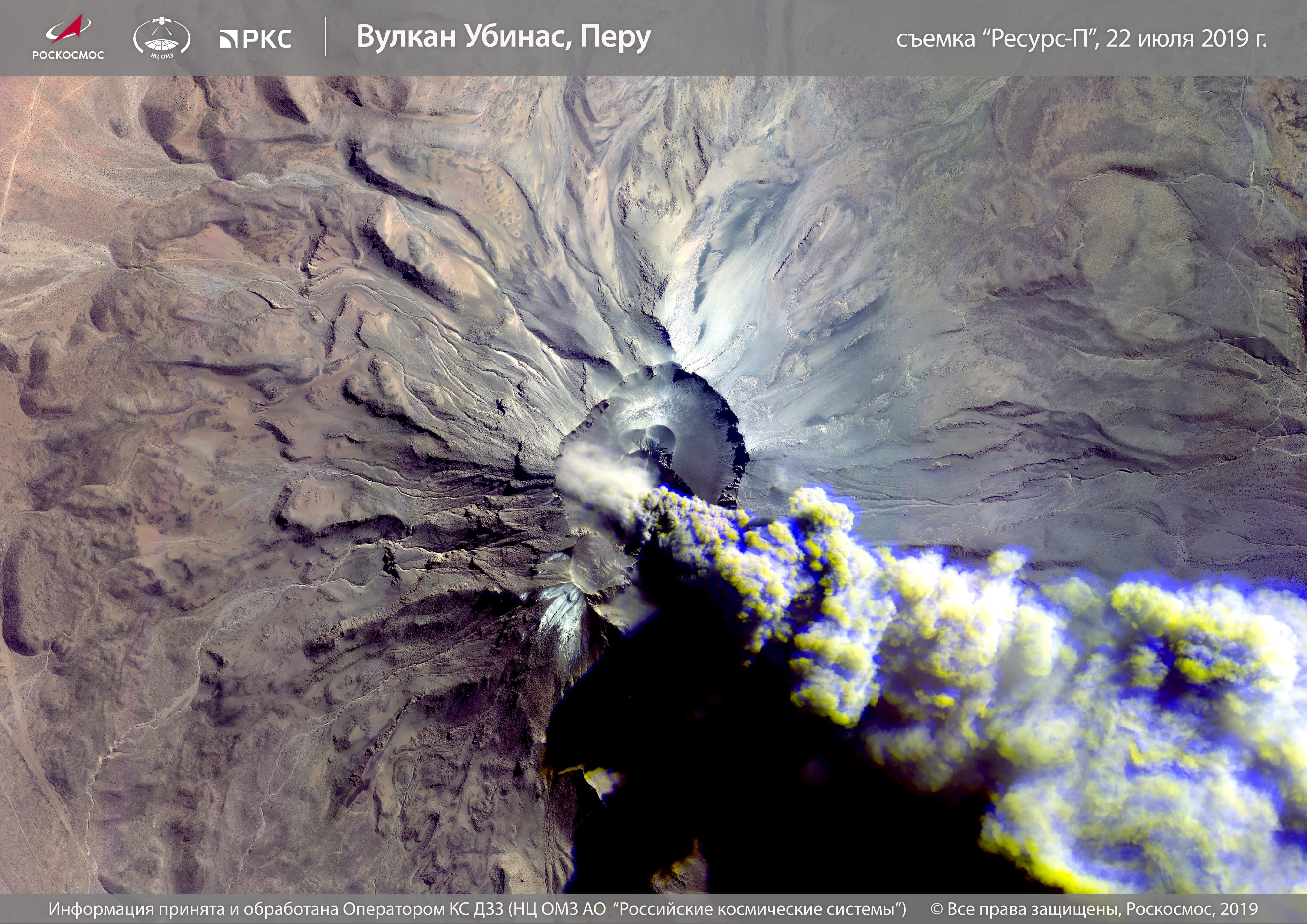
A Russian remote sensing satellite has captured a striking new image of Peru's most active volcano, called Ubinas, in the middle of an eruption that has affected thousands of residents.
The column of ash billows from the volcano in the unmistakable image captured by a Resurs-P satellite, which the Russian space agency, Roscosmos, uses for nonmilitary purposes.
The Resurs-P satellite photographed the #Ubinas volcano, which has been active during the last few days.According to the media, the column of hot ash, smoke and lava stones from the crater is 12 km high, drifting with the wind in all directions. pic.twitter.com/3z9qc4OksYJuly 24, 2019
Peru's Ubinas volcano began erupting at about dawn last Friday (July 19), spewing ash which has reached areas within a 16-mile (25 kilometers) radius, according to Reuters.
Related: Raikoke Volcano's Eruption Seen from Space (Photos)
Peru's National Institute of Civil Defense (INDECI) ordered an evacuation of the area near the volcano, located north of Moquegua, in southern Peru, according to Reuters. People used masks and goggles to protect themselves from the billowing ash.
On Sunday (July 21), two days after the eruption began, the Geophysical Institute of Peru (IGP) issued an "orange warning," meaning there was still a chance that the volcano might erupt again and emit more ash. As of Monday (July 22), the eruption had affected 29,703 people and had damaged 637 public buildings and homes, the Peru National Emergency Operations Center reported.
#ErupciónUbinas CENVUL: Análisis del volcán - últimas 24 hrs:Explosiones: 0Sismos: 266Emisiones de ceniza: Continuas, alcanzando altura aprox. 500 m. sobre base del cráter, dispersándose a sectores sureste y este del volcán (distritos Ubinas, Lloque y Chojata y anexos) (1/1) pic.twitter.com/0yohQHqynzJuly 21, 2019
Today, IGP officials said the volcano may still expel ash or erupt. Ubinas volcano is one of a dozen active volcanoes in the region that are a part of the "Ring of Fire," a horseshoe-shaped stretch of land that's known for frequent earthquakes and volcanic eruptions.
Get the Space.com Newsletter
Breaking space news, the latest updates on rocket launches, skywatching events and more!
- Explorer 1: How the First American Satellite Worked (Infographic)
- How 4 NASA Satellites Will Study Magnetic Fields of Earth & Sun (Infographic)
- How NASA's Soil Moisture Satellite Works (Infographic)
Follow Chelsea Gohd on Twitter @chelsea_gohd. Follow us on Twitter @Spacedotcom and on Facebook.
Join our Space Forums to keep talking space on the latest missions, night sky and more! And if you have a news tip, correction or comment, let us know at: community@space.com.
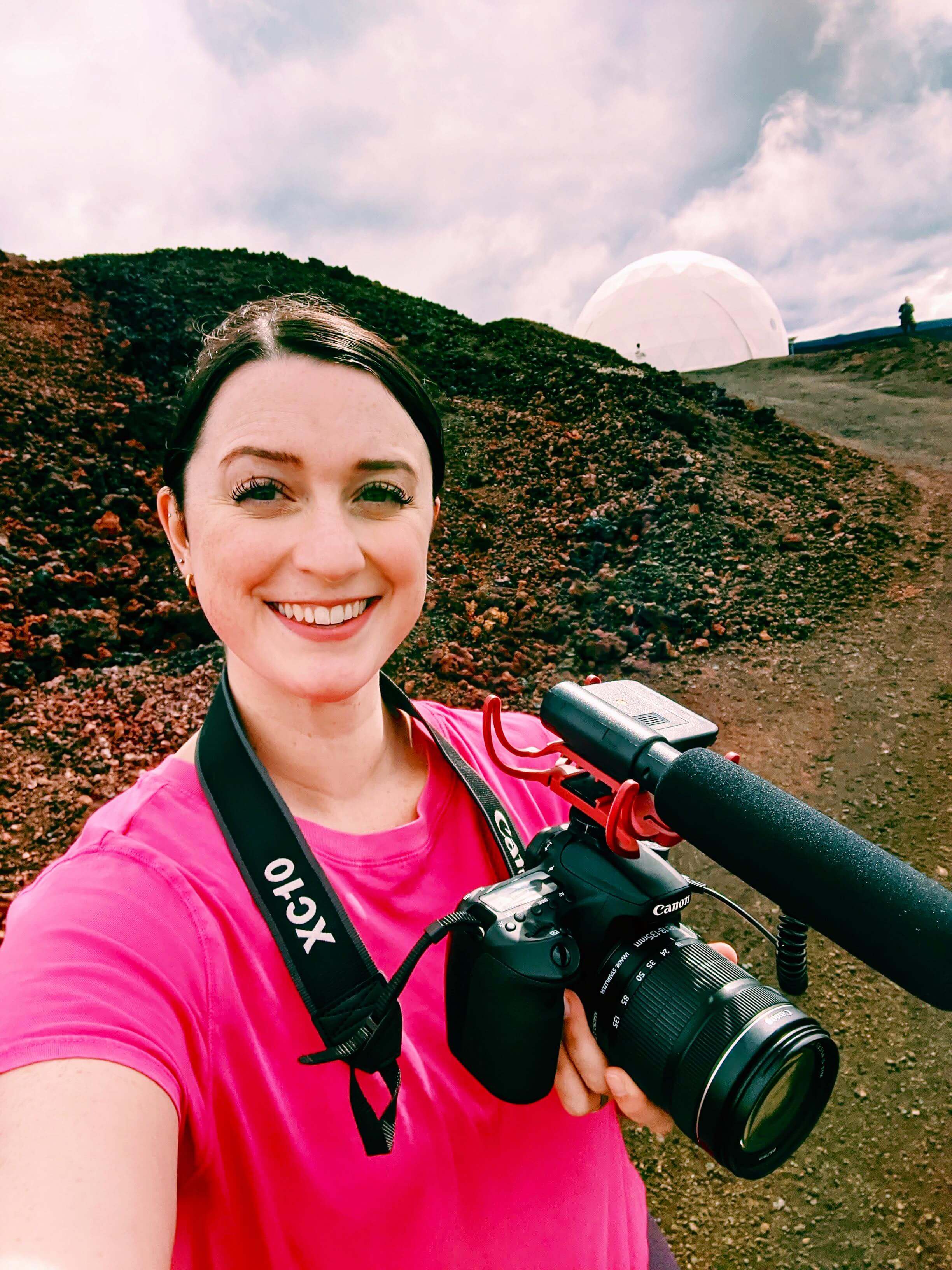
Chelsea “Foxanne” Gohd joined Space.com in 2018 and is now a Senior Writer, writing about everything from climate change to planetary science and human spaceflight in both articles and on-camera in videos. With a degree in Public Health and biological sciences, Chelsea has written and worked for institutions including the American Museum of Natural History, Scientific American, Discover Magazine Blog, Astronomy Magazine and Live Science. When not writing, editing or filming something space-y, Chelsea "Foxanne" Gohd is writing music and performing as Foxanne, even launching a song to space in 2021 with Inspiration4. You can follow her on Twitter @chelsea_gohd and @foxannemusic.
