How satellites could protect archaeology sites vulnerable to climate change
Satellite studies "could provide valuable insights into these impacts."

Archaeologists should consider tapping into satellite imagery when assessing the impacts climate change can have on ancient underground structures, a new study argues.
Satellite studies would be one tool to help monitor and stabilize "underground heritage sites" on Earth that are becoming more vulnerable to human-induced climate change, flash floods, urbanization and other threats, the Aug. 12 study in Heritage Science states.
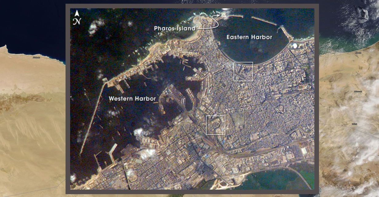
Specifically, the study focuses on the ancient city of Alexandria, Egypt. This area is perhaps best known for the famous Lighthouse (or Pharos) of Alexandria, which was completed around 280 BCE during the reign of Ptolemy II, according to Britannica.
The lighthouse was said to be one of the seven ancient wonders of the world — while no longer standing, it is just one example of the archaeological potential of Alexandria. Climate change, however, is affecting subterranean Greek, Roman and Egyptian tombs and necropolis in the region as these structures were built in porous limestone (calcarenitic) rocks that are vulnerable to water.
Related: Four amazing astronomical discoveries from ancient Greece
"Climate change is increasing the number of natural disasters like flash flooding, heavy rain and sea level rise and their intensive negative impact on UNESCO world natural and cultural heritage sites in Alexandria," the study states. (UNESCO is the United Nations Educational, Scientific and Cultural Organization and maintains a list of heritage sites around the world.)
"Recently, the increasing number of natural disasters linked to climate crises has put Alexandria's underground and above surface cultural built heritage at greater risk than ever before, which imposes new complex challenges on us to safeguard the historical urban fabric and built heritage in Alexandria," the study authors added.
Breaking space news, the latest updates on rocket launches, skywatching events and more!
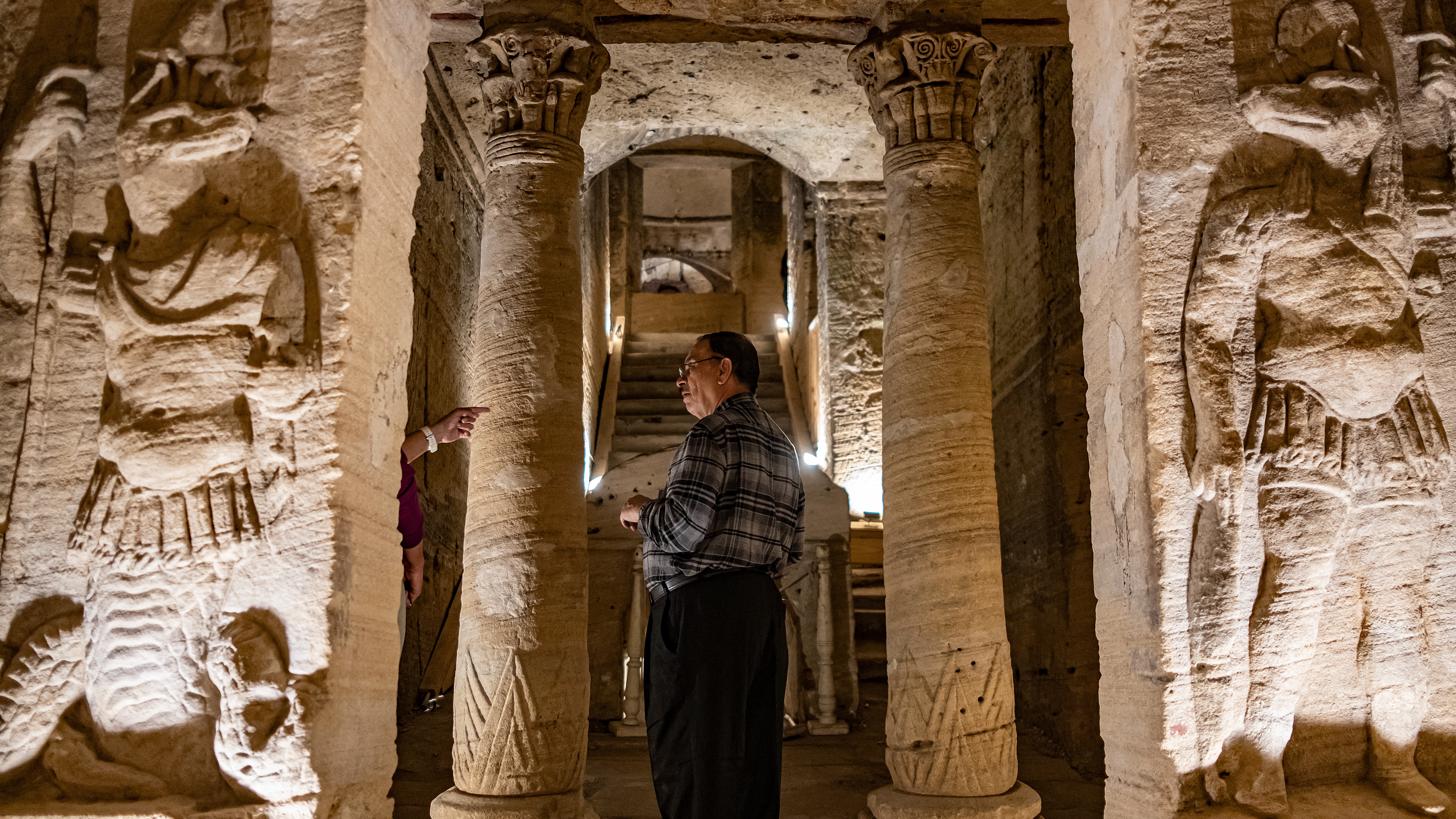
Study author Sayed Hemeda presents a case study of damage imparted on the 2nd century AD Catacombs of Kom El-Shoqafa; in fact, the researcher had already examined the site across several peer-reviewed studies prior to this one. Hemeda is a professor with Cairo University's faculty of archaeology, focusing on architectural conservation.
Lonely Planet describes the site as "one of the last major works of construction dedicated to the religion of ancient Egypt," which is important as it shows how Pharaonic and Greek styles were blended roughly 1,800 years ago. The bulk of Hemeda's study discusses possible methods to stabilize the rock when flooding and similar climate change-induced problems occur. But the implications are wide-ranging, as the catacombs' issues illustrate the importance of protecting other ancient sites vulnerable to global warming as well.
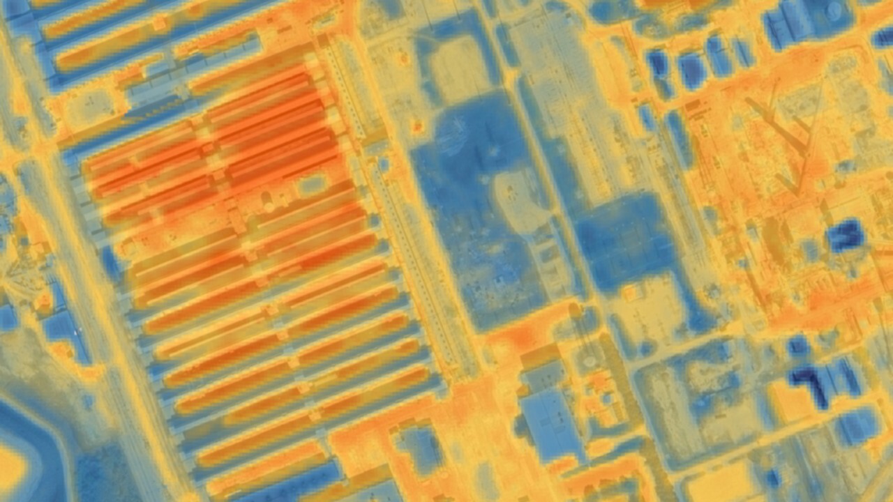
Satellites have various tools to track structures and movements beneath the Earth, such as ground-penetrating radar, to see old buildings or monuments, and gravity-based groundwater measurements to track water. (NASA's now-retired Gravity Recovery and Climate Experiment or GRACE is a famous example of twin satellites using gravity to examine water underground.)
While satellite images can be expensive to obtain, open-access and older imagery have been used many times in recent peer-reviewed literature. Hemeda cites a December 2023 study of archaeological landscapes in Egypt's Nile Delta as an example of good dataset usage from archives. That study's data came from instruments including Landsat (a joint effort of NASA and the U.S. Geological Survey), the decommissioned spy satellite series called Corona, and the Advanced Spaceborne Thermal Emission and Reflection Radiometer instrument aboard NASA's still-active Terra satellite.
As a whole, satellite studies may assist, Hemeda says, in examining "the broader impact of climate change on archaeological sites, particularly in vulnerable areas like the northern Nile Delta."

Elizabeth Howell (she/her), Ph.D., was a staff writer in the spaceflight channel between 2022 and 2024 specializing in Canadian space news. She was contributing writer for Space.com for 10 years from 2012 to 2024. Elizabeth's reporting includes multiple exclusives with the White House, leading world coverage about a lost-and-found space tomato on the International Space Station, witnessing five human spaceflight launches on two continents, flying parabolic, working inside a spacesuit, and participating in a simulated Mars mission. Her latest book, "Why Am I Taller?" (ECW Press, 2022) is co-written with astronaut Dave Williams.

