Star maps through the ages: A Q&A with the author of 'The Sky Atlas'
"Star maps, even though they show the world above, still reflect a lot of what's going on down below," he said.
Sure, humans have looked to the stars for millennia, but it's still difficult to step into the shoes of all those people.
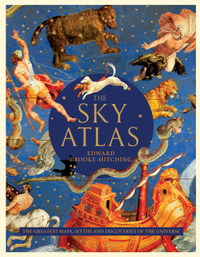
That's less true when you can truly see the way they envisioned the night sky, however, and that's the premise of "The Sky Atlas: The Greatest Maps, Myths and Discoveries of the Universe" (Chronicle Books, 2020) by Edward Brooke-HItching.
"The Sky Atlas" gathers stunning images that humans around the world have created to try to understand the universe around them, from prehistory to the days of planet-size telescopes. This interview has been edited for length and clarity.
Related: Best space books and sci-fi for 2020
Space.com: How did this project come about?

Edward Brooke-Hitching: I'd written two books previously about maps. … We're all used to seeing them hanging on the wall. They're sort of lifeless things now, behind the glass, which is a shame, because with the right context, you appreciate just how many stories there are hidden among the lines of maps. …
This book was designed to take the most overlooked type of map in terms of how maps have been written about, the celestial map or star map. Star maps are either viewed as the sort of technical diagrams that are only of interest to a Ph.D. astronomer or, paradoxically, they're viewed by a lot of dealers and collectors as merely decorative things. [I wanted to] show that star maps, even though they show the world above, still reflect a lot of what's going on down below.
Get the Space.com Newsletter
Breaking space news, the latest updates on rocket launches, skywatching events and more!

Space.com: How did terrestrial maps in some ways become prioritized over sky maps?
Brooke-Hitching: Originally, you couldn't necessarily say terrestrial maps had priority. The great atlases, when they started being produced, from the late 16th century, usually came in two volumes, terrestrial and celestial. When you see the great globes, they are the globe of the Earth and the globe of the heavens. You see people mistaking this, whenever they have the figure of Atlas carrying a globe on his back. That seems to be a misconception now, that he's carrying the world on his back, but of course it's the heavens. So we've kind of airbrushed the history of this mapping out a little bit. …
The mapping itself has kind of been forgotten because, of course, technology has overtaken the classical style of mapping. Everyone can Google every square inch of our planet. But of course, what's been lost with all this digital mapping and astrophotography is the artistic side of mapping. Maps are extraordinary documents and arguably unique in the sense that they are right in the intersection between art, science and politics. They represent all of these things in a way that no other document can. So the idea of this book was partly to say, these are some of the most beautiful works of art that have ever been created.
The Sky Atlas: The Greatest Maps, Myths and Discoveries of the Universe | $29.95
Edward Brooke-Hitching's "The Sky Atlas" offers a beautiful look back at humanity's maps of the night sky and our relationship with the universe.
Space.com: Could you tell me a little bit about the research you did for the book?
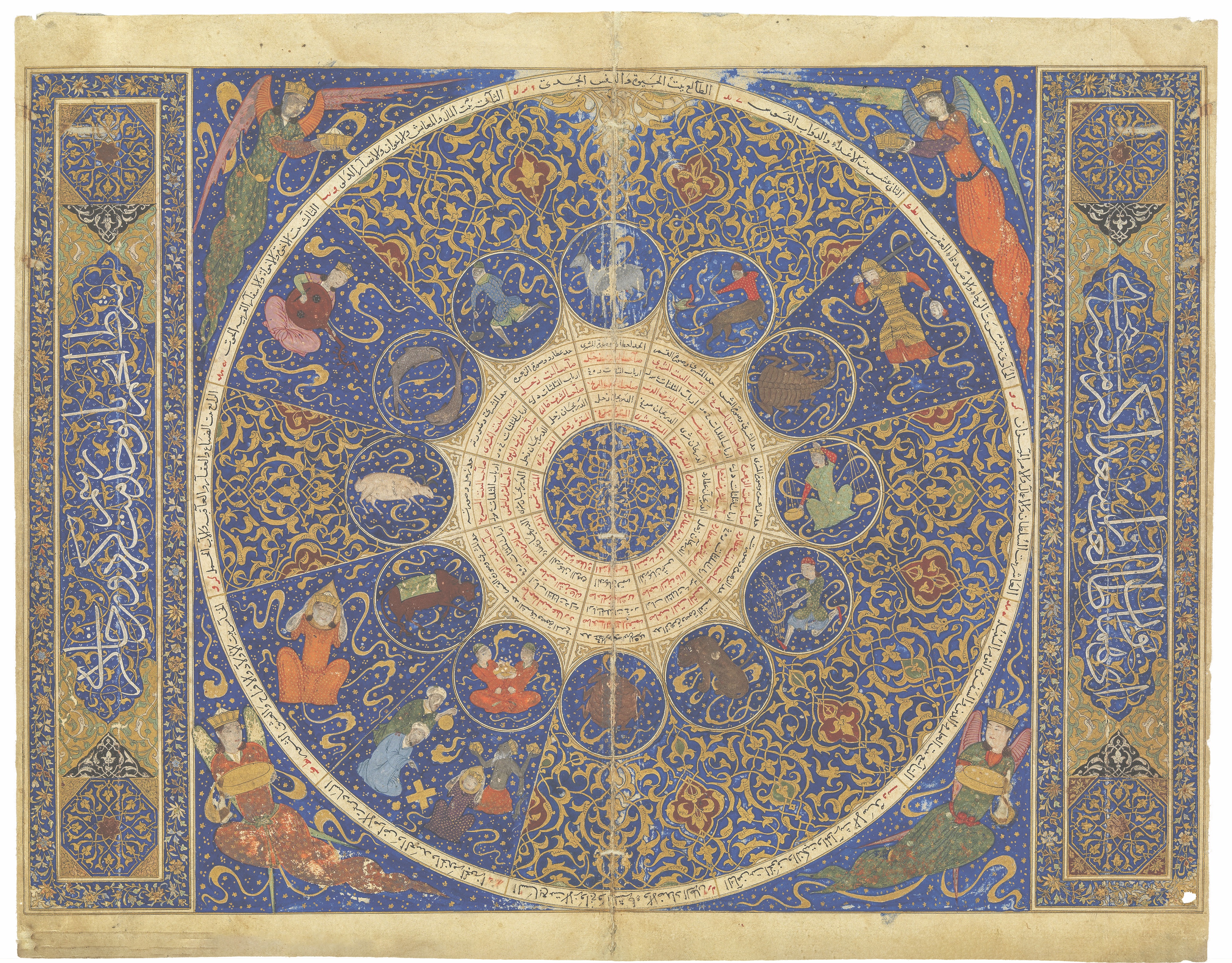
Brooke-Hitching: I grew up in a rare book shop. My dad is a rare book dealer, and rare book men, if there's any space with no shelves, the walls are covered in maps. And so my exposure to maps was not from knowing their history, but it was from getting a sort of osmosis effect of just their beauty and their intrigue. … In terms of research, I thought the best thing to do was not just go to public libraries, the British Library, the great institutions, because that's where everyone goes for their images and their stories. So I split it between going to museums and libraries, but also talking to a lot of dealers who have this magpie's eye for a great story, and they know how to sell you a map with just a few words. That's a very attractive sort of philosophy for writing books as well.
A lot of these images in the books, some of them haven't been published before. These are the most beautiful examples of the rarest kinds of maps. You want to give someone something that no one's ever seen before. And quite apart from all this accumulation, it's got the first photograph that was ever taken of the moon in it. And it's also, from what I'm aware, the first book that carries a photograph of the black hole. That was released the day before I had to submit the book to the publishers. It was a mad scramble, but we managed to get it in.
So it feels like more than a book. It feels like an object because it has all of these really rare treasures in it.
Space.com: What are some of your favorite tidbits that you learned working on this book?
Brooke-Hitching: One thing I really liked working on and I hoped that would really sort of click with people is that just as much as it covers the great discoveries, it looks at the ways that we got things wrong. I wanted to do a complete history of the sky, which is really foolish in retrospect — it's such an enormous subject. But honestly, I think we learn just as much from the way that we got things wrong as we do from the way that we got things right. You're providing the context from which the great discoveries emerged, the chaos, and it's just such a testament to the power of human imagination
Some of them are inspired by literal biblical interpretation, as in the story of the sea above the sky. That was this belief in medieval Europe, based on the mention of the waters above and below the firmament in the Bible, that there was an ocean above the clouds sailed on by men. There's even stories that you can find going back to 1214 of ships' anchors crashing in the churchyard and a star sailor sliding down and drowning in air.
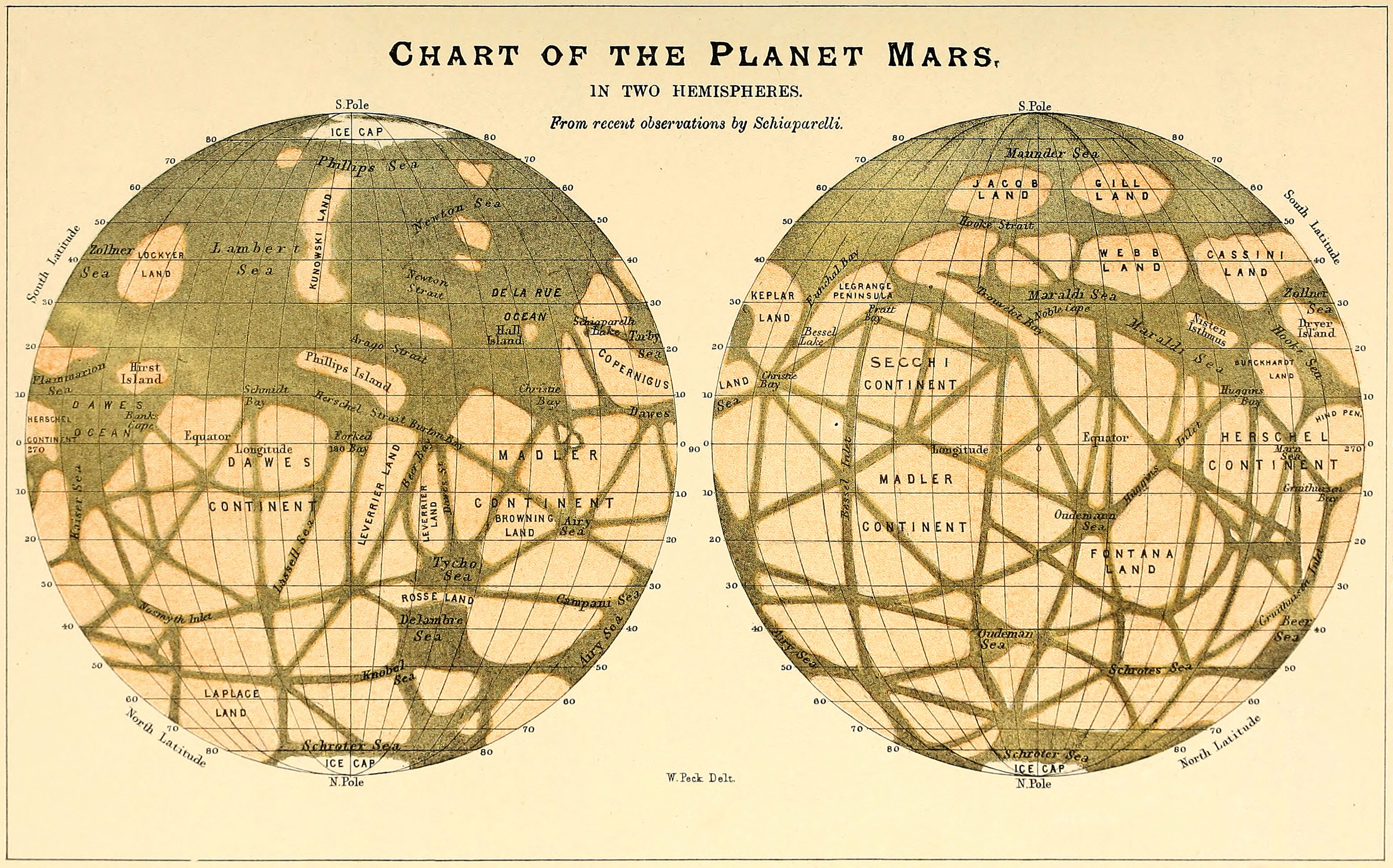
It just makes the whole subject wonderfully exciting and enlivens the more technical aspects of later scientific discoveries. In a nonpatronizing way, I loved finding out how we got things wrong, because it just brought so much more dimension to the subject.
Space.com: I noticed there's significantly more geographic diversity than one might expect to find picking up a book about cartography or a book about astronomy. How did that come about?
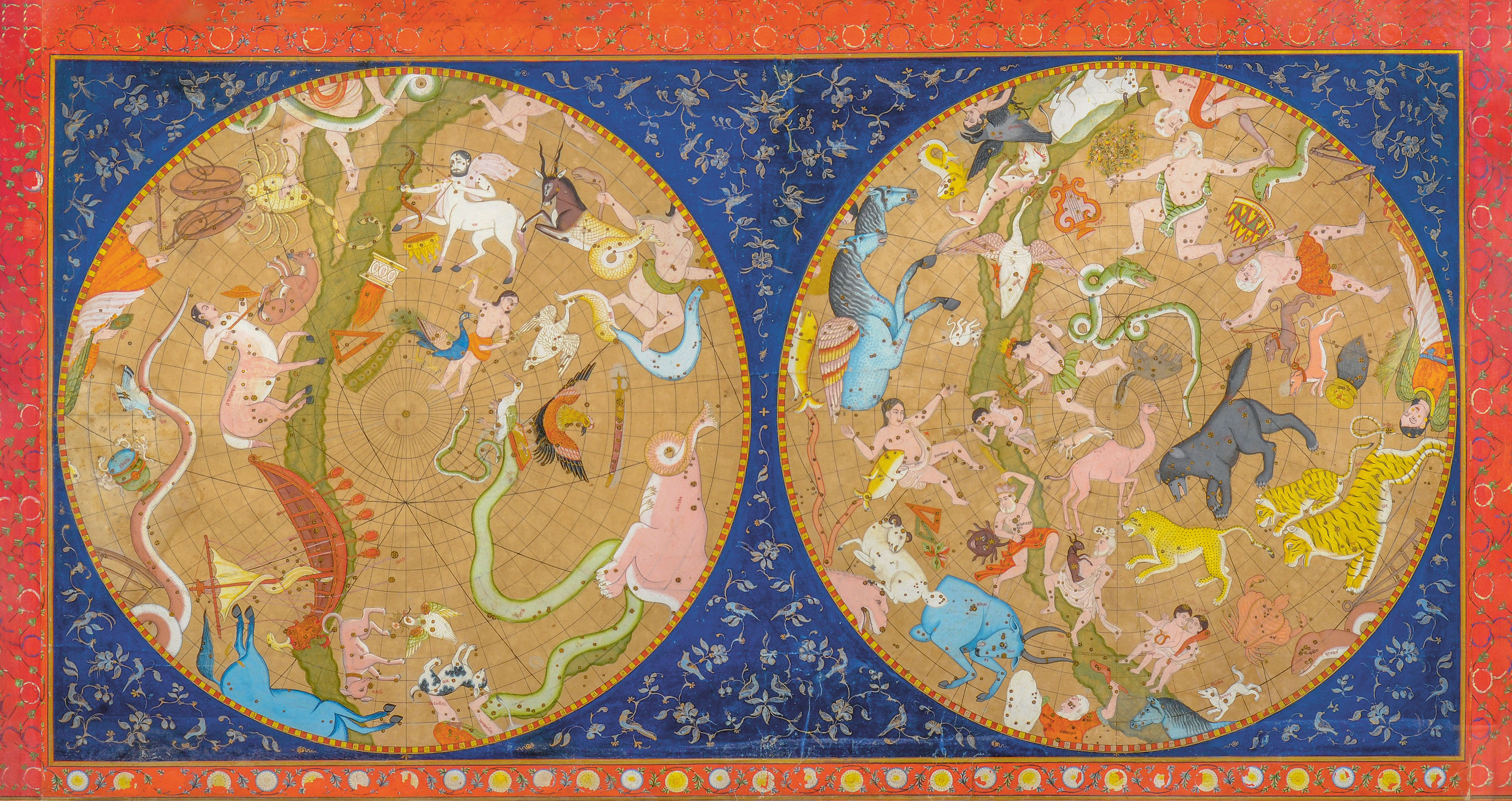
Brooke-Hitching: I was thinking, "What's something that people don't normally come across? How do we present this in a new way?" And part of it was thinking, obviously, the sky is something we all have in common around the world. Every culture has its own creation myth. The ancient Chinese had P'an-ku, the furry, horned giant who emerged from a cosmic egg, cut it in two with his ax and then fell on one half, which was the Earth, and his limbs became the mountains and his blood the rivers and his breath the wind.
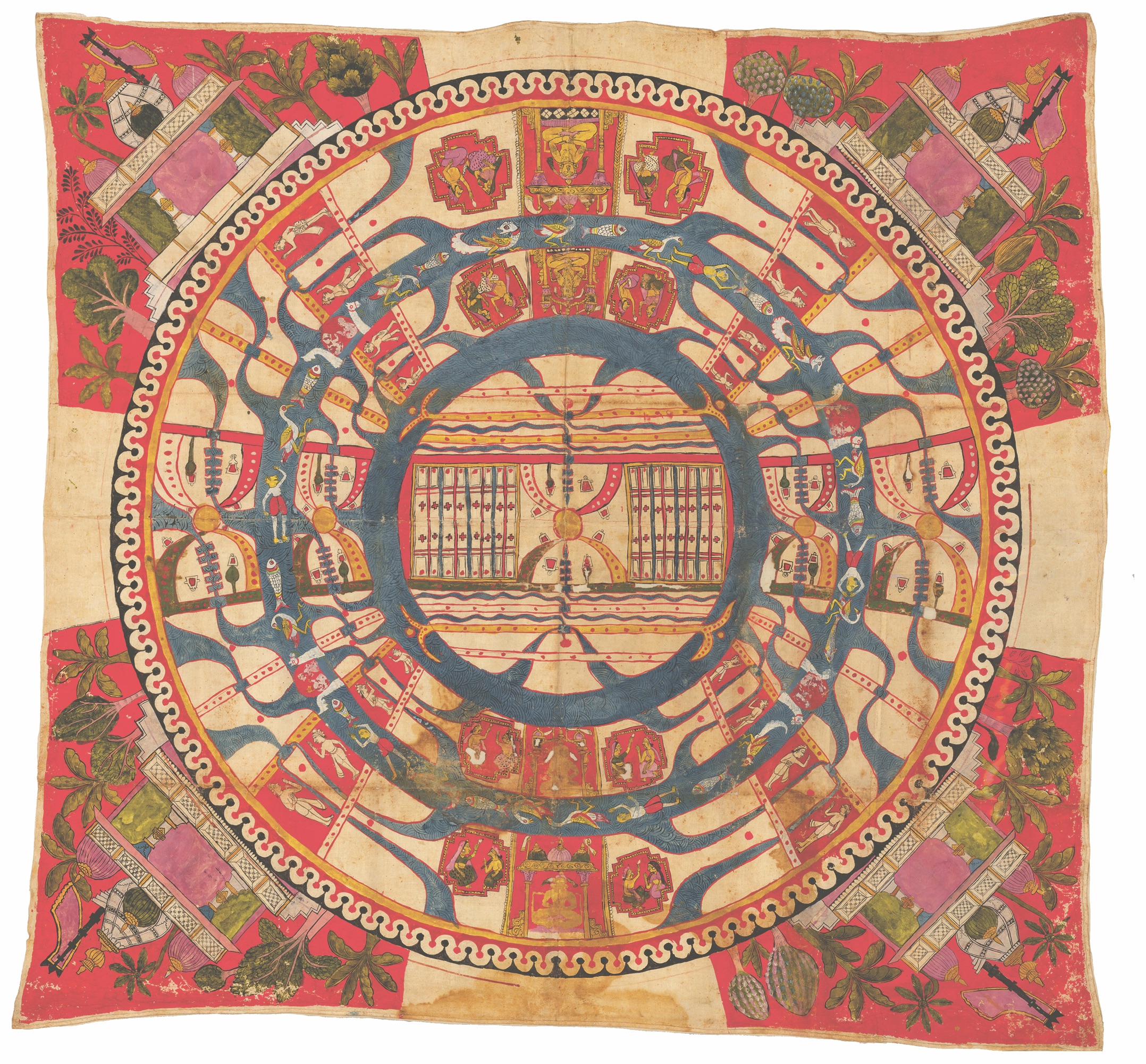
Why not treat the sky as a universal property, this global property, and look at how it's been represented visually by as many cultures as possible? I think people might also be quite used to the most famous kinds of maps. But when you see the sort of cosmology map of the Indian religion Jainism and you see this giant cosmic figure, it's just startling, and it makes you sort of fall in love again with the sky and how rich the history of it is.
Space.com: Are there any favorite images that are in the book that you particularly enjoy?
Brooke-Hitching: They're all selected from a much bigger pile, so they're all sort of favorite children. But I think it's the mythological aspects in one regard. So, there's the giant painting of the tower of Babylon, which was particularly beautiful, and how it was then disproved on the following page by a scholar named Athanasius Kircher, who showed it couldn't possibly be tall enough to reach heaven. There's the painting of the great Wild Hunt myth of the Norse of Scandinavia that explained thunder in the sky: It was Odin's hunting party riding across the clouds and chasing demons.
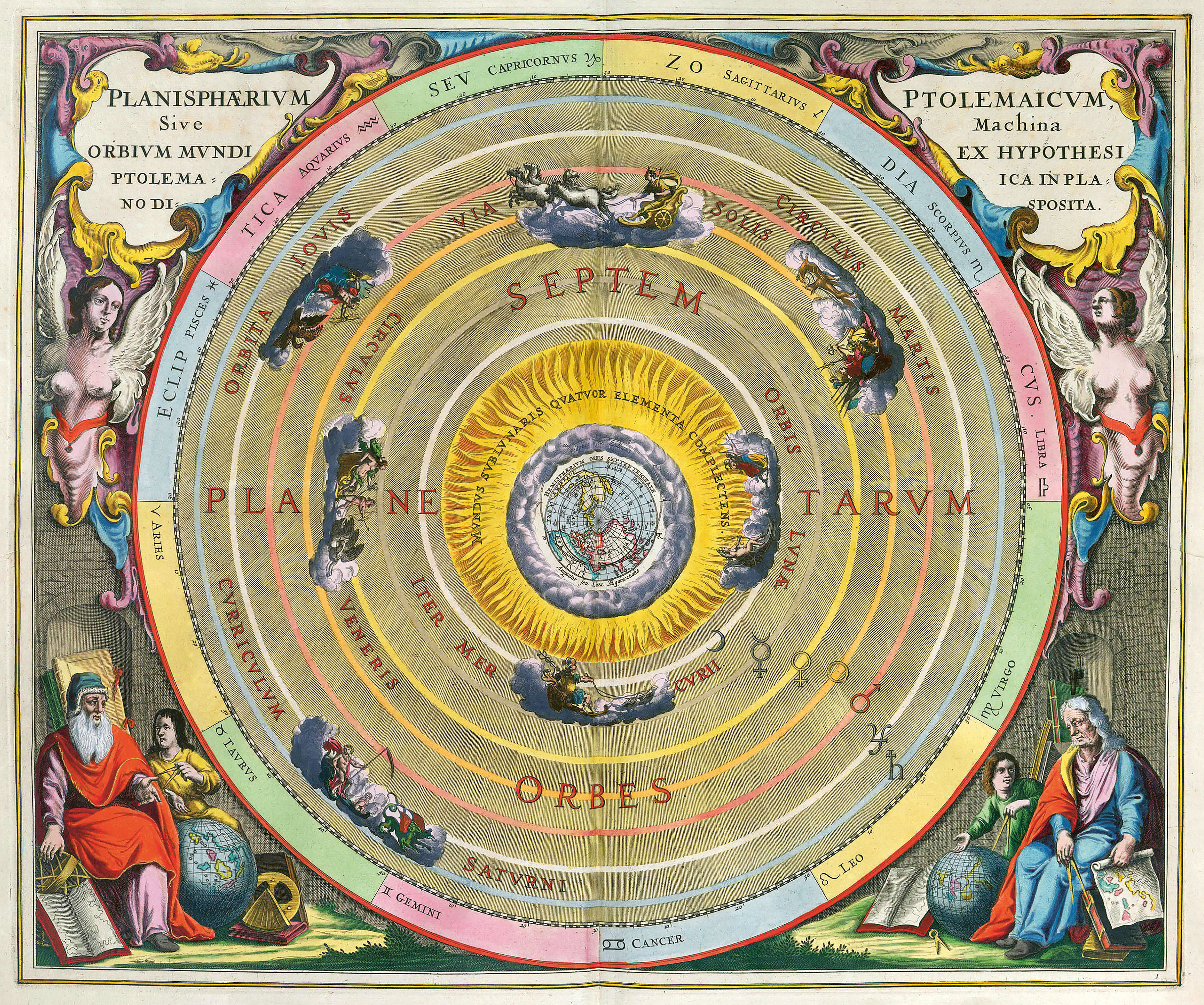
And then, of course, when you enter the late 16th, early 17th century, you have the great treasures of cartography, this golden age of cartography. Mapmakers like [Andreas] Cellarius were producing just unbelievably colorful and detailed images of the universe, representing this sort of milieu of competing theories of the geocentric universe or the Earth orbiting the sun. It's a very exciting way of looking in on a time when, technically, everything was possible, because no one quite understood how anything was possible.
Space.com: What would you like space people to get excited about from the cartography aspect of this book?
Brooke-Hitching: I feel so passionate about, so in love with [it], it feels a shame that the art of mapping has now technically been lost. But I would have thought this is precisely the kind of thing that for people who are already aware of the science, of the astronomy, it would be something that can put their knowledge and their studies into visual context.
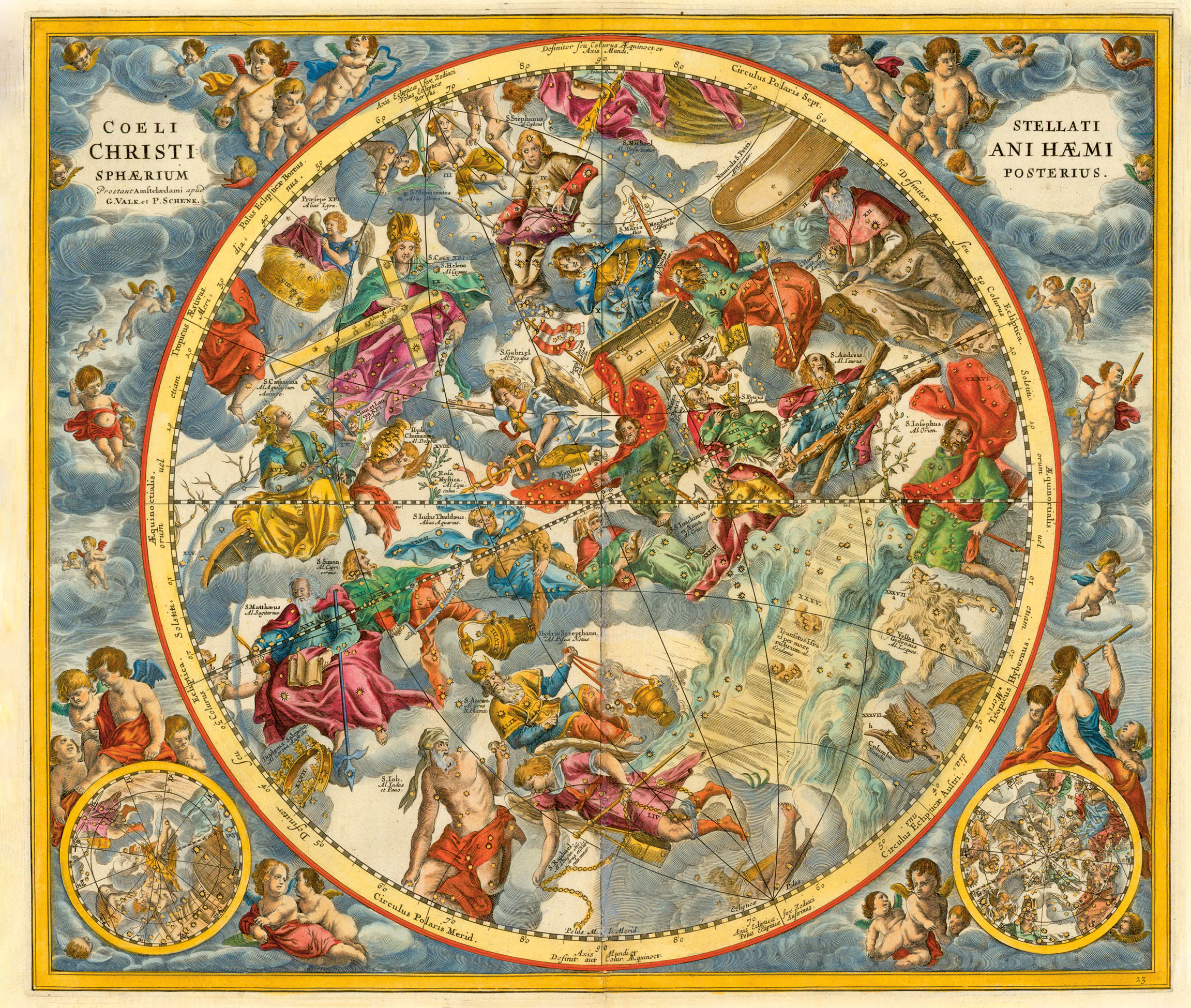
It's actually a really exciting thing to see how people have put to paper the ideas that they're very familiar with. For people who are studying, it helps to understand some of these quite complicated ideas — you know, the Cartesian universe of the plenum [in which the universe is packed full of matter], as opposed to the vacuum — and really quite bizarre images to get a hold of. When you see these illustrations, because I've tried to put in as many as possible, you can read it in a sort of easy flow. It just, it brings the whole subject alive again, maybe, just in a way that it just reminds you why you fell in love with it in the first place.
Space.com: And has this process of studying how people have pictured the sky through the ages, has that changed the way that you see the night sky yourself?
Brooke-Hitching: Halfway through the book, I went out and bought an enormous telescope. It's very overwhelming. Some of the stories, it really does make you quite emotional when you realize the scale of achievement in this area. Maybe the telescope is a terrible idea living in London with permanently gray, overcast sky. I've probably become an expert in blank clouds.
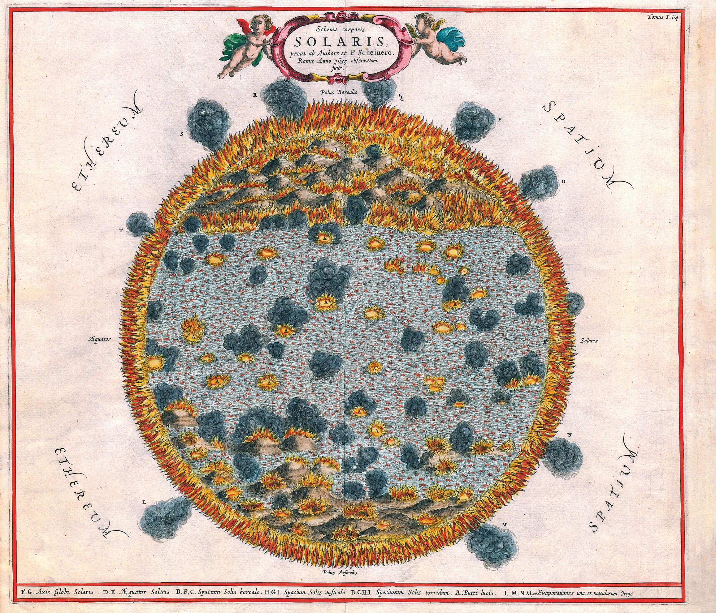
But absolutely, you don't write a book and then just sort of leave everything behind and forget about it. I've got maps on my walls now of star charts. And one of my favorite illustrations in the book, which was Athanasius Kircher's map of Solaris, the sun, and he's drawn this enormous solar sea, this swirling blue sea in the center of it, and at its poles it has these giant, puffing mountains. And it's just a classic example of these images that just never get old and just fill you with the same kind of wonder that they must have had at the time.
You can buy "The Sky Atlas" on Amazon.com.
- The 10 must-see skywatching events to look for in 2020
- '100 Things to See in the Night Sky': A stargazing guide for beginners
- Sky-charting mobile apps can be your astronomical time machine
Email Meghan Bartels at mbartels@space.com or follow her @meghanbartels. Follow us on Twitter @Spacedotcom and on Facebook.
OFFER: Save at least 56% with our latest magazine deal!
All About Space magazine takes you on an awe-inspiring journey through our solar system and beyond, from the amazing technology and spacecraft that enables humanity to venture into orbit, to the complexities of space science.
Join our Space Forums to keep talking space on the latest missions, night sky and more! And if you have a news tip, correction or comment, let us know at: community@space.com.

Meghan is a senior writer at Space.com and has more than five years' experience as a science journalist based in New York City. She joined Space.com in July 2018, with previous writing published in outlets including Newsweek and Audubon. Meghan earned an MA in science journalism from New York University and a BA in classics from Georgetown University, and in her free time she enjoys reading and visiting museums. Follow her on Twitter at @meghanbartels.
