Tropical Storm Cristobal captured in astronaut, satellite imagery
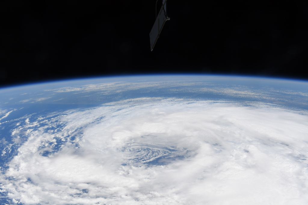
Photos of now-Tropical Depression Cristobal taken by a NASA astronaut and a satellite show the powerful storm tearing through the Gulf Coast region and making its way north across the United States.
Astronaut Chris Cassidy on the International Space Station captured four views of Cristobal, then still a tropical storm, on Monday (June 8) as it appeared from 260 miles (420 kilometers) above Earth.
"Best of luck to all of the folks in the gulf coast region who are about to deal with the weather from Tropical Storm #Cristobal," Cassidy wrote on Twitter.
Related: The most powerful storms of the solar system in photos
Cristobal made landfall in Louisiana on Sunday evening (June 7), according to CBS News, with maximum sustained winds of 50 mph(80 km/h).
Best of luck to all of the folks in the gulf coast region who are about to deal with the weather from Tropical Storm #Cristobal. pic.twitter.com/xxNrazh53aJune 8, 2020
On Tuesday (June 9), NASA released images from the Aqua satellite showing the depression moving north toward the Great Lakes region. The satellite's Moderate Resolution Imaging Spectroradiometer (MODIS) picked up the strongest regions of the storm using infrared images. Infrared data shows which parts of the storm are coldest; these regions are also the most powerful because they have thunderstorms that reach the highest in Earth's atmosphere, NASA said.
Early on Tuesday, MODIS data suggested that the strongest storms were "northeast and north of the elongated center over western Missouri, Iowa and Illinois," NASA said, and the instrument measured storm cloud-top temperatures as cold as minus 63 degrees Fahrenheit (nearly minus 57 degrees Celsius).
Get the Space.com Newsletter
Breaking space news, the latest updates on rocket launches, skywatching events and more!
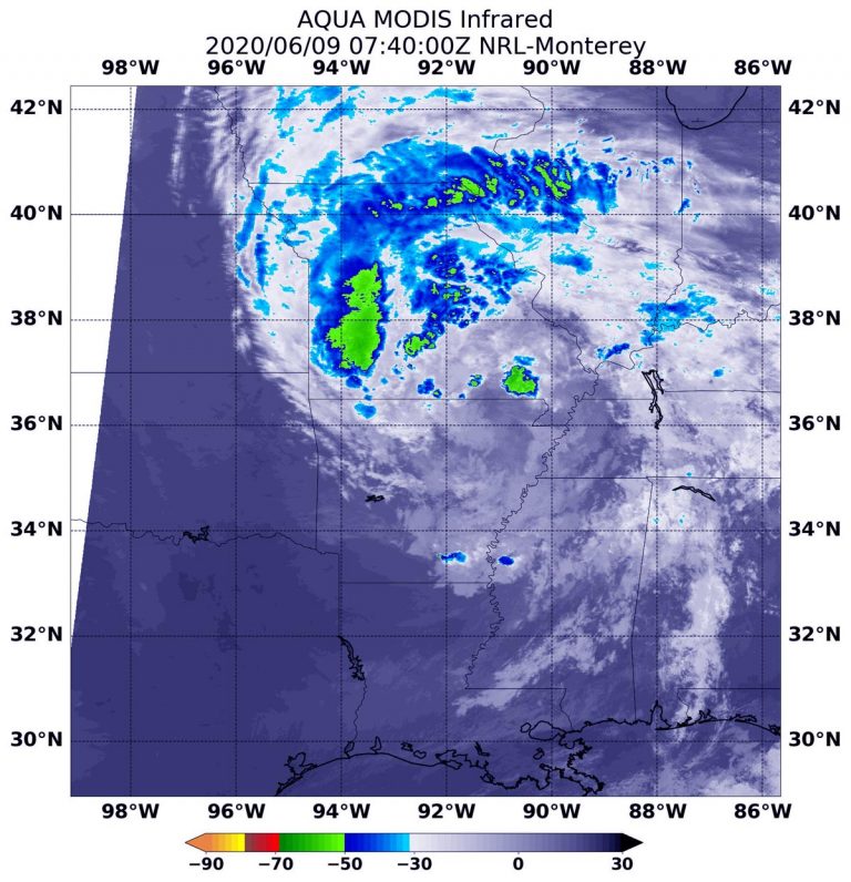
Cristobal, however, is quickly evolving and forecasts will change rapidly in the next few days. As of late afternoon Tuesday, the National Weather Service's Weather Prediction Center says Cristobal is moving across Missouri, with heavy rainfall expected in the middle and upper Mississippi Valley, as well as in the western Great Lakes region.
- See Tropical Storm Arthur, the Atlantic's 1st named storm of 2020, from space
- Amazing hurricane photos from space
- Hurricane Florence in photos: See the massive storm from space
Follow Elizabeth Howell on Twitter @howellspace. Follow us on Twitter @Spacedotcom and on Facebook.
OFFER: Save 45% on 'All About Space' 'How it Works' and 'All About History'!
For a limited time, you can take out a digital subscription to any of our best-selling science magazines for just $2.38 per month, or 45% off the standard price for the first three months.
Join our Space Forums to keep talking space on the latest missions, night sky and more! And if you have a news tip, correction or comment, let us know at: community@space.com.

Elizabeth Howell (she/her), Ph.D., was a staff writer in the spaceflight channel between 2022 and 2024 specializing in Canadian space news. She was contributing writer for Space.com for 10 years from 2012 to 2024. Elizabeth's reporting includes multiple exclusives with the White House, leading world coverage about a lost-and-found space tomato on the International Space Station, witnessing five human spaceflight launches on two continents, flying parabolic, working inside a spacesuit, and participating in a simulated Mars mission. Her latest book, "Why Am I Taller?" (ECW Press, 2022) is co-written with astronaut Dave Williams.
-
Helio While it was in the Gulf, it was bizarre to see its directional plot head due north into Wisconsin. I would have bet money that the Coriolis effect would eventually overpower it and turn it east. I'm glad I didn't bet. That was the first to make it into Wisconsin, ever!Reply

