Astronaut and satellites see tropical storms Laura and Marco from space
Laura has since strengthened into a hurricane, while Marco is quickly losing steam.
Satellites have spotted tropical storms Marco and Laura as they simultaneously marched toward the Gulf of Mexico.
After being downgraded from a Category 1 hurricane to a tropical storm on Sunday (Aug. 23), Marco made landfall along the coast of Louisiana late on Monday (Aug. 24), bringing rainfall, gusty winds and storm surge just before weakening into a post-tropical cyclone, according to the National Hurricane Center (NHC).
Tropical Storm Laura intensified into a Category 1 hurricane on Tuesday morning (Aug. 25) and is expected to strengthen into a major Category 3 storm by the time it makes landfall along the Louisiana and Texas coasts early Thursday (Aug. 26).
Related: How Earth-orbiting satellites are tracking the 2020 hurricane season
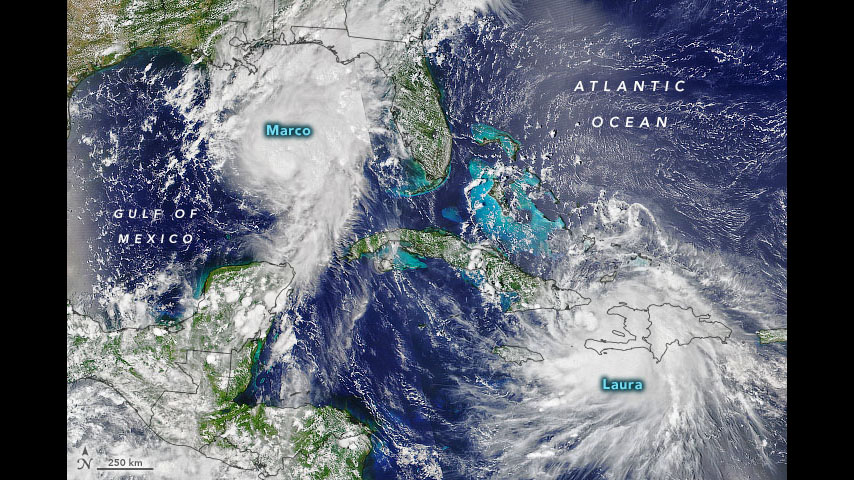
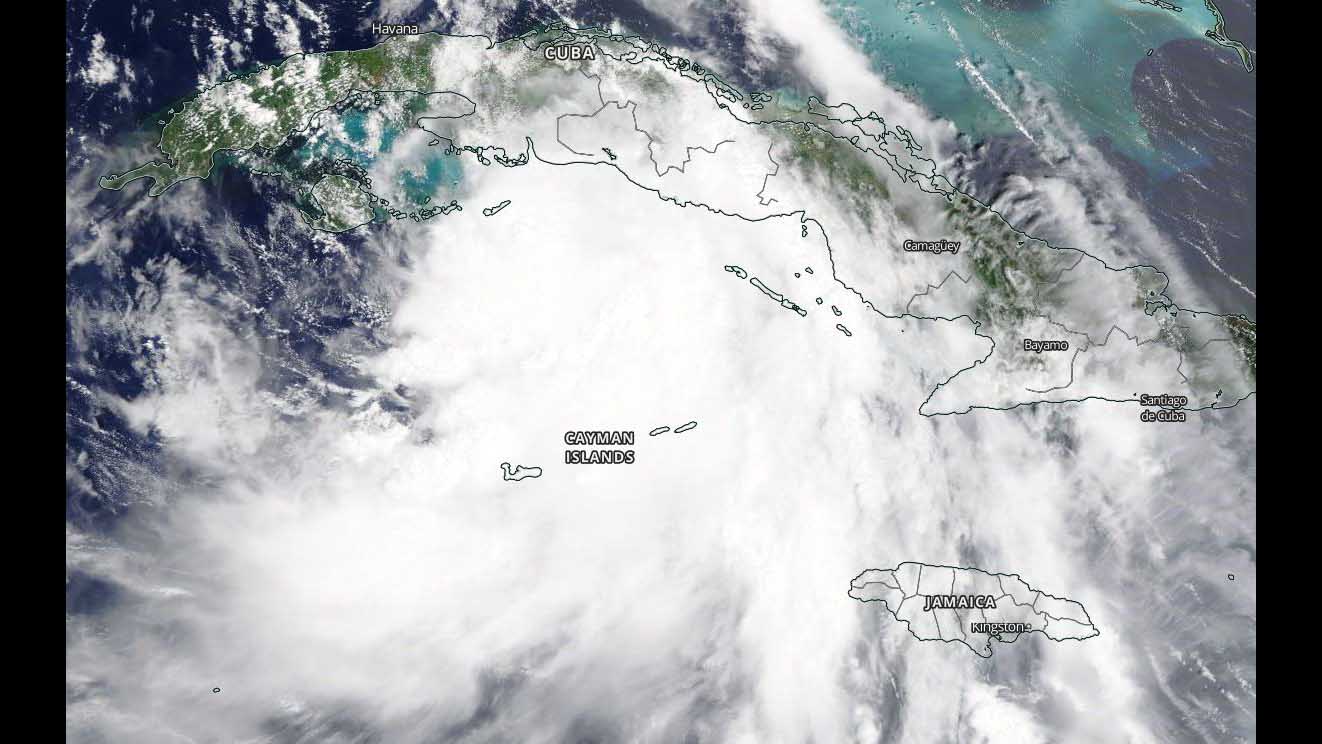
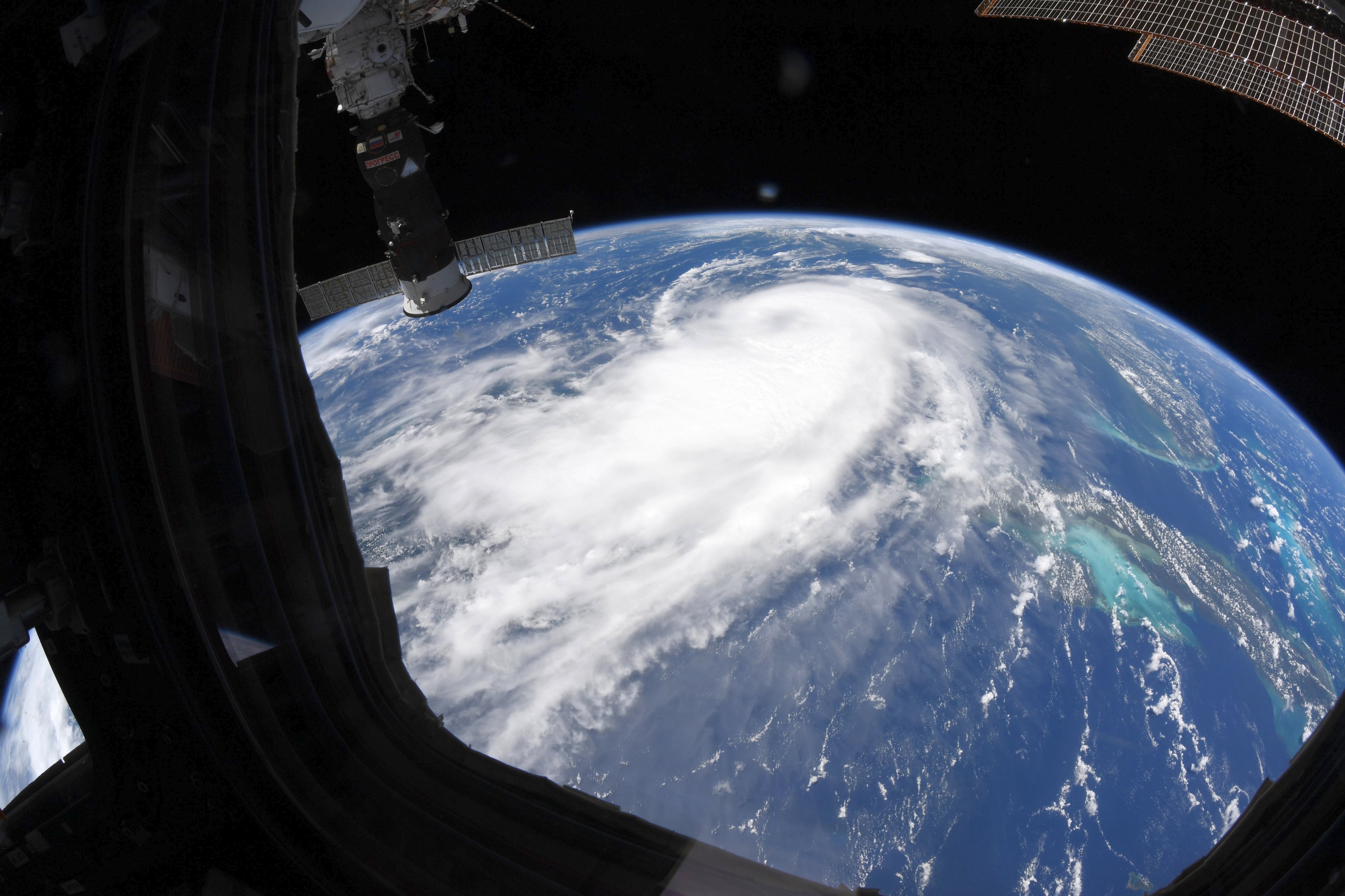
The International Space Station captured views of what was then Tropical Storm Laura on Sunday (Aug. 23), prior to the storm making landfall in Cuba. A video captures an aerial view of Tropical Storm Laura, taken approximately 250 miles (400 kilometers) above the storm by external cameras on the orbiting lab.
And today (Aug. 25), NASA astronaut Chris Cassidy, who is currently living and working on the orbiting laboratory, shared his view of now-Hurricane Laura.
Hurricane Laura pic.twitter.com/zVd2HracH7August 25, 2020
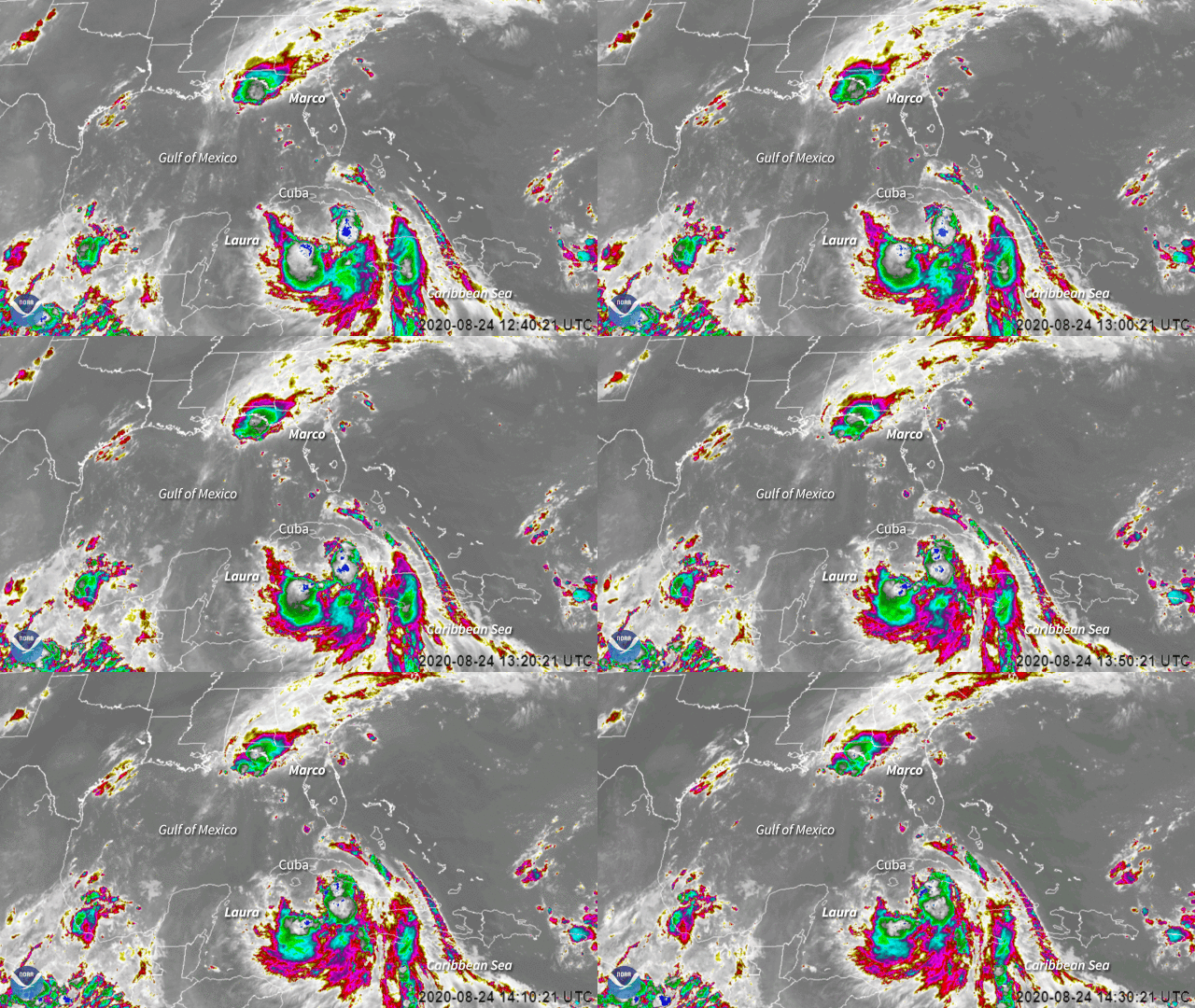
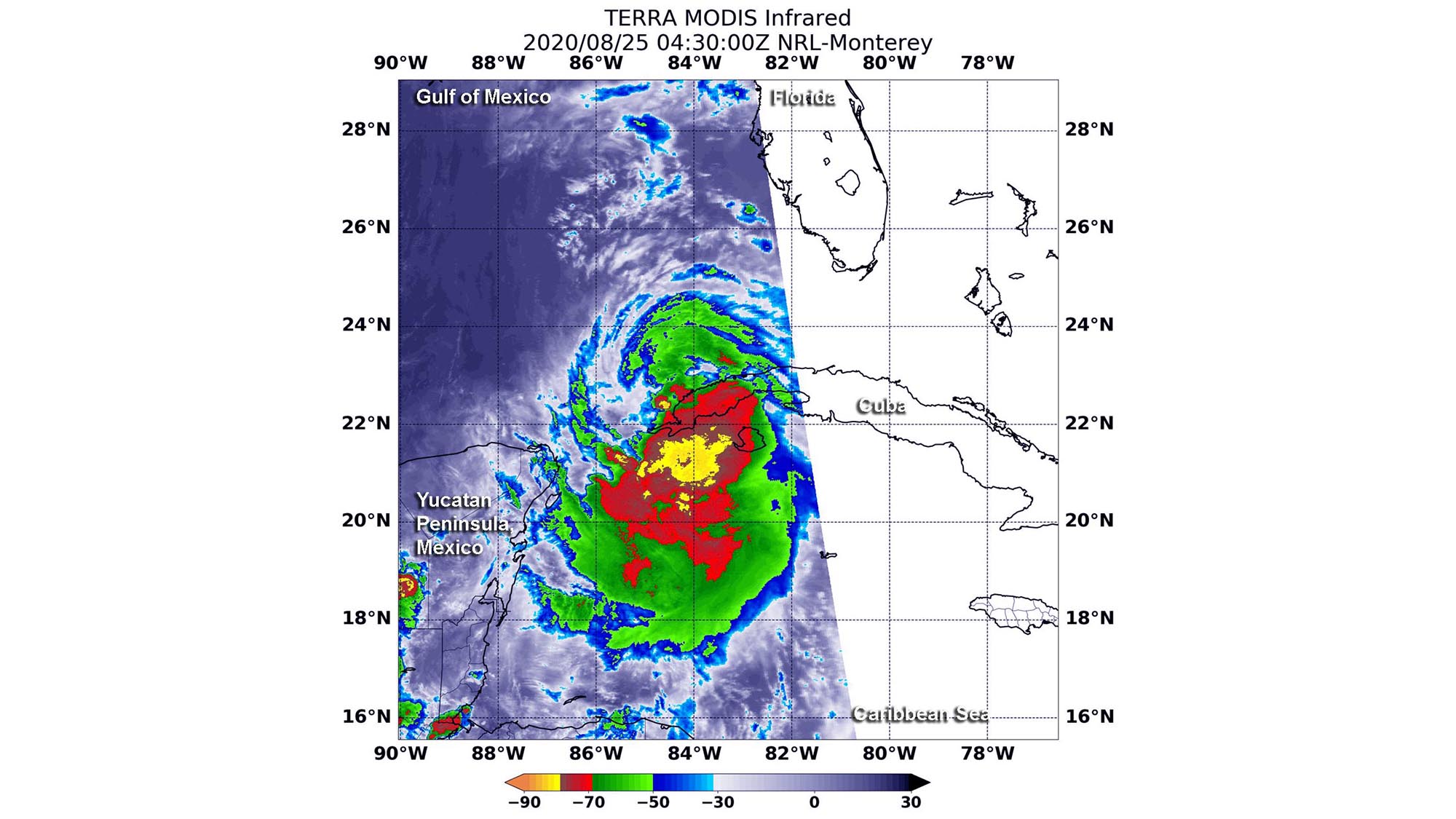
NASA's Terra satellite also captured infrared views of Tropical Storm Marco using its Moderate Resolution Imaging Spectroradiometer (MODIS) instrument, which recorded temperature information from Marco's cloud tops on Tuesday at 12:30 a.m. EDT (0430 GMT).
Breaking space news, the latest updates on rocket launches, skywatching events and more!
The satellite views showed remnant thunderstorms northeast of the center of the storm, where temperatures were as cold as minus 50 degrees Fahrenheit (minus 45.5 degrees Celsius). These cloud-top temperatures indicate strong thunderstorms that reach high into the atmosphere and have the potential to generate heavy rainfall, according to a statement from NASA.
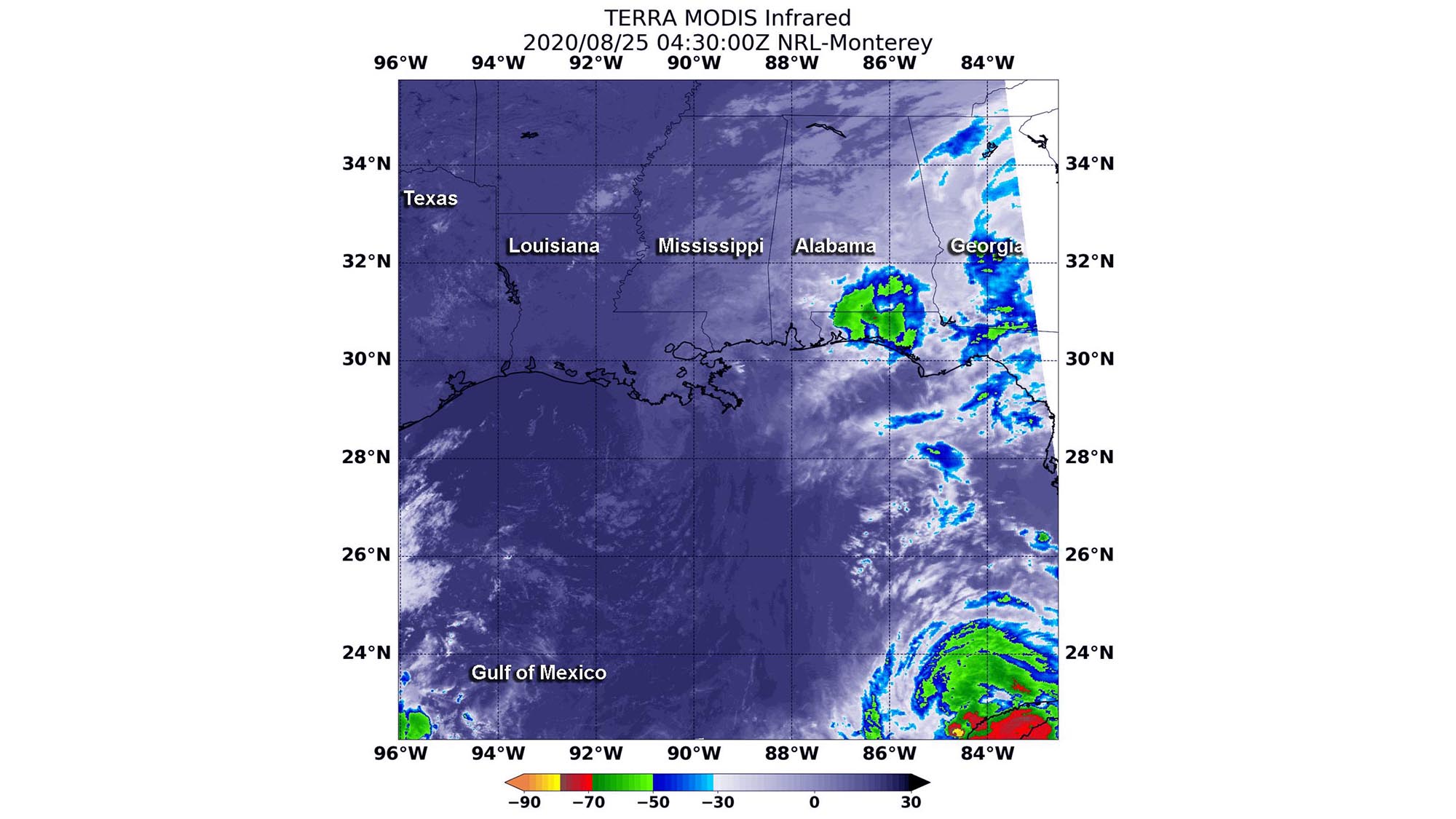
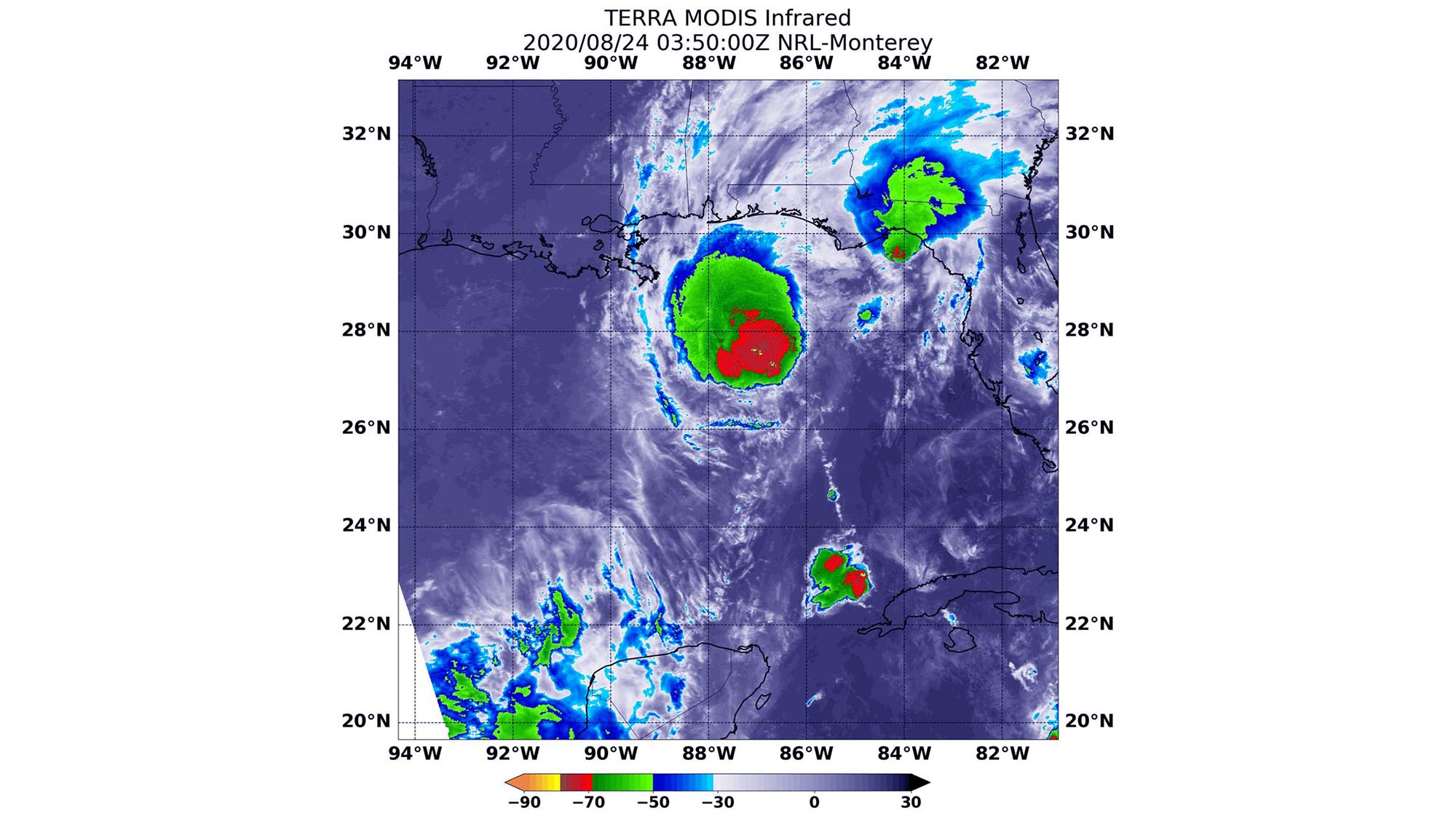
"Marco is expected to produce total rainfall accumulations of 3 to 5 inches (7.62 to 12.7 centimeters) with isolated maximum amounts of 10 inches [25 cm] across portions of the northeast and north-central Gulf coast through Tuesday," the National Hurricane Center said in a public advisory. "This rainfall may result in areas of flash, urban and small stream flooding in the area."
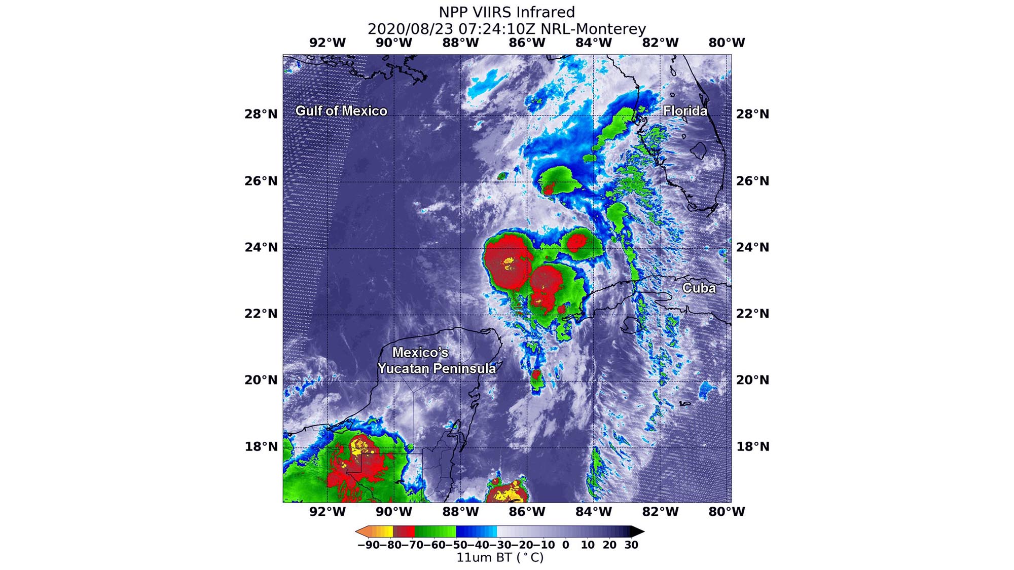
The MODIS instrument also captured Tropical Storm Laura, measuring the storm's cloud-top temperatures on Aug. 23 at 11:45 p.m. EDT (Aug. 24 at 0345 GMT). The instrument revealed that the most powerful thunderstorms were located near Laura's center, where temperatures were as cold as minus 80 degrees F (minus 62.2 C). At that time, the storm was just north of Jamaica, which could experience up to 10 inches (25.4 cm) of rainfall, according to a statement from NASA.
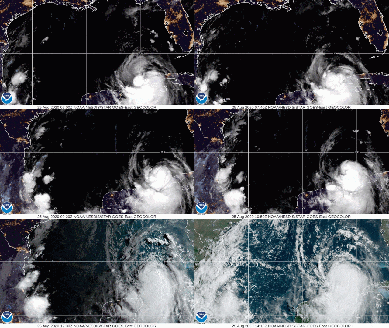
It's #TimelapseTuesday! In this 13-sec. loop from #GOESEast, we can track the paths of #Marco and #Laura over ~2 1/2 days. Marco reached hurricane status before weakening to a post-tropical cyclone, and Laura strengthened into a #hurricane today. More: https://t.co/1L8q1zg4eW pic.twitter.com/Kh0ziCjSRgAugust 25, 2020
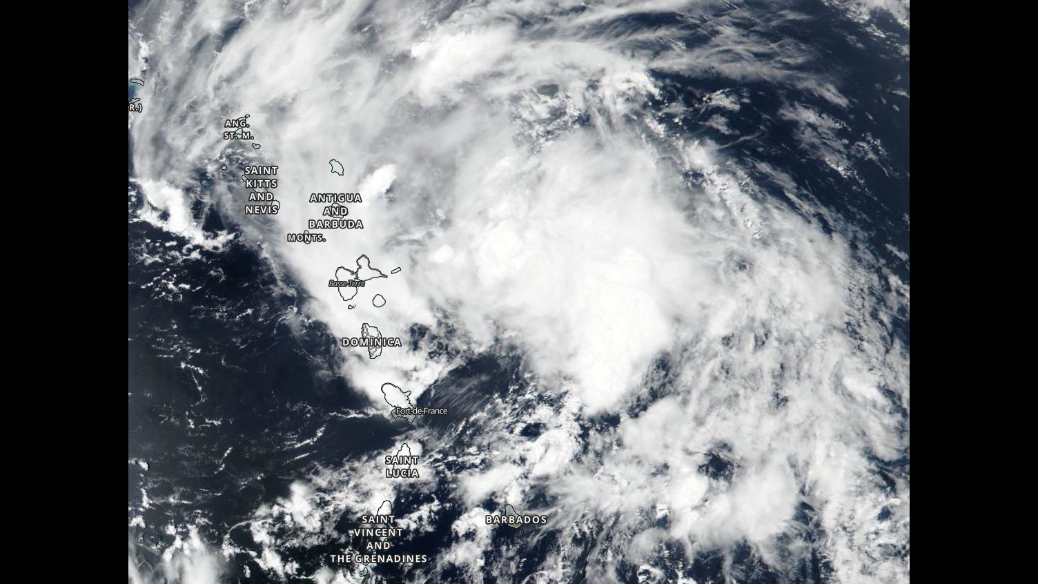
Other satellite instruments, including the Visible Infrared Imaging Radiometer Suite (VIIRS) on the NOAA-20 satellite and the NOAA's GOES-East satellite, are also tracking the storms as they continue through the Gulf of Mexico.
Sunrise on the broad area of convection associated with Tropical Storm Laura. pic.twitter.com/dKEKn5uJrrAugust 24, 2020
Editor's note: This story was updated at 4:40 p.m. EDT to include photos of Hurricane Laura taken on the space station by NASA astronaut Chris Cassidy. Follow Samantha Mathewson @Sam_Ashley13. Follow us on Twitter @Spacedotcom and on Facebook.
Join our Space Forums to keep talking space on the latest missions, night sky and more! And if you have a news tip, correction or comment, let us know at: community@space.com.
Samantha Mathewson joined Space.com as an intern in the summer of 2016. She received a B.A. in Journalism and Environmental Science at the University of New Haven, in Connecticut. Previously, her work has been published in Nature World News. When not writing or reading about science, Samantha enjoys traveling to new places and taking photos! You can follow her on Twitter @Sam_Ashley13.
