Volcanic island spewing ash and lava spotted from space
Satellites have spotted ash and lava spewing from the young, remote island of Nishinoshima in the Pacific Ocean.
Nishinoshima is a volcanic island located approximately 600 miles (1,000 kilometers) south of Tokyo, Japan. Volcanic activity has picked up at Nishinoshima, one of the Ogasawara Islands, since late-May, according to a statement from NASA Earth Observatory.
Two NASA satellites have captured aerial views of the island, tracking its growth over the last few months, as well as vigorous plumes of ash and lava. The satellites have observed that the island is experiencing a growth spurt following this recent volcanic activity.
Related: Huge Philippines volcano eruption blasts ash 9 miles up (video)
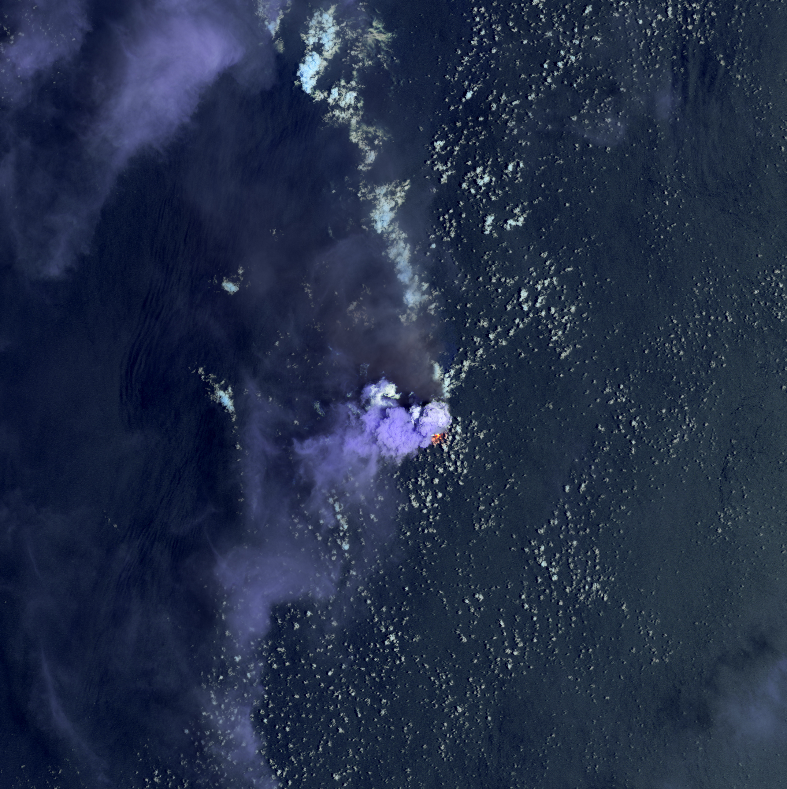
The Landsat 8 satellite, a joint effort of NASA and the U.S. Geological Survey, captured a striking photo of the island on Sunday (July 4). The false-color image combines shortwave infrared and visible wavelengths, revealing a heat signature showing erupting lava and the relative coolness of the dark ash plume as it blows north across the ocean.
The Landsat 8 satellite image also shows bright purple clouds over the island, which represent either steam from the volcano or lava from vaporizing seawater, according to the statement.
On July 3, the Japan Coast Guard reported massive volcanic plumes that rose as high as 15,400 feet (4,700 meters) above sea level. Those plumes grew drastically in size by the next day.
Get the Space.com Newsletter
Breaking space news, the latest updates on rocket launches, skywatching events and more!
Reports from July 4 revealed that volcanic bombs, or larger fragments of solid and molten material, were ejected up to 1.6 miles (2.5 km) and clouds of ash reached up to 27,200 feet (8,300 meters) — the highest altitude recorded since the volcano emerged in 2013, according to the statement.
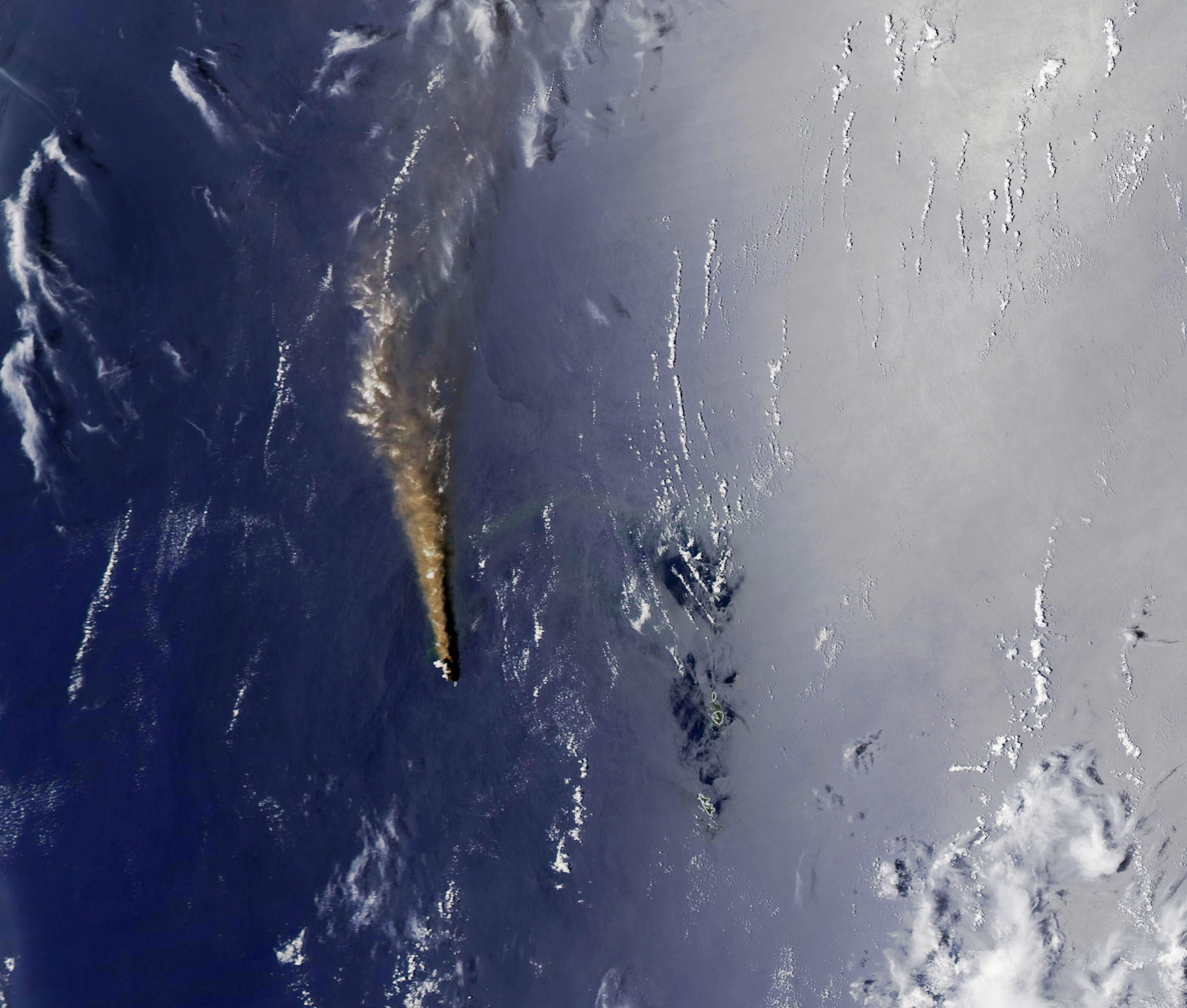
The Moderate Resolution Imaging Spectroradiometer (MODIS) on NASA’s Aqua satellite also captured a stunning view of the island's volcanic activity on Monday (July 6). The natural-color image shows a volcanic plume stretching hundreds of kilometers to the north and several thousand meters into the sky.
Nishinoshima erupted above sea level in November 2013, generating lava flows that remained active through November 2015. Frequent volcanic activity has fueled the growth of the island.
Volcanic activity on Nishinoshima started to pick up again in late May 2020, triggering a vigorous growth spurt by mid-June. Reports from the Geospatial Information Authority of Japan suggest the southern shore of the island grew by at least 492 feet (150 meters) between June 19 and July 3, according to the statement.
You can see the growth of Nishinoshima and the evolution of the island's volcanic activity online at NASA Earth Observatory. NASA satellite images of the island date back to 2013.
Follow Samantha Mathewson @Sam_Ashley13. Follow us on Twitter @Spacedotcom and on Facebook.
Join our Space Forums to keep talking space on the latest missions, night sky and more! And if you have a news tip, correction or comment, let us know at: community@space.com.

Samantha Mathewson joined Space.com as an intern in the summer of 2016. She received a B.A. in Journalism and Environmental Science at the University of New Haven, in Connecticut. Previously, her work has been published in Nature World News. When not writing or reading about science, Samantha enjoys traveling to new places and taking photos! You can follow her on Twitter @Sam_Ashley13.
